Tropics: Increasing risk of a short lived tropical cyclone in Bay of Campeche, watching eastern Pacific also

Starting off again today in the tropics, which have gotten a bit more active both in the Atlantic and the eastern Pacific. In the Atlantic, the system we were talking about yesterday just east of the Yucatan Peninsula has now crossed the peninsula and is in the far southern Bay of Campeche. While it is still not well organized, there has been some recent increase in the thunderstorm activity closer to the center of the weak low pressure center, indicating a bit of an organizing trend as it moves slowly west-northwest.
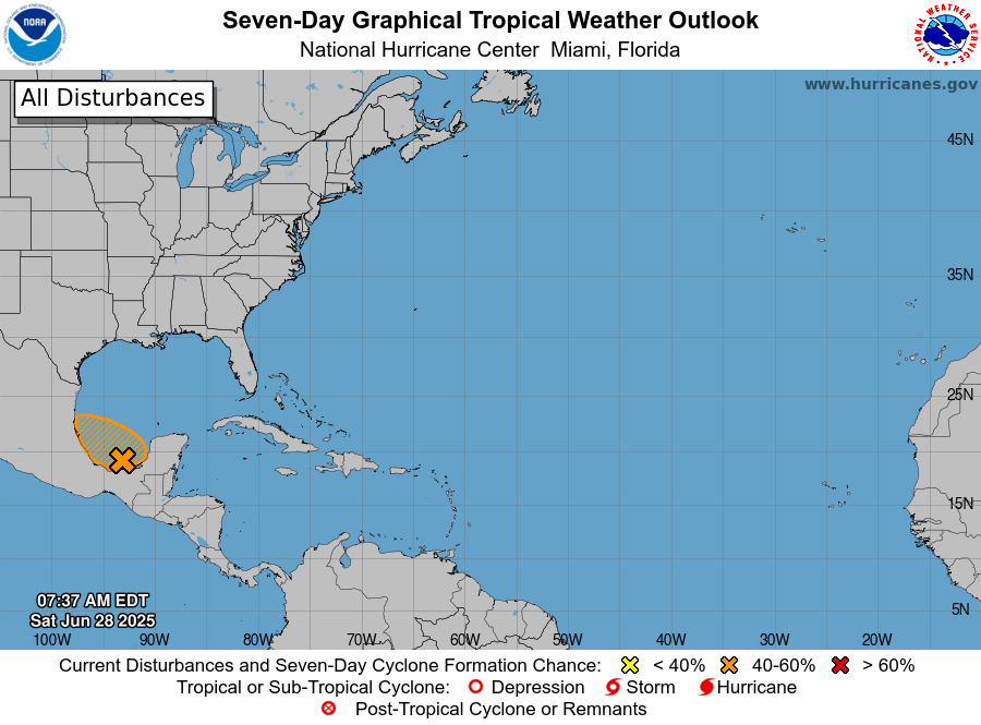
Conditions are marginally favorable for development, and an increasing number of forecast members from the ensemble models (though still a minority) show an organized system developing before it reaches the coast late Sunday in the general vicinity of Tampico. NHC has increased the probability of tropical cyclone development with the system (now designated as Invest 91L) to 50%, and it certainly would not be a surprise to see a short lived tropical depression or storm develop before it moves inland.

Regardless of development, the major risk with 91L will be heavy rainfall along its path with potential flash flooding. Again, this system should not pose any threat to the US coastline.
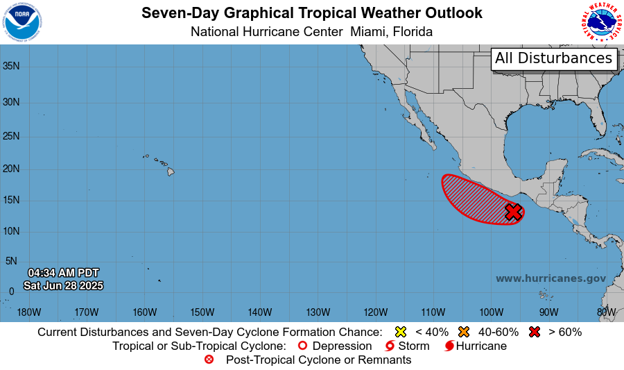
Meanwhile, in the eastern Pacific, Invest 95E has been designated south of the Gulf of Tehuantepec, and is forecast to gradually get better organized as it moves slowly west-northwest. The environment over the eastern Pacific is more favorable than the southern Gulf, and this system is eventually likely to become a strong tropical storm or hurricane as it tracks just offshore the southern coast of Mexico over the next several days.

For US weather, 95E is of interest because as the system approaches the southern tip of Baja California late next week, moisture from the system could be fed into and enhance what looks to be an already favorable pattern for monsoonal thunderstorm activity over the southwestern United States. This will be something to keep an eye on as the week progresses.
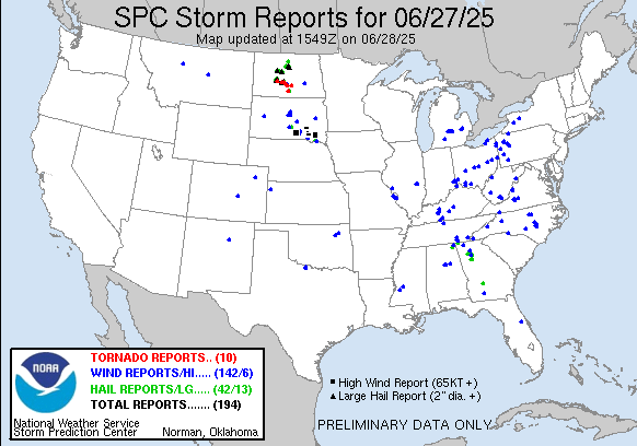
Turning now to severe weather, yesterday was again a very active day in the Dakotas, with a number of intense severe storms that produced tornadoes, very large hail and significant straight line winds. Sporadic severe storms occurred other parts of the central and eastern US, and in another case of a storm in the wrong place at the wrong time, a severe storm impacted Hartsfield-Jackson Atlanta International Airport causing the cancellation of nearly 400 flights.
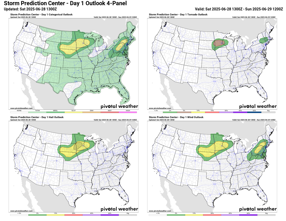
The upper Midwest will be the primary hotspot for severe weather again today, particularly over southern Minnesota and adjacent portions of South Dakota where supercell storms along a slow moving cold front could produce very large hail, tornadoes and damaging winds. A slight (level 2 of 5) risk is also in place in parts of Pennsylvania and New York where an upper level disturbance should produce scattered severe storms capable of damaging winds and a few tornadoes.

A severe thunderstorm watch is already in place at midday over much of Pennsylvania and parts of upstate New York.
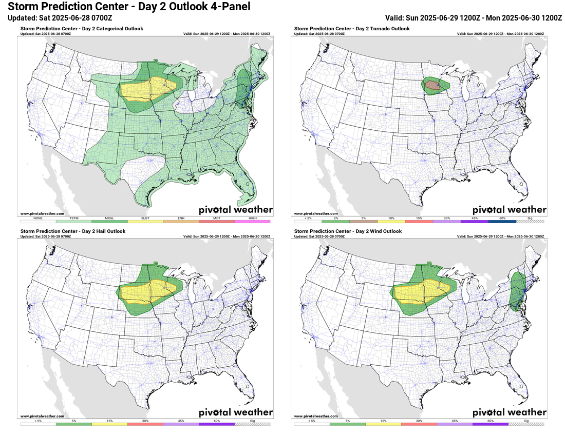
The severe weather risk areas and threats will actually be rather similar on Sunday as today. In the Northeast, the risk will be a bit lower and farther east than today, with a few severe storms with damaging downburst winds being the primary risk.

Heat will be making a return to parts of the western US this weekend, particularly in the Southwest where extreme heat warnings are in effect for southern Arizona as temperatures will once again approach or exceed 115F in the Phoenix area Sunday through Tuesday.

Leave a comment