Monday sees another record high temperature in Phoenix

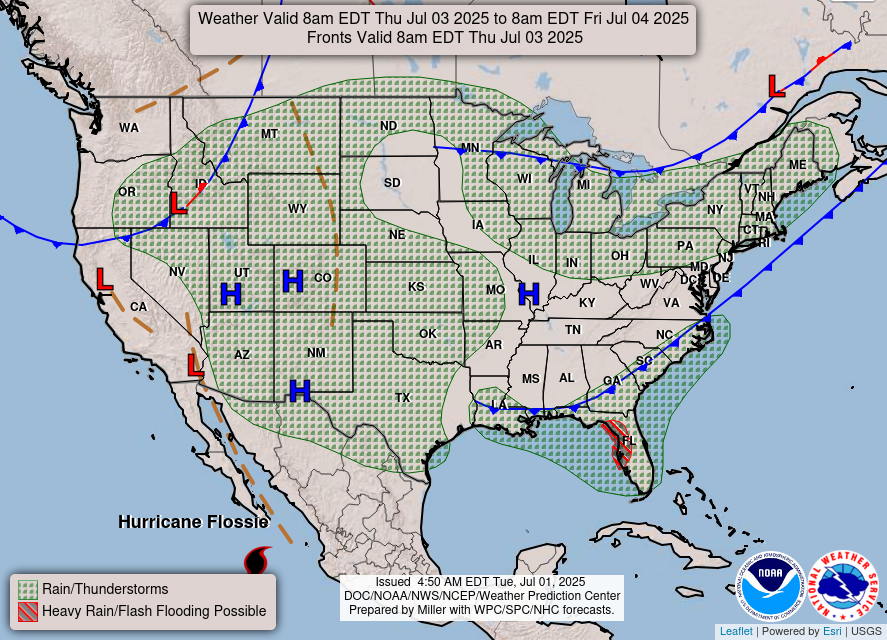
The focus for hazardous weather today is on potential flash flooding in both the East and Southwest. In the East, a slow moving cold front will continue to move east toward the coast today. There is already a band of showers and storms along the front over western Pennsylvania and West Virginia, where a couple of flash flood warnings are in place. Moisture is unusually high ahead of the front, with the precipitable water value – the parameter that integrates the moisture through the atmosphere to show meteorologists how much precipitation can occur – at a record high level for the date on this morning’s Washington, DC upper air balloon data.
As the front moves east into an increasingly moist and unstable atmosphere, additional slow moving thunderstorms with very high rainfall rates should develop. Given that antecedent conditions across the region are quite wet, potentially widespread and significant flash flooding is possible, especially in urban locations. The Weather Prediction Center now has a moderate (level 3 of 4) risk of excessive rainfall and flash flooding across parts of the Mid-Atlantic, with a large surrounding slight risk.
Monsoonal moisture moving into west Texas and southeast New Mexico will fuel thunderstorms with locally heavy rain in that region, resulting in a slight risk of flash flooding. Moisture associated with the remnants of tropical storm Barry will cause localized heavy rain and flash flooding in south Texas.
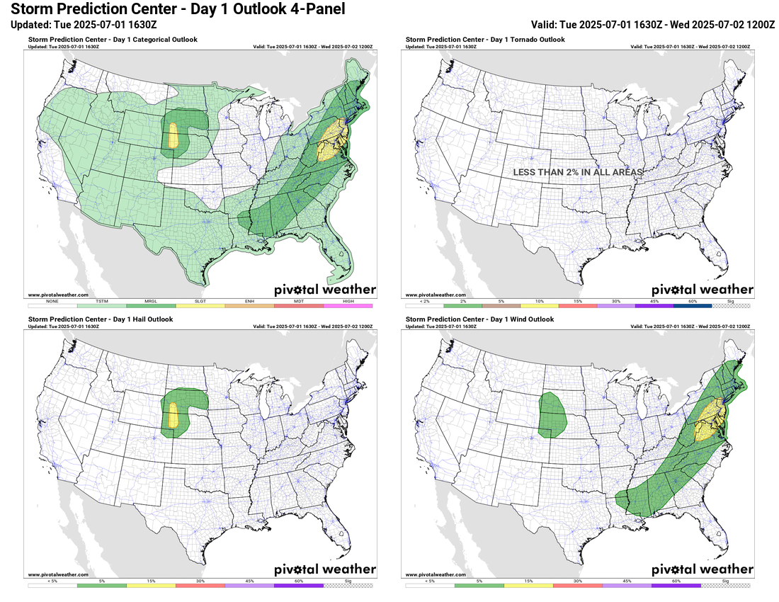
Some severe weather will also be possible along the front in the east, with the strongest storms capable of producing damaging downburst winds. A few severe storms are also possible in parts of the central and northern Plains.
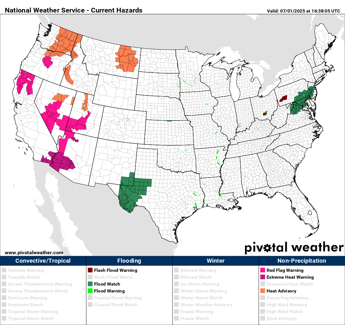
Heat and fire danger will continue to be the primary risks in the western United States, with red flag warnings and heat warnings and advisories in effect. Phoenix set a record high on Monday at 116F, and is expecting similar temperatures today.
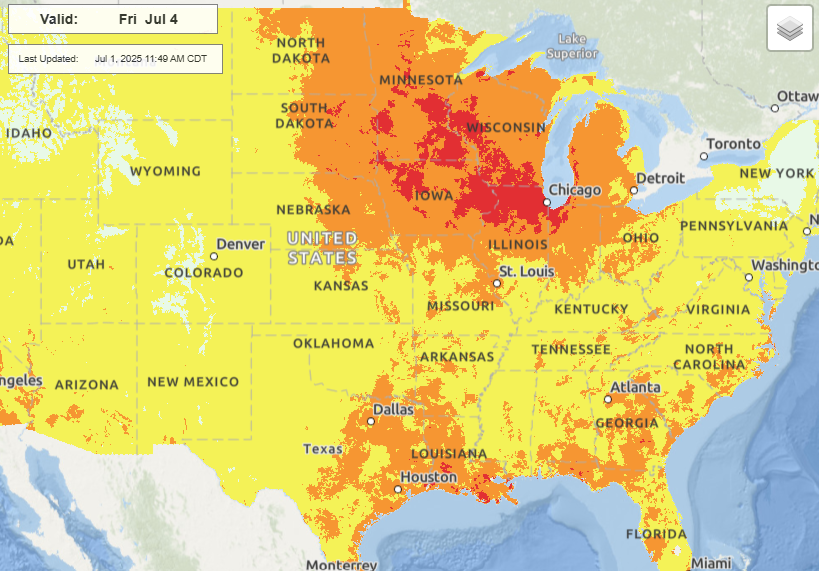
Over the next couple of days, a series of upper level lows will move into the West Coast, putting a temper on the heat in that region for a while. The heat will shift east into the middle part of the country by Independence Day, with moderate to major heat risk expected over the upper Midwest and Great Lakes region.
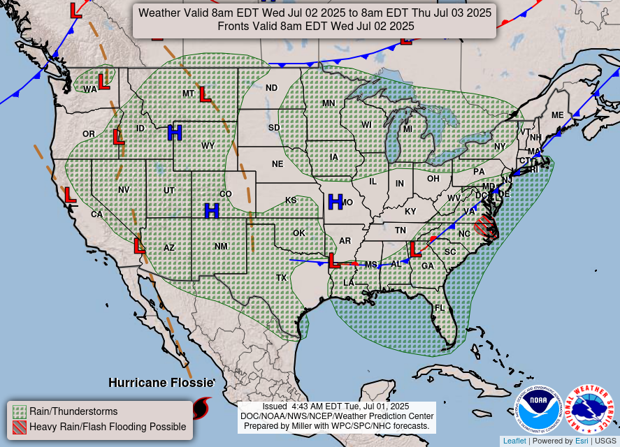
In the meantime, the slow moving front in the Southeast will continue to focus thunderstorm activity, while monsoonal moisture will continue to fuel thunderstorm activity in the Southwest and Intermountain West.
By the end of the week, the stalling front over the Southeast will become a focus for thunderstorms and heavy rainfall. Some risk for tropical development exists this weekend in the region. You can read more about that in my recently posted tropical newsletter and I will be updating as we go through the week.

Leave a comment