Watching off the Southeast coast for tropical development
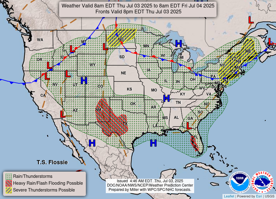
The day before Independence Day looks to be most active weatherwise around the edges of the country. Along the northern border, severe weather will be a risk, while flash flooding will be a concern for parts of New Mexico, Texas and Florida.
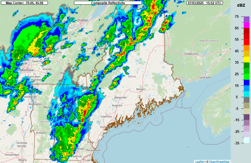
In the Northeast, an upper level weather disturbance dropping southeast into the region is already producing some bands of scattered strong to severe thunderstorms across Maine, New Hampshire and parts of Quebec. A severe thunderstorm watch is in effect for Maine and New Hampshire through the afternoon, and additional watches are possible for the rest of the Northeast as additional severe storms develop through the afternoon. Damaging winds and some hail look to be the primary risks with severe storms in the region.
Meanwhile, in North Dakota, another late afternoon of scattered supercell storms with very large hail will likely evolve into clusters of storms capable of significant wind damage as they move east across the state this evening. A few tornadoes are also possible.
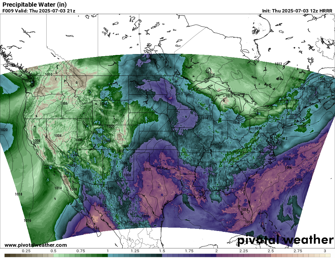
In the southern part of the country, plumes of unusually high moisture are in place across Florida and the south central and southwestern US. Precipitable water – a parameter that shows the moisture throughout the depth of the atmosphere available to produce precipitation – will be in excess of 2” over much of Florida and Texas today, with unusual 1-1.5” values extending into the usually drier areas of New Mexico and Arizona. Scattered to numerous slow moving thunderstorms that develop within this unusually moist atmosphere will be capable of producing high rainfall rates and instances of flash flooding.
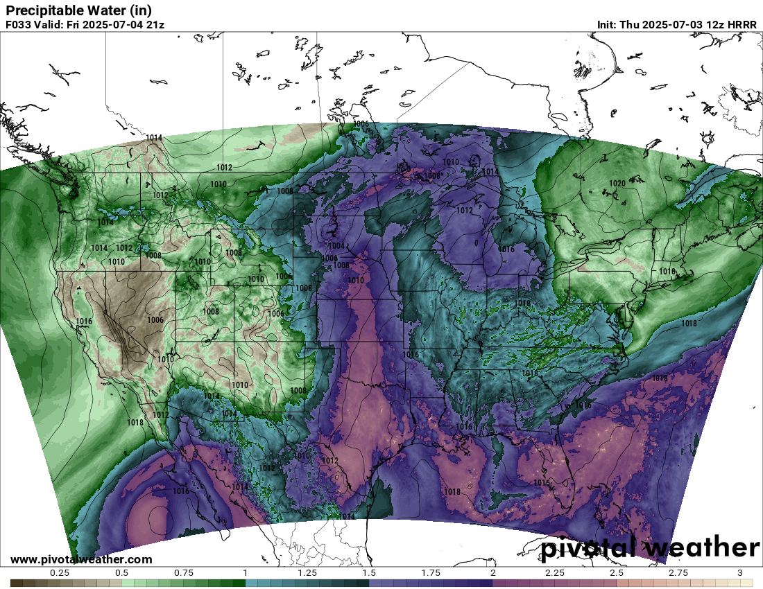
For the Fourth, the moisture plume will continue across Florida and the Gulf Coast and expand north from Texas into the upper Midwest, while additional moisture will spread into the Southwest associated with the remnants of Flossie.
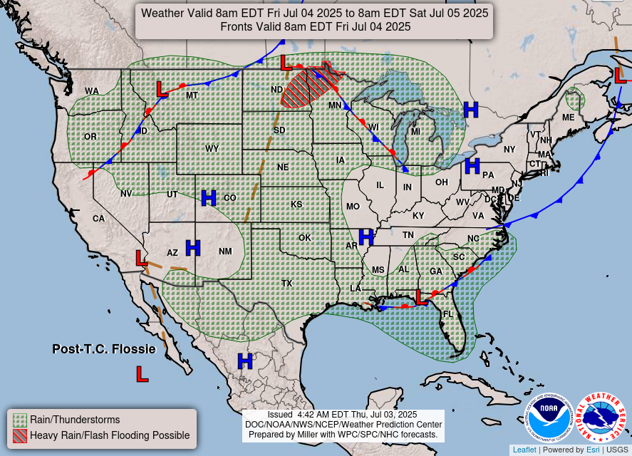
Scattered to numerous showers and storms with heavy rainfall will be possible in these areas. In the upper Midwest, a more focused area of intense storms with heavy rainfall and severe weather are possible Friday afternoon and evening.
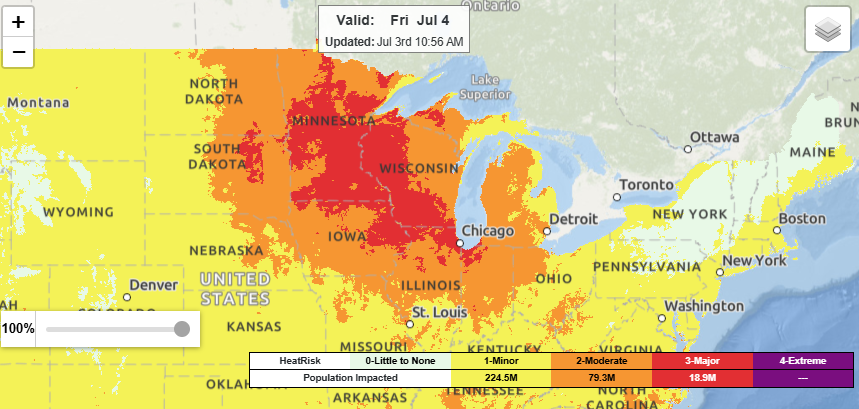
The increasing humidity along with rising temperatures will also result in building heat risk across the upper Midwest and Great Lakes regions for the Fourth, with widespread moderate to major heat risk anticipated. Heat advisories are in effect for a number of locations here.
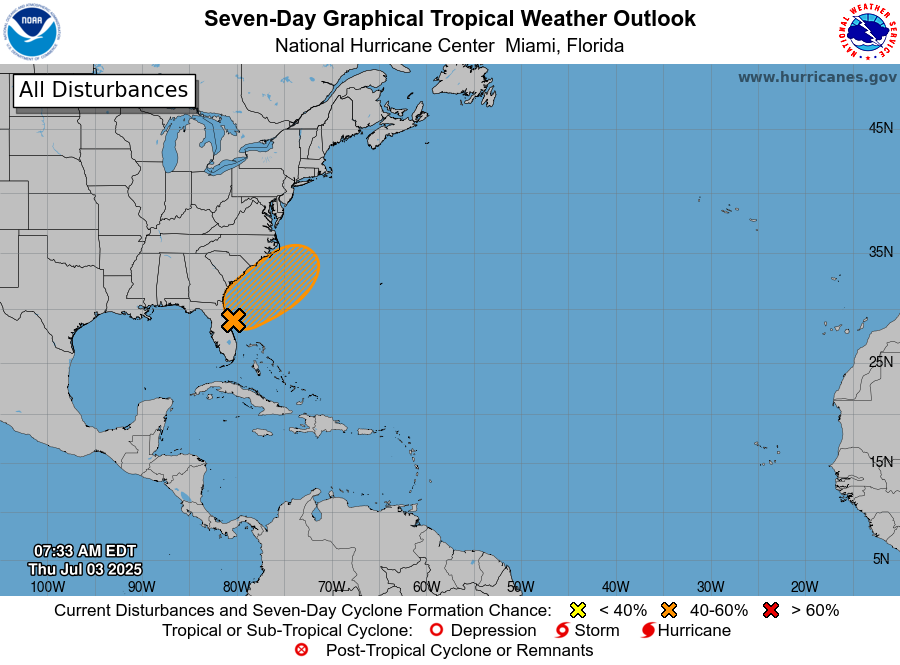
As we have been discussing the last few days, there continue to be signs that within the moisture plume in the vicinity of Florida that thunderstorms will become concentrated enough to eventually begin to spur some tropical cyclone development. Over the last 24 hours, the models seem to be coming into clearer focus on any potential system developing east or northeast of Florida this weekend and drifting north toward the Carolina coast. Again, as of now the development of a system is still uncertain, but NHC has increased the probability to 60% in its most recent outlook. Conditions do not look overly favorable for development so any system should be relatively weak – but of course we will continue to monitor as we head into the weekend.

Leave a comment