And still anticipating major heat over the Southwest this week
Aug 04, 2025
August is climatologically the start of the ramp up of Atlantic hurricane season toward its peak in September, and right on cue the tropics are getting more active this week. Since I did a deep dive yesterday into what looks to be the other big weather story this week, the heat and fire weather in the West, I am going to use today’s daily newsletter to focus on the tropics as Monday is the day I try to do a tropical newsletter anyway. I will talk a little about today’s other weather at the end.
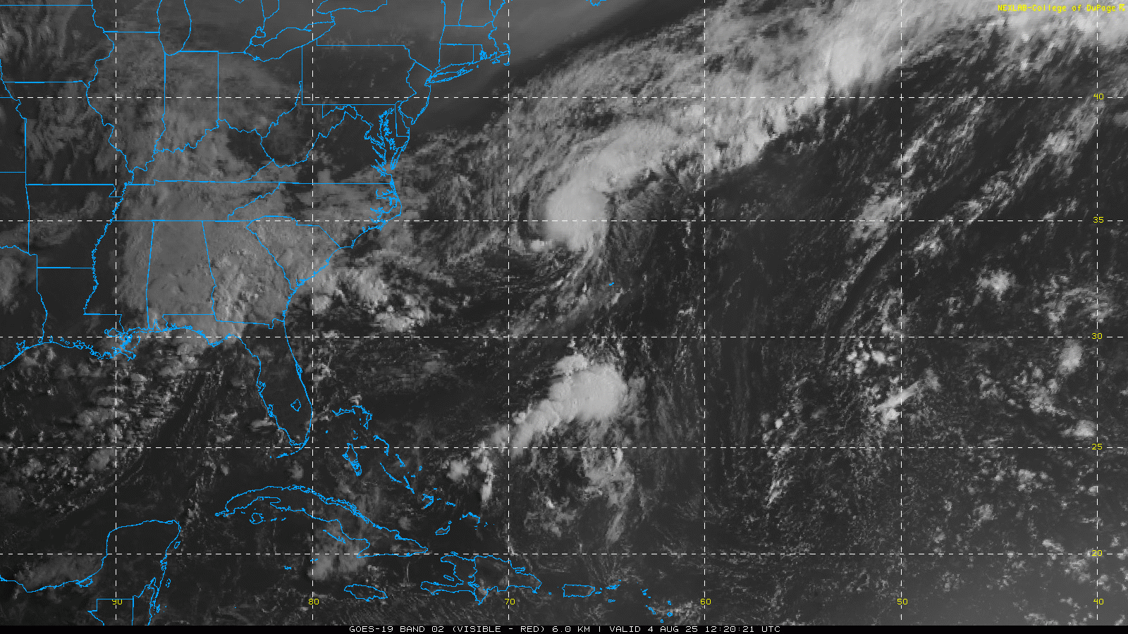
I like to start an examination of the tropics with a visible satellite loop. Most of the action we are focused on today is in the southwest Atlantic, where there are two main areas of interest this morning. The first is recently formed Tropical Storm Dexter, which you can see spinning pretty much due east of Cape Hatteras. Dexter is currently a low end tropical storm, with maximum sustained winds of 45 mph. If you look closely, you can see that most of the brighter thunderstorm clouds are located east of the center. That is indication of upper level westerly wind shear on the system, which blows the storms to the east side of the low pressure center and is a hindrance to intensification.

This upper level wind shear is only forecast to increase over the next couple of days, so Dexter is only forecast to slightly intensify. It will continue to move east-northeast away from the United States and north of Bermuda. In a few days, Dexter will become a post-tropical storm and eventually get absorbed by another system in the north Atlantic.
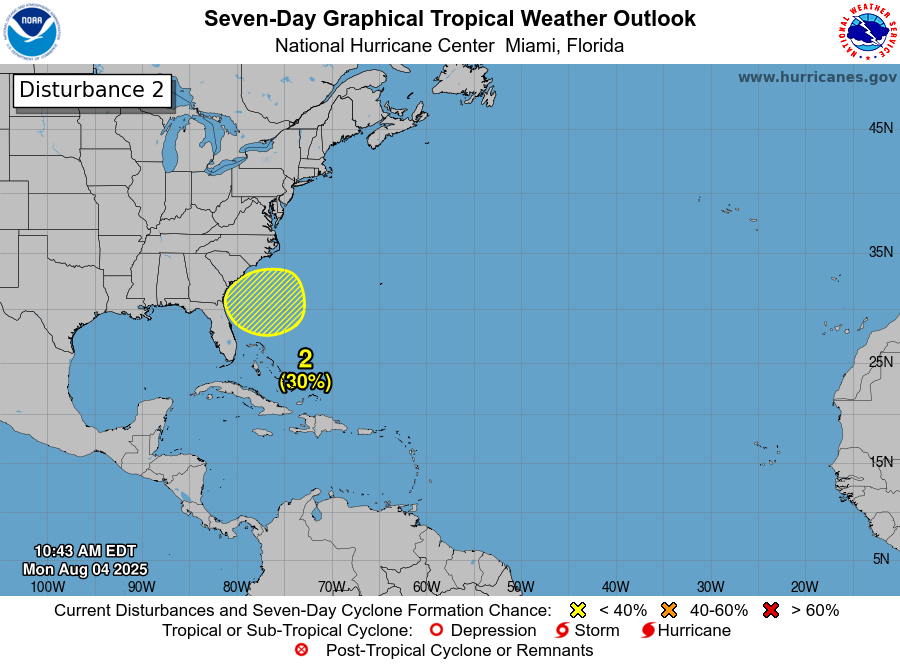
The other system you can see in the satellite loop is due south of Dexter and east of Florida. This is another area of low and mid level spin in the atmosphere that is producing somewhat concentrated thunderstorm activity as it moves slowly south and southwest. NHC has an area with 30% probability of development in this general area, but how development might occur still seems quite uncertain in the model solutions.
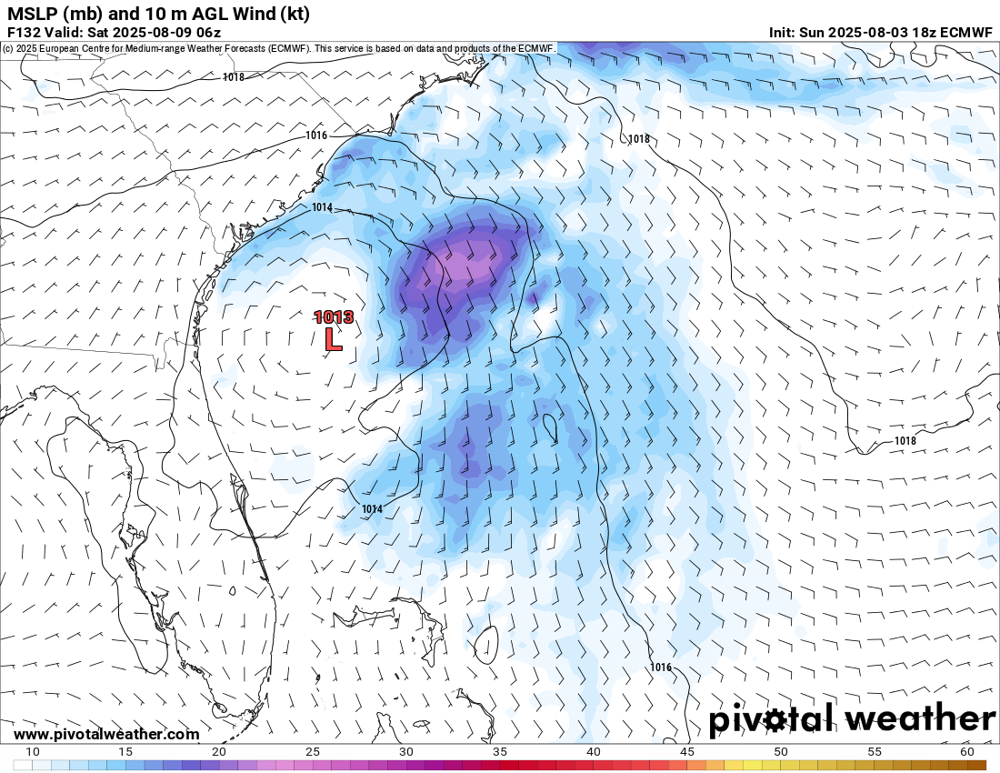
The primary models such as the European Centre (ECMWF) and US Global Model (GFS) imply that a new area of low pressure will develop out of the remnant low pressure left behind by Dexter, and eventually move west/northwest slowly toward the coast.
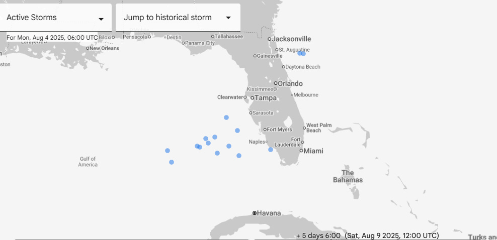
Meanwhile, the AI models such as the Google WeatherLab and the ECMWF AI Forecast System seem more focused on the area of disturbed weather we can see this morning south of Dexter, and hence have development occurring farther south closer to Florida. The most recent run of Google AI ensemble shown above actually is clustered toward a system southwest of the Florida peninsula by this weekend that would slowly move north-northwest or northwest. The European AI model has been gradually shifting its track of this system closer to Florida, and now essentially runs it up the Peninsula with little development.
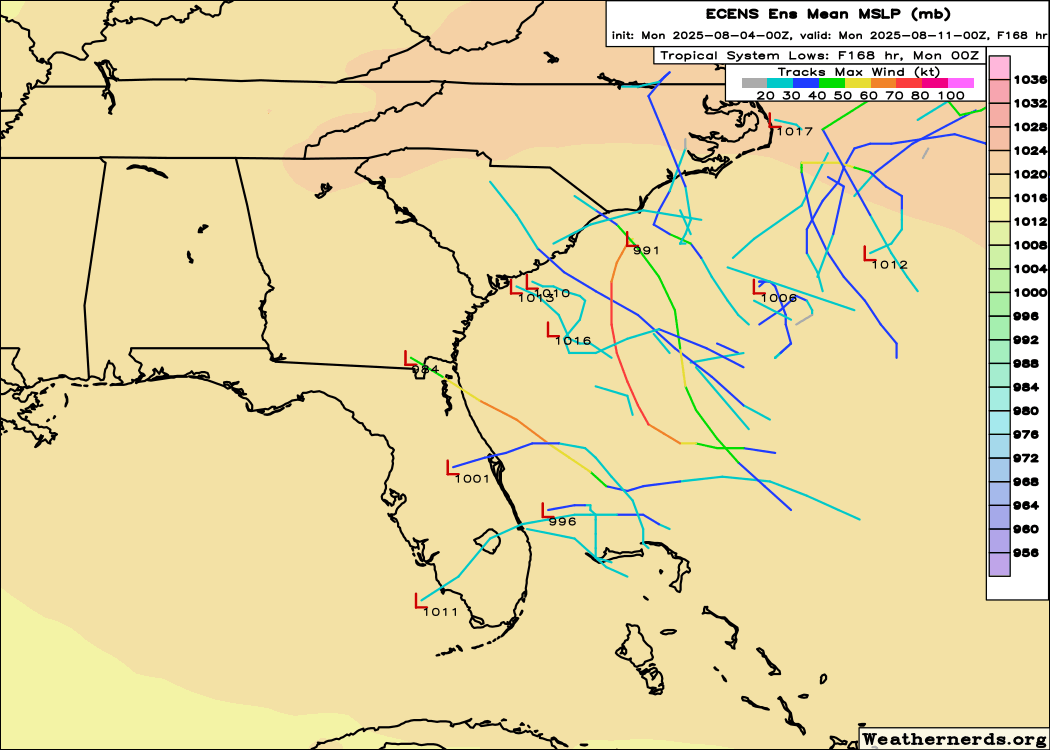
Looking at this plot of European ensemble members valid Sunday evening, you can kind of see both possibilities, with a few members showing development close to Florida, with several more members showing a system closer to the Carolinas. Obviously, what, if anything, more organized might come out of this region remains to be seen. However, it is certainly worth keeping a pretty close eye on this week as overall conditions seem generally favorable with relatively light winds aloft and above normal moisture ,and a few potential areas of weak surface low pressure to watch.

The other system of interest in the Atlantic this week is a tropical wave currently emerging off the west coast of Africa. While this system is unlikely to do much in the next few days, toward the weekend the various models suggest the possibility of development as it reaches the central Atlantic region.
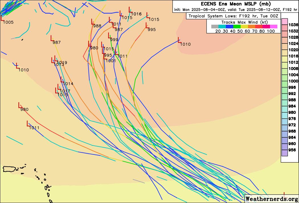
The European ensemble model suggests at least weak development, with a few members showing a more intense system. The model indicates that whatever does develop should move into a weakness in the subtropical high pressure ridge and likely recurve into the north Atlantic.
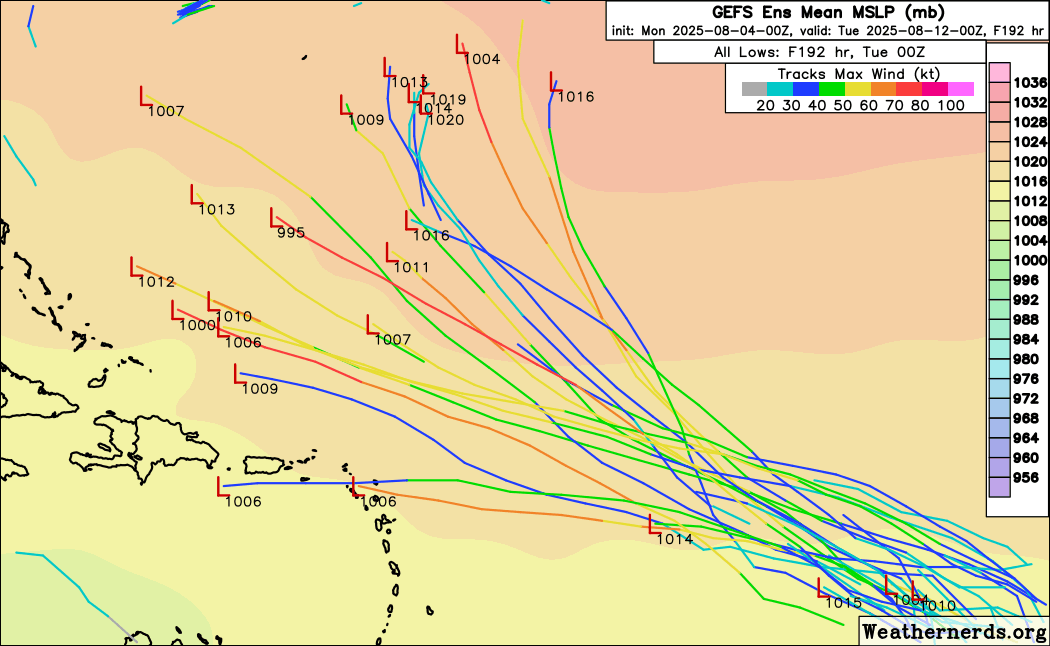
The US Global ensemble (GEFS) has more members suggesting a track farther to the west. For what it’s worth, the AI models are more in line with the European model solutions. Regardless, this system is still at least 4 to 5 days away from any sort of significant development, so there is plenty of time to watch.
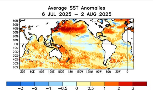
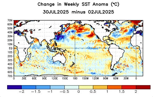
Looking at some of the larger scale trends as we head into August, sea surface temperatures (SSTs) remain above normal over the entire Atlantic, and departures from normal have increased over the most the Atlantic basin south of 30N. The trend has been toward less positive anomalies north of 30N, but SSTs still remain well above normal in this region. There continues to be little signs of any developing El Nino or La Nina to play a major role in the rest of the hurricane season, as equatorial Pacific temperatures have trended slightly below normal over the last few weeks. Overall, conditions seem to continue to support a slightly above normal rest of the season. Colorado State University will release their next seasonal update on Wednesday along with their first 2-week forecast, and I will provide a summary of that later in the week.

Finishing up with a quick look at today’s weather. The stationary front we have been talking about for a few days will continue to be the focus for thunderstorm activity, with flash flooding possible in the Southeast and some severe thunderstorms in the High Plains region. Hot, dry and breezy conditions will continue to support elevated fire danger concerns, with particularly critical conditions forecast over much of Utah into parts of Wyoming and Colorado. Heat will be most extreme today over the desert Southwest, with an expansion and intensification of the heat still anticipated into the middle of the week.

Leave a comment