East Pacific looks to say active while Atlantic has areas of convection but little organization
Sep 08, 2025
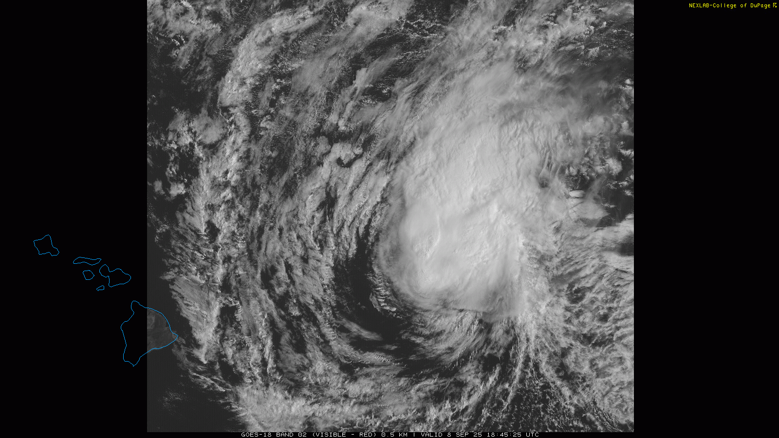
Running a bit late with our Monday weekly tropical update as I am traveling back from the NWA Annual Meeting today. We are going to work from west to east today and start in the central Pacific with the lone named system of US interest, Kiko. After several days as a significant hurricane, Kiko is getting battered by strong southwesterly upper level wind shear today and is over water temperatures cooler than 26C — the typical minimum threshold for tropical development. As a result it has weakened to a category 1 hurricane as of late this morning. Looking at the current satellite loop above, it has likely weakened even further, and it is expected to be down to a tropical storm later today or on Tuesday.
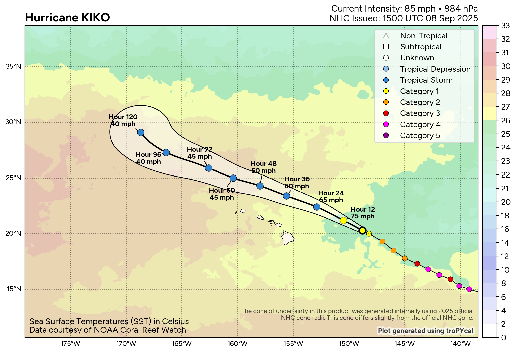
Looking at the forecast for Kiko overlaid over sea surface temperatures (found at PolarWx, one can see that Kiko is currently over the coldest water it will be over, and by Tuesday it will start moving over gradually warmer water. Shear is also forecast to decrease for a time, so it is not impossible that it could undergo a bit of reorganization in the next couple of days. However, the inner structure of Kiko has likely been so disrupted by the current hostile conditions that this is probably the lower probability outcome, and the more likely scenario is that gradual weakening will continue.
![[Key Messages]](https://substackcdn.com/image/fetch/$s_!-0c7!,f_auto,q_auto:good,fl_progressive:steep/https%3A%2F%2Fsubstack-post-media.s3.amazonaws.com%2Fpublic%2Fimages%2F14b3a685-89af-4464-a75e-0a91701cf0c1_897x736.png "[Key Messages]")
As the forecast track of Kiko has shifted over the last week to well north of the islands, the biggest impact to Hawaii now looks to be surf, swell and rip currents. While the hurricane is currently weakening, it has already generated very large waves and swell over the last several days, and that will be impacting east facing island shorelines the next few days. Life-threatening high surf and rip currents are expected to be a risk for anyone venturing into the water at these beaches.
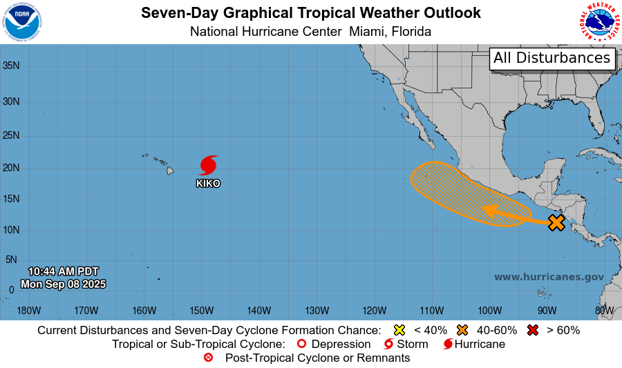
Farther east, a tropical wave crossing Central America is expected to become better organized later this week, and it seems likely that a new tropical storm will form to the southwest of Mexico.
This system looks as if it will move to south of the southern tip of Baja California by this weekend, probably as a strong tropical storm or hurricane. From there, as we saw with Lorena, there is model disagreement with some models turning a weaker system more west and other models having a more distinct system turning more northeast. We will keep an eye on it as again a stronger system moving more northeast toward northwest Mexico would likely mean more impacts to the Southwest US.
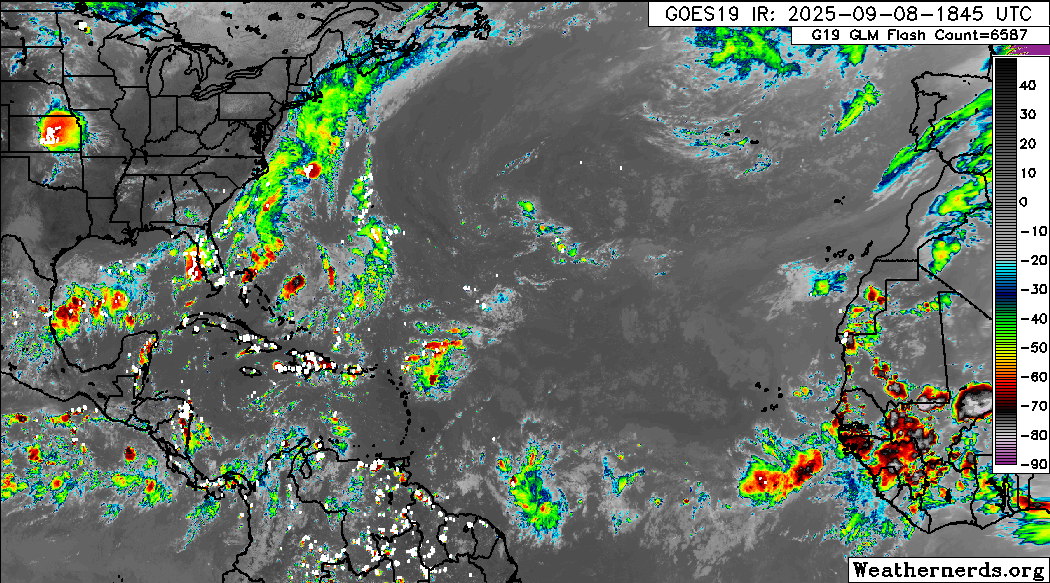
Turning to the Atlantic, we can actually see quite a bit of thunderstorm activity on the satellite image this afternoon: storms along a (seemingly permanent) stationary front across the Gulf, Florida and southwest Atlantic, storms northeast of the Lesser Antilles with the remnants of 91L, and another tropical wave with shower and storm activity south of the Cabo Verde Islands. However — at least as of now — none of these systems have any organization and NHC does not have any areas highlighted in their tropical outlook.
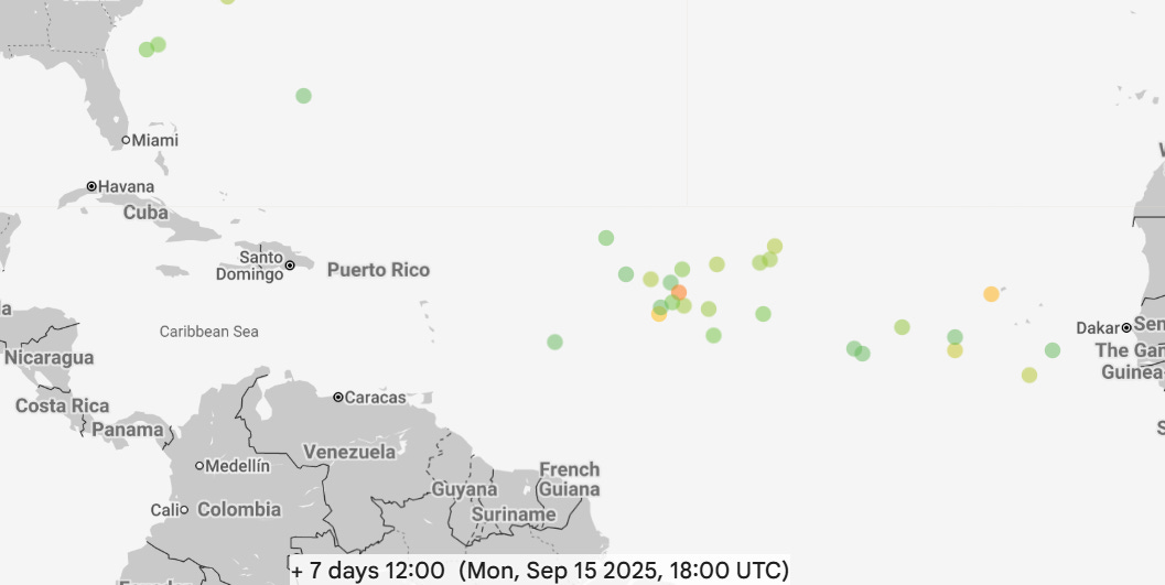
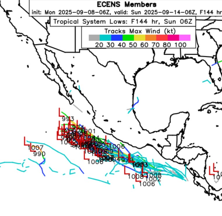
Overall, it still seems as if conditions will become more favorable in the Atlantic by late this week into mid-September. The Google DeepMind AI (above) shows a decent number of members developing a system over the central Atlantic by a week from now, with a lesser number with another wave farther east. The latest European ensemble is similar, although it has each of these systems a bit farther west than the AI model does.
While none of the models are showing anything right now, I am also keeping an eye on the western Caribbean later this week into early next week; the favorable environment associated with the developing eastern Pacific system could shift a bit farther east to the Atlantic side, and there are some hints in the models of enhanced thunderstorm activity in this area. But both this area and along the old front in Gulf and southwest Atlantic are not showing any signs of any specific system of concern.
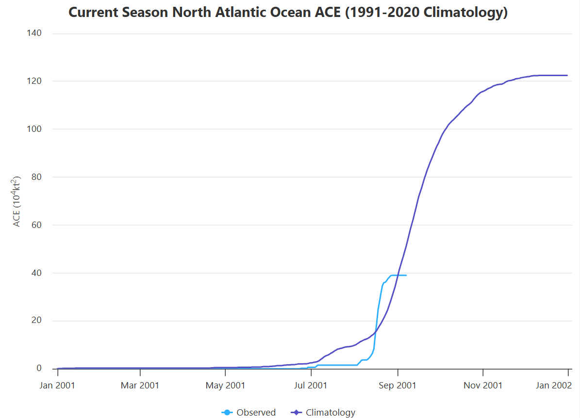
Overall, we have to feel pretty good about not having much to worry about here in early September. With the recent quiet period the Atlantic has fallen a bit behind the climatological normal for seasonal activity as measured by accumulated cyclone energy (ACE).
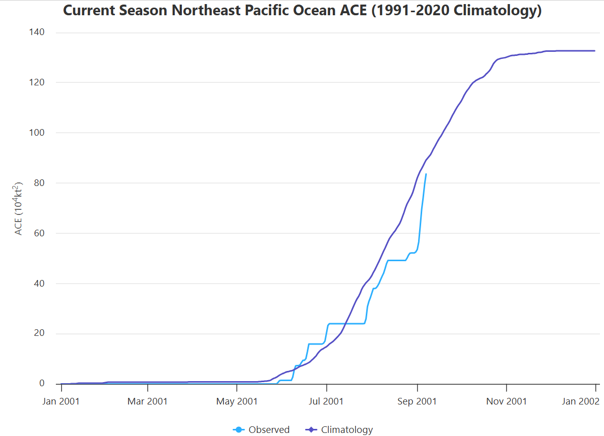
Meanwhile, Lorena and especially Kiko have made a significant contribution to ACE in the eastern Pacific the last 10 days. However, even after the busy first several weeks of the season, this basin is also running just a tad below normal for this point in the year.

Leave a comment