Thunderstorms and snow in the West, coastal flooding in Alaska and the East, and tropical cyclones forming in unusual places for the time of year
Oct 13, 2025
Coming at you with an additional late afternoon Monday weather focused post given all that is happening in the weather world currently and since I focused my usual daily post on the major coastal flooding event in Alaska.
 | Video clips by quotes | 301bff7c | 紗")
I have to tell you — in my opinion, the weather is unusually weird right now and I am bringing receipts to try to support my opinion. By the middle of this week, we will have seen over the last 2 weeks:
- A multi-day rain and thunderstorm event in the Southwest that has featured serious flash flooding as well as highly unusual nighttime hail producing supercells
- A very early season heavy snowstorm in the Sierra Nevada
- An intense typhoon fueled storm system taking an unusual track and causing historic storm surge flooding in western Alaska
- Tropical cyclones forming in early to mid October in the deep central tropical Atlantic, an area where they typically develop in August and September (and really did not do so this year)
- All-time record monthly high temperatures in Canada and parts of the northern US
Add to all of that the “blob” of incredibly warm sea surface temperatures across the northern Pacific and a developing La Nina, the bottom line is…a lot of action, and a lot of weirdness.
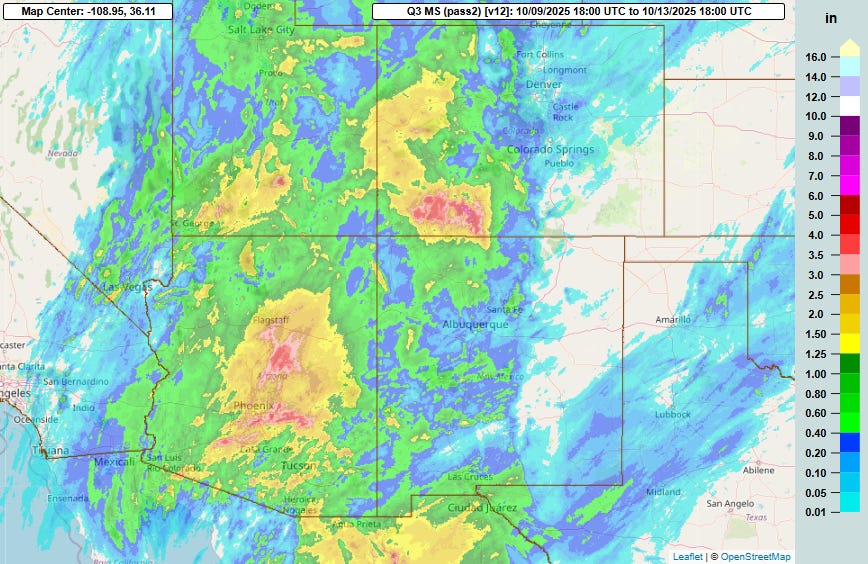
Let’s start in the Southwest, where this four-day MRMS rainfall total graphic shows they have been getting a lot of precipitation, something most areas there have not seen in a long time. This has occurred as a slow moving upper level storm system along the West Coast has pulled unusually high levels of moisture associated with the remnants of eastern Pacific tropical storms Patricia and Raymond northeast. The heaviest rainfall — more than 5” in spots — has falling in parts of central Arizona, including just south and east of Phoenix, and in southwest Colorado.
Both areas have seen significant flash flooding. In Arizona, flash flood emergencies were issued southeast of Phoenix on Sunday. Numerous water rescues were reported over the weekend in parts of the Phoenix metro area, and one person is tragically missing after their vehicle was swept away by a flash flood early Sunday morning near Goodyear. With 1.97” of rain on Sunday, Phoenix had their 16th wettest calendar day on record and wettest since 2.19” on October 13, 2018. The airport at Gila Bend had 3.61” of rain, including 3.29” in 6 hours ending at 11 am MT; the all-time daily record at the official NWS cooperative observer site in Gila Bend is 2.61” (records go back to 1892).
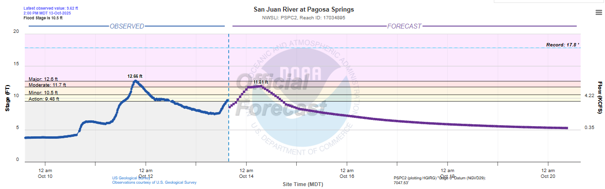
In southwest Colorado, the town of Pagosa Springs was seriously impacted this weekend by flooding along the San Juan River, forcing evacuations. The crest of 12.66’ on the river gage there was the third highest on record, and the highest in nearly 100 years since a 13.50’ crest in 1927.
Additional rain and thunderstorms are moving across Arizona this afternoon. A severe thunderstorm moving north through the Phoenix metro area recently produced a 63 mph wind gust at Phoenix Sky Harbor airport.
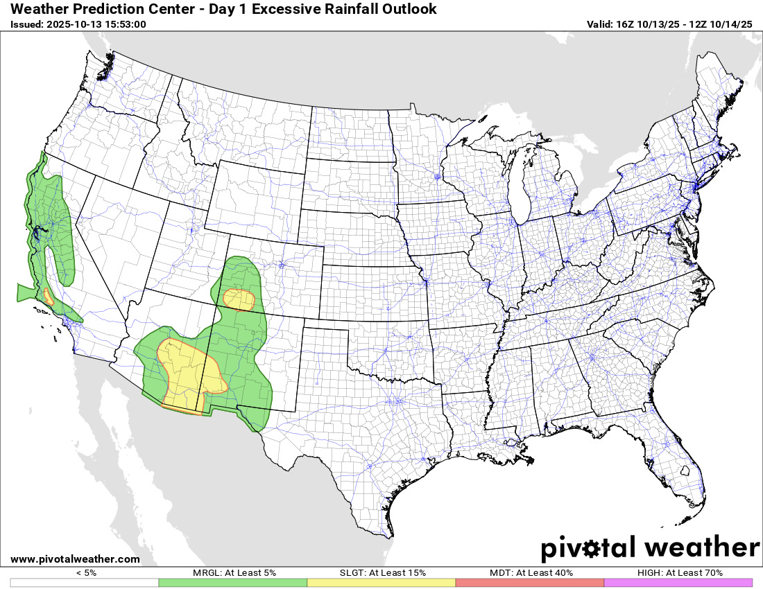
A few additional severe thunderstorms are possible this afternoon and evening across central Arizona, along with more flash flood potential as shown in the Weather Prediction Center excessive rainfall outlook above. Additional flash flooding is also possible in southwest Colorado where heavy rain will fall on top of saturated grounds.
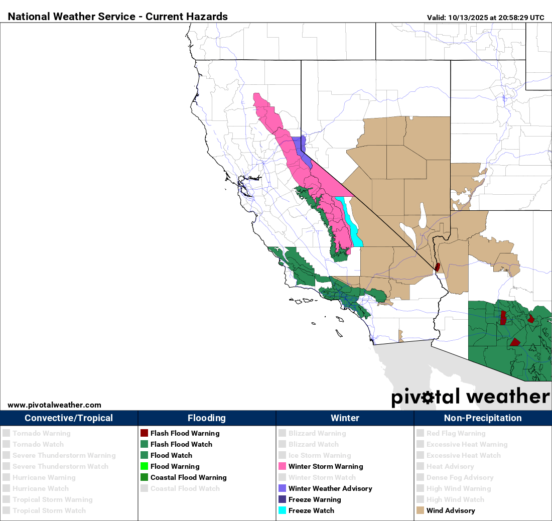
A new intense upper level low pressure system dropping south along the West Coast is expected to bring widespread impacts to California the next 24 to 48 hours. Thunderstorms are possible along the coast from the Bay Area south, with flash flooding and a few severe storms possible.
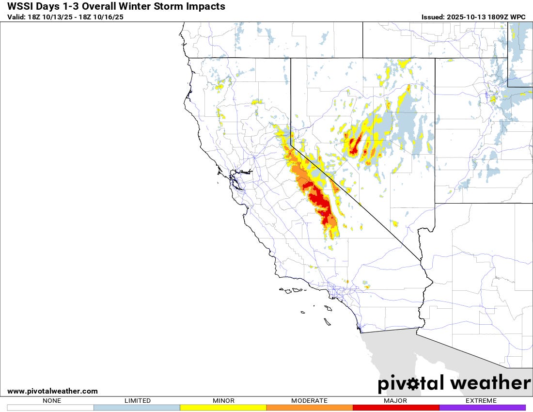
An early season high elevation mountain snow event is expected across the central Sierra Nevada and into the highest terrain of Nevada. Winter storm warnings are in effect in the California Sierra Nevada.
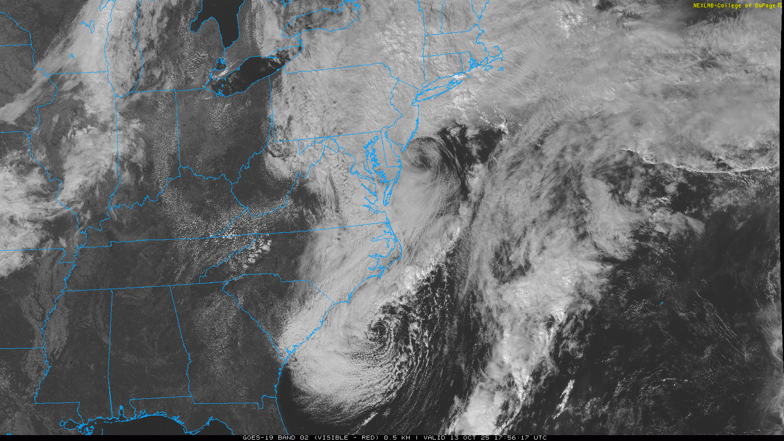
Turning to the other coast, afternoon visible satellite imagery is very cool, clearly showing the two low pressure centers the models have been forecasting the development of, one off the Carolinas and the other just east of the Delmarva. Both lows are very decidedly non-tropical with little in the way of thunderstorm activity associated with either. There have been significant impacts from strong winds and coastal flooding up and down the coast, although coastal flooding has been less severe than initially feared with so far mainly moderate coastal flooding observed. Conditions should be gradually improving over the next couple of days as the low pressure centers move slowly east.
Weekly tropical update

The 12th named storm of the 2025 Atlantic tropical season formed as Lorenzo developed early today in the tropical Atlantic well east of the Caribbean. Lorenzo is currently a tropical storm with maximum sustained winds of 50 mph, but it is dealing with west-southwest upper level wind shear which should keep it from intensifying too much the next few days. NHC is forecasting it to be a 50-60 mph tropical storm as it moves north and then northeast over the central and eastern Atlantic.
It is rather unusual to see tropical cyclones develop as far southeast as Lorenzo this late in the season. In fact, my meteorological colleague Michael Lowry pointed out in his morning tropical Substack newsletter that Lorenzo is the farthest southeast developing tropical storm this late in the season since 2003.
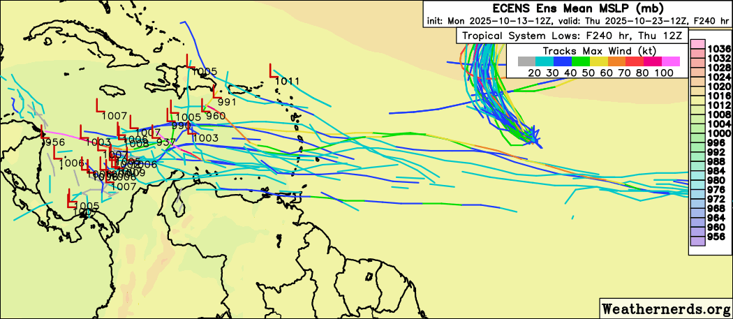
In spite of the rarity of deep tropical systems this late in the year, the models are implying that the next tropical wave moving west across the Atlantic will also pose a risk of development as it approaches the Caribbean in about a week. The European ensemble (shown above) actually seems the most bullish model on this scenario right now, although the Google DeepMind AI shows an increasing risk of development as the wave moves into farther west into the Caribbean and into an area more climatologically supportive of tropical development during the latter half of October. Given the fact that the Caribbean is an area we have to watch closely for US threats at this time of year, we will be keeping a close eye on this potential system.
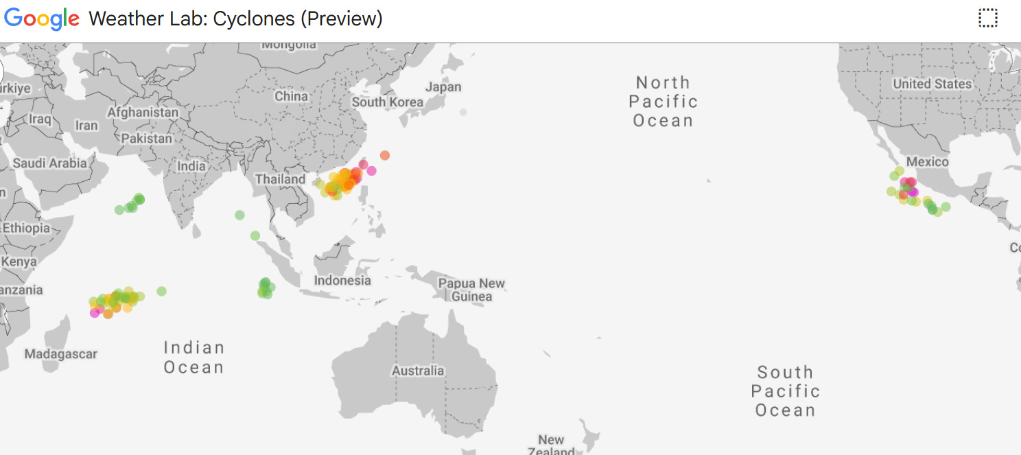
The Pacific is relatively quiet right now, with weakening Tropical Storm Nakri moving east to the east of Japan the only named system. However, the models (Google DeepMind AI shown ensemble system member forecasts shown above) imply that significant systems are likely to develop off the west coast of Mexico and in the western Pacific between the Philippines and China in about 5-7 days.
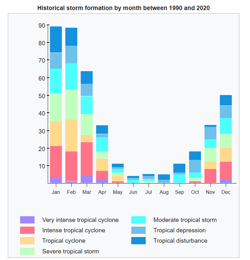
Another area to watch will be in the southwest Indian Ocean to the northeast of Madagascar. The tropical cyclone climatology of the southwest Indian Ocean is shown above, and one can see that getting a strong tropical cyclone in this area so early in the season would be rather unusual as this region usually does not get active until we move closer to summer in the Southern Hemisphere. So it will be very interesting to see if we do indeed get a system here.

Leave a comment