Invest 98L gradually getting better organized
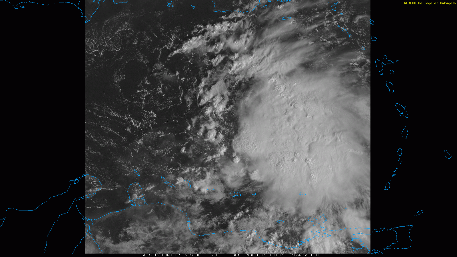
Good morning, starting off our tropical Monday with the primary weather story this morning, tropical disturbance Invest 98L. The disturbance is gradually getting better organized to the northeast of the ABC Islands, with increasing thunderstorm activity and signs of a gradually developing circulation. The tropical wave that became 98L has been moving rather rapidly to the west the last several days, but is starting to slow down as it approaches the central Caribbean.
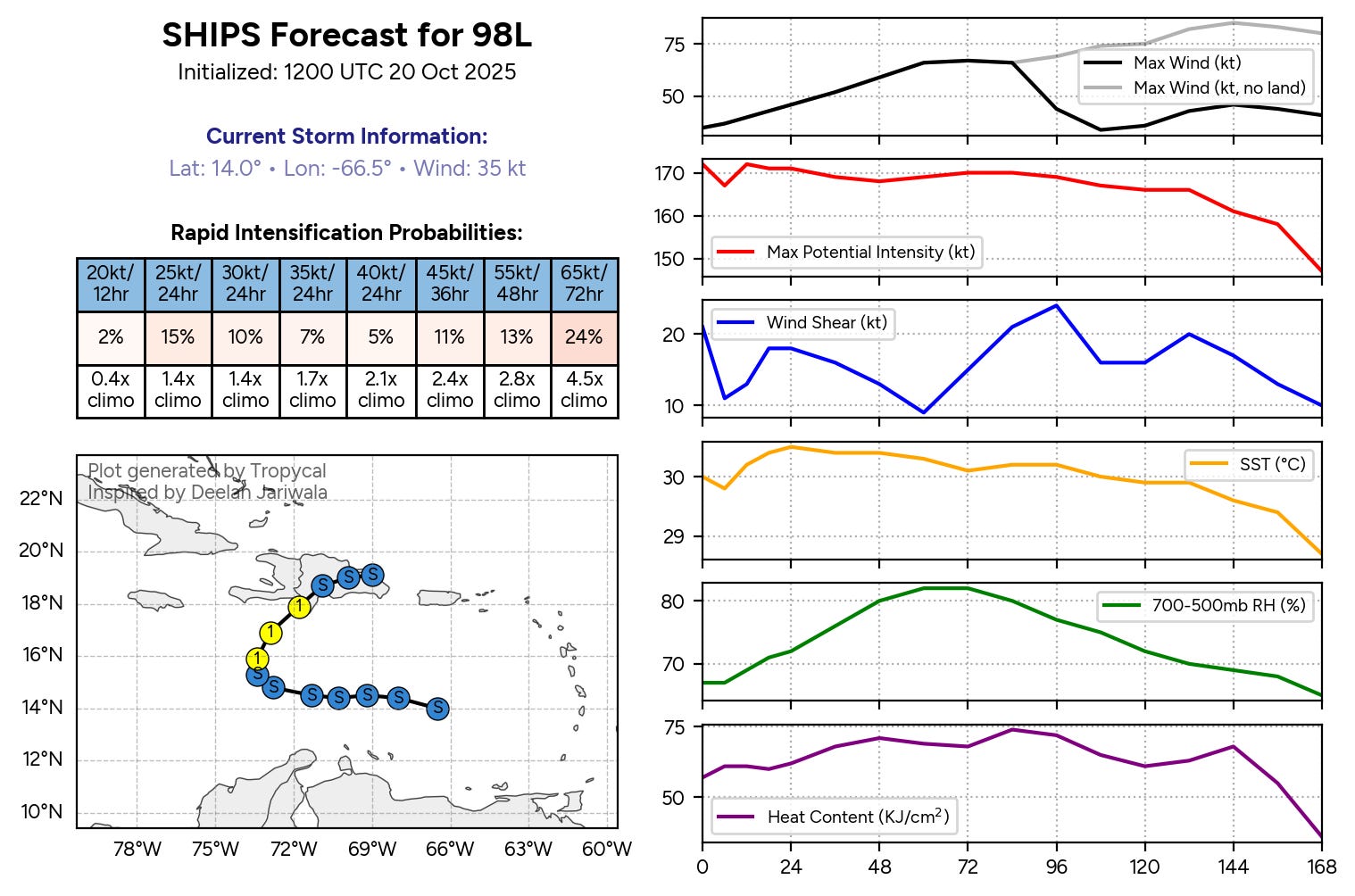
A model that meteorologists use to help gauge the environment is the Statistical Hurricane Intensity Prediction Scheme, or SHIPS. SHIPS provides a quick summary of the various environment factors governing the intensity of a tropical cyclone — in the graphic above, the lower four panels on the right plots of anticipated wind shear, sea surface temperatures (SSTs), mid level moisture, and the oceanic heat content along the most likely track of the disturbance. All of these parameters look relatively favorable, with decreasing shear and increasing moisture as well as very warm SSTs.
SHIPS also provides a statistical forecast of the probability of rapid intensification (upper left table) and compares it to what is “normal” (climo in the table); the probabilities for Invest 98L are mainly quite high. While Invest 98L still has quite a bit of organizing to do before it even becomes a tropical storm (which is why the shorter term rapid intensification probabilities are low), these probabilities suggest that once the system does develop a well organized center, it could intensify fairly quickly.
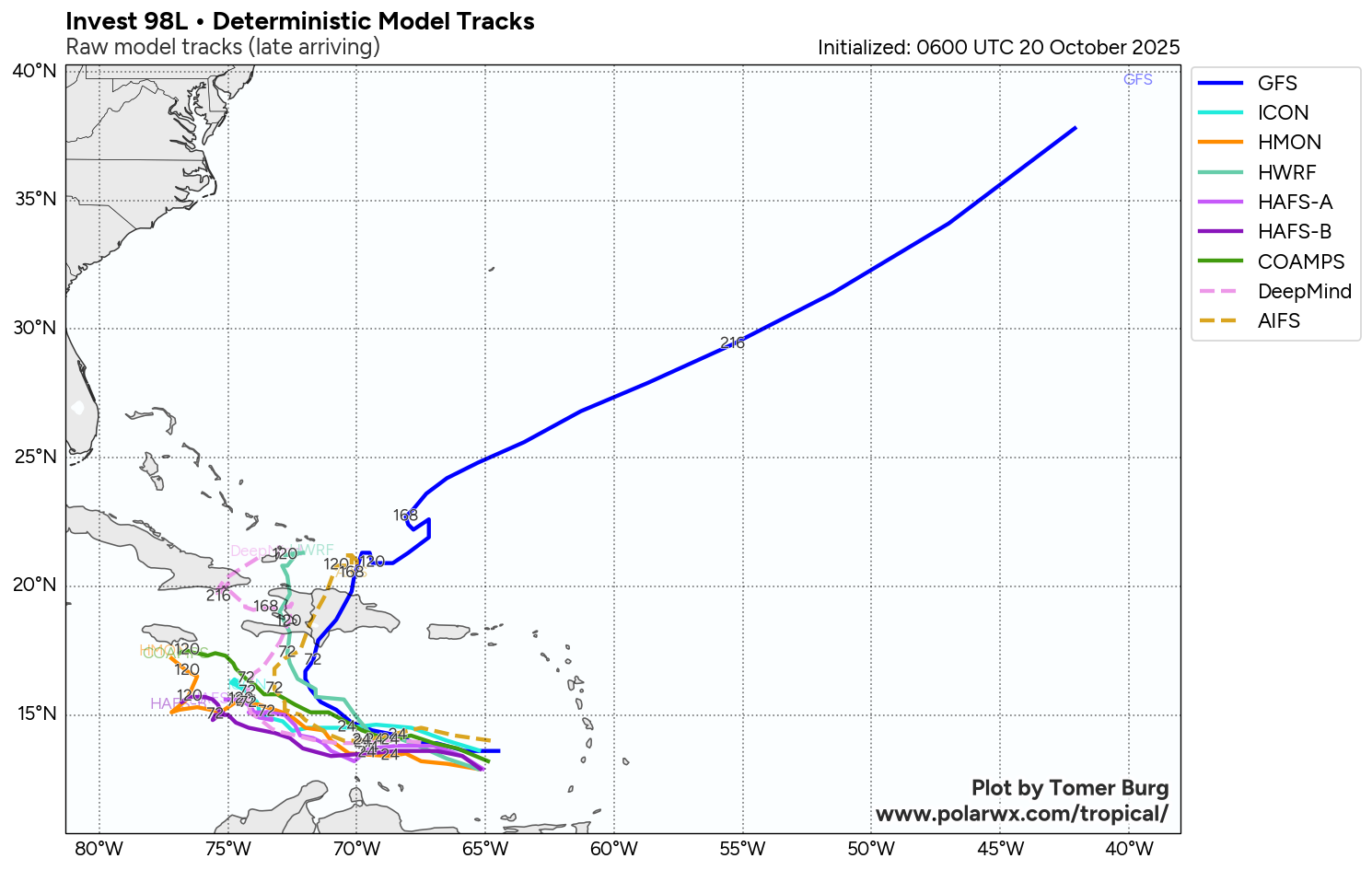
As far as track, in the short term all of the models agree on 98L really putting on the brakes and becoming very slow moving to the south of Hispaniola the next few days.
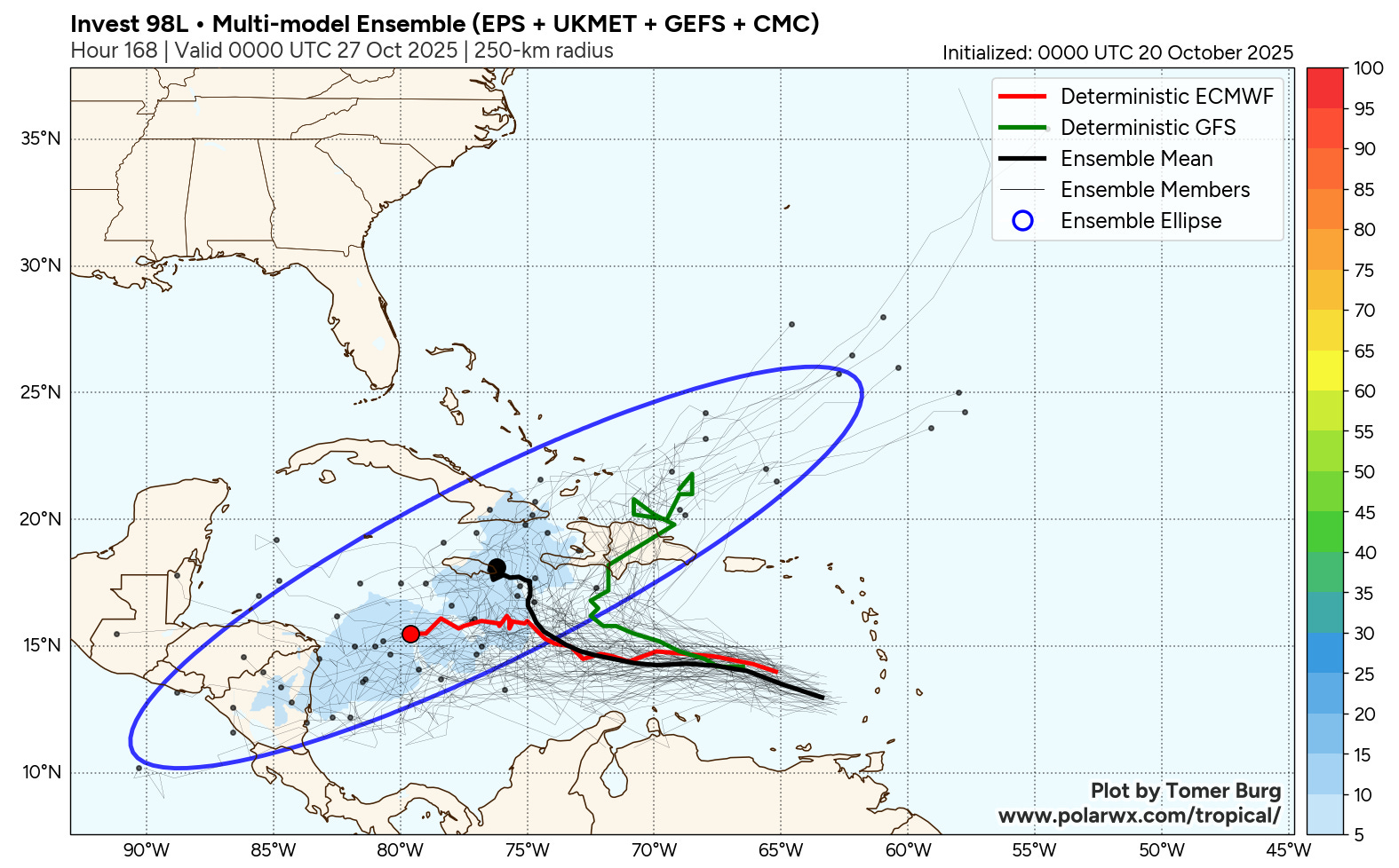
The longer term track is more uncertain, with a continued split between a camp of models that turn the system north and northeast across Hispaniola and into the North Atlantic versus a slower motion to the west that keeps the system that evolves out of 98L in the central or western Caribbean well into next week. The spread is quite apparent in the 7-day “super ensemble” forecast above from Tomer Burg’s PolarWx site. This super ensemble combines all of the ensemble members from the four main physical global model systems, and you can see the potential location of the center a week from now is literally all over the map.
Overall, I think the forecast trend is leaning toward the solution of a system eventually moving more to the north. It still seems like a stronger system would be more likely to make that turn, and given how robust the system looks already and the favorable environment ahead of it, a stronger solution seems more plausible now. Additionally, most of the members of the Google DeepMind and European AI forecast systems — which have been some of the best track forecast guidance this year — have trended toward a majority of their members in that camp. Still, the well regarded physics based European ensemble shows a majority of members in the slower, farther west camp. So for now we will continue to monitor trends; once a well developed center of circulation evolves, that should help improve and refine the track forecasts.
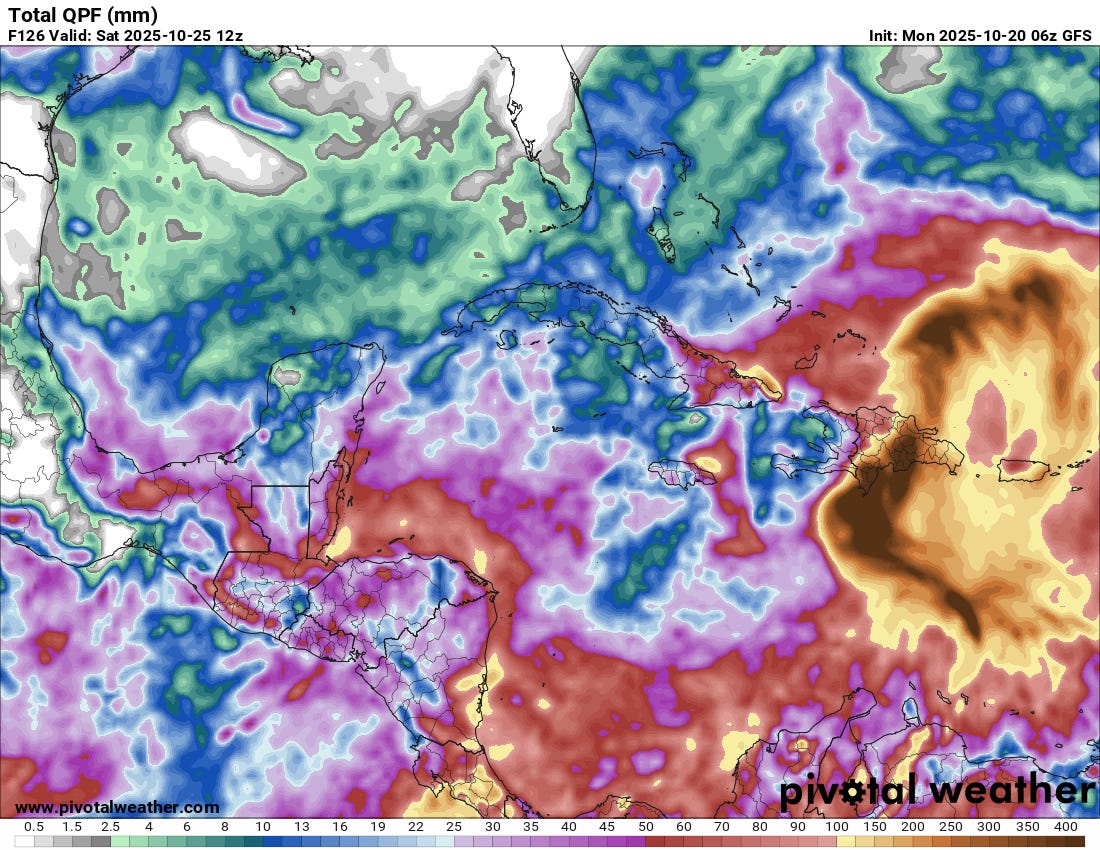
A potential serious risk with 98L that I want to start highlighting is the heavy rainfall and flash flood potential on Hispaniola. The mountainous terrain of Hispaniola is highly vulnerable to catastrophic flash flooding and has suffered from disastrous flash floods in the past. There will be a risk of heavy rain and flash flooding regardless of which track scenario evolves — but it will be magnified greatly if a well organized tropical cyclone moves north across the island. I show the most recent GFS model forecast rainfall above NOT as a forecast, but because the GFS model shows a tropical cyclone moving across Hispaniola so it can give us an idea of what sort of rainfall might be produced if that scenario comes to pass. The model is showing rainfall amounts in excess of 20” along the path of the system, which seems plausible given past tropical cyclone rainfall events on Hispaniola. Obviously, this would be a serious and potentially catastrophic flash flood and mudslide risk. Given my discussion above there is obviously still a lot of uncertainty, but given the potential magnitude of risk that could evolve I think it is important for people to start being aware of the possibility.
For next week, if 98L does move north out of the Caribbean, a number of the ensembles that follow that scenario show another system potentially developing in the western Caribbean. Given the time of year and the overall favorable look of the region, the western Caribbean will be an area to keep an eye on for one reason or another next week.
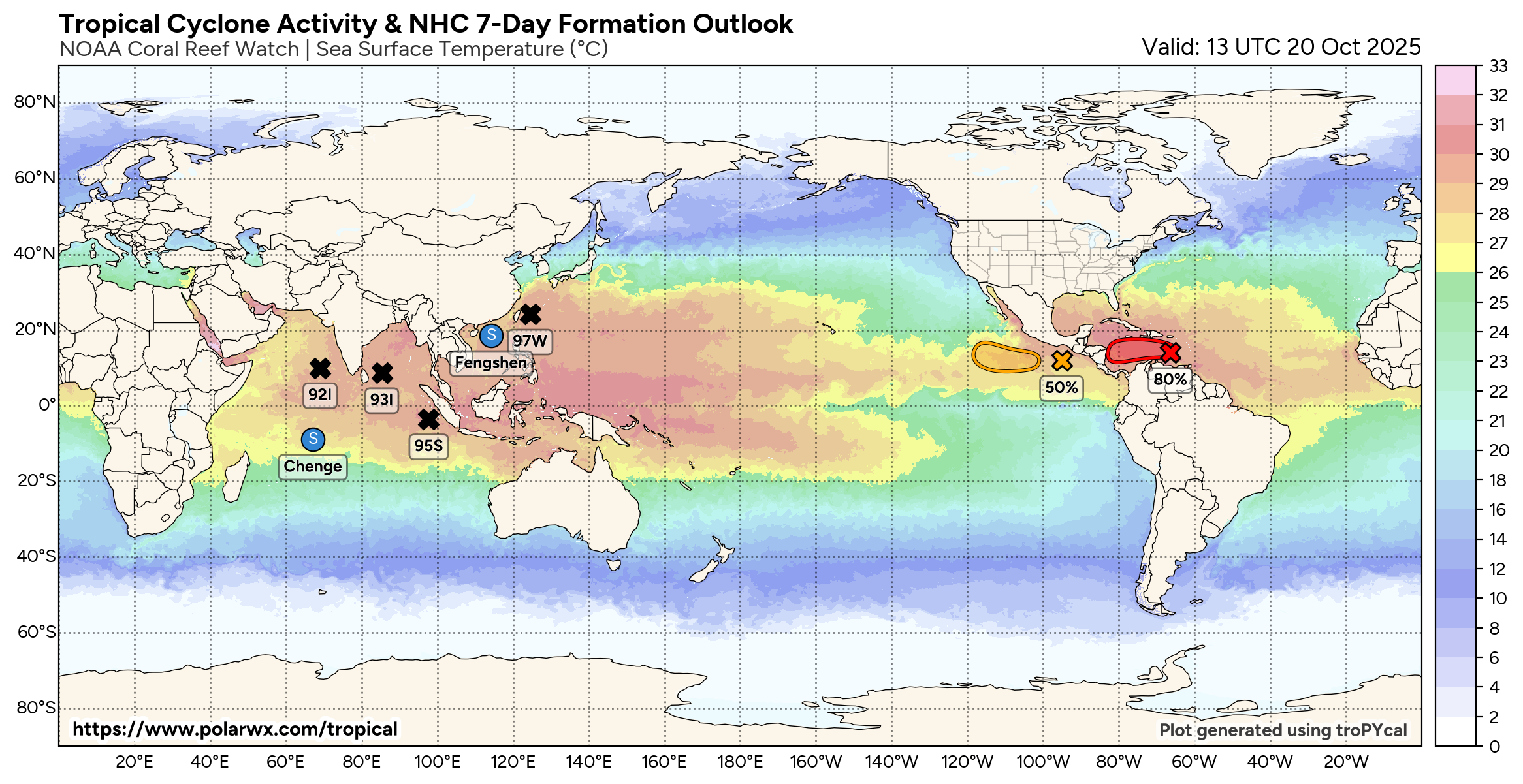
Elsewhere around the global tropics, the potential unusual system for the south Indian Ocean I talked about in last week’s tropical update did in fact develop. Severe Tropical Cyclone Chenge has winds of 65 mph but is forecast to gradually weaken over the next several days as it moves slowly west in the general direction of northern Madagascar.
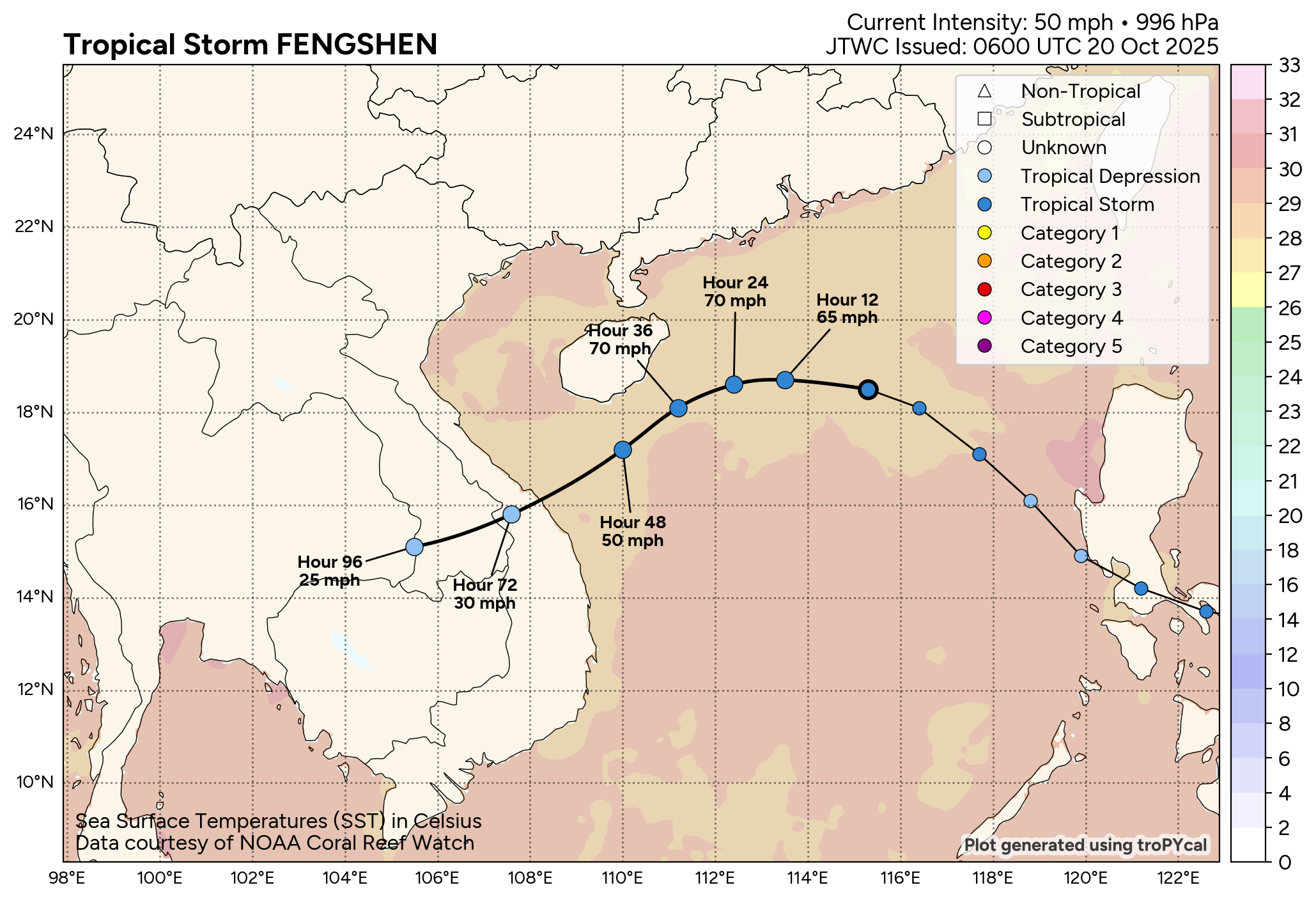
The other main story in the global tropics is Tropical Storm Fengshen, which caused serious flooding in the Philippines that has left several people dead. Fengshen is forecast to intensify a bit as it gradually turns southwest, and then weaken as it approaches Vietnam. Still, torrential rain and flooding are anticipated in portions of southeast Asia as Fengshen slowly moves southwest across the region later this week.
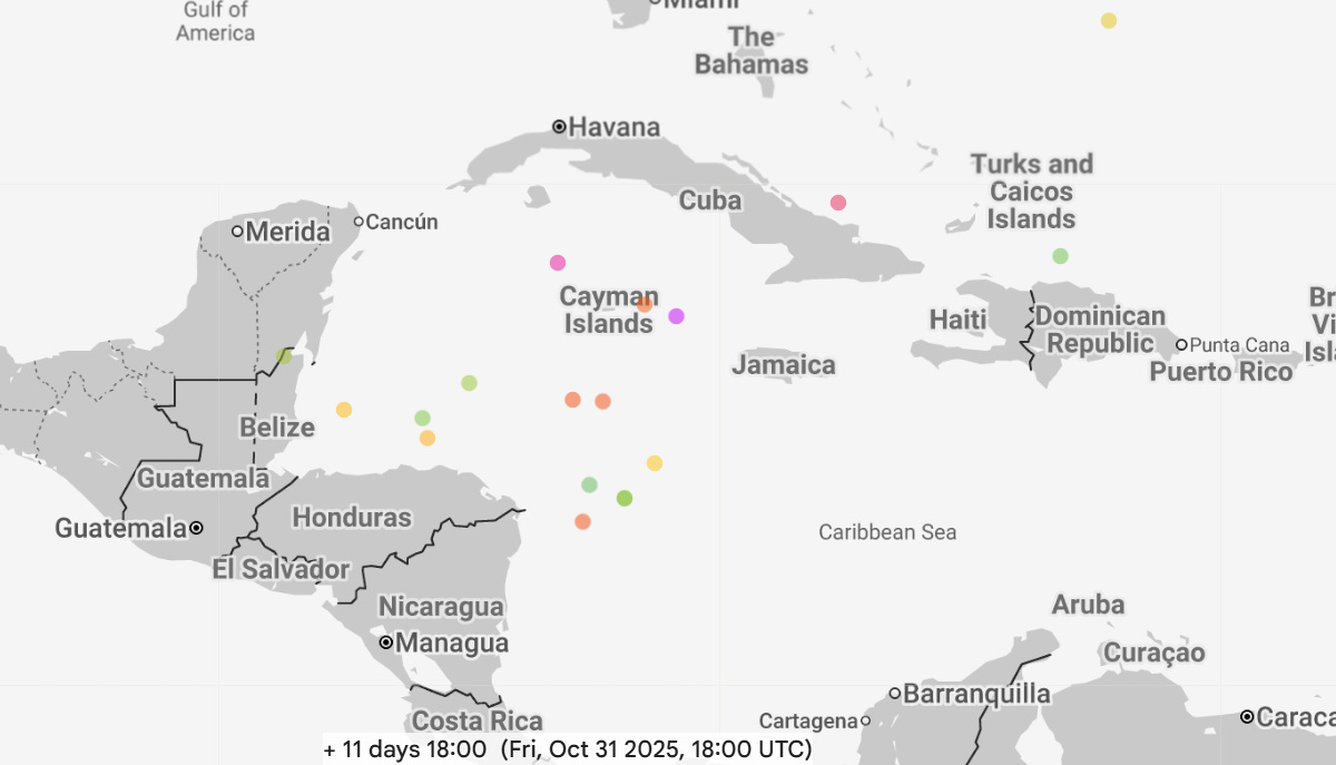
In the global map above, several other disturbances are being tracked, but right now none of them is forecast to intensify into a strong tropical cyclone. Invest 93I will bear watching for potential heavy rain and flooding potential for parts of southern India as it moves west-northwest into that region.

Leave a comment