Slow movement of an intensifying and enlarging (eventual) hurricane means prolonged and potentially massive impacts, with Jamaica and parts of Haiti most under threat initially.
Oct 23, 2025
Tropical Storm Melissa has not been doing much the last 24 to 36 hours other than meandering around and producing thunderstorms near its center that have been getting blown off to the southeast by strong upper level winds. A NOAA reconnaissance aircraft has been in the storm this evening and has not found a lot of change, with pressure and winds about the same as earlier today; NHC’s latest advisory showed maximum sustained winds of 45 mph.
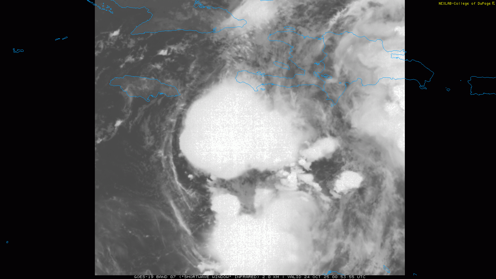
However, satellite imagery this evening shows some subtle changes that suggest the upper level winds may be starting to relax a bit. If you look closely at this shortwave infrared loop from this evening, you can see that thunderstorms are now starting to build toward the west to the southeast of Jamaica. This is a sign that the shear is not quite as strong and thunderstorms are able to maintain themselves close to the center of circulation, which is now under the mass of thunderstorms. If this trend persists overnight, it would definitely be a sign of decreasing shear and perhaps the start of the anticipated intensification process.
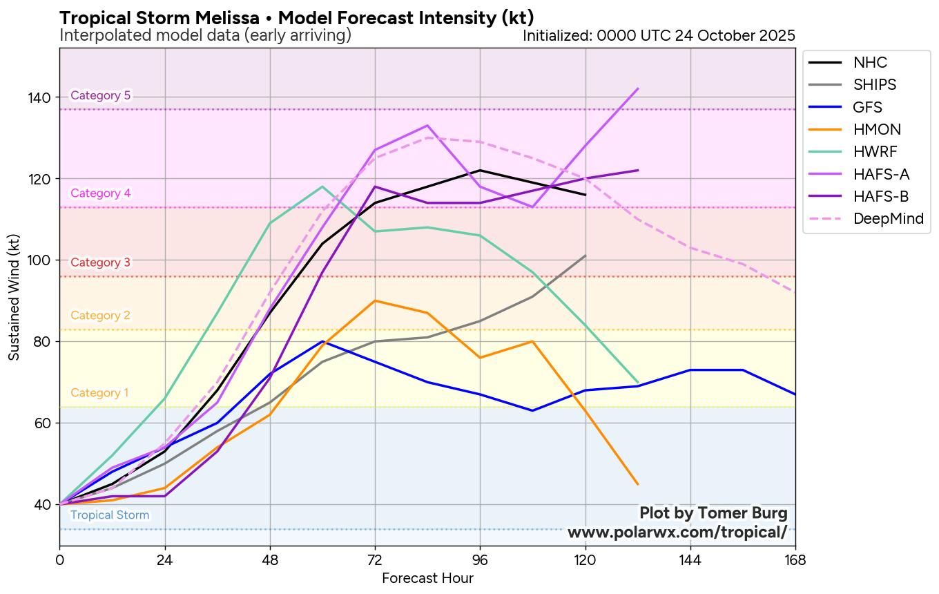
If Melissa does not intensify into a powerful hurricane (unlikely) by late this weekend or early next week, it will be a huge model bust because nearly all of the most reliable models are showing a favorable environment and responding with rapid intensification to category 3 or higher intensity.
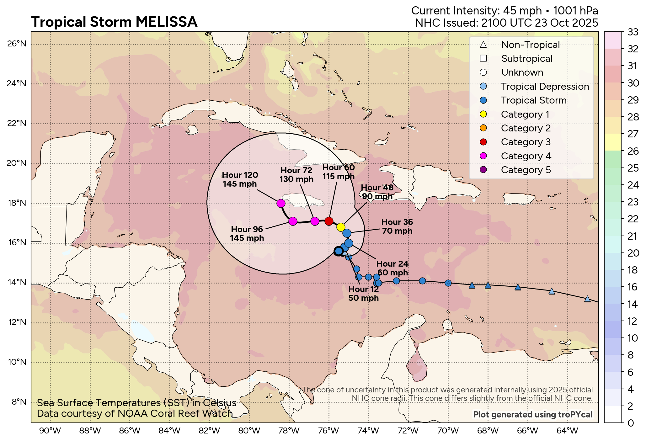
The track forecast is still rather uncertain, but in general a slow meander to the north followed by a slow drift to the west or northwest is anticipated over the next 5 days. As you can see in the NHC forecast above (graphic from polarwx.com), they are forecasting an intensifying and enlarging hurricane in the vicinity of Jamaica and southwest Haiti for the next several days, with the hurricane reaching category 4 intensity in 5 days.
![[Key Messages]](https://substackcdn.com/image/fetch/$s_!kFrk!,f_auto,q_auto:good,fl_progressive:steep/https%3A%2F%2Fsubstack-post-media.s3.amazonaws.com%2Fpublic%2Fimages%2F220d7ca3-1d7f-4347-8688-5c874055fbfb_897x736.png "[Key Messages]")
The National Hurricane Center is using grave wording to warn of potentially catastrophic impacts to these regions from winds and torrential flooding rains with disastrous landslides over the next 5 days.
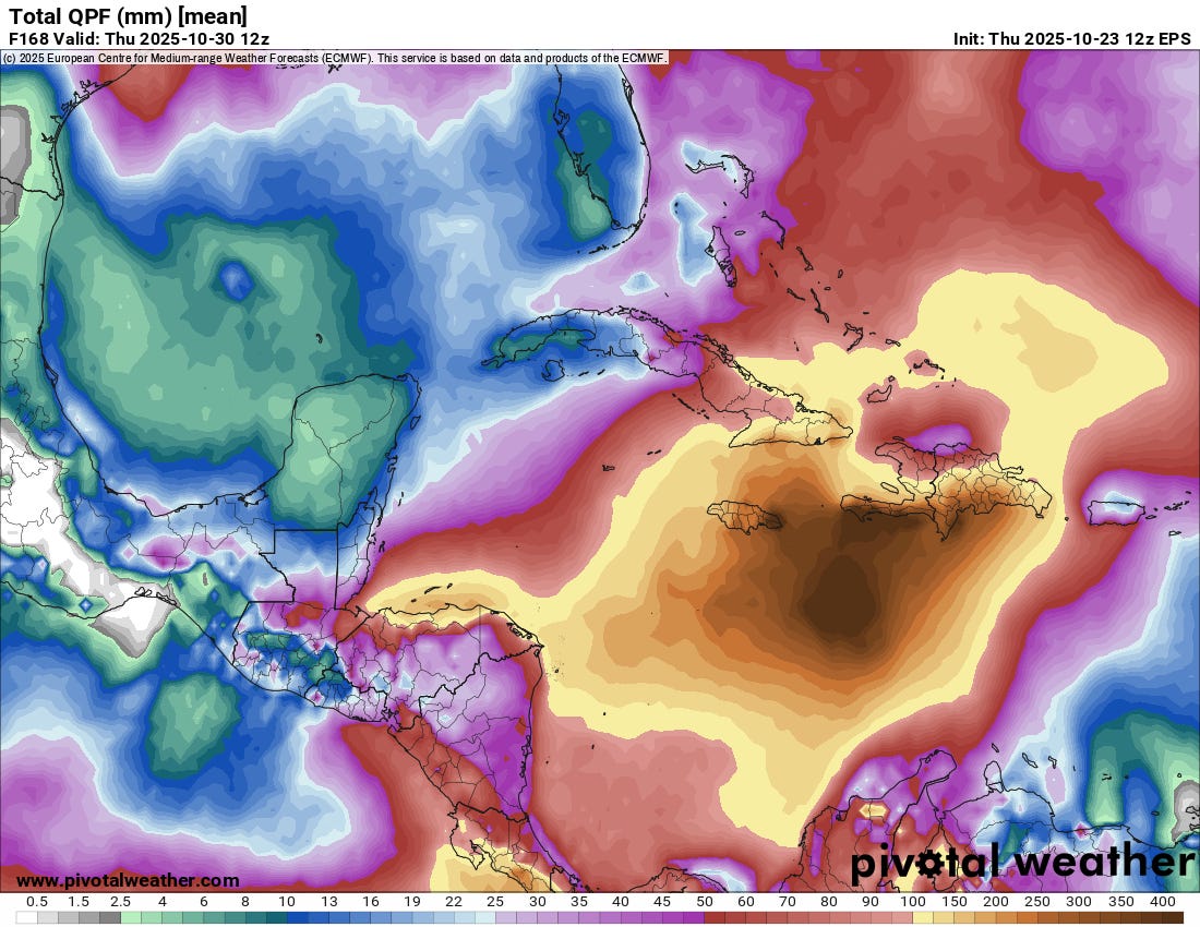
Heavy rain has already been occurring in southern parts of Hispaniola the last few days, and it is important to recognize that the rainfall forecast map in the NHC graphic above is just additional rainfall for the next 3 days. Rainfall will continue in this region for at least a few days beyond that and also expand to affect at least eastern Cuba and possibly the Cayman Islands. The graphic above is the 7-day forecast rainfall from the most recent European ensemble model, and it shows rainfall of up to 600 mm (~24”) over parts of eastern Jamaica and southern Hispaniola. This would obviously result in devastating flash floods and mudslides in this mountainous region.
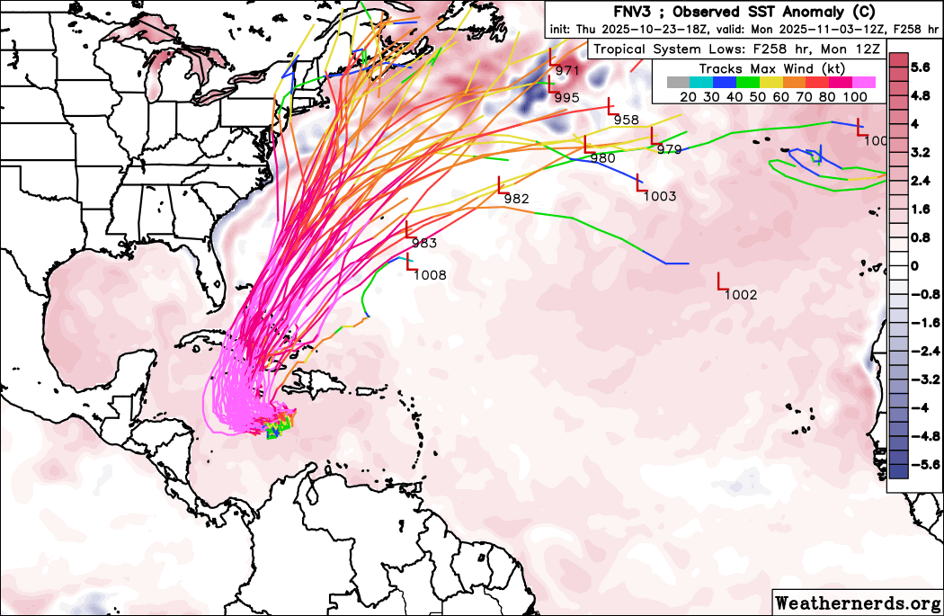
While the primary focus on Melissa is the next several days of potentially catastrophic impacts in the Caribbean, obviously there are longer term concerns as well. Uncertainty in the details definitely still exist, but the general idea of Melissa drifting in the vicinity of Jamaica and possibly in the direction of the Cayman Islands the next 5 to 7 days, followed by a turn to the north and northeast across central or eastern Cuba and then the Bahamas is now anticipated by nearly all of the models (Google DeepMind (GDM) ensemble forecast tracks above). Obviously, people in or with interests in those areas should be monitoring forecasts for Melissa very closely.
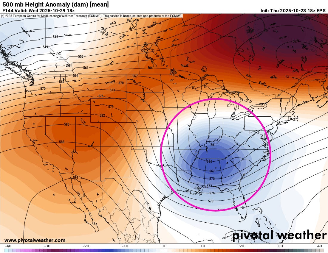
You may note in that GDM ensemble forecast map above that by the end of the 10 day forecast period a number of tracks come near or even over the Northeast or Canadian Maritimes. As I talked about in a post earlier this week, a series of upper level troughs of low pressure will be digging into the eastern United States and could potentially play a role in the track of Melissa. It is looking increasingly likely that the upper level trough forecast to develop over the eastern United States in about a week as shown above (European ensemble forecast for next Wednesday) will play a key role in the long term track of Melissa. There is a ton of uncertainty in the strength and position of this upper low in the various ensemble model solutions, so there will likely be significant evolution in the model forecasts for Melissa’s longer term track. The bottom line though is while the risk of Melissa causing impacts to the East Coast or Canadian Maritimes at this point is low, it is certainly not zero, and we will be closely watching how forecasts for this upper level trough evolve.
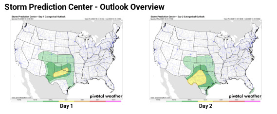
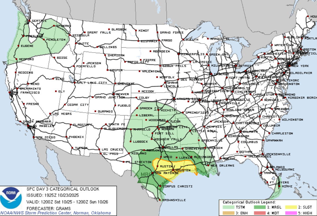
The first system in this series of upper level troughs of low pressure will be causing some potent thunderstorm activity the next few days over parts of the south central United States. Slight (level 2 of 5) risks of severe thunderstorms are forecast by the Storm Prediction Center as this system progresses east.
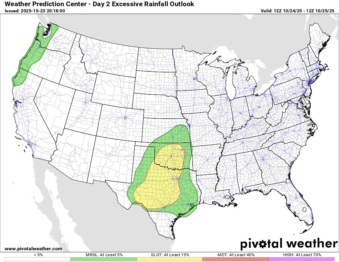
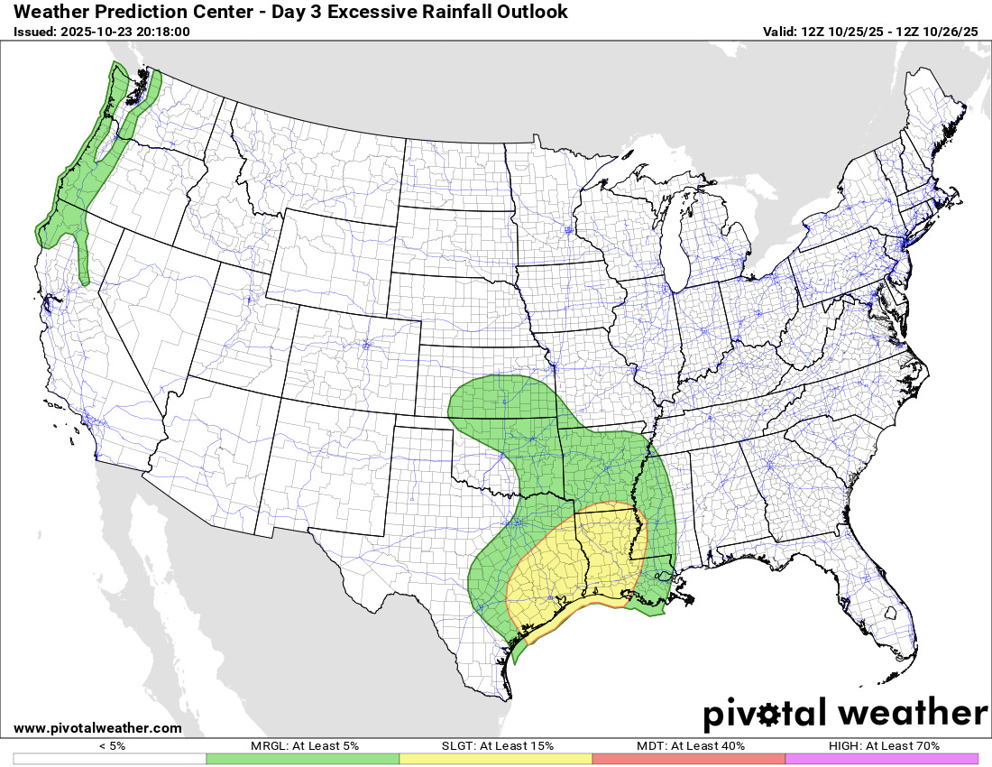
Flash flooding will also be a risk with these thunderstorms, and slight (level 2 of 4) risks of excessive rainfall are also in place. An atmospheric river will also bring heavy rainfall to the Pacific Northwest.

Leave a comment