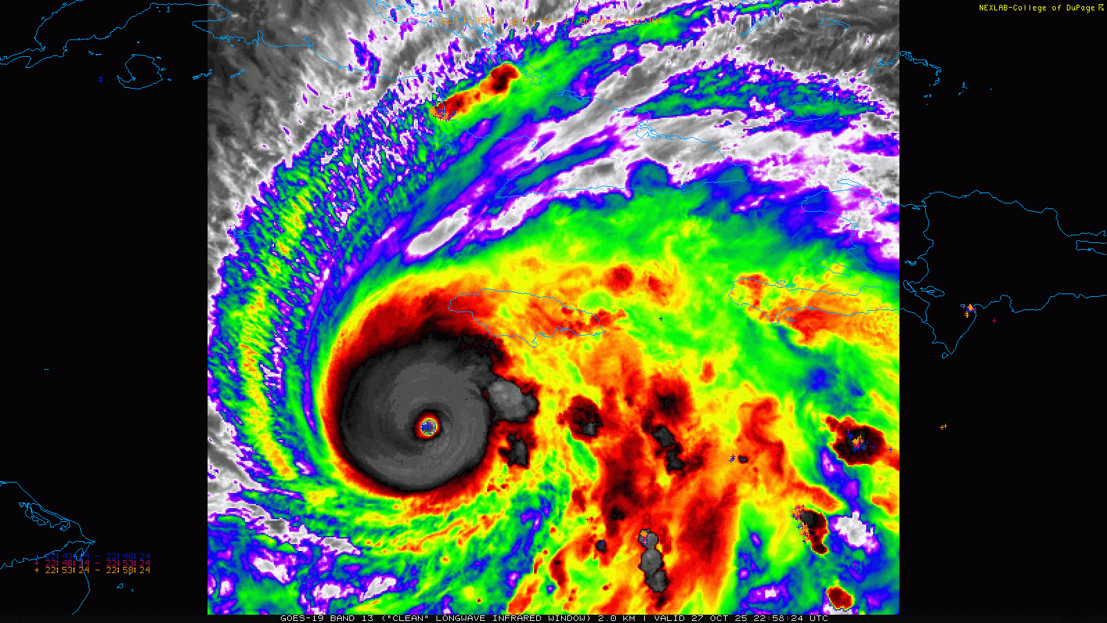
Another quick update on Hurricane Melissa. The hurricane has pretty much become completely stationary about 155 miles southwest of Kingston, Jamaica, or about 100 miles south-southwest of the western tip of the island. Two reconnaissance aircraft are flying through the system this evening, and as of now they have found that the hurricane looks to be holding its intensity, with maximum sustained winds of 175 mph and a minimum central pressure of 909 mb (up very slightly since bottoming out at 906 mb).
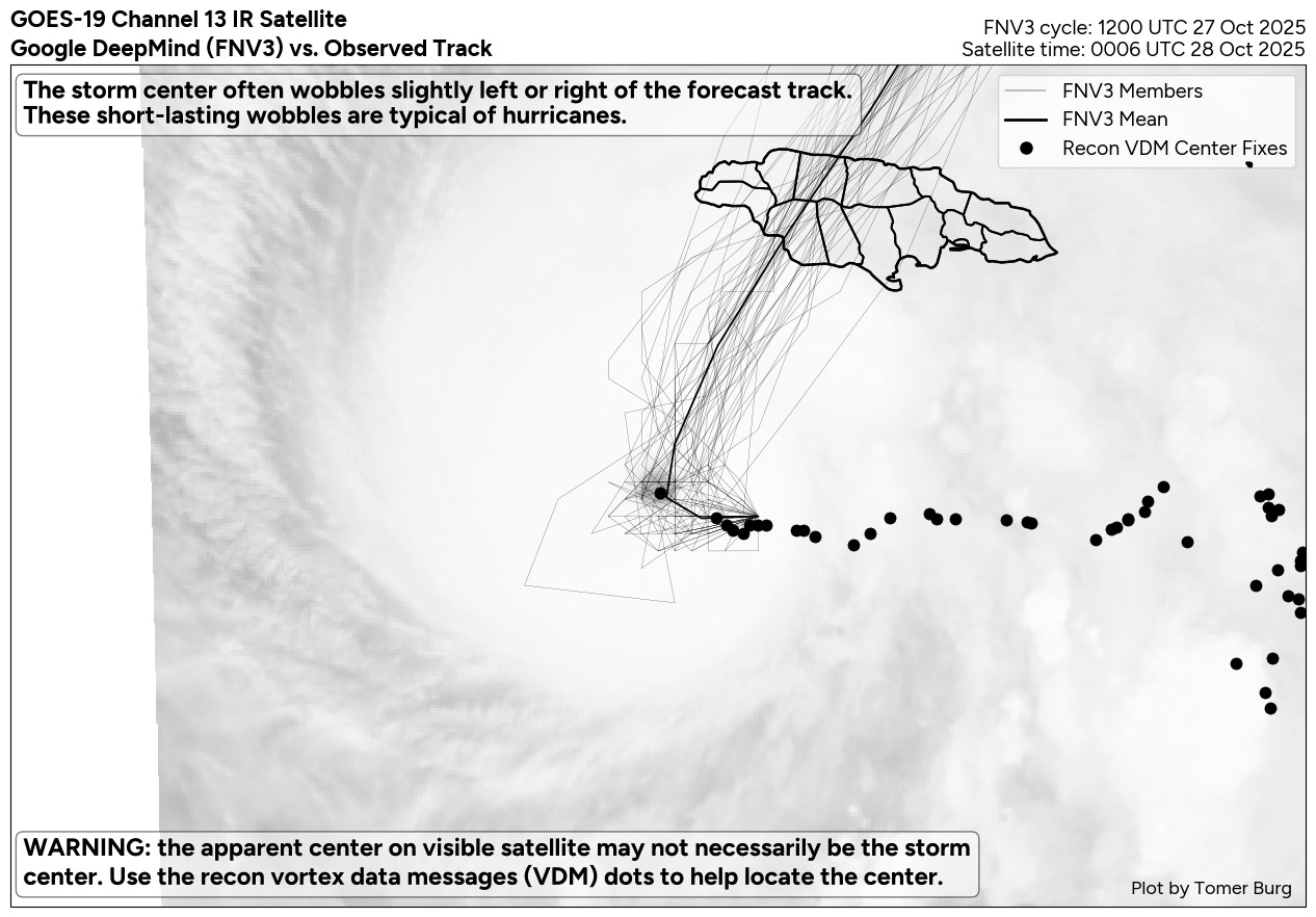
All indications are that as the upper level trough we have been talking about for days over the eastern United States continues to dig southeast, the steering flow will evolve such that Melissa will start to move north-northeast toward the south coast of Jamaica tonight (Polarwx.com plot of satellite and forecast model tracks from the Google DeepMind ensemble shown above).
![[Key Messages]](https://substackcdn.com/image/fetch/$s_!8rHD!,f_auto,q_auto:good,fl_progressive:steep/https%3A%2F%2Fsubstack-post-media.s3.amazonaws.com%2Fpublic%2Fimages%2F74adec20-0801-4551-9884-78650280636b_897x736.png "[Key Messages]")
Regardless of whether Melissa makes landfall as a category 4 or 5 hurricane, tremendous impacts from winds, storm surge, and flooding from up to 30” of additional rainfall are expected. Again, it cannot be stressed enough that all indications are that this will be the most intense and damaging hurricane to strike the island of Jamaica on record. Extreme conditions are anticipated for much of the island over the next 24 to 36 hours.
I will be doing a live chat (live content is a paid subscriber benefit) at 9 pm ET/8 pm CT to talk more about what we are seeing in the data tonight and to answer questions about Melissa. Additional updates through short Substack posts and notes as well as BlueSky posts will continue as I can provide them.

Leave a comment