Bermuda and possibly the Canadian Maritimes are the next and final targets for the storm
Starting off this afternoon’s newsletter by sharing that I was invited to put together a guest essay for the the New York Times to convey my thoughts and perspectives about Hurricane Melissa as a longtime meteorologist. You can read the article here. Needless to say, I am devastated by the impacts that Melissa has had on the Caribbean, and am thinking about all of those impacted. As I allude to in my NYT essay, I hope this is a clarion call for the need for improving not only our weather and water forecasting capabilities but also our disaster preparedness and response.
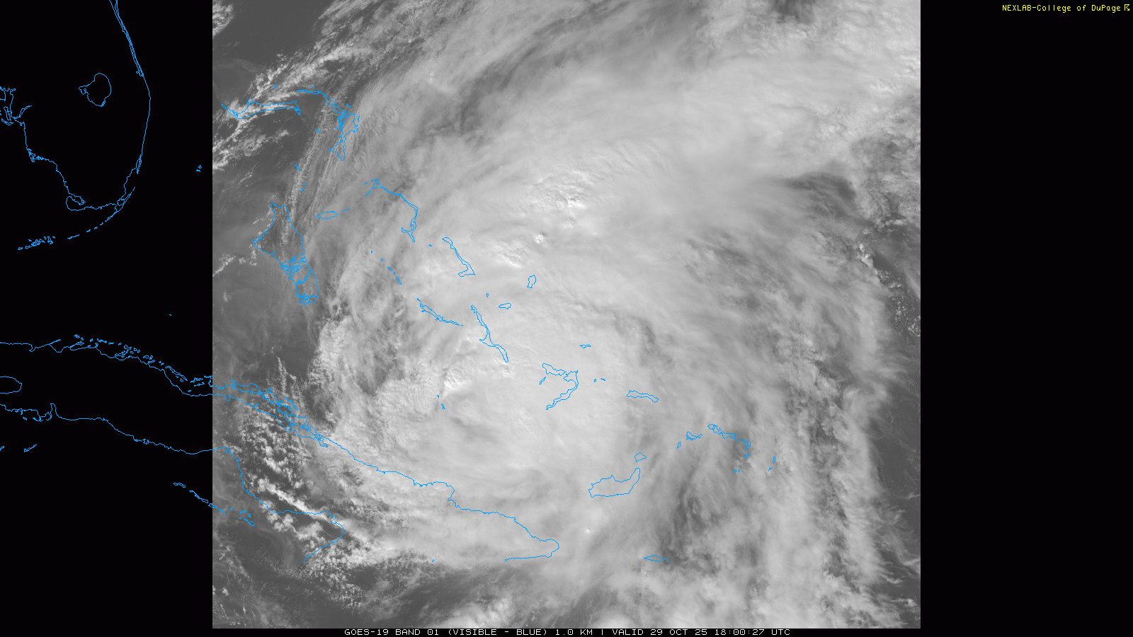
While Melissa took a horrible toll on Jamaica and Cuba, those mountainous islands also took a notable toll on the hurricane itself. Melissa is much more disheveled looking on satellite this afternoon, with a defined eye no longer visible and rather disjointed looking thunderstorm activity. The central pressure of the hurricane is up about 80 millibars from its pre-Jamaica minimum, to 974 millibars (28.77”).
![[Key Messages]](https://substackcdn.com/image/fetch/$s_!0e-W!,f_auto,q_auto:good,fl_progressive:steep/https%3A%2F%2Fsubstack-post-media.s3.amazonaws.com%2Fpublic%2Fimages%2F9ffd2dbb-3044-45b3-94c1-470766db7c9f_897x736.png "[Key Messages]")
Even with all of this trend toward disorganization, Melissa is still a formidable category 2 hurricane based on reconnaissance data, with maximum sustained winds of 100 mph. Significant impacts from wind, storm surge and heavy rainfall will continue into tonight across the eastern Bahamas. Heavy bands of rainfall are also continuing over eastern Cuba as well as Hispaniola, where the death toll from catastrophic flash flooding produced by Melissa has risen to at least 20 in Haiti. All of these impacts should start to diminish by Thursday as Melissa continues to accelerate to the northeast.
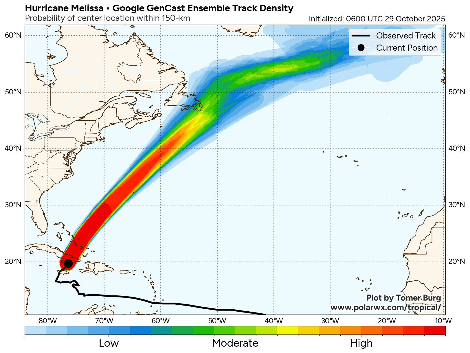
While Melissa could reorganize a bit in the next several hours as it is over warmer water and wind shear is not too restrictive, all indications are that increasing wind shear and cooling sea surface temperatures should mean an eventual gradual weakening of Melissa over the next couple of days. However, Melissa is still forecast to be a hurricane as it makes its closest approach to Bermuda on Thursday, and a hurricane warning is in effect for the island.

The forecast track of Melissa has been shifting more to the west in the longer term, and it now looks as if the storm will pass fairly close to Newfoundland as it is transitioning to a post-tropical storm Friday into Saturday. Heavy rain and high winds are already anticipated in the Canadian Maritimes due to a Nor’easter, but the Canadian Hurricane Centre is advising that Melissa could enhance these impacts to parts of Newfoundland depending on the exact track of the storm.

Speaking of that Nor’easter, it is expected to produce wind and rain over much of the Mid-Atlantic and Northeast Thursday into Friday. Some high elevation snowfall will be possible in northern New England by Friday.

Leave a comment