48 confirmed dead and more missing, new system likely to threaten northern Philippines as a supertyphoon this weekend.
Infrared satellite imagery this morning shows that Typhoon Kalmaegi has continued to move west in the last 24 hours and the center is now about to pass west of westernmost islands of the Philippines. The typhoon has weakened a bit due to its passage over the central Philippines and now has maximum sustained winds of 80 mph. Extremely intense thunderstorm activity continues with Kalmaegi, particularly south and west of the center.
That intense thunderstorm activity produced torrential rainfall as it moved across the central Philippines during the last couple of days, causing devastating flash floods particularly in areas of mountainous terrain. Cebu province seems to have been the hardest hit, with Cebu City picking up 183 mm (~7.25”) of rain in the 24 hours before the typhoon made landfall, and of course additional heavy rain fell after this. This region of the Philippines is particularly vulnerable right now due to a magnitude 6.9 earthquake on September 30 which killed 79 people and left thousands of people living in temporary tent cities.
ABS-CBN, the national news organization in the Philippines, reports that 48 people have been confirmed dead in Cebu province due to flooding, with additional people missing (note that the Philippines does not use the international naming convention for typhoons, and the local name for Kalmaegi is “Tino.”) The Cebu provincial governor described the flooding situation there as “unprecedented,” and in an observation that has sadly been made so many times by so many people over the years, said “we were expecting the winds to be the dangerous part, but… the water is what’s truly putting our people at risk. The floodwaters are just devastating.”
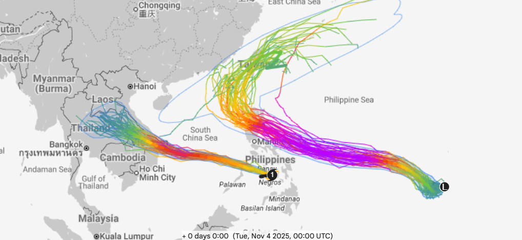
As Kalmaegi pulls away from the Philippines over the next couple of days, it should encounter a relatively favorable environment for intensification, and the Joint Typhoon Warning Center (JTWC) forecasts its maximum sustained winds to peak at 110 mph over the south China Sea. As can be seen above, the Google DeepMind (GDM) AI system — which has been the best performing model in the eastern Pacific and Atlantic basins this year — is actually a bit more bullish than JTWC. We noted a similar trend with Kalmaegi before it made landfall in the Philippines, and it ended up that the GDM was too strong as discussed in this excellent blog post by hurricane researcher Andy Hazelton. It will be interesting to see if a similar trend holds for this forecast.
Regardless of its eventual peak intensity, Kalmaegi should weaken a bit as it approaches Vietnam due to cooler oceanic temperatures and increasing shear. Still, it should be a formidable typhoon when it makes landfall in Vietnam on Thursday (US time). Vietnam is already recovering from recent heavy rainfall and flooding that has left at least 37 people dead so Kalmaegi poses a serious threat to the country.
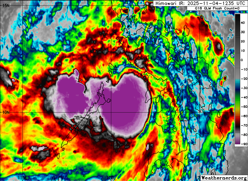
Unfortunately, the system farther east from the Philippines that I mentioned yesterday has continued to get better organized and has now been designated a tropical depression to the southwest of Guam by JTWC. As can be seen above, the GDM has an extremely strong signal for intensification with nearly all members of the ensemble showing this system becoming a super typhoon as it approaches the northern Philippines.
As far as track, the GDM has a strong signal for this system to make landfall in Luzon in the northern Philippines. The “grand” ensemble from polarwx.com that includes all of the hundreds of various model ensemble members shows the most likely track in this area, however there is more spread as a decent number of the physics based ensemble tracks are a bit farther north. The bottom line is that while there is still some uncertainty, for this time range (5 days) the probability of a landfalling supertyphoon in the northern Philippines is rather high, and this will be a situation to watch very closely in the coming days.
We do not want to forget about the continuing crisis left behind by Hurricane Melissa. NBC News reports that the confirmed death toll has reached 67 from the storm, including 32 in Jamaica and 34 in Haiti. This short video from The Weather Channel shows some of the devastating damage and describes how western Jamaica is on the brink of a humanitarian crisis as food, water and other aid is desperately needed. Again, if you are interested in helping with this crisis, USA Today has a list of non-profits working in the region.
Sticking with Melissa and the Atlantic tropics for a moment, I want to highlight this excellent Substack post from my colleague Michael Lowry in which he discussed the performance of the new Google DeepMind AI (very good!) and for NOAA/NWS Global Forecast System (GFS) model (very bad) for Melissa and 2025 in general.
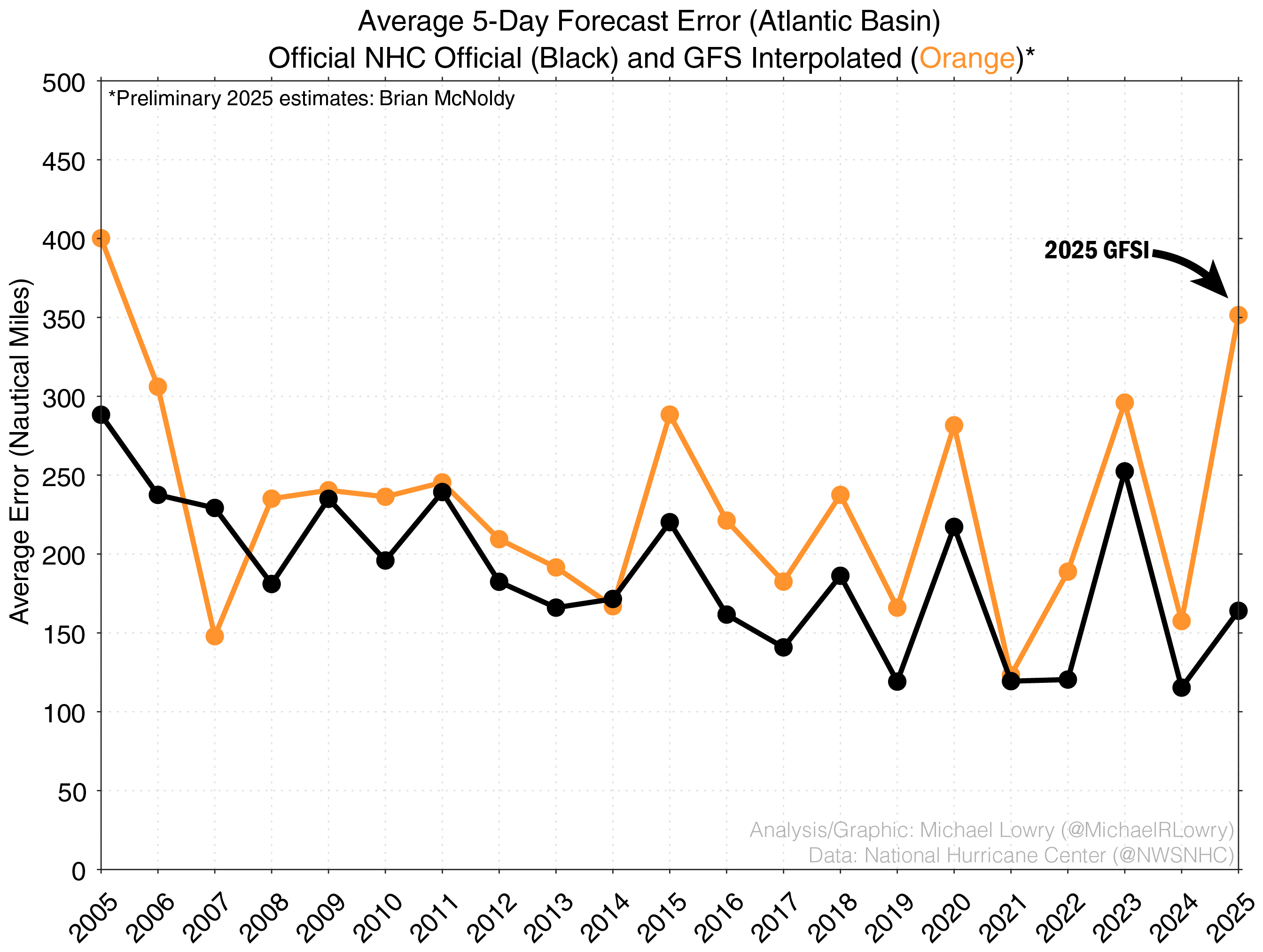
Michael highlights that Brian McNoldy has taken his verification work on the GFS further since I talked about it in my post Friday, and has found as you can see in the graphic above that the track forecasts from the GFS for the 2025 Atlantic season are actually the worst since 2005. While it might be instinct to blame this on 2025 specific NWS issues such as reduced upper air data, as Michael correctly points out if that were the case we should see similar degradation of skill in other models’ performance, which we do not. Hence, it is much more likely that this is something unique to the GFS and more the result of chronic issues that have plagued NOAA/NWS global modeling for years. As I discussed in that Friday post, global modeling is one of a few key areas where NOAA/NWS was already in need of significant improvement and reorganization prior to this year, and I worry about the ability for the agency to focus on these needed areas for improvement given the current budgetary and administrative environment in Washington.

Taking a quick look at US weather, the main focus for precipitation will continue to be in the Northwest the next few days as a series of storm systems brings heavy rainfall and some high elevation snowfall. Much of the country will see above normal temperatures, with some record high temperatures possible particularly in the Southern Plains and Rockies.
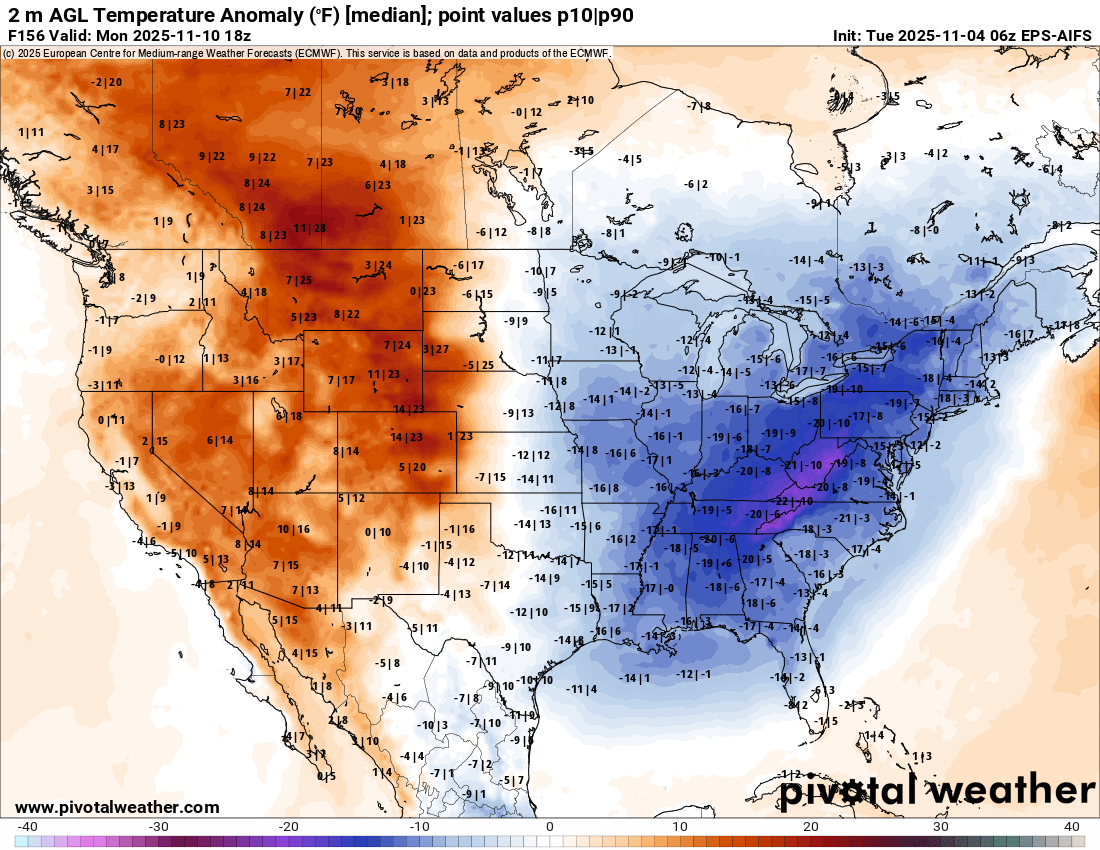
By this weekend, the weather pattern will evolve toward a building upper level ridge of high pressure in the western United States with a downstream trough over the eastern United States. This should bring at least a few days of below normal temperatures to the eastern half of the nation by early next week, while unseasonable warmth will build over the West.
Note: The US weather community relies on the work of NOAA scientists who are exempt from the ongoing federal furlough due to the life-saving nature of their work. These federal employees are in their 35th day of working without pay and without knowing when they will eventually receive pay. You can read more about this situation in this post.

Leave a comment