Coldest air so far this season to make visit to eastern half of the country early next week with record lows possible
Nov 06, 2025
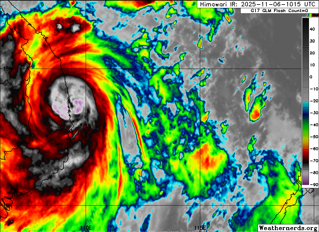
Typhoon Kalmaegi made landfall in central Vietnam several hours ago. It peaked at a category 4 on the Saffir-Simpson Hurricane Wind Scale last evening (US time), before weakening a bit just before landfall. The slight weakening before landfall was anticipated, but unfortunately Kalmaegi did get significantly stronger than forecast before than weakening, and impacts in central Vietnam were likely significant. We discussed in Tuesday’s post how the Google DeepMind (GDM) AI had overforecast the intensity of Kalmaegi before its Philippines landfall, and was similarly more bullish over the South China Sea. It looks like this time, though, the GDM was unfortunately correct with its stronger forecast.
 and almost 200 inches over 5000 millimeters of rain in a week ending October 27.")
As I have mentioned in earlier posts, the landfall of Kalmaegi in central Vietnam is of particular concern due to extremely heavy rain and serious flooding in recent weeks which had already left 37 people dead. Gallagher Re scientist Steve Bowen put together this excellent graphic showing the extreme rainfall that fell over central Vietnam in late October, including nearly 70” (!) of rain in 24 hours at a mountain site near Hue City. If there is any bright spot here, Kalmaegi does seem to be moving steadily west which will hopefully help limit extreme rainfall from the typhoon, but exacerbated flooding along with damaging winds and storm surge likely caused serious impacts in the region as it made landfall.
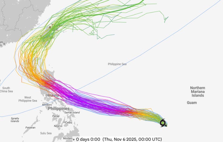
The next system behind Kalmaegi has continued to become better organized in the last 24 hours, and has now been designated as Tropical Storm Fung-Wong, with maximum sustained winds of 45 mph. Model intensity forecasts with Fung-Wong have backed off slightly, but it is still forecast to become a powerful typhoon as it moves west-northwest — the GDM shown above continues to show Fung-Wong becoming a super typhoon (equivalent of a high end category 4 hurricane) before landfall in Luzon. The model track forecasts have unfortunately shifted a bit south in the last 24 hours, and accordingly a direct impact in the northern Philippines now seems fairly certain late this weekend (US time).

Relatively quiet weather is anticipated across much of the US the next day or two as shown in the Weather Prediction Center forecast weather map above, although significant precipitation will continue in the Pacific Northwest. Unseasonably warm temperatures will dominate most of the country, but the focus headed into the weekend will be on a shift in the weather pattern which will bring unusually cold air to the eastern half of the country, while even warmer conditions build in the West.
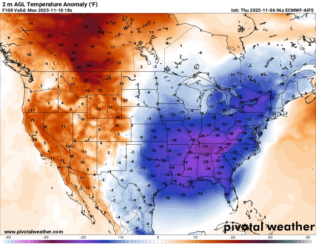
By Monday, temperatures 15 to 25 degrees F below normal will be common over the eastern half of the country, with the core of the cold anomaly over the Southeast. Water temperatures over the Great Lakes are still quite warm, and as a result this outbreak of cold air should bring significant lake effect snow downstream of all of the lakes early next week.
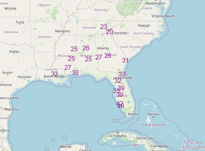
Numerous record low temperatures are possible in the Southeast early next week, with Tuesday (current forecast record low mins shown above) the peak of the cold. Lows in the 30s will be possible as far south as the I-4 corridor in central Florida.
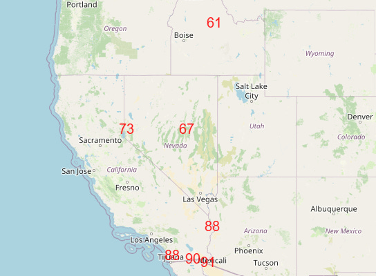
On the flip side, unseasonable warmth will be the rule early next week in the West, with a number of record warm temperatures possible (Monday forecast record highs shown above).
Note: The US weather community relies on the work of NOAA scientists who are exempt from the ongoing federal furlough due to the life-saving nature of their work. These federal employees are in their 37th day of working without pay and without knowing when they will eventually receive pay. You can read more about this situation in this post.

Leave a comment