Weather over much of the rest of the country decent for busiest travel day of year – but another storm system lurks for the weekend.
Nov 25, 2025
Wednesday is typically the busiest travel day of the year — and I myself will be traveling, so I am doing a weather update tonight.
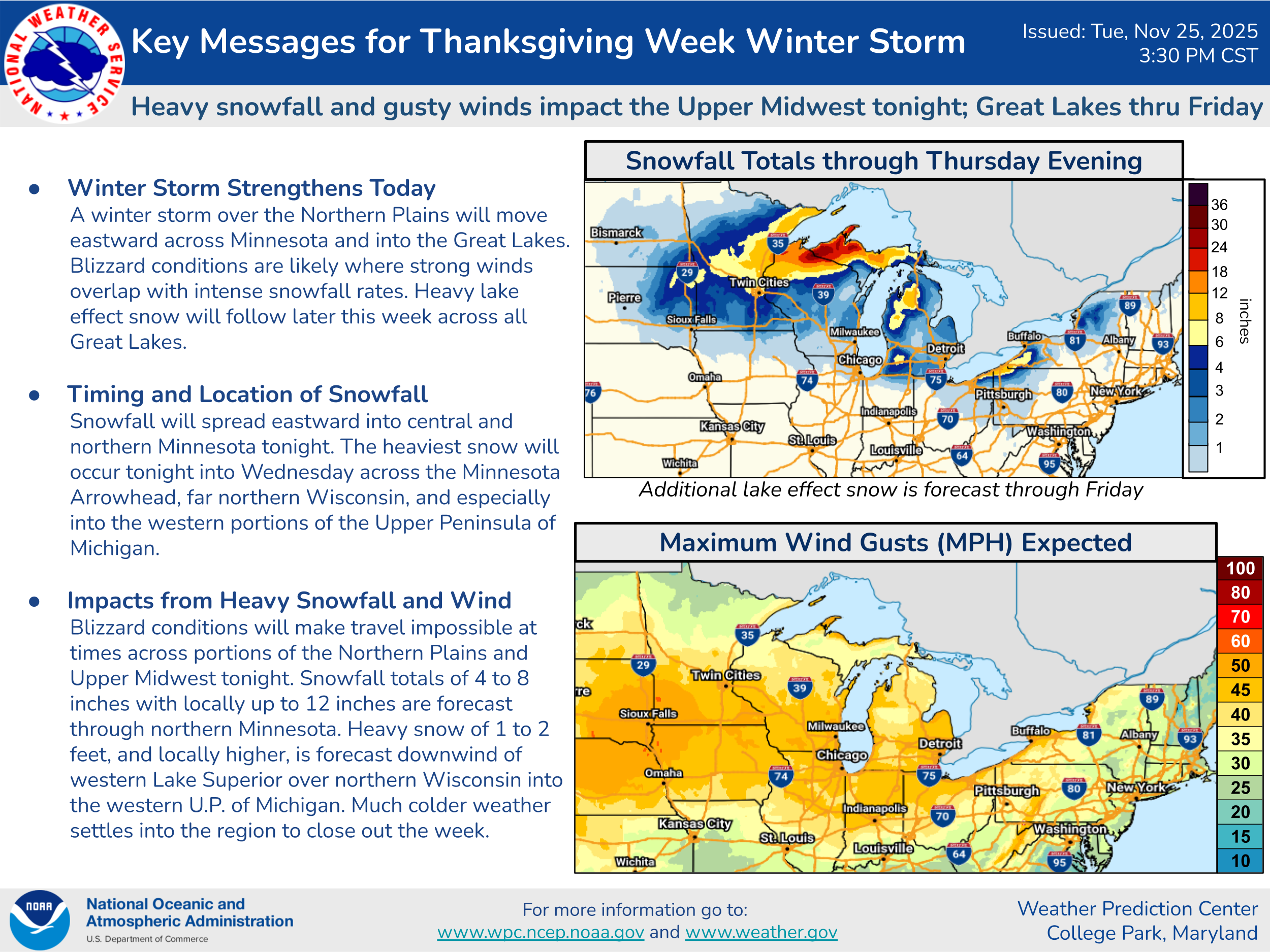
The upper Midwest winter storm I talked about in this morning’s newsletter has continued to trend more potent, and a swath of 6-12” of total snowfall is now anticipated through Wednesday morning from central Minnesota into the Upper Peninsula of Michigan. As colder air rushes in behind the low, heavy bands of lake effect snow will develop later on Wednesday into Thanksgiving Day across the UP of Michigan, adding to snowfall totals there, resulting in multiday totals of up to 2 feet, with even locally even heavier amounts in the typical lake effect maxima spots.
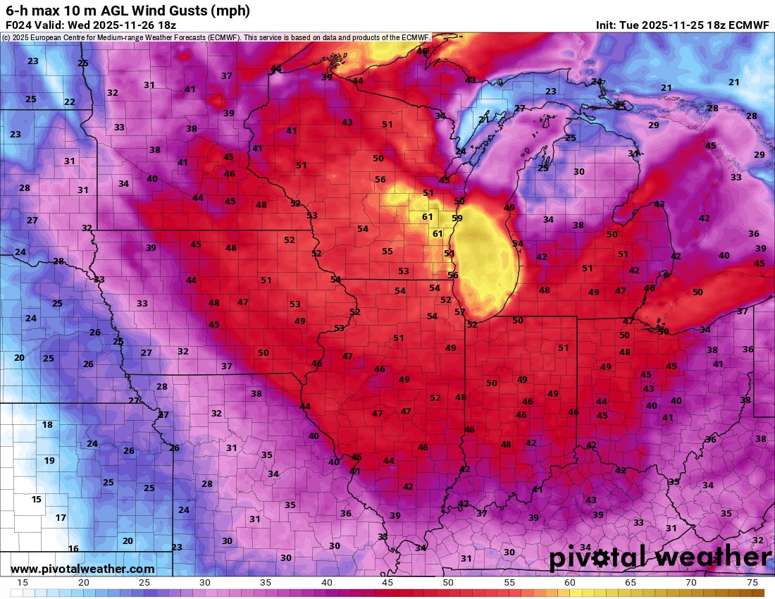
Strong winds will also be associated with the intensifying low pressure center as it moves through the region, and this will create significant blowing and drifting of snow. Blizzard warnings are now in effect into Wednesday for parts of the Upper Peninsula of Michigan and far northern Wisconsin along Lake Superior.

This storm system will also produce precipitation over much of the eastern Great Lakes and Eastern Seaboard on Wednesday, but for most areas from the major cities south, it will be too warm for snow and rain along with some thunderstorms will be the rule. Some wintry mix is possible from the eastern Great Lakes into northern New England, but impacts look minor. Periods of rain and mountain snow will continue over the Northwest as a series of storm systems continues to impact that region. Most of the rest of the country will be relatively quiet on Wednesday.

Heading into Wednesday night and Thanksgiving, bands of heavy lake effect snow will develop downwind of all of the Great Lakes, with lighter snow showers elsewhere around the region into northern New England. Rain and mountain snow will continue in the Northwest as another storm system moves into the region.
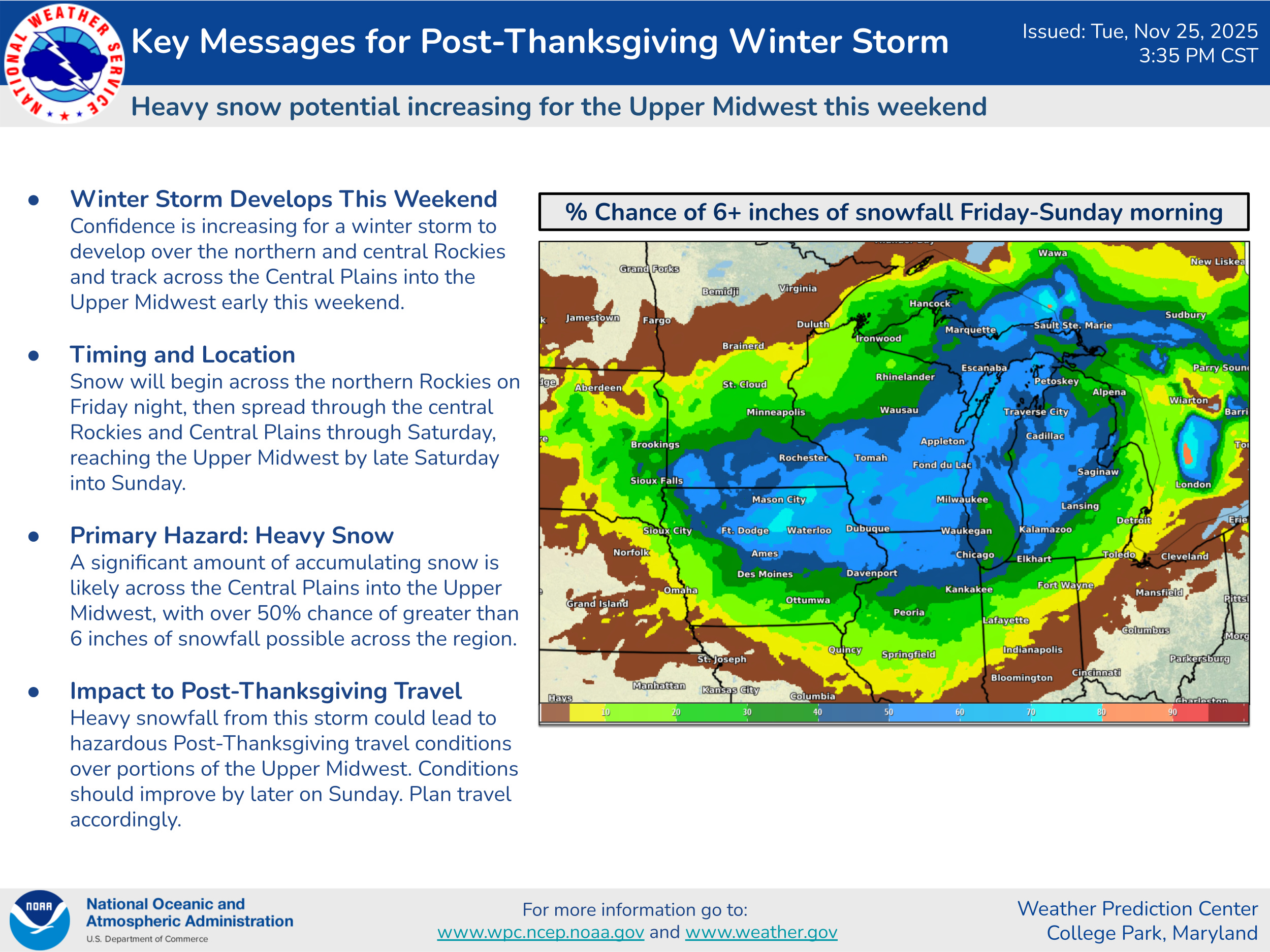
Another significant storm system looks to be on tap for this weekend in the Midwest, with impacts expected to be farther south than the one currently ongoing. Heavy snow of 6” or more could impact areas from northern and eastern Iowa across much of Michigan, particularly on Saturday. Chicago could be impacted by this system, so if you are flying through or into there this weekend, you should keep a close eye on the forecasts.
I wish you safe travels if you are venturing out in the next day or so to visit family or loved ones for the Thanksgiving holiday. I am planning to post at least a short weather update sometime Thanksgiving morning.

Leave a comment