Lake effect snow and snow squalls an issue today in the eastern Great Lakes and Northeast
Nov 28, 2025
Happy Black Friday and welcome to the “official” start of the Christmas season. My posts the next few days will be a bit abbreviated as I am visiting family and traveling — but there’s plenty of weather to talk about as we head into the post-Thanksgiving travel weekend.
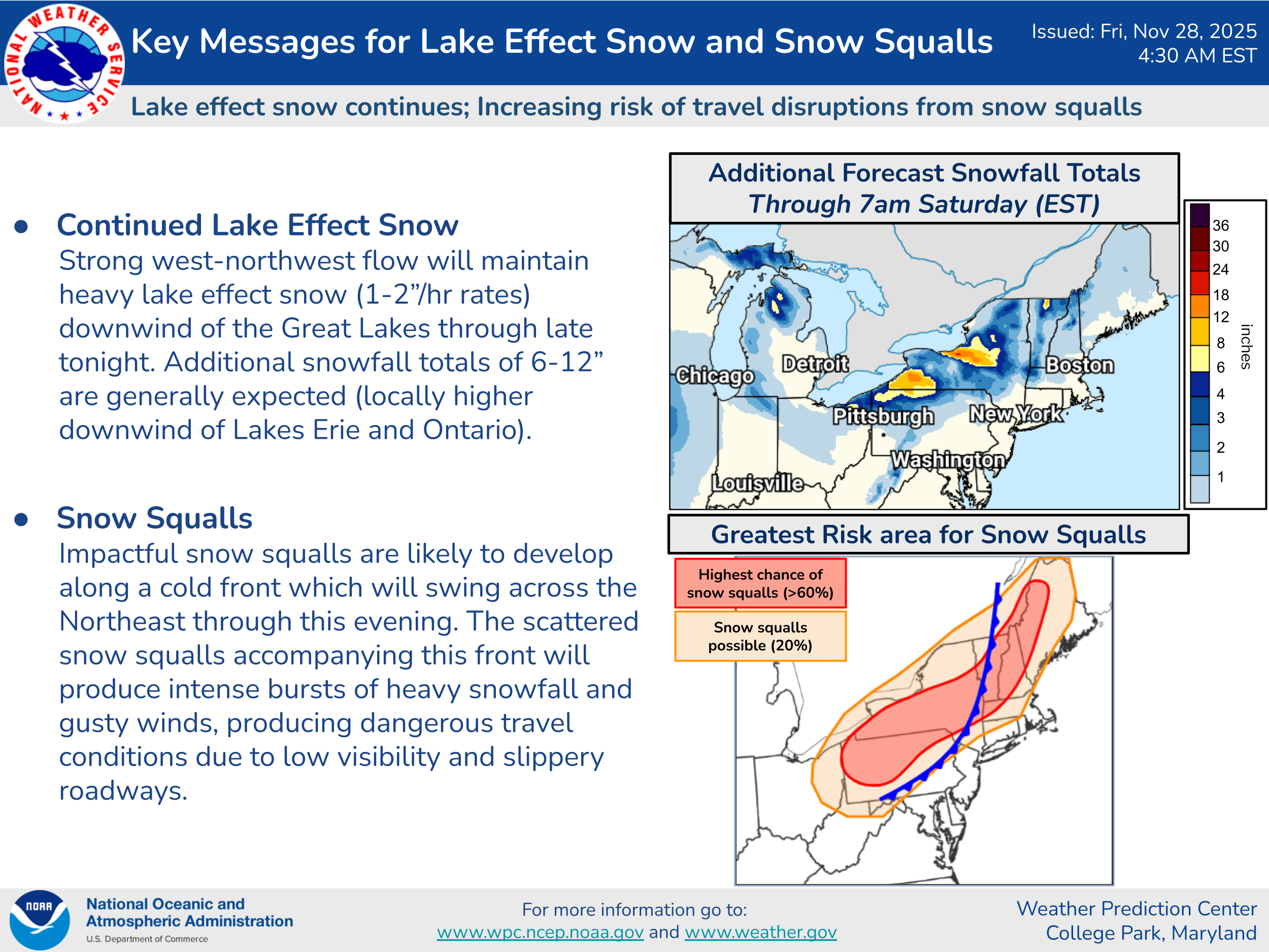
Before I get into the big winter storm for the Midwest, I do want to share this graphic from the NOAA/NWS Weather Prediction Center highlighting the continuing lake effect snow for today downwind of lakes Erie and Ontario, as well as the possibility of heavy snow squalls impacting areas farther from the lakes from western Pennsylvania into northern New England and Maine. These scattered snow squalls can cause bursts of very heavy snowfall and strong winds, creating near blizzard conditions for a short period of time. Snow squalls such as this are very hazardous for travel and have been responsible for many major traffic disasters over the years. If you receive a snow squall warning from the NWS for your area, take it seriously and try to be off the roads.
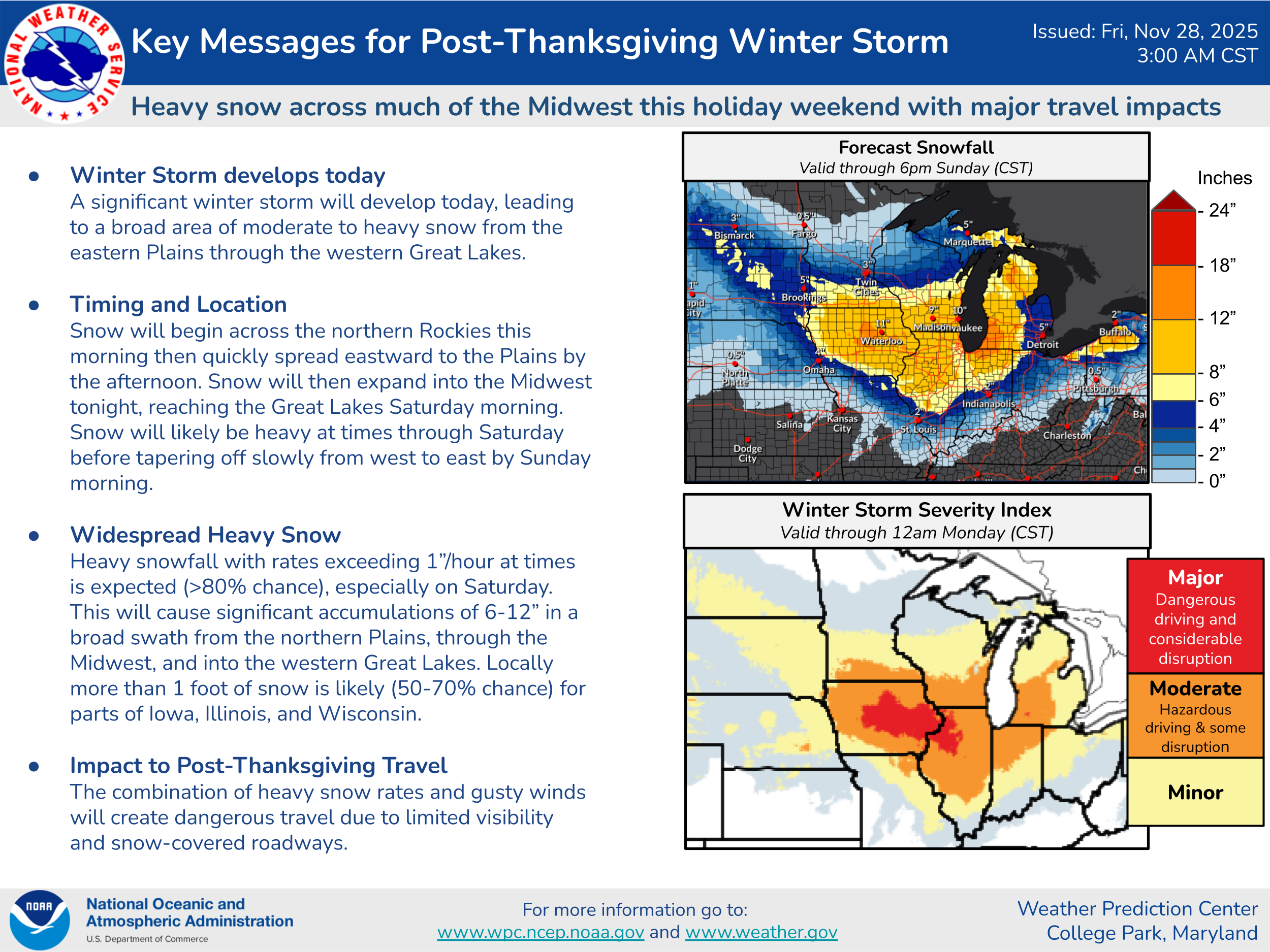
The major story this weekend will be the advertised winter storm that will get started in the Midwest today and continue into the weekend. This “key messages” product from the NOAA/NWS Weather Prediction Center does a great job of summarizing the anticipated impacts from this event. 8+” of snow is expected to fall over almost all of Iowa, the northern half of Illinois, southern Wisconsin, northern Indiana and most of the Lower Peninsula of Michigan. Localized amounts of a foot or more are anticipated, with areas south and east of Lake Michigan likely to see more widespread 12-18” amounts due to enhanced moisture from the lake.
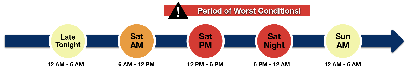
With this being such a busy travel period, a lot of people will have air travel plans that take them through Chicago this weekend. This graphic from NWS Chicago shows their anticipated timing for winter weather impacts in their region. Obviously, anyone with travel plans through Chicago Saturday — especially Saturday afternoon and evening — should be anticipating serious issues.
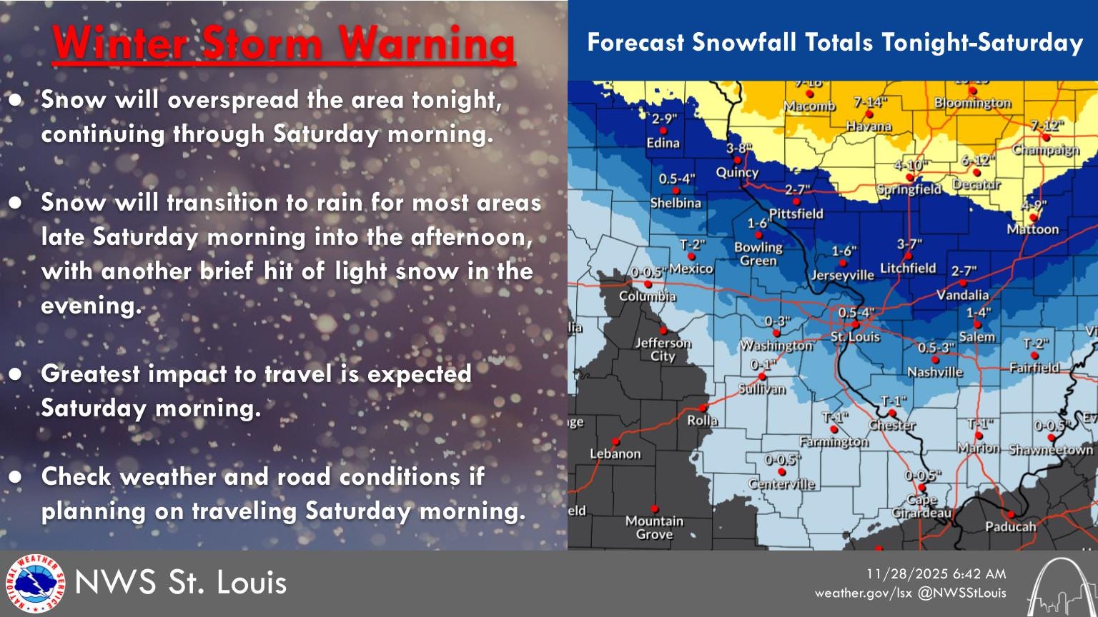
As I talked about yesterday, the area around Interstate 70 from St. Louis to Indianapolis looks to be a particular forecast trouble spot with this winter storm, as it will be in the transition zone between warmer low level air working north but with still cold air aloft supporting snow when heavier precipitation is occurring. The forecast here is still rather low confidence, but it does look as if there will be at least a few hour burst of moderate to heavy snow as the precipitation starts late tonight into Saturday morning. How persistent that heavier precipitation is and how quickly warmer low level air moves in will determine how much snow occurs.
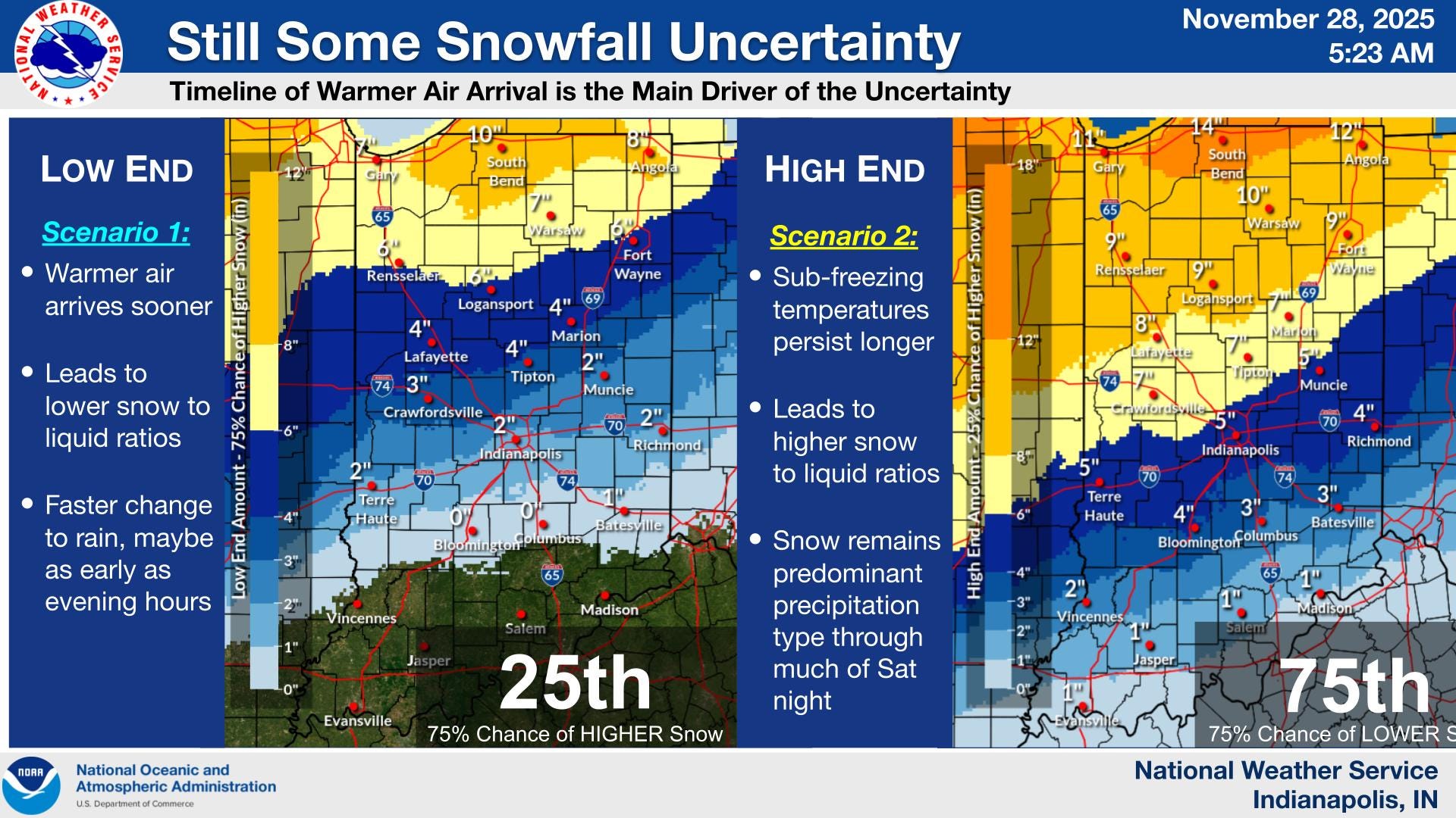
Looking at some of the morning high resolution model runs, it seems most likely there will be a rather quick 1-4” of snow in this corridor before the changeover to rain and drizzle, and a lower but meaningful probability of some heavier amounts if the precipitation is heavier and remains snow for a longer period of time. This graphic from NWS Indianapolis does a good job of capturing the low end and high end possibilities in a probabilistic manner.

On the warm side of this storm system, scattered to numerous showers and thunderstorms will occur in the south central US. While again this storm system does not look to have a big risk of severe weather and flash flooding, there could be a few incidences of those hazards, mainly across the western Gulf Coast region.

The low pressure system will move northeast on Sunday, with some lighter rain and mixed wintry precipitation expected across the East. A new storm system will bring some snow to the intermountain West.

Leave a comment