More: A welcome miss for the AI tropical forecasts in the western Pacific, and more snow for the Midwest the last 24 hours
Dec 07, 2025
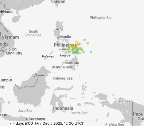
Good Sunday morning. Starting off with a quick follow-up about the potential western Pacific tropical development I talked about in Monday’s newsletter. I mentioned that the models were showing the potential for a new tropical cyclone to develop in the vicinity of the Philippines by this weekend, with the Google DeepMind (GDM) AI system (Monday’s forecast valid Friday shown above) rather bullish in showing a strong tropical storm or typhoon by the weekend.
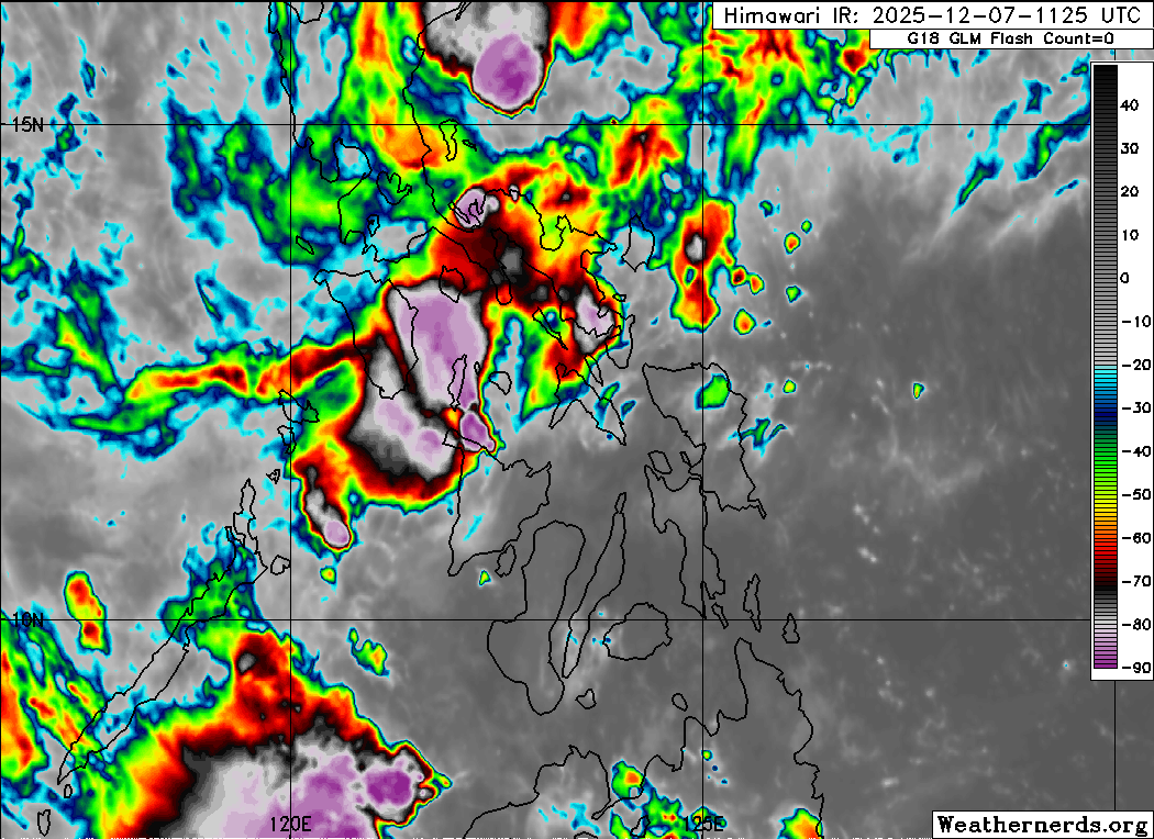
Satellite this morning in the vicinity of the Philippines shows some disorganized thunderstorm activity, but luckily the system in question was never able to get particularly well organized. This is obviously a positive for a region that has been battered by typhoons and serious flooding over the last weeks.
It is also a reminder that while the AI based forecasting systems have shown remarkable skill in their early development, they are not a panacea and will have misses just like any other forecasting system. Some meteorologists who follow the western Pacific more closely than me have mentioned that the GDM definitely needs more work in the western Pacific — and I am sure there will continue to be effort to improve the forecasts there (and everywhere, of course).
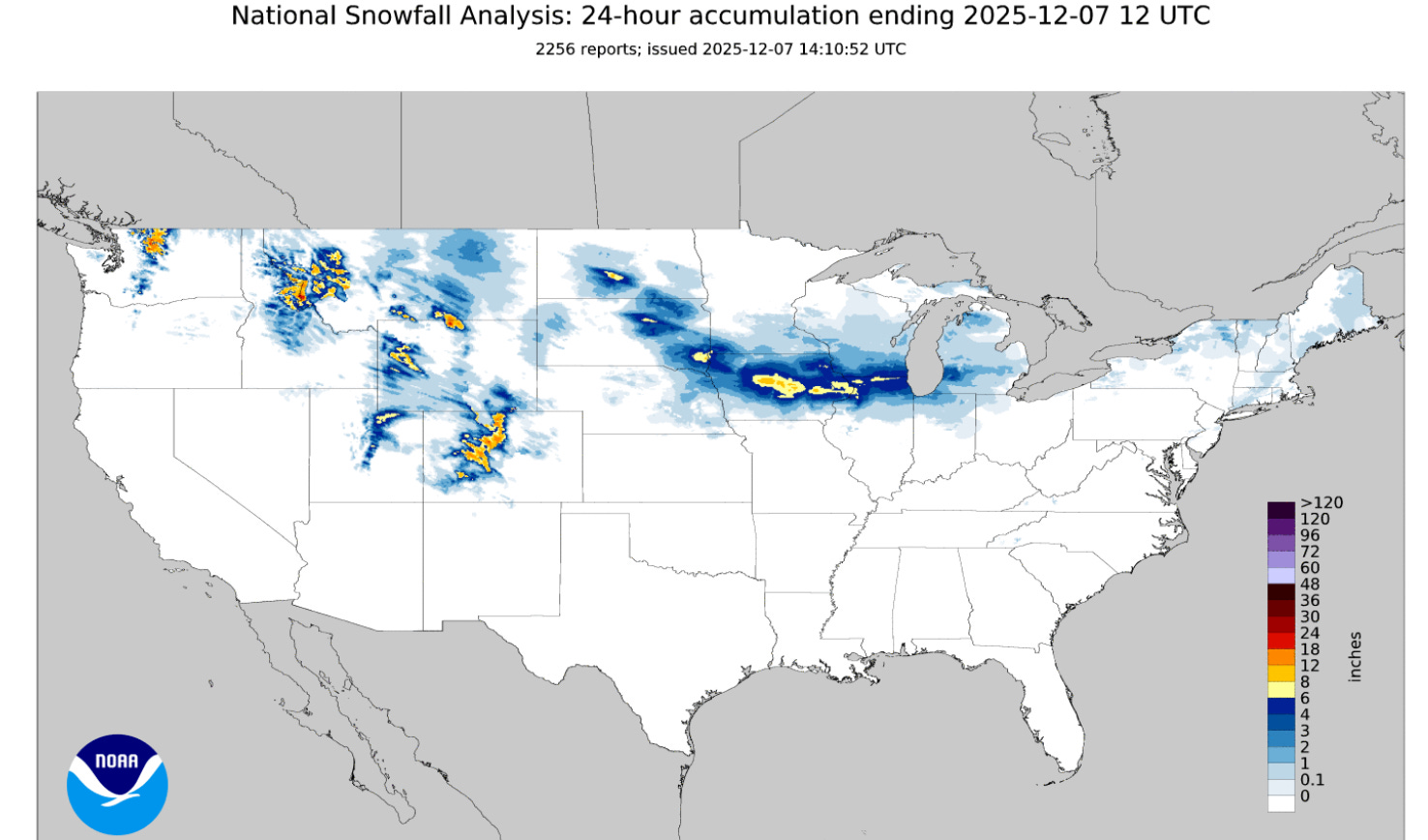
Back in the U.S., the last 24 hours saw more snow for regions that have been seeing plenty of it early this winter, from the Northwest into the Midwest and lower Great Lakes region. The stretch from eastern South Dakota across Iowa and into northern Illinois saw its second consecutive Saturday with a snowstorm. While this one was not as big as last weekend’s, there was still a swath of 6-10” of snow from central Iowa into northwest Illinois.

For today, that storm system will continue to slide east, spreading light snow and mixed wintry precipitation east. The greatest chance for accumulating snow of up to a few inches will be over the eastern Great Lakes and into northern New England.
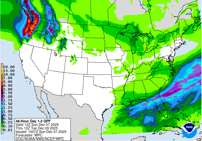
Meanwhile, on the warm side of the system rain and some thunderstorms are expected over the Southeast and into Florida. Some heavier — but mostly welcome for an area dealing with drought — rainfall is expected over northern Florida. The Pacific Northwest will see the seemingly endless stream of systems continue to move through with heavy precipitation — mainly rain with rather high snow levels — over the next couple of days.

This heavy precipitation the next couple of days will be the start of another very wet week in the Northwest, with some localized rainfall amounts of over a foot expected in parts of western Washington and Oregon.
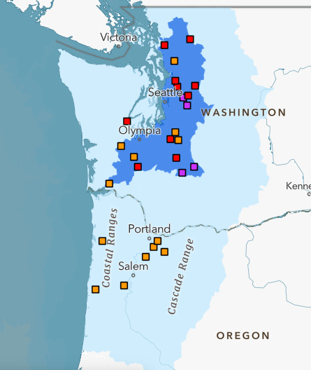
Given plenty of recent precipitation over the last few weeks, the heavy rainfall this week will bring a considerable risk of flooding to the region. The flood risk outlook from the NOAA/NWS National Water Center above shows the greatest risk in western Washington, where a number of river forecast sites are forecast to go into moderate (red squares) or major (purple squares) flood during the upcoming week.

Leave a comment