Unseasonable warmth to dominate much of the rest of the West for the foreseeable future
Dec 09, 2025
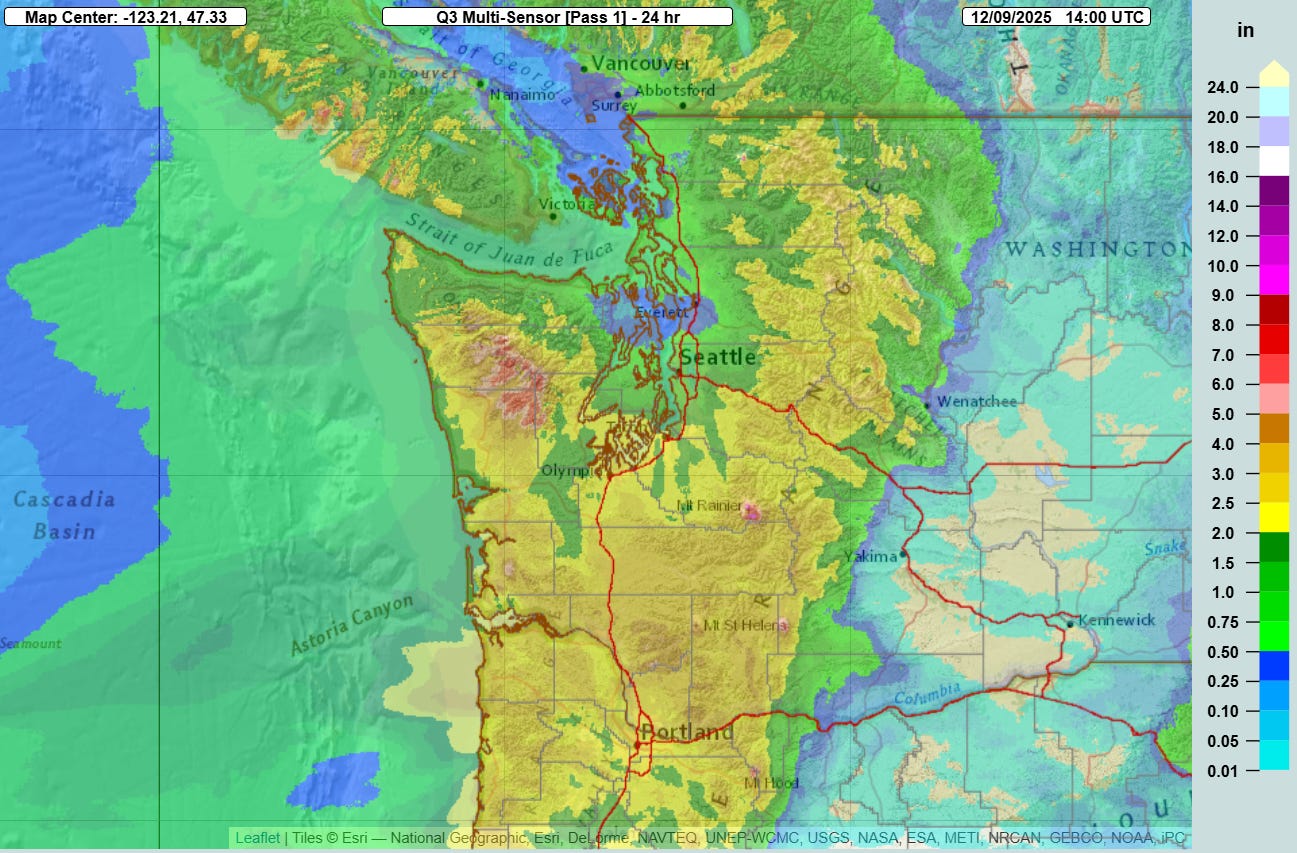
The first in a pair of storm systems combining with unusually high levels of atmospheric moisture impacted the Pacific Northwest in the last 24 hours, bringing widespread heavy precipitation to the region. Amounts of 2-4” were widespread across western Washington and northwest Oregon, with heavier amounts in higher terrain. Much of the precipitation fell as heavy rainfall with relatively high snow levels.
With the passage of the first system, snow levels have lowered a bit and precipitation intensity has lessened. However, a second strong low pressure system will move onshore over British Columbia over the next 36 hours, focusing another wave of heavy precipitation with high snow levels across the region later today into Wednesday, along with strong winds. Flood watches and wind advisories are in effect for most of this area.
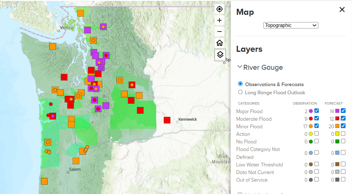
A couple of rivers in western Washington have already reached major flood stage, and with the additional wave of heavy rainfall anticipated, several more are forecast to reach major flood levels. Additionally, urban and small stream flooding will likely become an issue, along with potential for landslides and also debris flows in burn scar areas from wildfires the last couple of summers. Obviously, people in the Northwest need to be paying close attention to the weather and any guidance from local officials as this situation evolves.
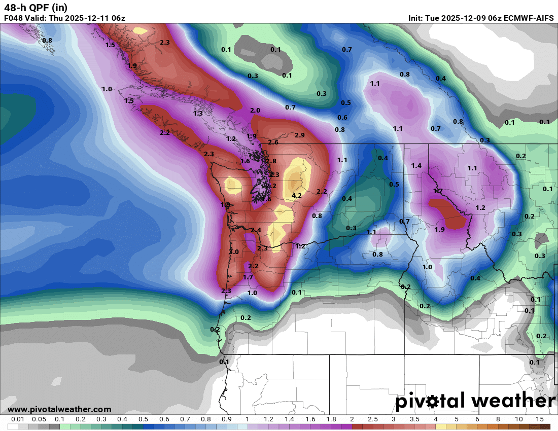
This next storm system will be the peak of the heavy rainfall for this week, with widespread heavy precipitation not expected from Thursday through the weekend. However, wet conditions are expected, and there looks to be some potential for a return of waves of heavier precipitation to the region next week.
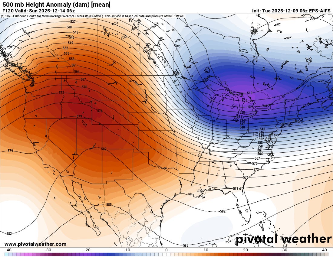
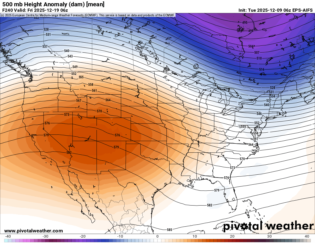
This wet weather pattern is on the northern edge of an unseasonably strong area of high pressure in middle and upper levels of the atmosphere which looks set to dominate the weather in the Southwest for at least the next 10 days (European AI ensemble model forecasts for heights and anomalies at 500 millibars — 18K ft AGL in the atmosphere — shown above for 5 days and 10 days from today). This will bring widespread unseasonable — and at times record — warmth to the region.
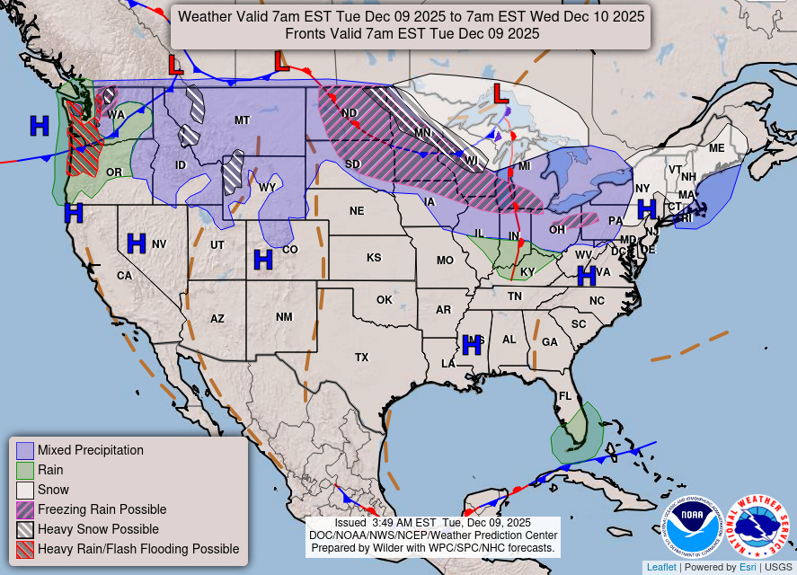
Downstream of this area of high pressure, colder conditions are expected across the central and eastern United States with a series of weaker storm systems bringing waves of wintry precipitation. Heavy snow and some mixed wintry precipitation is expected across the upper Midwest during the next 24 hours, and winter storm warnings and winter weather advisories are in effect as shown in the NWS advisory map below.
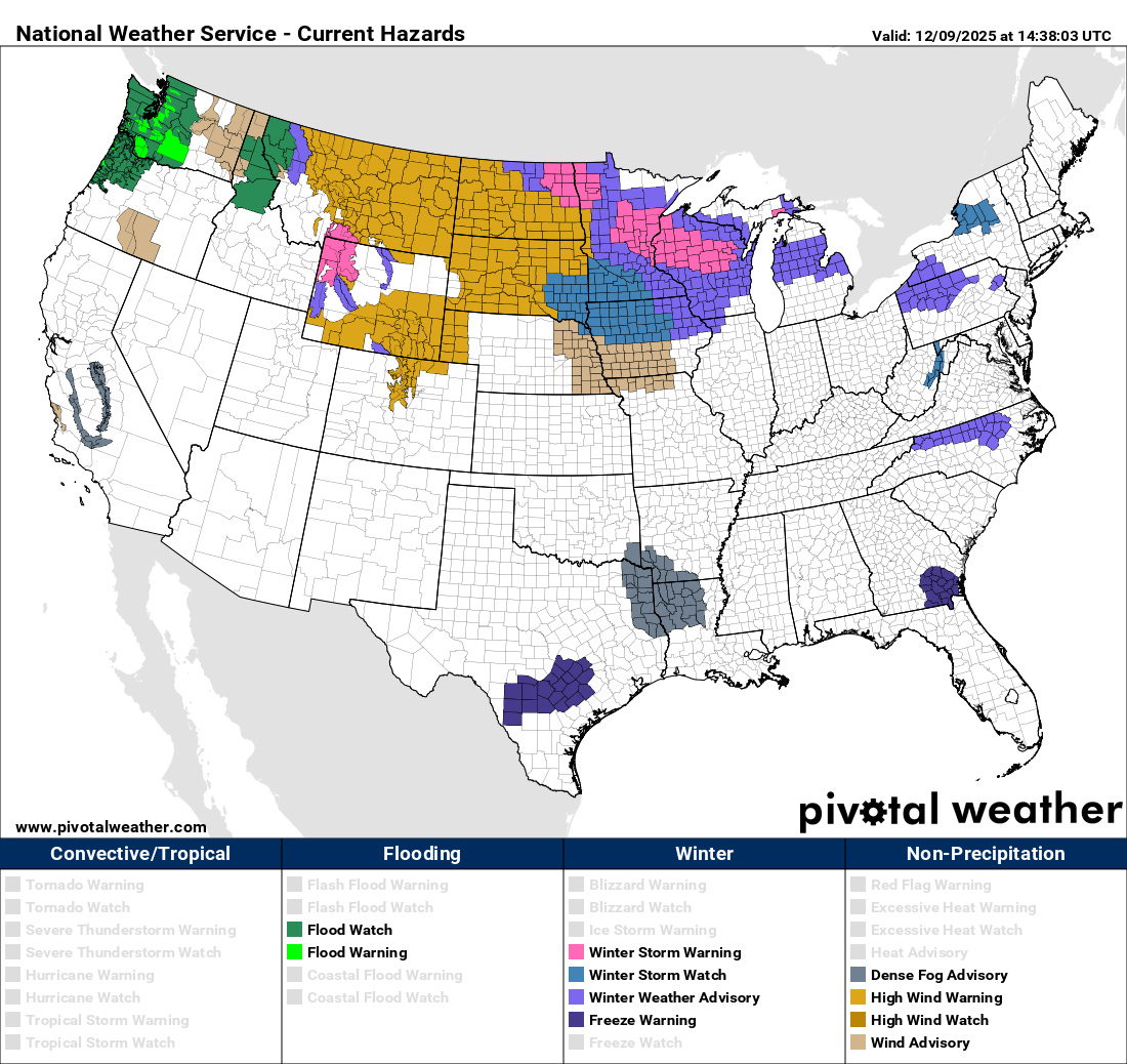
Strong winds are also anticipated over a large part of the north central United States as well, and high wind warnings and advisories are in place for much of the northern Rockies through the Dakotas.

Leave a comment