Waves of cold air and some wintry precipitation, potentially as far south as the Florida Panhandle
Jan 17, 2026
Happy Saturday everyone. FYI I am going to be traveling this weekend, so posts or updates will be limited and erratic.

A quick weather update…today the next in a series of shots of cold will continue to move into the East.
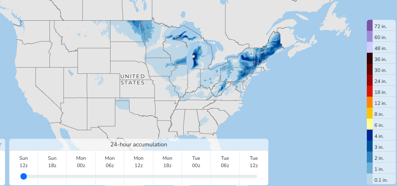
Some mixed wintry precipitation is expected along the East Coast, with moderate snowfall accumulations anticipated in parts of the interior Northeast and to the lee of Lakes Superior and Michigan.
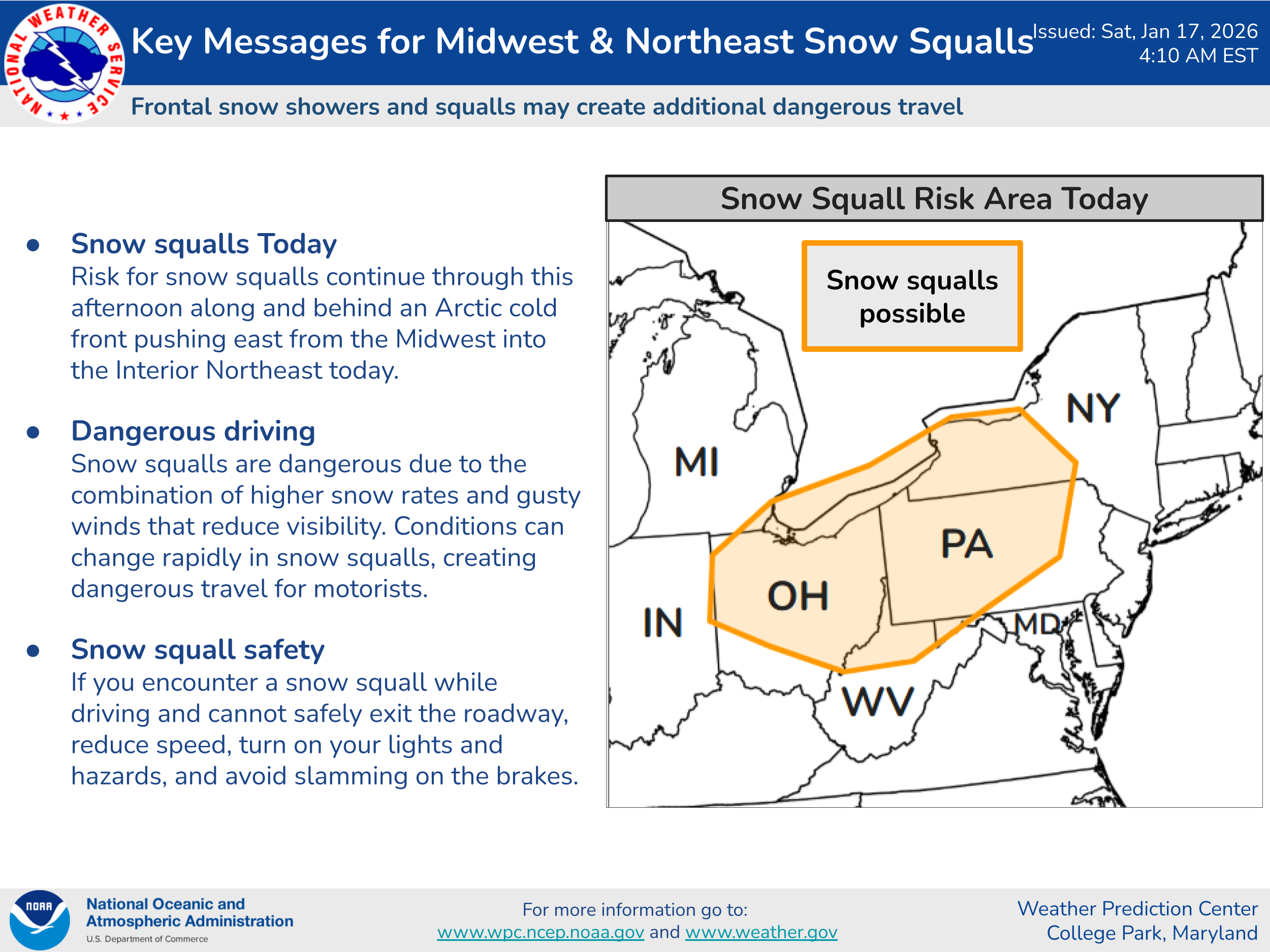
Snow showers and squalls could cause dangerous driving conditions in parts of the Lower Great Lakes and central Appalachians today, so people planning travel in this area should be on the alert and monitoring for snow squall warnings from the NWS.

On Sunday, low pressure will develop off the Southeast coast, and with unseasonably cold air in place, mixed wintry precipitation will be possible from the Florida Panhandle across the Carolinas.
There remains quite a bit uncertainty with the forecast for this storm system and any potential wintry impacts. For now, it appears like surface temperatures will be a bit too warm for any significant winter impacts in the Southeast and any periods of snow will be brief enough to keep accumulations minor. However, obviously people in this region should keep monitoring local forecasts given the forecast uncertainty.
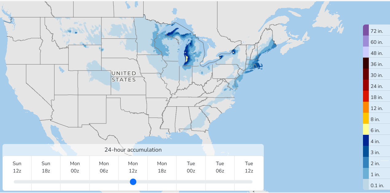
While the low will be passing fairly far offshore the Mid-Atlantic and Northeast, it looks to be close enough to spread some accumulating snow Sunday into Sunday night from the Delmarva into coastal New England. Of course, forecast uncertainty is higher than normal here as well, so continue to monitor later forecasts.
A new wave of arctic air spreading into the upper Midwest will bring even colder temperatures, gusty winds and snow showers to this region Sunday into Sunday night. This could impact the NFL playoff game in Chicago Sunday evening, particularly with gusty winds and single digit to subzero wind chills.

Leave a comment