Model trends over last 24 hours bring areas farther north into play for potential impacts
Jan 21, 2026
Happy hump day! The very high impact winter storm for late this week into early next week is still coming. However, I emphasized in my newsletter that there were still a lot of uncertainties in the forecast and those uncertainties pretty much remain this morning. Having said that, some defined and significant trends in the modeling in the last 24 hours have expanded the potential impacts from this storm into areas farther north as well as given us more clues on how things may evolve farther south.
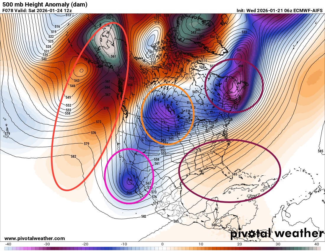
The middle and upper level atmospheric pattern driving this winter weather event is very complicated, with a number of features that are interacting in a complex manner that the models are struggling to handle. The intense upper level high pressure over the eastern Pacific and into Alaska (red ellipse) remains a key cog in the setup, and helped spur the initial southward plunge in a large piece of the polar vortex (purple ellipse) that is driving the Arctic air deep toward the Gulf Coast.
Meanwhile, another lobe of the polar vortex (orange circle) will be coming south across central Canada and the Northern Plains while the upper level low we have been discussing off of southern California (magenta circle) will be sliding east toward northern Mexico. How these two weather disturbances interact with each other will play a huge role in the ultimate strength and track of the low pressure systems that will drive the wintry precipitation. Additionally, the strength of an upper level area of high pressure meandering over the southwest Atlantic and southeast US will also play a key role in the system — and will also be affected by how the two western weather disturbances interact.
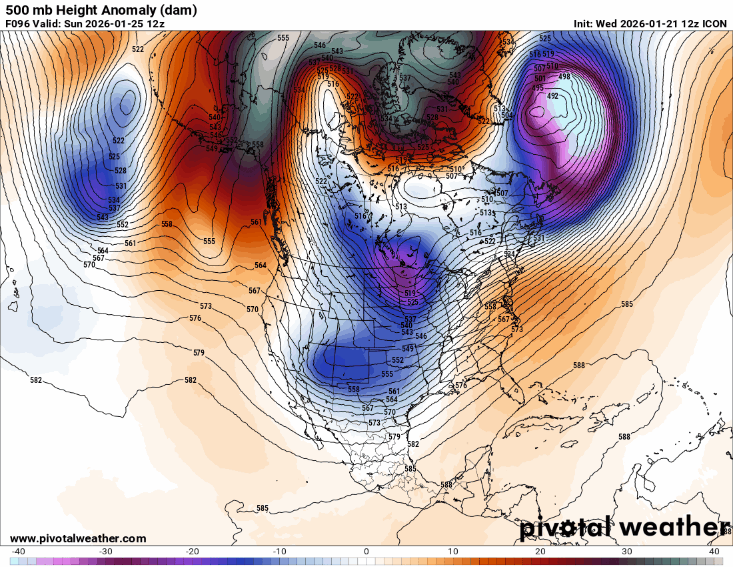
To illustrate how much the models are struggling with this atmospheric flow pattern, above is an animation of the North America 500 millibar (~18K ft AGL) forecast for Sunday morning from each of the last 6 runs of the German ICON atmospheric model. Without getting into the meteorological details, I think you can pretty clearly see how each run looks very different across the United States. This is indicative of unusually high uncertainty in even the large scale weather pattern — which means the details of temperature, precipitation type and amount, and the resulting impacts at a local level will be particularly uncertain as well with a lot of potential for changes to forecasts.
A pivotal key to this forecast is whether or not the piece of polar vortex dropping south and the upper level low sliding east across northern Mexico “phase.” Phasing is a meteorological process in which two upper level disturbances essentially merge to form a larger, more intense area of low pressure. If you look at the ICON animation above, you can see how the various forecasts range from a complete phasing of the system to maintaining total separation.
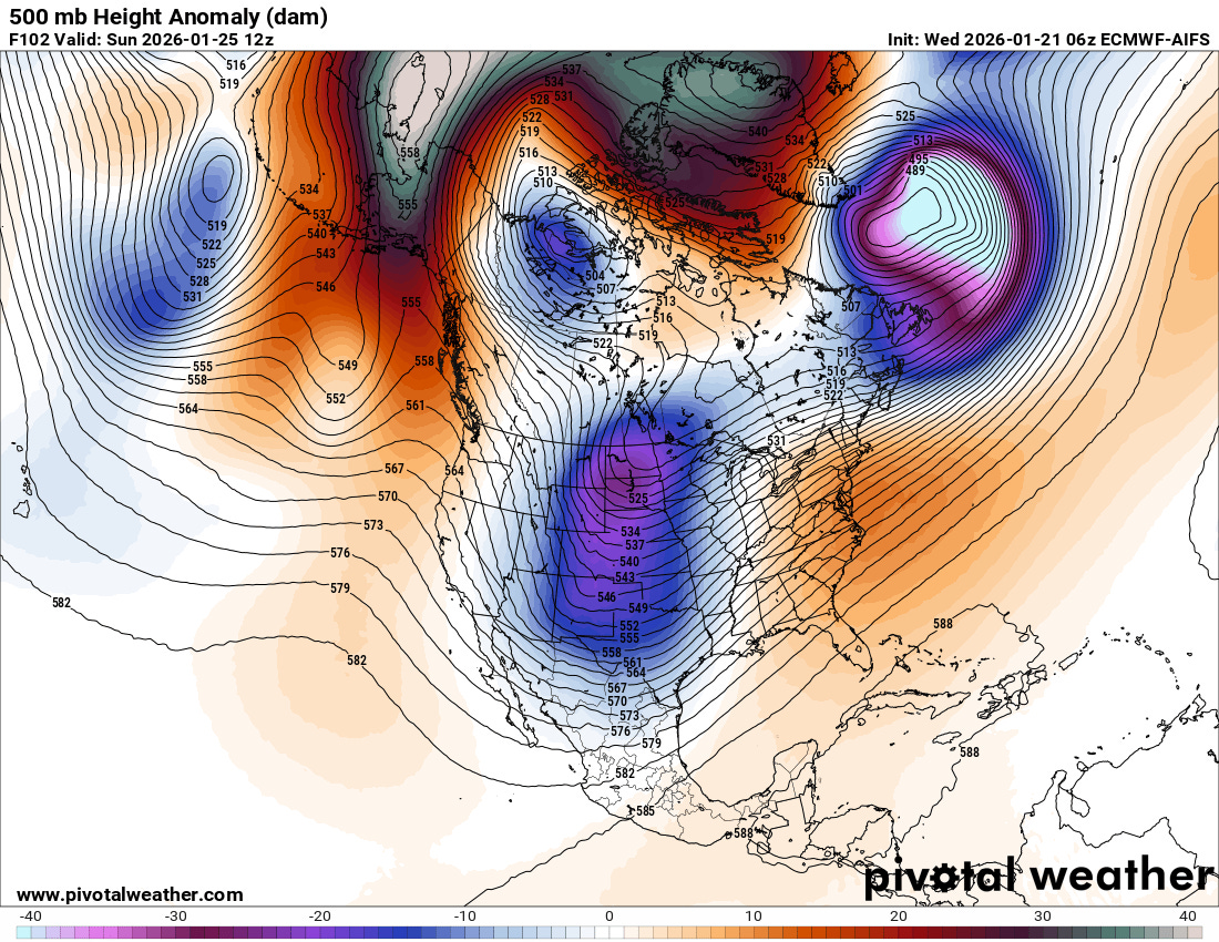
However, the overall trend over the last day has been toward more phasing — particularly in the European models as the latest AI European 500 millibar forecast above shows the systems becoming completely phased. A more phased system will also result in a stronger downstream ridge of high pressure along the East Coast — which would result in warmer air coming farther north into the Southeast as well as shifting and expanding the precipitation shield much farther north into the Northeast.
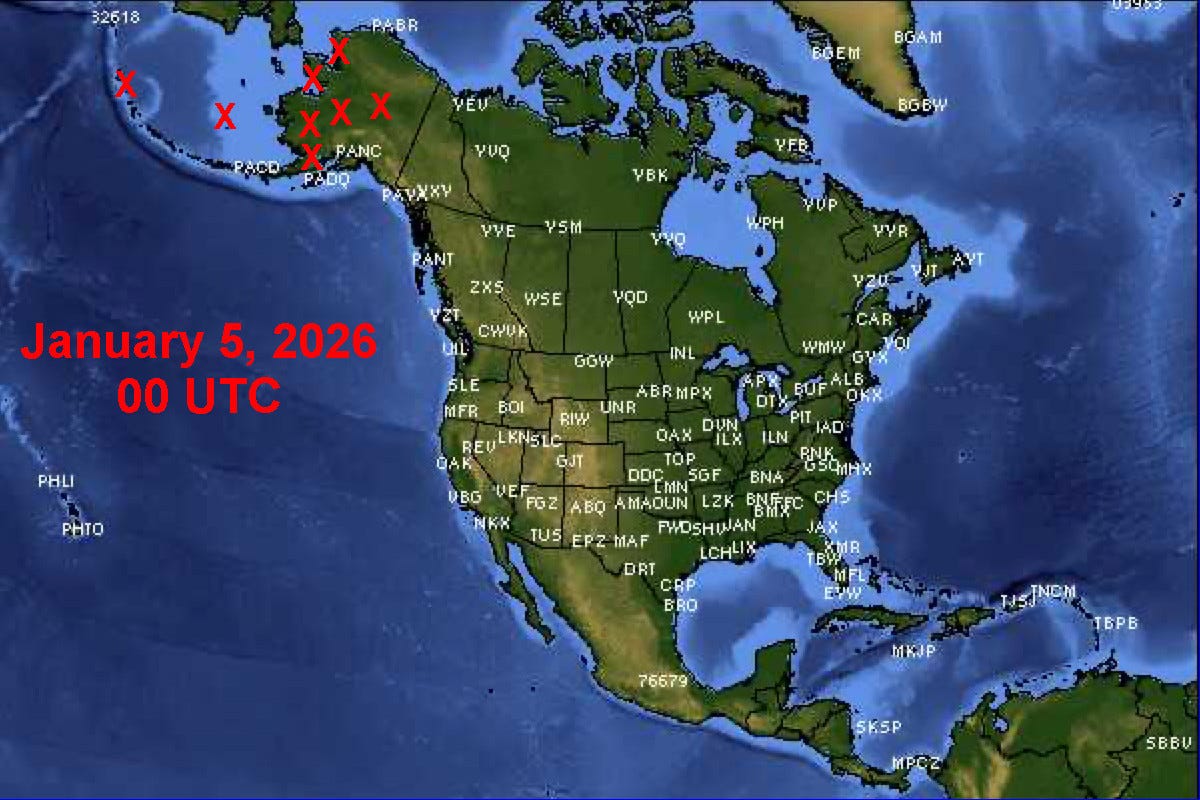
One thing I want to mention here is that sampling of upper air features across Alaska and western Canada will be critical, as what ends up occurring in the United States will be greatly impacted by what is happening upstream of us. As my colleague in Alaska Rick Thoman has been reporting and I have been trying to share in Balanced Weather, the NWS upper air balloon network in Alaska has been seriously degraded for months due to NWS staffing, budget and equipment issues. This map shows a particularly egregious example from a couple of weeks ago when 8 of Alaska’s 14 sites were missing.
Rick updated me this morning that Kotzebue, Nome and St. Paul Island have had no flights for months, King Salmon no flights since Jan 12, and Shemya has been getting up one flight a day about half the time. The only improvement is the site at Bethel has made it back to two launches per day. Again, it would take a significant scientific study to fully understand the impacts of all of this missing upper air data on the forecast for this upcoming weather system — but of course, it is not helpful and could be a significant degrading factor. Of course, we should be concerned about the daily impacts of this missing data on the forecast for Alaskans, many of whom are particularly vulnerable to weather impacts. On a more positive note, NOAA and US Air Force reconnaissance aircraft will be flying missions in both the Atlantic and Pacific over the next several days, releasing dropsondes and gather atmospheric data in an effect to improve the model forecasts for this system.
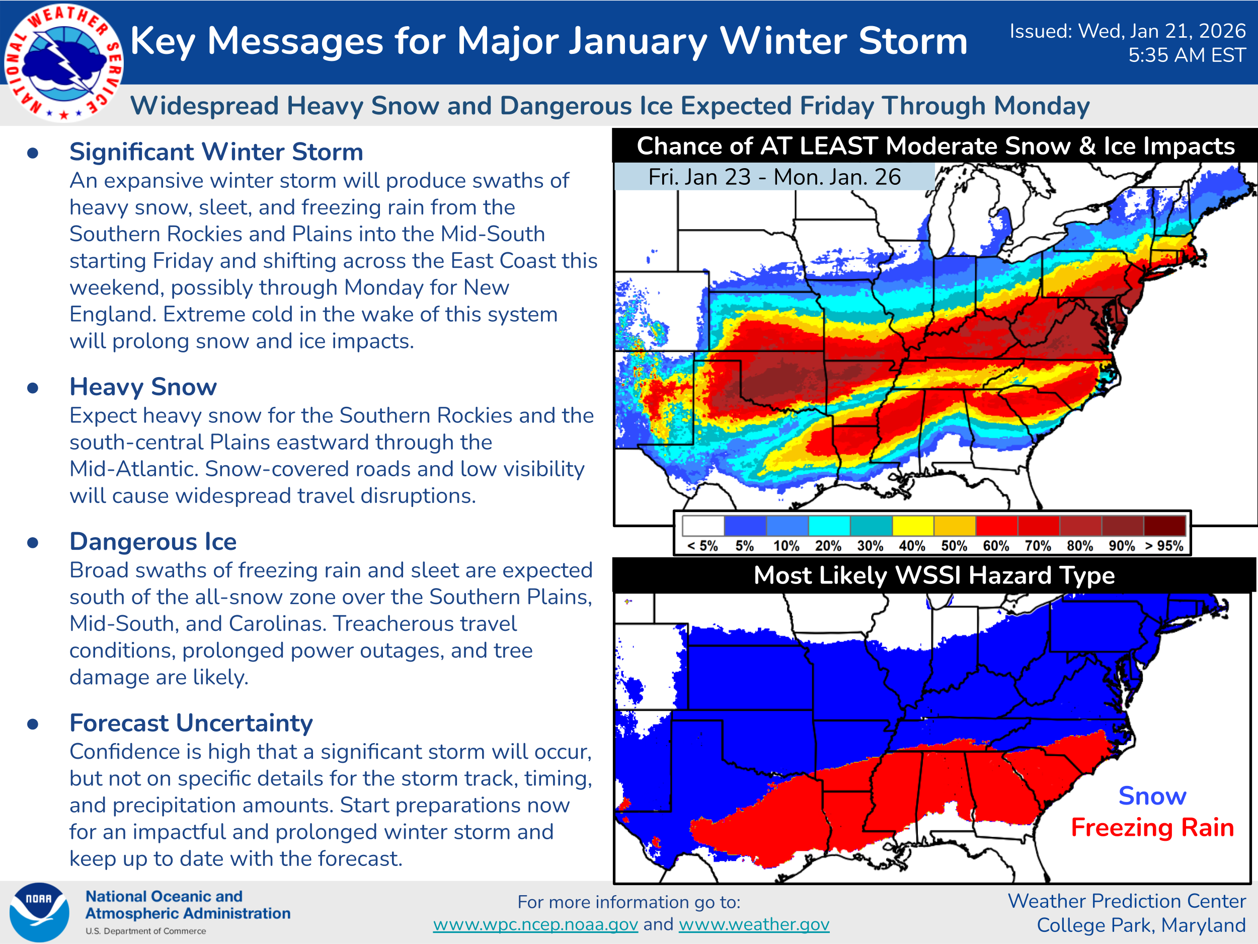
So getting to that forecast, the NWS Weather Prediction Center (WPC) key messages continues to provide an excellent overview of this situation. As they state, confidence is high that a significant storm with major impacts will occur, but details as far as specific amounts, timing and precipitation type remain quite uncertain. One thing to particularly note in the map of probability for moderate impacts using the Winter Storm Severity Index (WSSI) is that the area of potential impacts has expanded substantially north compared to yesterday.
Again, unusual levels of subtropical and Gulf moisture should be tapped by this system, and models continue to show very heavy accumulations of snow and ice (potentially 1’+ of snow and 1”+ of ice) where the greatest impacts will occur — however, where exactly those areas will be is still uncertain. Having said that, the early part of this storm Friday into Saturday looks to have a high probability of moderate to major impacts from heavy snow and sleet (WPC WSSI probability of major impacts shown above) across parts of the Southern Plains and Mid-South.
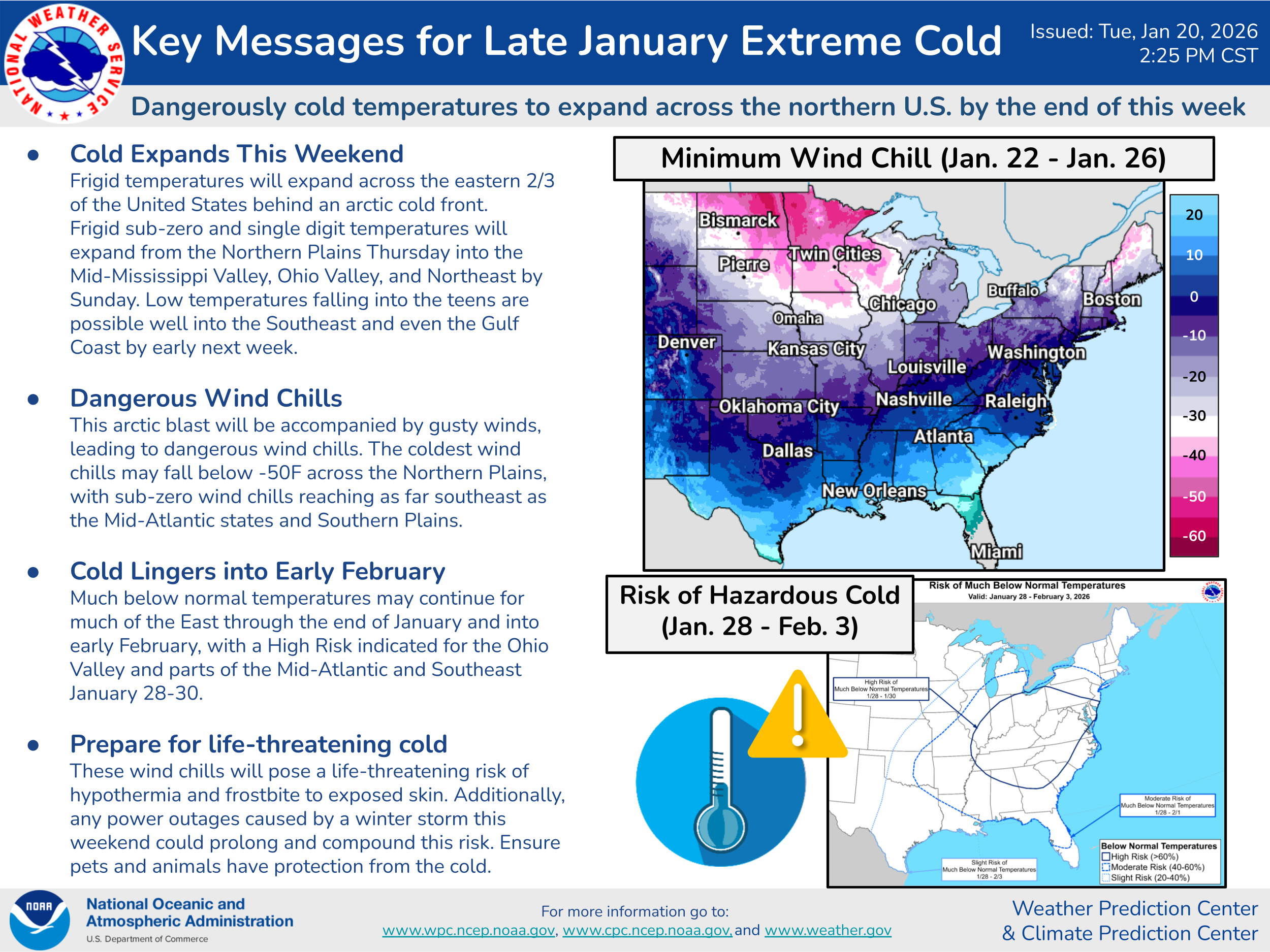
Of course, extreme cold will still be a significant threat especially in the upper Midwest this weekend — and the overall cold pattern with frequent shots of Arctic air looks pretty locked in over at least the next 10 days.
To summarize, while the details remain uncertain, the likelihood of a high impact storm remains quite high, and people in and near the areas of high probabilities of impacts as shown on the WPC key messages map above should be preparing for potential impacts including potentially impossible travel and prolonged power outages. I will be continuing to provide updates via Substack Notes and posts on BlueSky and Facebook. Additionally, I am planning a live interactive paid subscriber Substack chat at 3:30 pm ET/2:30 pm CT to answer any specific questions folks may have as well as provide my thoughts from the most recent model forecasts.

Leave a comment