Confidence has increased in precipitation amounts, but still plenty of lurking issues with the forecast and ultimate impacts
Jan 23, 2026
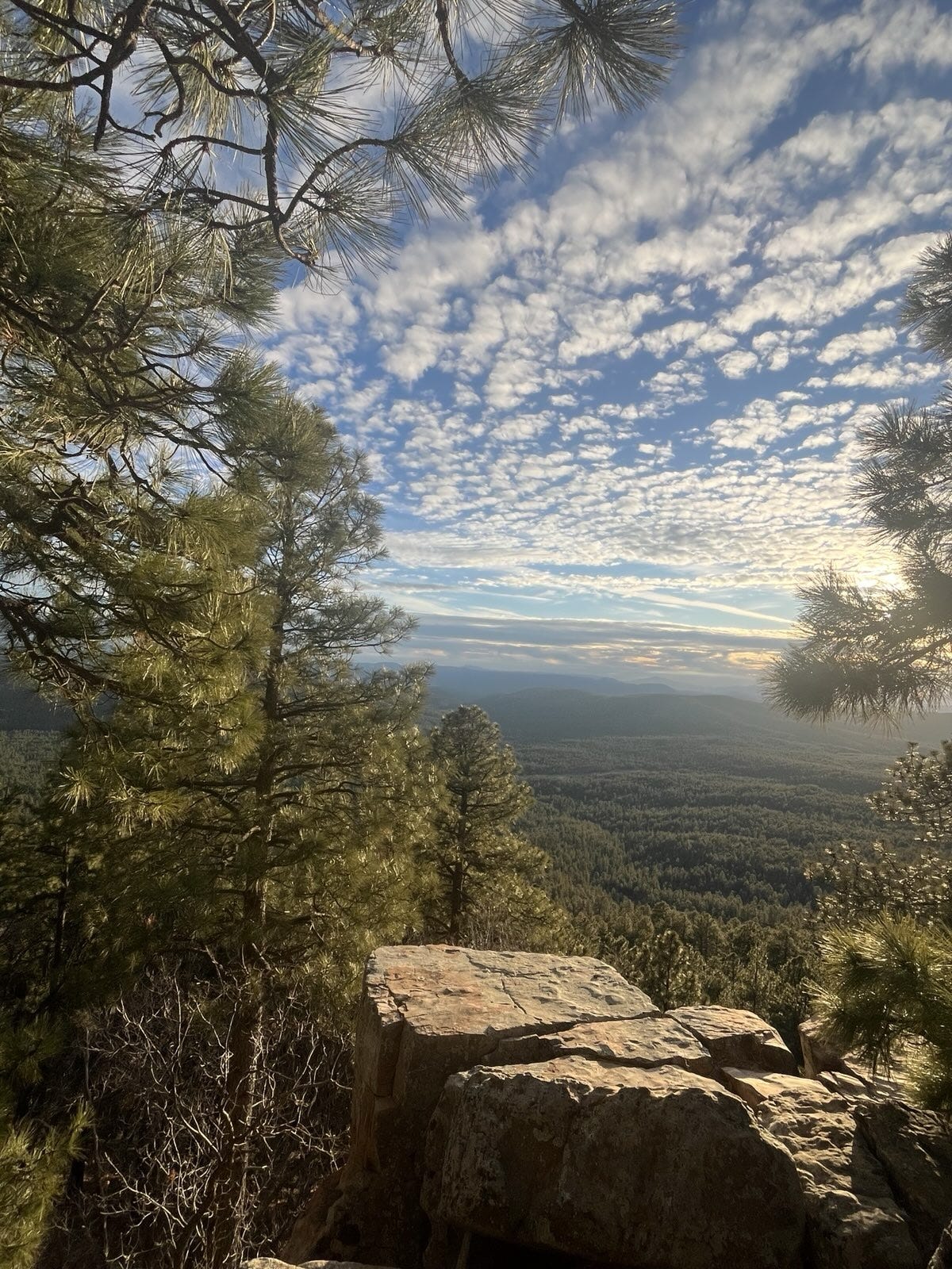
Good morning and happy Friday. My wife and I are lucky enough to be away from our usual abode in Oklahoma and visiting my son in Arizona. So while we will not be experiencing this winter storm directly, we able to watch the sunset from the Mogollon Rim above Payson last night — and see the leading edge of clouds and rain showers with the upper level low pressure center moving east from the Pacific that will be the initial driving force in the expansive winter precipitation the next several days.
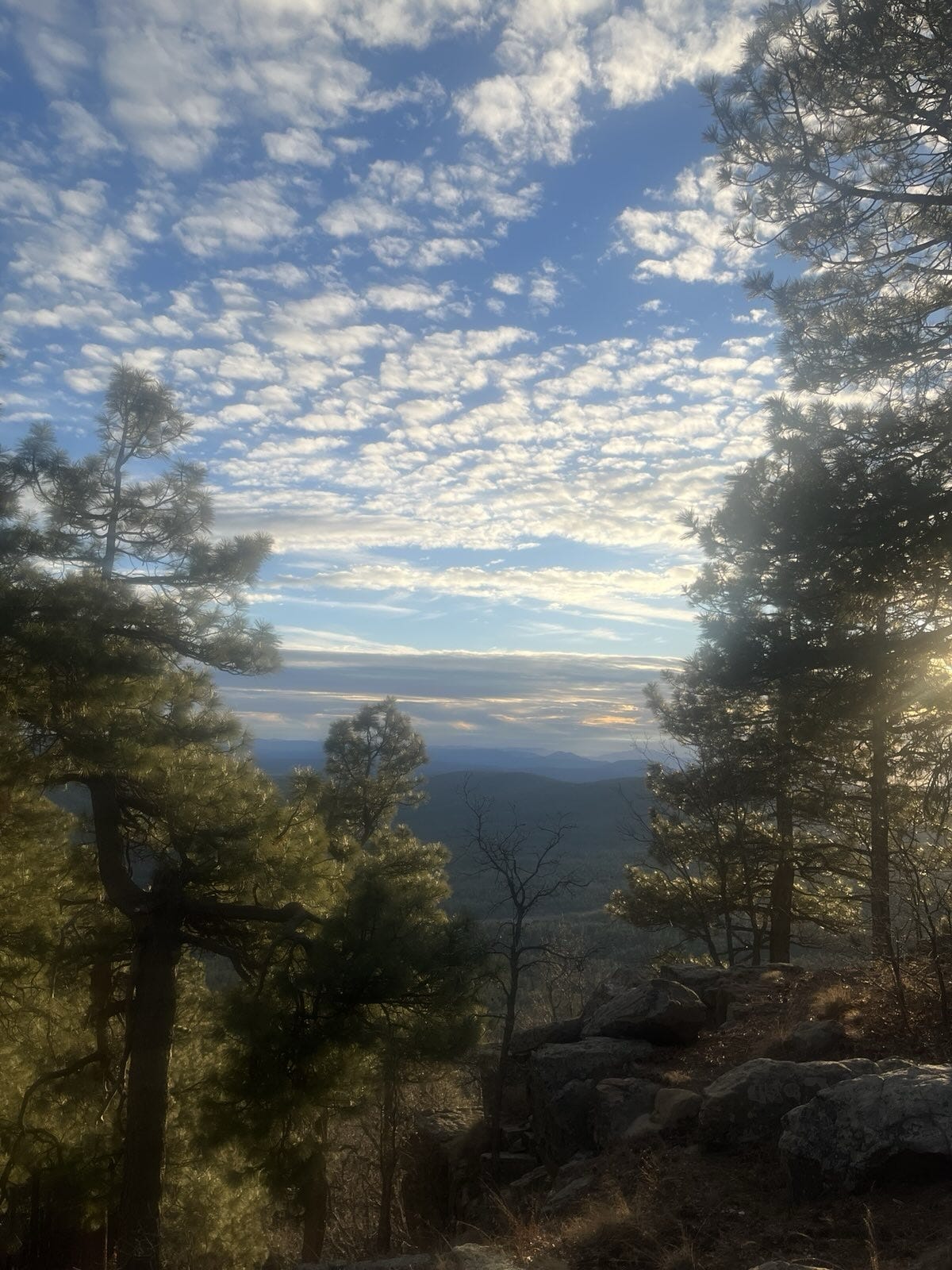
There was quite a bit of virga visible at sunset, and we even drove through some rain showers on our way back to Phoenix. Some welcome rain and snow showers are in the forecast for the Southwest the next couple of days.
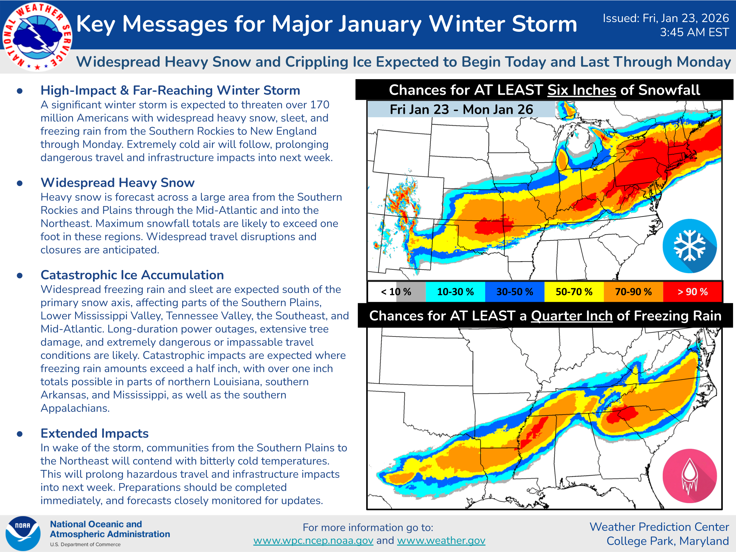
Of course, the primary weather focus for the next several days is on the expansive, high impact winter storm expected through early next week. One of the most impressive aspects of this storm to me is just what a huge footprint of heavy snow and ice is anticipated. Daryl Herzmann, the lead for the Iowa Environmental Mesonet sites that the weather community relies upon for many archived datasets, posted on BlueSky this morning that the number of counties under a winter storm warning for this event is second highest since 2008, only slightly trailing February 15 2021. One key impact of this large expanse of heavy wintry precipitation is that dozens of airports will be impacted across the country at some level — including major hubs such as Dallas-Fort Worth, Atlanta, Charlotte and the Northeast Corridor airports — meaning there will likely be massive and cascading impacts on the national airspace for the next several days.
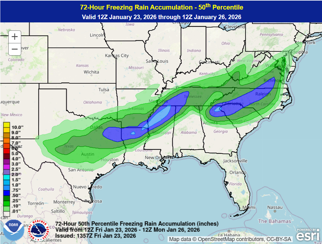
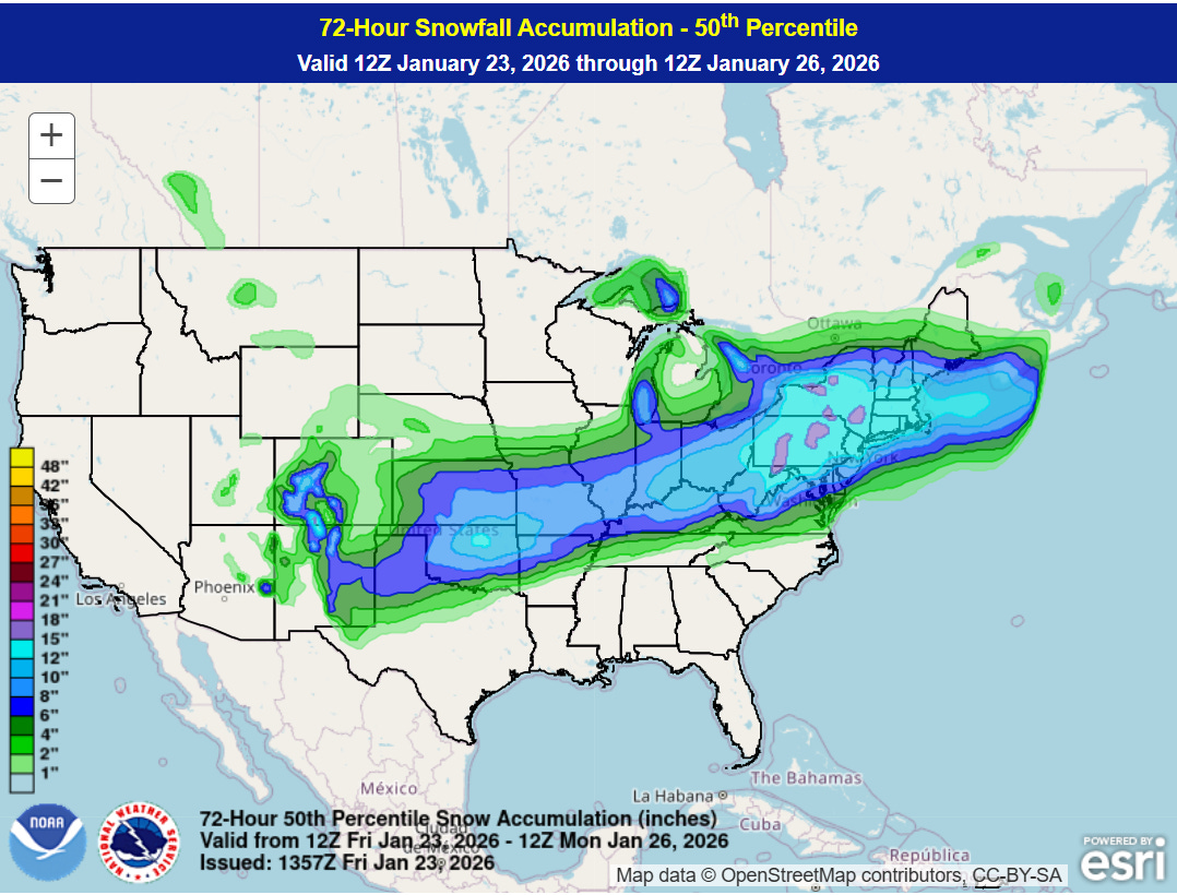
With the models now in better agreement on the large scale features driving this winter storm and most of the impacts within 72 hours, we can now get into looking more closely at specific amounts and potential impacts. The maps above are the forecasts of expected (50% probability) amount of ice (top) and snow (bottom) accumulation from the NWS Weather Prediction Center (WPC).
While of course the huge swath of heavy snow — over a foot in some spots — is a big issue, I am most concerned about the swaths of heavy ice accumulation greater than .5” from northeast Texas into middle Tennessee, as well as over the southern Appalachians, Carolinas and into parts of Virginia. Assuming these amounts (or even heavier amounts) verify, catastrophic impacts to power infrastructure and trees as well as impossible travel are likely. Obviously, the forecasts still have their own potential sources of uncertainty, and I am going to dive into some of what we should be watching for as we go through the next few days.
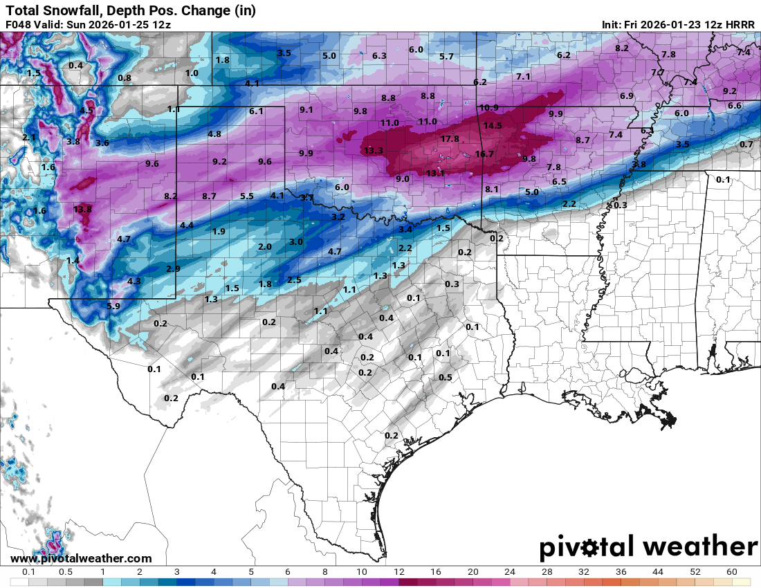
The initial focus for the winter storm will be in the south central states, where wintry precipitation will be developing today and multiple waves of moderate to heavy precipitation are expected through the weekend. There will likely be some localized bands and maxima of precipitation within this region due to small scale atmospheric features as well as actual thunderstorms. The high resolution models can give us some clues on to where these maxima might occur, and there has been a pretty persistent signal across multiple models and model runs (most recent High Resolution Rapid Refresh shown above) for an enhancement in snowfall somewhere along or north of I-40 in central/eastern Oklahoma and western Arkansas. One complicating factor for how much snow will fall in this region is the potential for sleet as well — which would bring down the snowfall accumulations but potentially further complicate travel with ice accumulations from heavy sleet. Bottom line, the forecast in this region is particularly complex and has higher uncertainty.
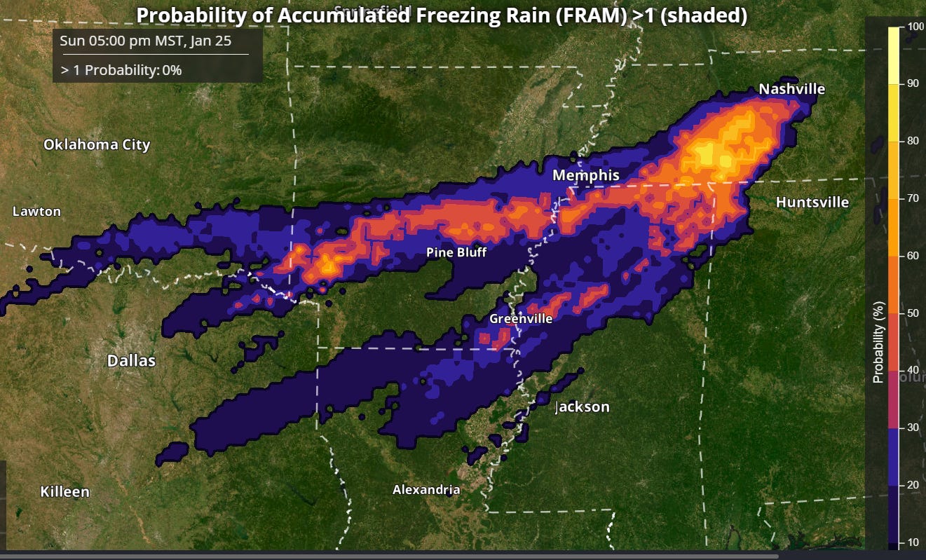
Looking at the potential ice accumulations farther south, amounts here will also be complicated by thunderstorms as well as how much sleet might occur. The REFS (rapid refresh ensemble forecast system) shows the highest probabilities for greater than 1” of ice accumulation from freezing rain across parts of southern Arkansas into northern Mississippi and middle Tennessee — where probability values actually show amounts greater than 1” likely. Obviously, ice accumulations at this magnitude would be particularly catastrophic, and meteorologists will be closely watching weather balloon data and near term model trends to try to better pin down precipitation type and intensity in this area.
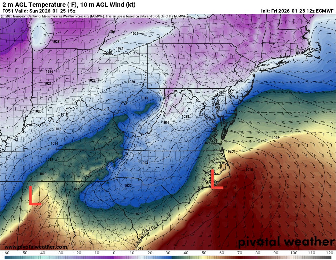
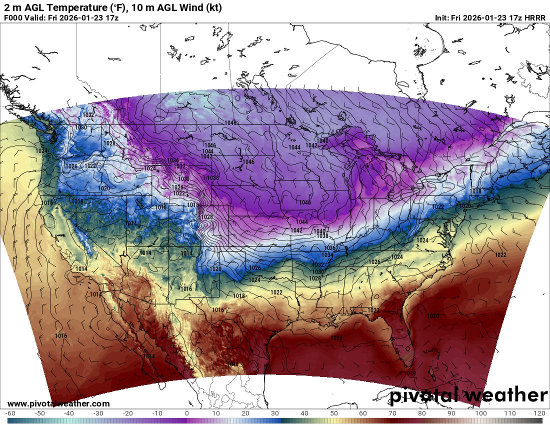
Farther east, the ice forecast for the southern Appalachians across the Carolinas and into Virginia hinges around “cold air damming,” the phenomenon where cold air surges down the Appalachians and becomes trapped. This forecast map for 10 am ET Sunday morning from the just arrived European model shows the situation well, with subfreezing air from northern Georgia north and northeast. Meanwhile, a surface low pressure system is moving northeast across Alabama with much warmer air (temperatures in the 60s) trying to surge north and erode the “wedge” of cold air. To make things even more complicated, as is typical in this type of weather situation, a new surface low will be developing along the North Carolina coast, which will gradually become the main storm system as the low to the southwest weakens.
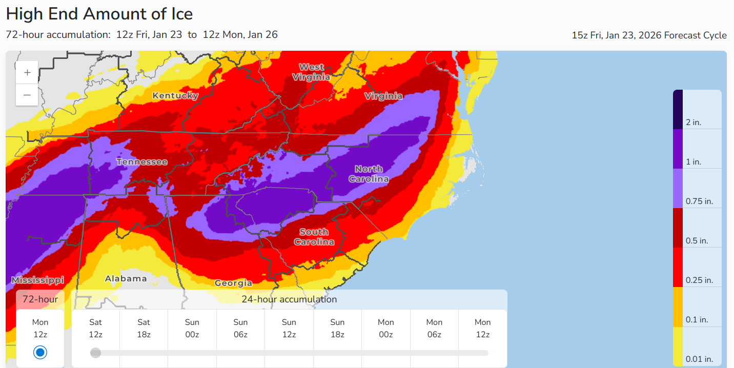
The specific timing of how all of this evolves is obviously very difficult for the models to handle, and will play a key role in how precipitation transitions between rain, freezing rain and sleet and thus how much ice will accumulate. The WPC “reasonable worst case scenario” — or 10% probability amount — of ice shows that some locations from northeast Georgia into the Carolinas could also receive over 1” of ice depending on how this all ends up playing out.
Of course, we also need to talk about the extremely cold Arctic air that is supporting all of the wintry precipitation. Arctic high pressure is building across the northern tier of states east of the Rockies, with subzero ambient temperatures down into northern Missouri and Illinois. Minneapolis-St. Paul saw a low of -21F this morning, with wind chills as low as -45F.
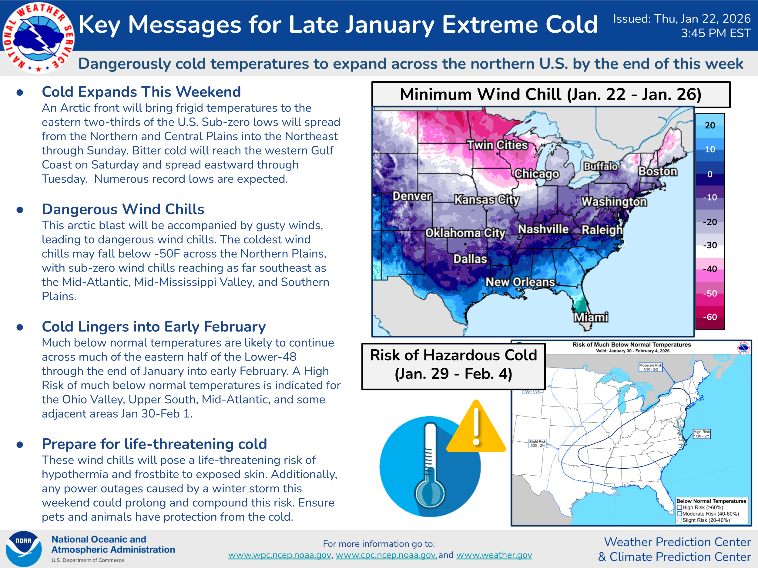
Extreme cold warnings are in effect for large parts of the eastern two-thirds of the country, as cold air will push south to the western Gulf Coast. The weather pattern will continue to be favorable for repeated surges of Arctic air across the eastern United States for the next 7 to 10 days — which will be of particular concern if extensive power outages do occur in areas impacted by the anticipated ice storm.
With regard to the potential infrastructure impacts from this event, there has been a lot of concern raised in recent days about how ready FEMA is to respond to a large scale potential disaster given its organizational issues that have been well documented in recent months, including in a recent Government Accountability Office study. In one spot of positive news, CNN reported this morning that FEMA has halted the termination of hundreds of disaster response workers within the agency, at least partially due to this impending storm. Obviously if major impacts do result as anticipated from this winter storm, many will be closely watching FEMA for the timeliness and quality of their response to the disaster.
Again, I will be continuing to update via Substack notes and social media posts. Also, I am planning to do another live Substack chat to answer questions and provide updates this afternoon at 4 pm ET/3 pm CT. Paid subscribers can join me then — and bring your questions about specific forecast issues, winter weather science items, or just whatever burning issue you have today!

Leave a comment