Arctic cold and high winds will add to the issues through the weekend
Jan 29, 2026
I will get into the latest forecast developments with the upcoming major Arctic outbreak and East Coast winter storm below, but I want to start off this morning again with the situation in the region that was heavily impacted by the devastating ice storm this weekend. Based on looking at news sites this morning, I am concerned that the disaster is starting to fall off of the radar, and the situation for many is still very difficult.
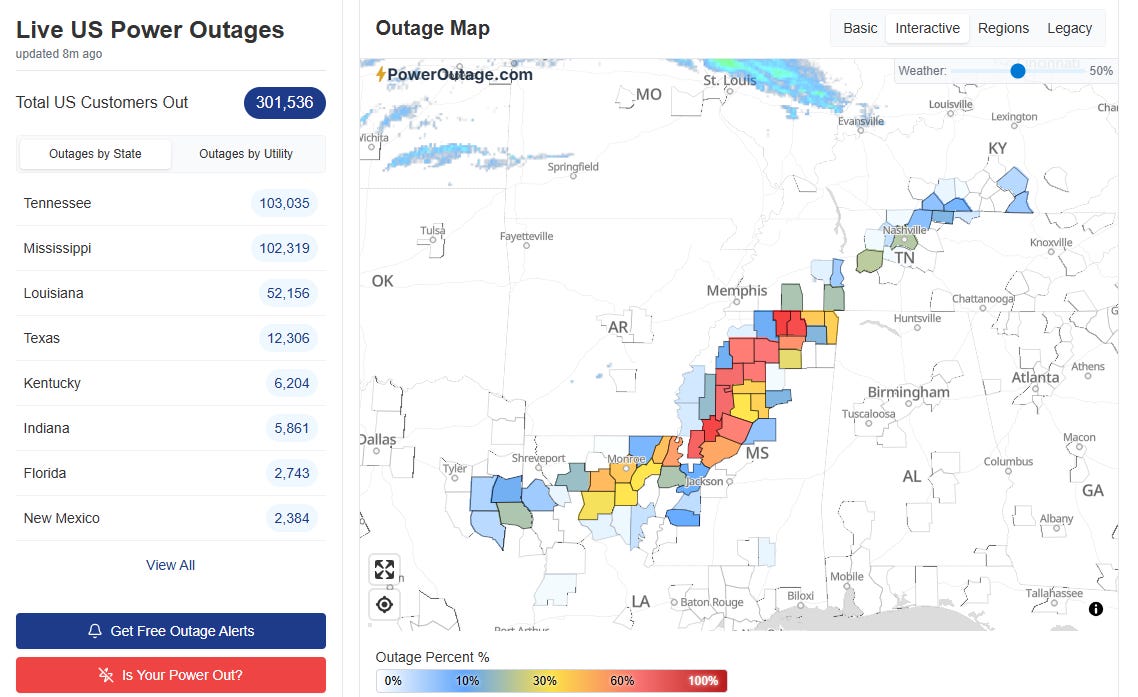
While significant progress has been made in power restoration, 300,000 customers still remain without power, with Mississippi particularly concerning as numerous counties in the Delta and northern Mississippi still have more than 50% of their population without power per Poweroutage.us. My friend Marshall Ramsey, a longtime author and political cartoonist in Mississippi, wrote a column in Mississippi Today I urge you to read talking about his experience living through the storm in Oxford, which appears to be have been the essential ground zero for the most serious impacts. The University of Mississippi in Oxford announced yesterday that it would be closed through the end of next week due to the serious damage to the city and its infrastructure. Some highlights from a post that Marshall made on Facebook last night about the impacts:
Oxford is having water system issues. The city is shutting off water to more and more parts of the city to allow the city water capacity to recharge and to find any potential leaks. The Mayor pleaded for people to not drip water… I-55 is still a mess — actually it is hellish between Batesville and Memphis, which of course, is problematic for students trying to get to the airport or head home via car…Our power came back on but has been off three times — I assume to add more people back to the grid. But it is gut wrenching when it goes off every time. Thankfully it has come back three times, too. This last time I saw dozens of my neighbors out walking around the neighborhood. Nerves are frayed. With another brutal cold snap coming this weekend with high winds — well, as you can imagine, nerves are frayed. Don’t underestimate the size and scope of this disaster. The progress that has been made is remarkable. But so much still needs to be done.
The most devastating damage from this ice storm impacted some of the most socioeconomically vulnerable parts of our nation — and as Marshall noted, the weather aspect of this disaster is not over as another Arctic outbreak looms for the weekend. Yesterday, the American Red Cross reported that the blood supply in many impacted regions is critically low and requested donations. If you can, I urge you to consider supporting ARC and other non-profits helping those impacted by the ongoing winter weather across the country.

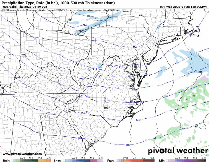
Speaking of the Arctic outbreak, that still looks on track, with the surge moving into the upper Midwest later today and then sweeping across the rest of the eastern United States and all the way across Florida by Saturday. Subzero low temperatures are expected over the weekend for much of the Midwest and across the Great Lakes and Ohio Valley, with single digits and teens well down into the South.
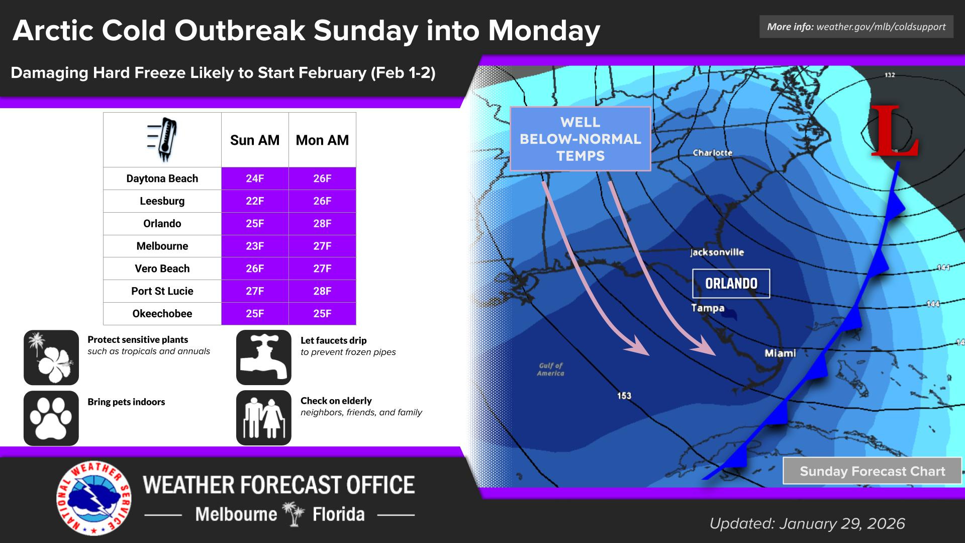
A damaging hard freeze is expected for much of Florida, with parts of the state experiencing the coldest low temperatures in more than a decade.
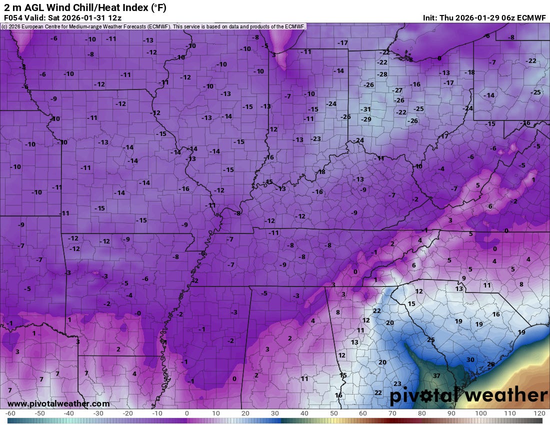
As the intense low pressure system develops along the Carolina coast this weekend, strong northerly winds will also develop, which will push wind chill readings below zero across a large swath of the Midwest and East, including into areas where such extreme cold is rare like Mississippi. Obviously, those without power will be at serious risk from hypothermia and exposure as this bitterly cold weather moves in.
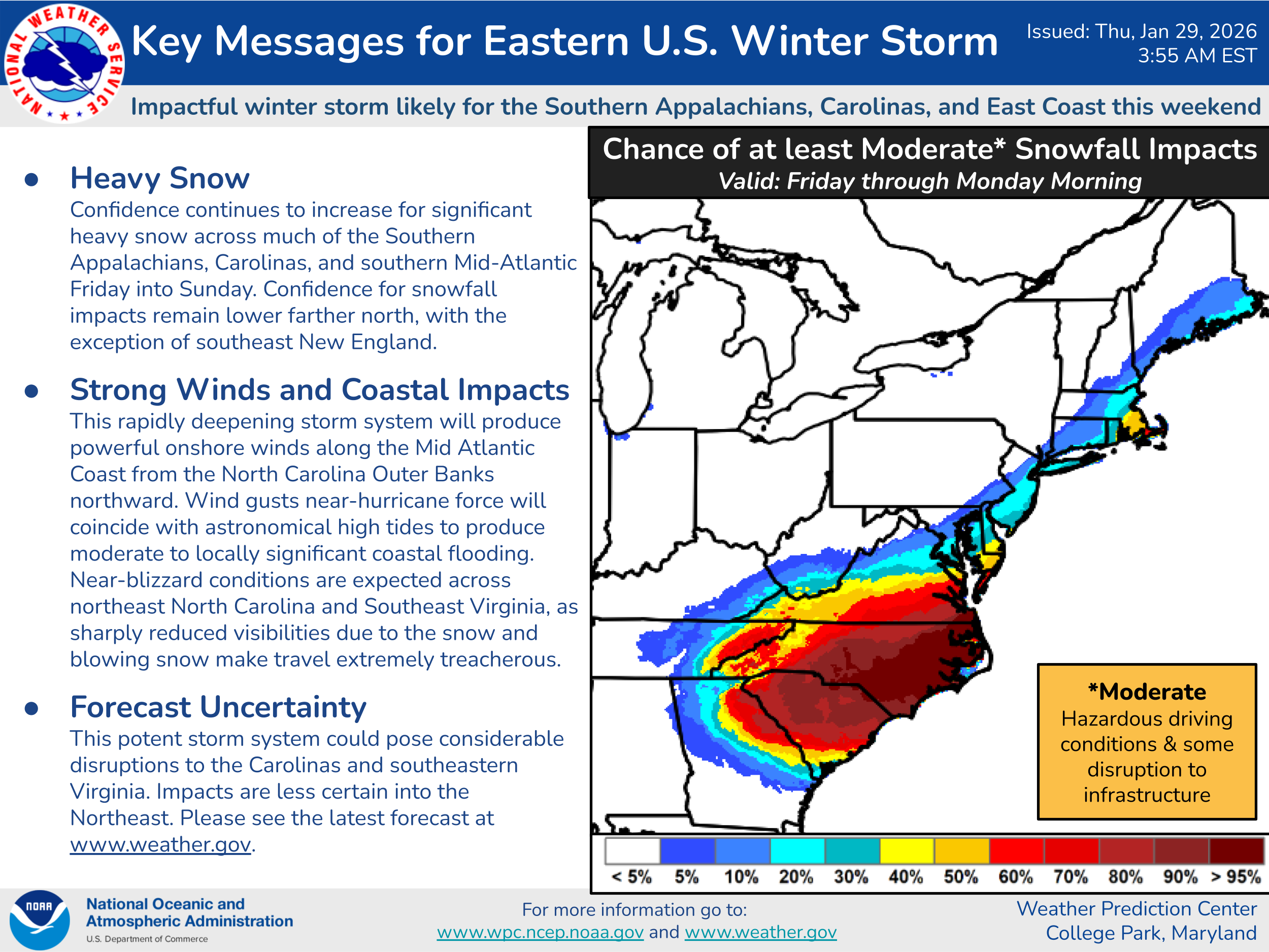
There are still uncertainties about the evolution of this storm system — but it is becoming increasingly certain that significant impacts from heavy snow and high winds will impact much of the Carolinas into parts of eastern Georgia and southern Virginia Friday into the weekend, with potential impacts northeast along the coast. The track of the low pressure system is less clear farther north, but the most likely impacts look to be in southeast New England and especially Cape Cod and the Islands
The evolution and track of this rapidly intensifying low pressure system looks very unusual, and could bring prolonged high winds and heavy snow to areas that are obviously not accustomed to such conditions, with actual blizzard conditions possible especially in eastern North Carolina and southeast Virginia. Wind gusts near hurricane force will be possible in areas near the coast, and significant coastal flooding is possible. Obviously, this increasingly looks like another major weather event and we will be following it closely into the weekend.

Leave a comment