Gezani and Fytia leave dozens dead and tens of thousands displaced
Feb 12, 2026
With all of the busy winter weather in the US the last several weeks, I have not talked about the tropics of late. However, it is always tropical cyclone season in the western Pacific, and given this is late summer in the Southern Hemisphere it is a peak time for basins south of the Equator as well.
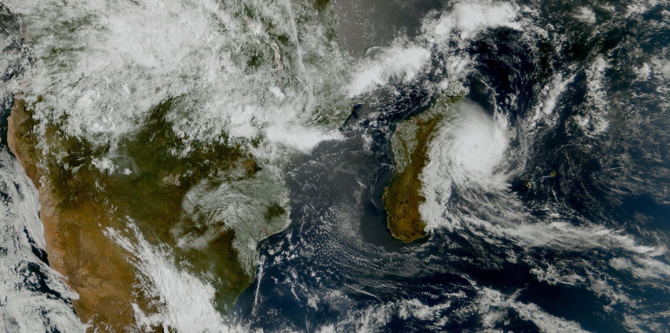
The southwest Indian Ocean has been particularly busy of late, and unfortunately has been causing major impacts to the island nation of Madagascar. This image above from EUMETSAT shows Cyclone Gezani approaching northern Madagascar on Tuesday.
")
Gezani made landfall as the equivalent of a major hurricane near the port city of Toamasina, the second largest city in Madagascar. Damage was severe, with the nation’s emergency management agency reporting 38 deaths, 6 people still missing, 374 injured and more than 12,000 displaced. Gezani impacted Madagascar just a little over a week after Tropical Cyclone Fytia struck northern Madagascar from the northwest. Forming in the Mozambique Channel, Fytia was one of the strongest cyclones to ever strike Madagascar in that region, reaching equivalent to category 3 intensity on the Saffir Simpson Hurricane Wind Scale. At least 12 people were killed by Fytia and more than 25,000 people were displaced per the nation’s disaster management agency.
Madagascar is one of the poorest nations in the world, with a gross domestic product of only about $600 per person. Most people live in sub-standard housing, and the nation is particularly vulnerable to weather related disasters such as these. Response and recovery from these back-to-back cyclones will certainly be challenging, and will definitely rely heavily on non-governmental organizations. You can read more here from the United Nations about the humanitarian relief effort.
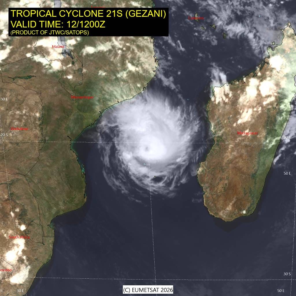
Unfortunately, Gezani is reintensifying after crossing Madagascar and reemerging in the Mozambique channel. This satellite image from earlier this morning shows that the cyclone has regained a defined eye, and it is expected to regain the equivalent of major hurricane intensity as it moves slowly southwest toward the southeast African coast the next few days.
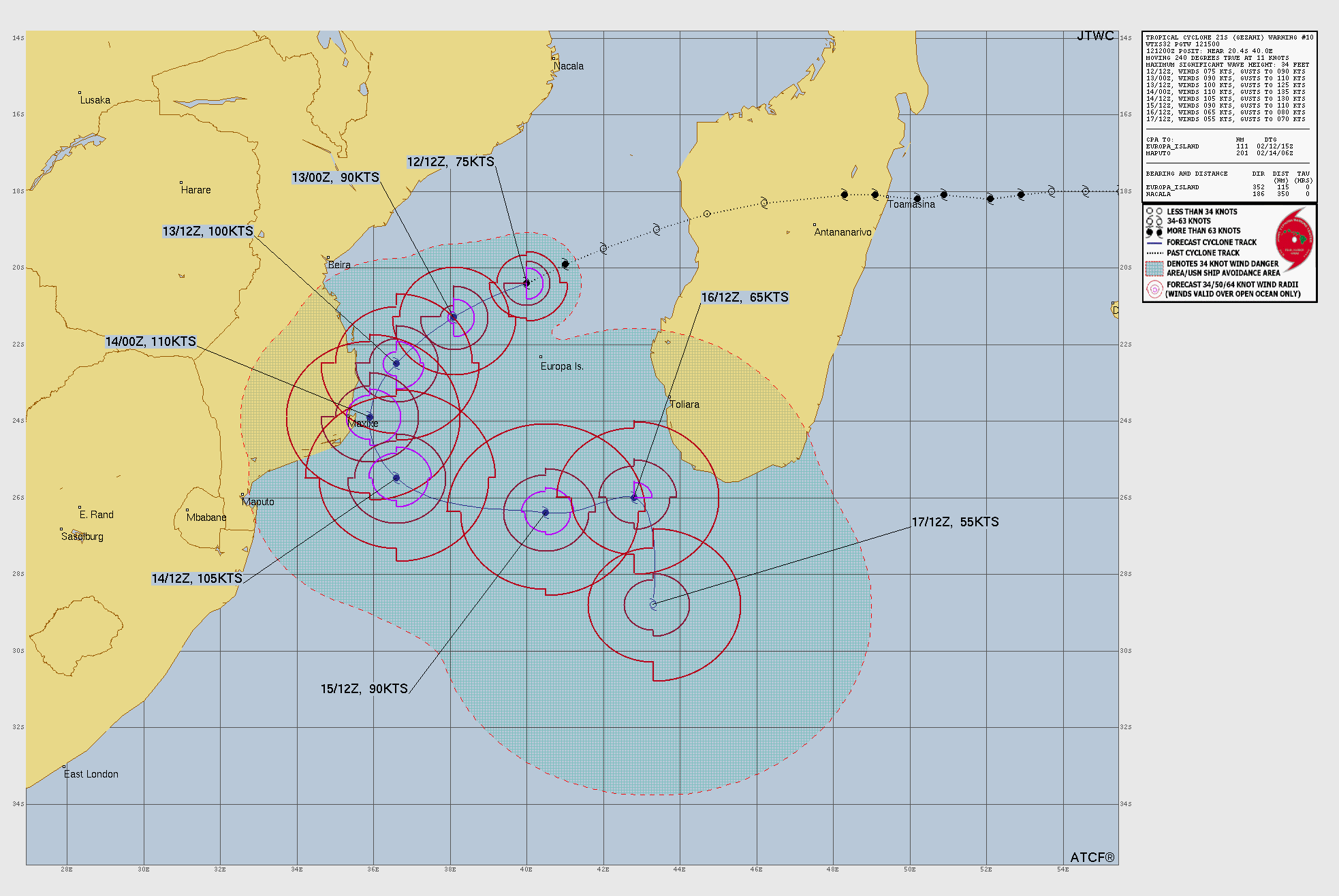
The Joint Typhoon Warning Center (JTWC) forecast shows the cyclone passing very close to the southern coast of Mozambique with maximum sustained winds of 110 knots (125 mph).
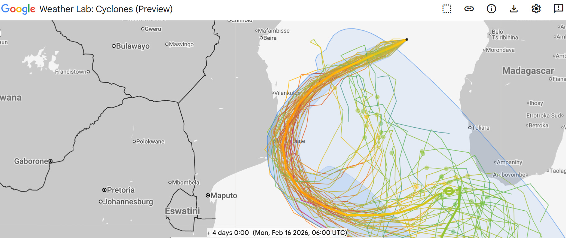
Gezani is in relatively weak steering flow to the north of a deep trough of upper level low pressure to the southeast of the southern tip of Africa. As such, its motion is likely to be relatively slow and erratic. The Google DeepMind AI ensemble (above) shows that the general motion of Gezani to the southwest with a turn to the southeast has decently high confidence — but whether or not the storm will actually make landfall in Mozambique near Inhambane or remain just offshore is uncertain. As an aside, my colleague Andrew Hazelton has a good blog post about the performance of the AI models with Gezani as it approached Madagascar.
Regardless of whether Gezani makes landfall, there will likely be significant impacts to this coastal region of Mozambique from wind and rainfall as the cyclone passes by in a couple of days. Obviously, those impacts along with storm surge would be magnified if the eye of the cyclone actually crosses the coast.

Taking a quick look at weather stateside, things are relatively quiet today, with some snow showers expected over the Northeast, and the upper level weather disturbance that brought rain and snow to California finally bringing some rain showers and higher elevation snows to the Intermountain West.
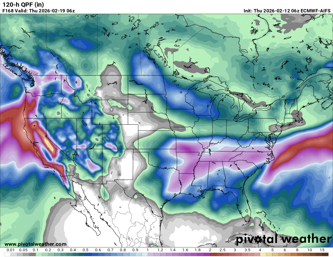
That system is still expected to move east and bring much needed rainfall to the southeast quarter of the country the next few days. Some thunderstorms are also anticipated and as I mentioned yesterday, there is at least a marginal risk of severe storms for the Southern Plains and western Gulf Coast regions Friday into Saturday. The threat of a more “phased,” intense Nor’easter as I mentioned on Tuesday associated with this system now appears to have passed, with the surface low pressure center most likely to move east off the coast early next week and intensify well offshore. Meanwhile, a busy period of weather is expected early next week in the West, with widespread heavy rainfall and very heavy mountain snows anticipated, particularly in California.

Leave a comment