More severe storms anticipated Friday into Saturday
Mar 06, 2026
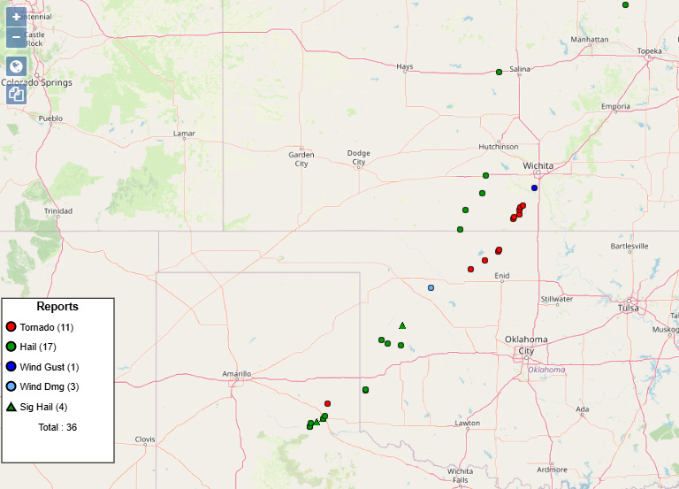
As anticipated, several supercell severe thunderstorms impacted the region from the Texas Panhandle to south central Kansas late Thursday into the overnight hours. The storms were responsible for more than 30 reports of severe weather, including several tornadoes and hail up to 2.25” in diameter.
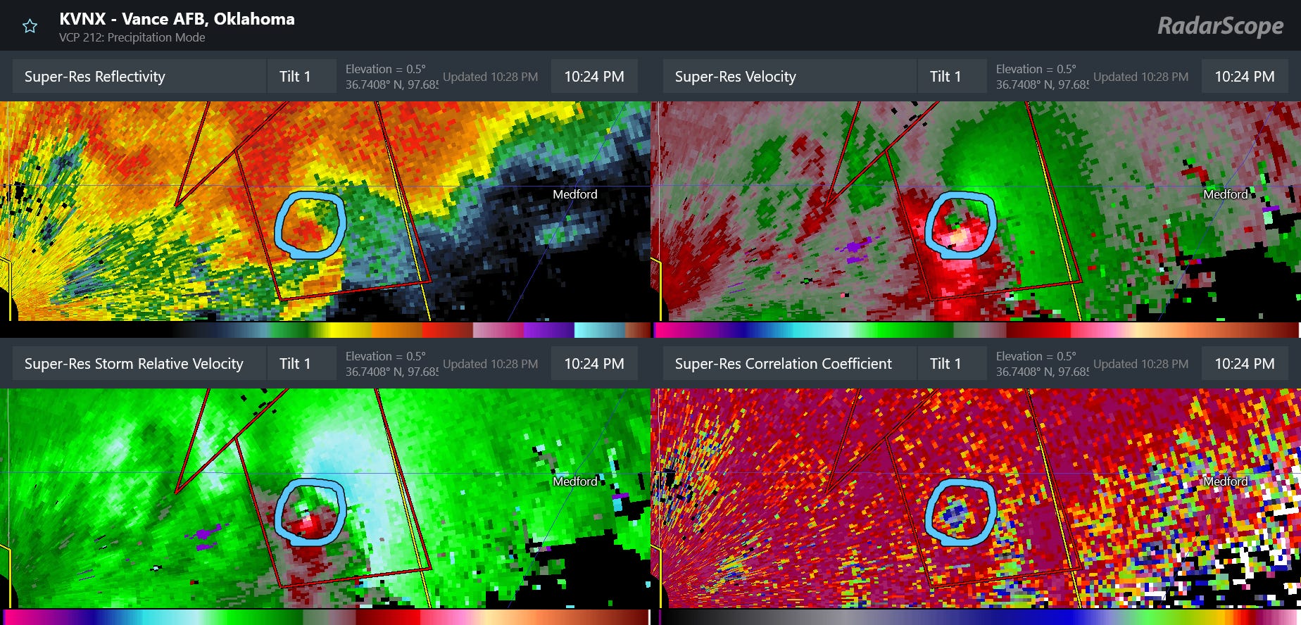
A series of storms in northwest and north central Oklahoma northwest of Enid produced a few tornadoes which looked potentially strong (EF2+) given radar data and chaser reports. The storms were relatively close to the Vance AFB radar site, which provided an excellent view of the storms This 4-panel display is classic example of a likely strong supercell tornado, with a very intense, tight circulation in velocity data (upper right and lower left panels). It also shows clear indications of lofted debris in the maximum of reflectivity in the “debris ball” (upper left) and low values of correlation coefficient dual-polarization data (lower right) due to the varying shapes and sizes of the detected debris. While these storms impacted a rather rural area, there have been reports of damaged homes and buildings, and unfortunately The Weather Channel is reporting that two people died when their car was struck by a tornado near Fairview, OK.
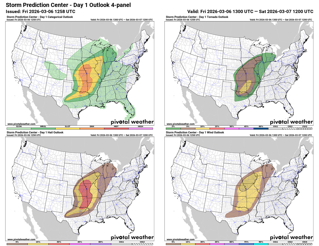
This afternoon and this evening still look like a fairly active period as far as severe thunderstorms, with the Storm Prediction Center continuing to have an enhanced (level 3 of 5) risk from southern Iowa south to the Red River along the Texas/Oklahoma border. However, there is still quite a bit of uncertainty in how storms will evolve and what areas will see the greatest risk. This is mainly because the atmospheric forcing for thunderstorm development is becoming more diffuse as the main upper level disturbance begins to cutoff and drop southwest toward Baja California rather than eject out to the northeast.
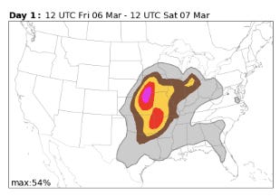
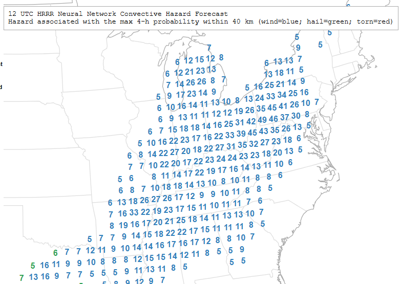
Some of the AI probabilistic guidance (NCAR “FengWu” based on European ensemble shown above) are hinting at two maxima in severe storm risk today. One where the main atmospheric disturbance and mid level maximum of winds will be moving through in the mid-Missouri Valley region, and another farther south where a separate area of storm development should occur in a region of more unstable air. Morning high resolution models suggest that the initial development in both of these areas will be supercell severe storms. However, the northern area should see rapid evolution to a line of severe storms that will move east and northeast across the region with a continued severe risk. The storms may remain more isolated for a longer time in the area farther south, but even there should evolve more into clusters and lines of storms as they move east across eastern Oklahoma and into western Arkansas.
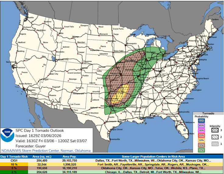
The combination of strong low level wind shear and sufficiently unstable air means that similar to yesterday a few strong tornadoes are possible this afternoon and night – both with the initial supercell thunderstorms and within the evolving lines of storms.
I want to point out that this tornado forecast from the Storm Prediction Center really shows the change in how SPC depicts the risk of strong tornadoes using the new conditional instability groups (CIG) it instituted earlier this week. Prior to this week, SPC “hatched” areas indicated at least a 10% probability of a significant severe weather report (for tornadoes, EF2+) within a 25 mile radius of a point. As such, the hatched area could only be forecast where there was at least a 10% tornado probability. Now, the CIG1 area above depicts where is a conditional risk of a significant tornado, i.e., if a tornado occurs, the atmospheric conditions are expected to support the potential for it to be strong. This is a significant change, and now allows SPC to show the CIG areas where lower probabilities of tornadoes are forecast, as you can see for today. In my mind, the change is going from the hatched area showing the greatest risk of significant tornadoes in the old forecast methodology, to the CIG1 area outlining where significant tornadoes are possible. CIG2 and CIG3 will be used to delineate the greater risk areas for significant tornadoes.
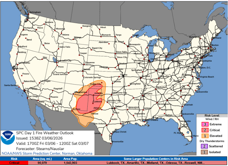
Along with the severe weather risk today, there is also a critical (level 2 of 3) risk of wildfire danger across the Plains to the west of the severe weather risk area. This area is suffering from a serious lack of rainfall over the last several months, and with dry and windy conditions developing today to the west of a dryline, concern exists for rapidly spreading wildfires.
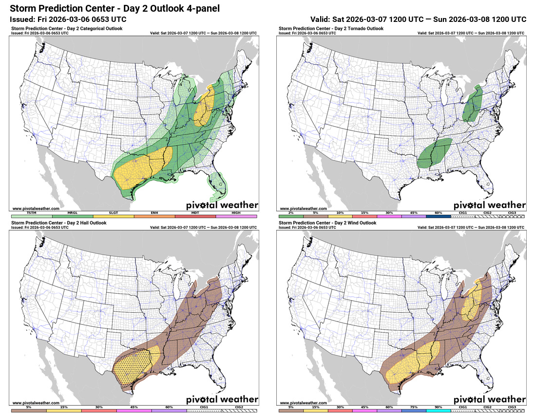
Additional severe thunderstorms will be possible on Saturday as the cold front associated with this weather system sags east and southeast.
Some of the AI guidance suggests a somewhat enhanced risk of wind damage across the central Appalachians on Saturday as a line of strong to severe storms moves east across the region, so that will be something I will be watching in later forecasts.

Leave a comment