More and more signs pointing toward development of a strong El Nino event
Apr 06, 2026
During Atlantic tropical season, I try to either in my Monday newsletter or in a Monday standalone post provide an update on what is happening in the tropics. While we’re still several weeks away from the start of the 2026 hurricane season, there are some important developments currently going on in the western Pacific tropics that we should take a look at.
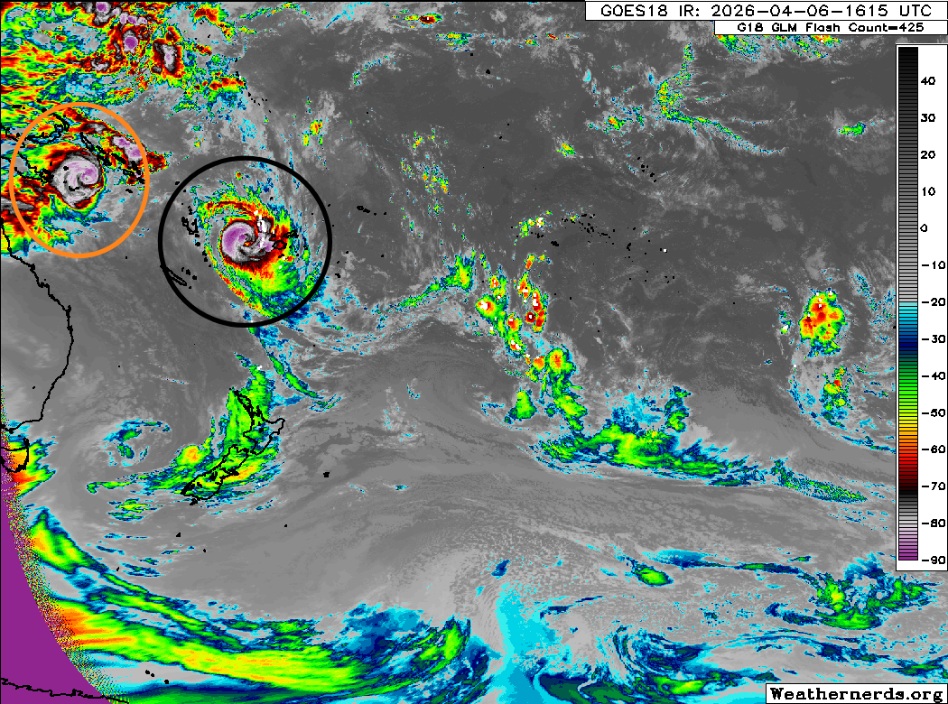
This GOES-18 infrared image (courtesy Weathernerds.org) shows two tropical cyclones to the east of Indonesia and northeast of Australia: Maila (orange circle) and Vaianu (black circle). Both of these cyclones are estimated by the Joint Typhoon Warning Center to be the equivalent of a strong category 2 hurricane on the Saffir-Simpson Hurricane Wind Scale.
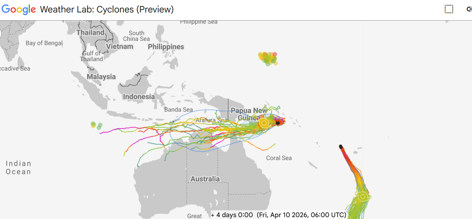
The Google DeepMind (GDM) AI forecast for the next four days — as well as the JTWC forecast — generally shows both Maila and Vaianu intensifying a bit more before starting a slow weakening trend. Maila will meander around before starting a slow west to southwest motion, while Vaianu will begin to move south in the general direction of New Zealand. Vaianu will begin to begin to transition to a post-tropical cyclone in a few days, and could cause significant impacts in New Zealand later this week as a large post-tropical system.
While all this is happening in the South Pacific, on the other side of the equator you can see most of the Google DeepMind ensemble members showing the development of a new system well to the east of the Philippines. GDM as well as global models are suggesting this will become a major typhoon by next weekend. The longer range track is uncertain as to whether it will move more west-northwest toward the Mariana Islands, or recurve more to the north and northeast.
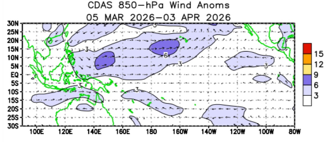
The formation of these tropical cyclones in relatively close proximity on either side of the equator is not a coincidence. It is part of a phenomenon known as a “westerly wind burst” (WWB) in which the normal easterly trade winds become more westerly — you can see in the wind anomaly over the last month how the winds have been anomalously westerly (arrows pointing west to east) in this region, and the formation of these tropical cyclones are further evidence that a WWB is in progress.
Westerly wind bursts are much more common during the formation process of El Nino, and they play a key role in the transport of anomalously warm water from the western equatorial Pacific toward the eastern Pacific.

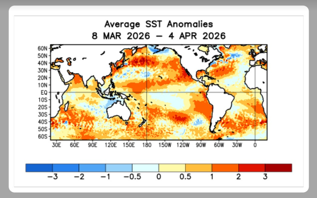
The presence of this WWB is yet another piece of evidence in a plethora of signs — including rapidly warming waters in the El Nino regions of the central and eastern Pacific — that we are likely heading toward a strong El Nino later this year. The most recent El Nino forecast from the long range European ensemble forecast shows nearly all of its members having the ENSO (El Nino Southern Oscillation) region sea surface temperature anomalies exceeding 1.5C — the threshold for a strong El Nino — by late this summer. As you can see, many of the members in fact are in excess of 2C.
Obviously, the evolution of such a strong El Nino would have major implications on global climate (click link to see the potential impacts) — including potentially reducing Atlantic tropical cyclone activity (and enhancing Pacific tropical cyclone activity). This will be a key climate story we will be following over the next several months.

Taking a quick look at US weather as we start a new work week — as I discussed in my last post Saturday, things have overall trended quieter across the country. The main focus for shower and thunderstorm activity the next few days will be in Florida as an active subtropical jet stream (possibly another sign of a potential atmospheric transition toward El Nino) will combine with a stationary front to produce some beneficial heavy rainfall. By later in the week and into early next week, conditions will likely become more active in the middle of the country again as a new upper level trough of low pressure moves into the West.
Programming note: I am attending and presenting at the National Tropical Weather Conference this week, so my posts may be a bit irregular.

Leave a comment