And recapping a relatively busy last 72 hours of weather in the middle of the country
Apr 04, 2026
Happy weekend! I have spent pretty much all of the last couple of days’ of Substack work covering various federal budget news items that have broken, so I have been remiss in talking about the relatively active weather that parts of the country have seen.
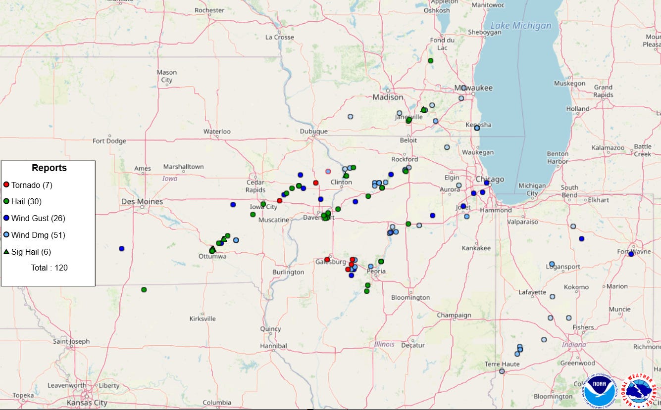
With regard to severe thunderstorms, Thursday ended up being the most impactful day as there were over 100 reports of severe weather in the Midwest including a few tornadoes and large hail up to just larger than baseball size.
The severe thunderstorm activity generally kind of underperformed across the Midwest on Friday, although one supercell storm did produce hen egg sized hail and a tornado in central Illinois. Most of the higher end severe weather reports were associated with a messy but potent complex of severe storms that moved across central Oklahoma Friday evening. Radar showed at times swaths of wind velocity values of up to 90 mph, and a few incidences of 80 mph wind gusts were reported along the path of the storm south and southeast of Oklahoma City along with likely some brief tornadoes.
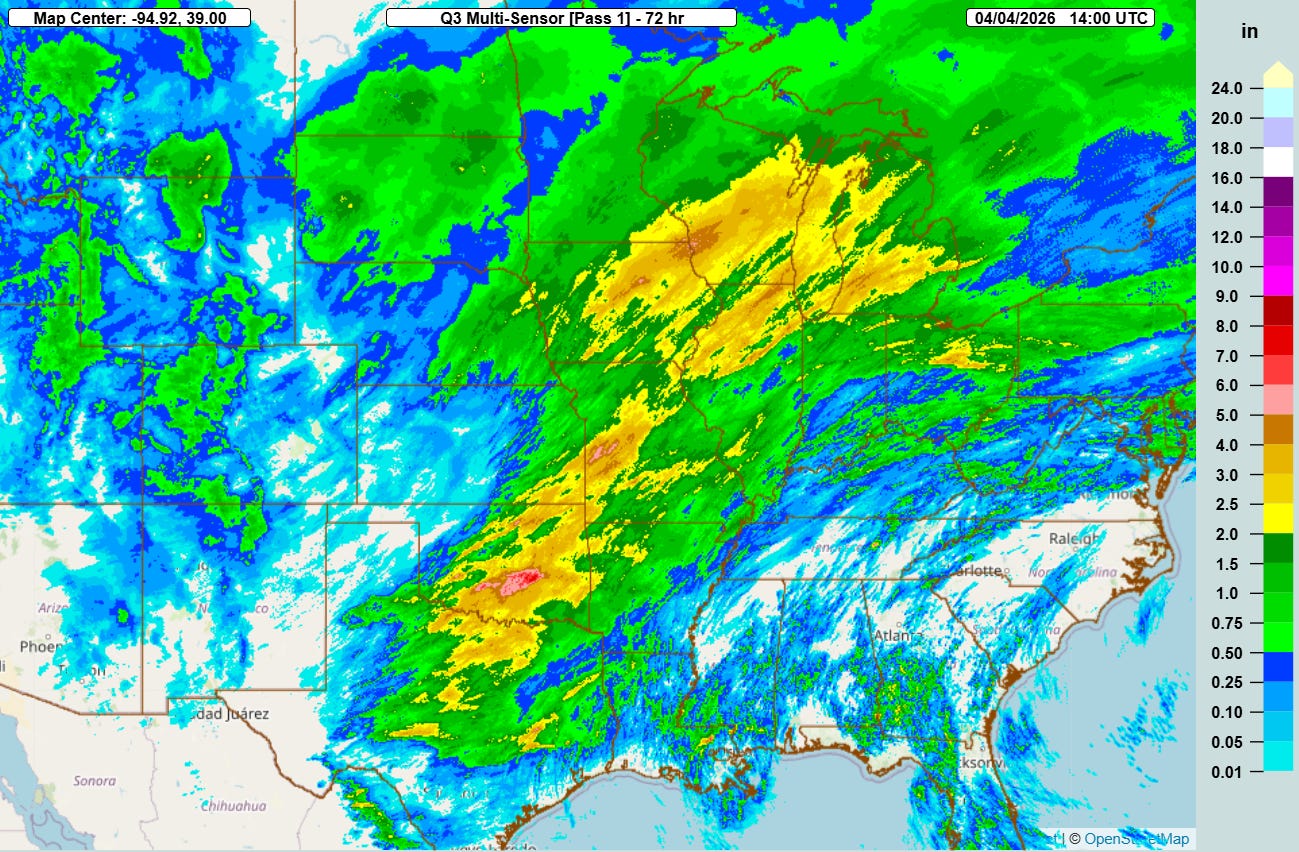
The 3-day estimated rainfall from the NSSL Multi-radar Multi-sensor System (MRMS) shows that widespread — mostly welcome and beneficial — heavy rainfall occurred from central Texas to the Great Lakes region. As thunderstorms temporarily trained for a few hours, localized heavier amounts along with some flash flooding occurred.
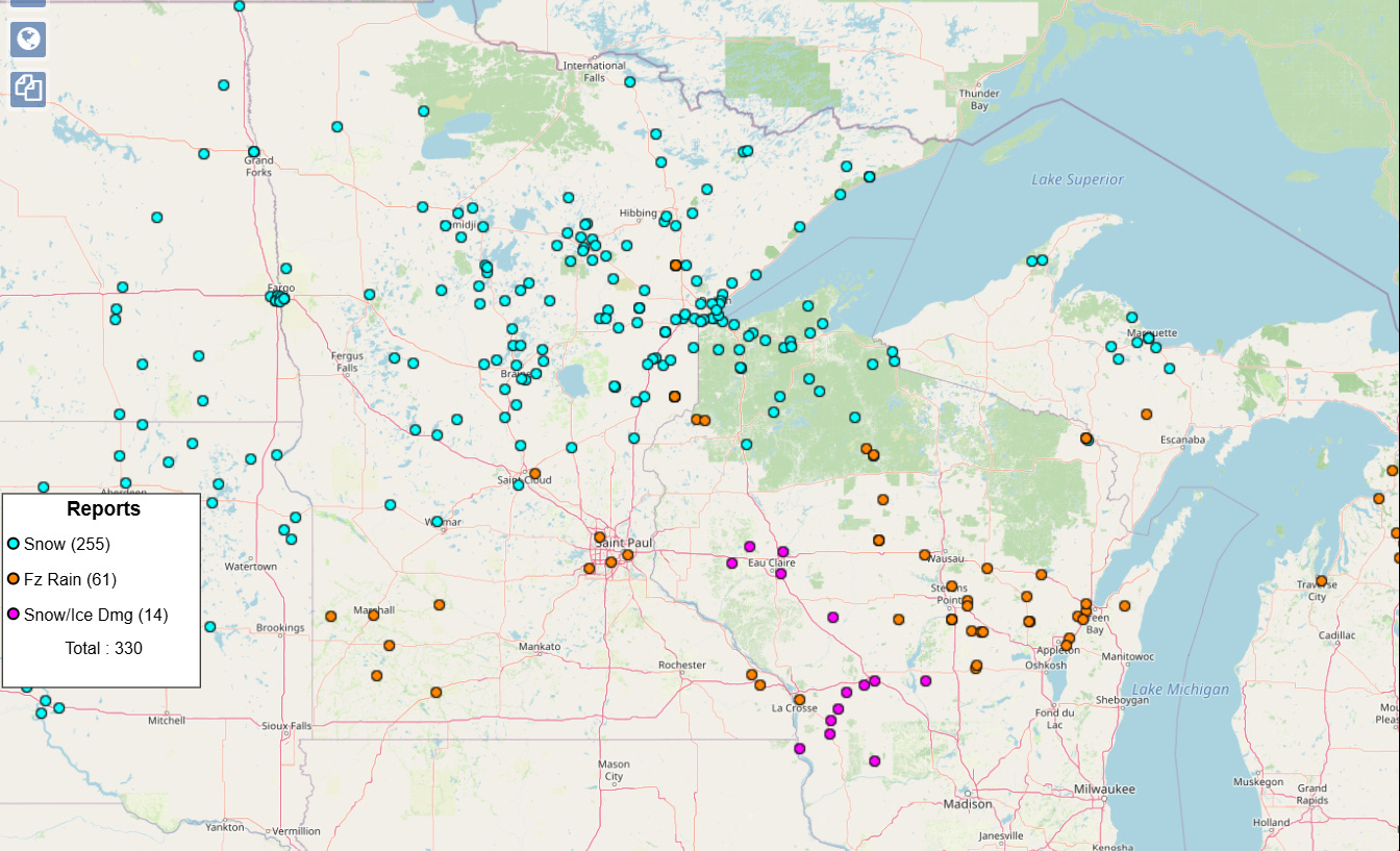
Along the northern periphery of this widespread precipitation, sufficient cold air was in place for it to fall as wintry precipitation across the Upper Midwest. Tens of thousands of power outages occurred due to freezing rain accumulations, particularly in parts of Wisconsin.
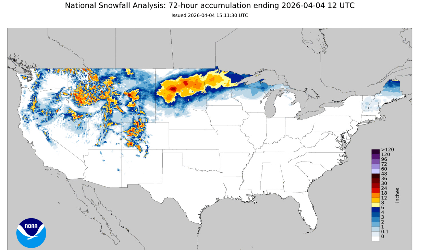
A swath of heavy snow fell across the Dakotas and northern Minnesota, while some of the high elevations of the northern and central Rockies got some snowfall.

This weekend will overall see a gradual trend toward winding down the active weather across the country. Today though will still see some risk of strong thunderstorms and heavy rainfall along a slow moving cold front in the eastern US. The greatest risk for severe storms should be in the Great Lakes region, where a slight (level 2 of 5) risk is in place for severe weather with damaging wind gusts the primary threat. The wintry precipitation will continue in the upper Midwest and northern Great Lakes, but will gradually be tapering off later today and tonight.

On Sunday, the cold front will work toward the East Coast with showers and thunderstorms continuing along it. A few severe storms with damaging wind gusts will be possible for Mid-Atlantic coastal regions. Colder air will move into the Midwest and East behind the front after another week of mainly well above normal —and at times record warm — temperatures.
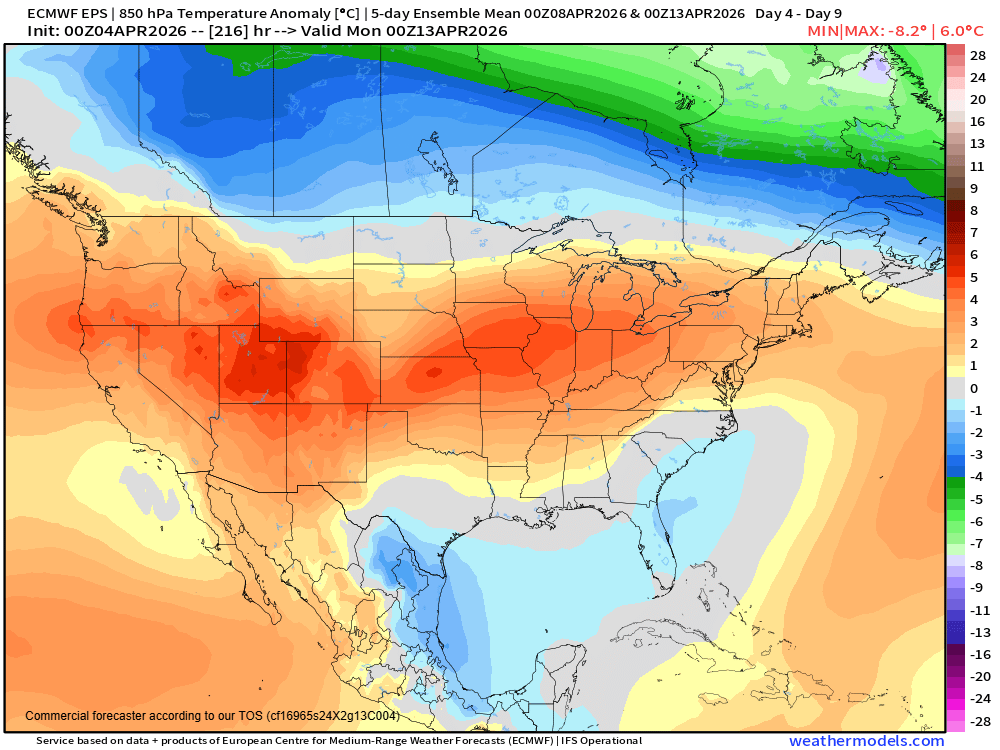
Once the front moves off the coast, the trend will be toward what looks to be a relatively quiet week of weather, with warmer conditions again developing for much of the country from west to east as the week goes on.

Leave a comment