Also 8th driest on record, with January-March driest start to a year on record.
Apr 08, 2026
Doing an evening post today as I spent most of the day in the National Tropical Weather Conference (NTWC) in South Padre Island, participating in excellent workshop sessions led by staff members of the NOAA/NWS National Hurricane Center. Over the last several years, NHC has become the epitome of what I think a government scientific service entity should be, doing a great job with outreach and education, as well as engaging with partners about how to improve NOAA’s tropical weather services. Today’s session of the NTWC was another excellent example of NHC undertaking that collaborative work with an audience mainly made up of broadcast meteorologists — and I expect that both the participants and the NHC staff got a lot of the exchanges.
Another outstanding experience I want to highlight so far from the NTWC was the student session on Monday. The NTWC dedicates the first day of this meeting to bringing in STEM students from high schools around the Rio Grande Valley to listen to talks from various experts from the tropical weather community, giving the students the opportunity to learn about meteorology, hurricanes, and potential science career options. The students were particularly fascinated by the closing plenary session in which longtime tropical cyclone chaser Josh Morgerman (iCyclone) spoke about his 84 tropical cyclone intercepts and shared some incredible storm footage. Given everything going on in the world these days, it was really refreshing to see these young people so engaged in the sessions and asking a lot of insightful questions of the expert speakers.
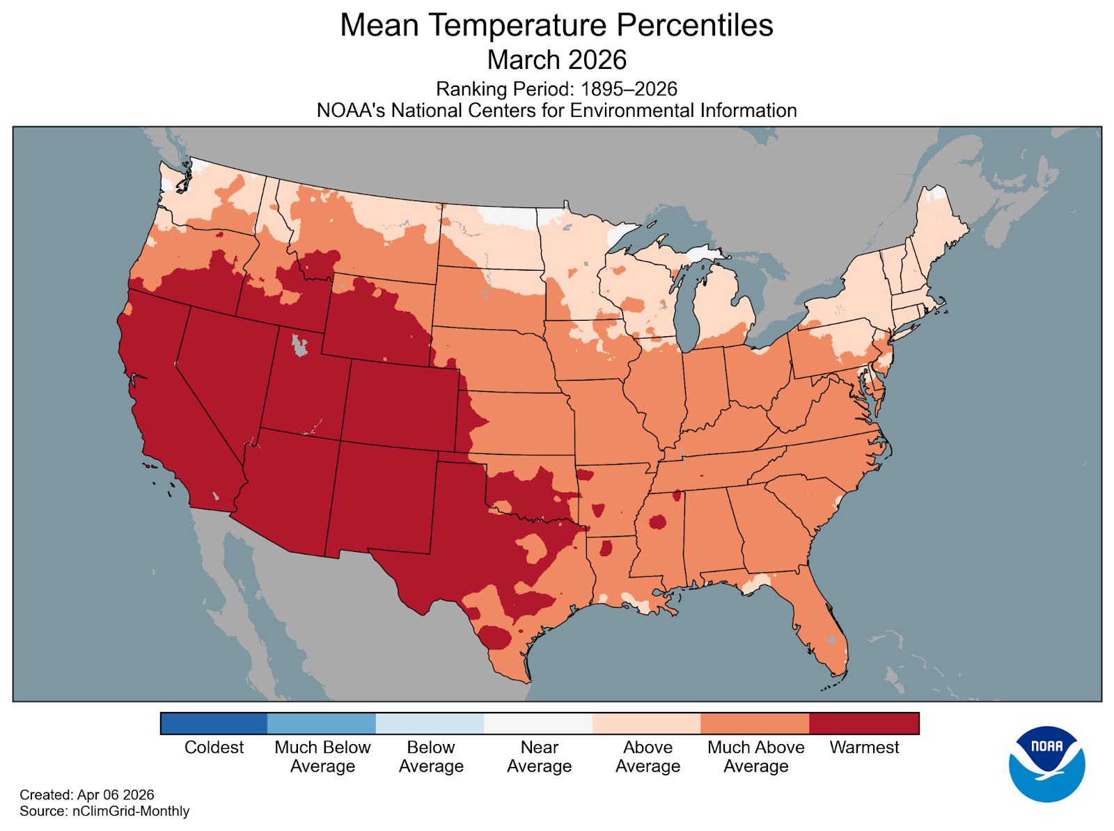
NOAA released its final national climate summary for March 2026 this morning, and its figures confirmed preliminary estimates that it was the warmest March on record for the contiguous United States. The average national temperature was 50.9F, which was 9.4F above normal. Daily maximum temperatures were particularly warm in March, averaging 11.4F above normal – and incredibly averaged 0.9F above April’s normal mean maximum temperature.
The warmth was particularly anomalous in about the southwest third of the country. Ten states in this region – Arizona, California, Colorado, Idaho, Nevada, New Mexico, Oklahoma, Texas, Utah and Wyoming – not only observed their warmest March on record, but also had an average March temperature that exceeded their average April temperature. California incredibly had an average March temperature that was 0.7F warmer than its normal average May temperature.
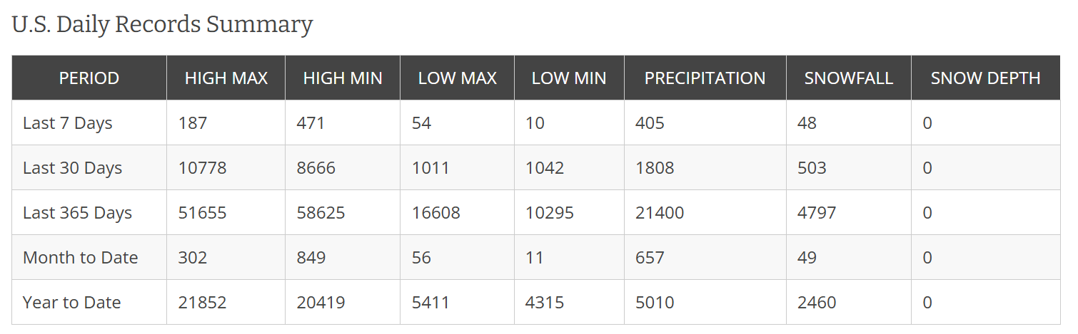
March 2026 was the climax of a 12 month period which NOAA reports was the warmest 12 month period ever observed in the United States. The daily records table from the NOAA National Centers for Environmental Information (NCEI) shows that the country has had more than 110,000 daily warm records (highs and lows) over the last year, compared to only about 29,000 record cold temperatures.

March 2026 was also dry across the CONUS, ranking 8th driest on record. With January and February also very dry nationally, NOAA reported that 2026 had the driest three month start of any year on record.
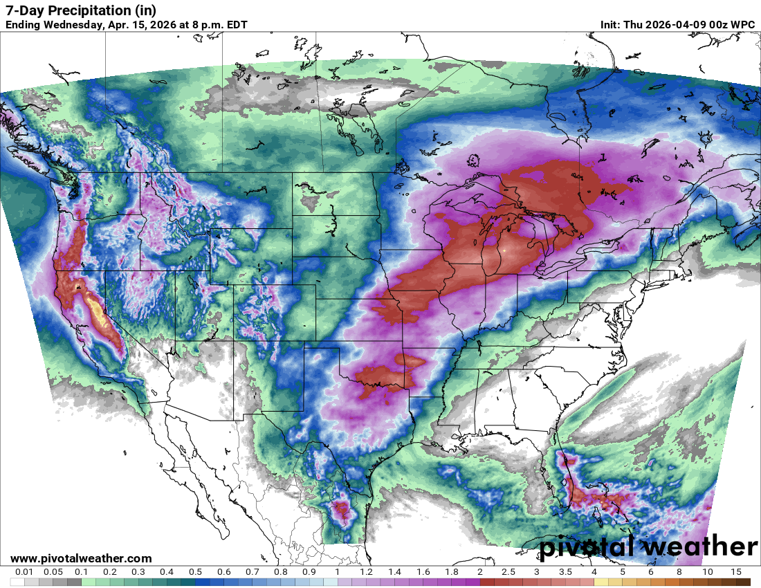
While the weather is currently relatively quiet across most of the country — other than some downpour producing showers and storms in Florida — conditions will gradually become increasingly active through the end of this week into early next week. Beneficial rainfall is expected for much of the country, with some higher elevation snowfall in the West, particularly in high elevations of the Sierra Nevada.

The risk for severe weather will also be ramping up over the next several days, with early next week looking to be relatively active from the Southern Plains into the Upper Midwest.

Leave a comment