Dangerous wildfire conditions expected over parts of the Southwest through the weekend
Jun 25, 2026
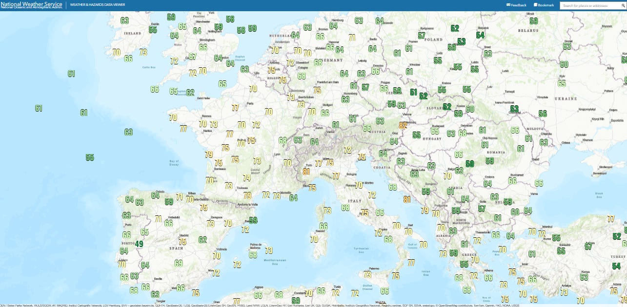
Starting off today’s newsletter with the incredible heatwave ongoing in Europe, and focusing on aspects I have not talked much about to this point, the humidity and the overnight low temperatures. The graphic above shows this morning’s low temperatures, and lows in the 70s were common over much of western Europe. Not only are these in many cases record warm minimums for the month (or even all-time), they are warmer than the daily normal high temperatures at many locations. Climatologist M. Herrera reported that the morning low at Brussels-Uccle of 24.2C (76F) was their warmest on record ever.
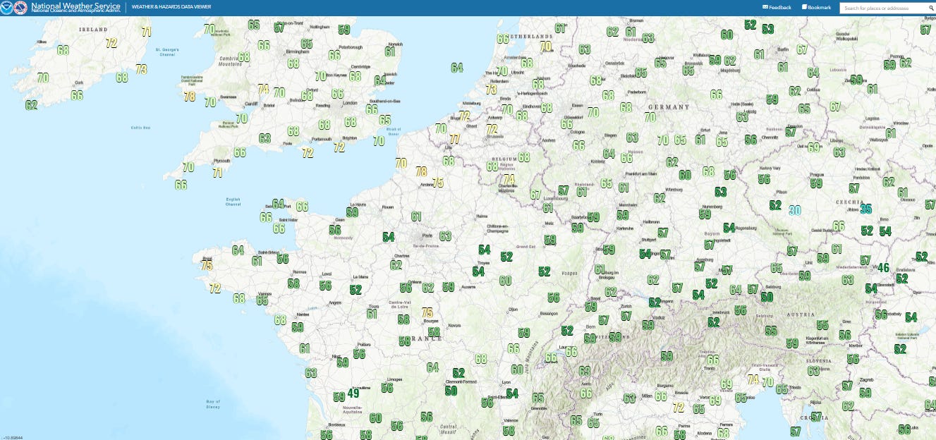
The latest dewpoint values shows that shallow near surface moisture over France has primarily mixed out with extreme daytime heating, but remains over Benelux, England and northern Germany with dewpoints in the upper 60s and 70s common. Of course, this unusual humidity only adds to the impacts with temperatures in the 90s — again, air conditioning is uncommon here and officials in Spain and France are reporting numerous heat related fatalities.
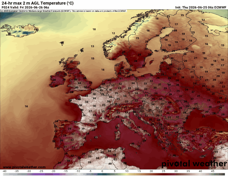
The heat will remain oppressive across western Europe for a couple of more days before some cooler air starts to work east off of the Atlantic. In the meantime, the record heat will expand and shift east to encompass central and eastern Europe, with maximum temperatures near 40C (104F) common into the first part of next week, which in some cases would shatter all-time record high temperatures.
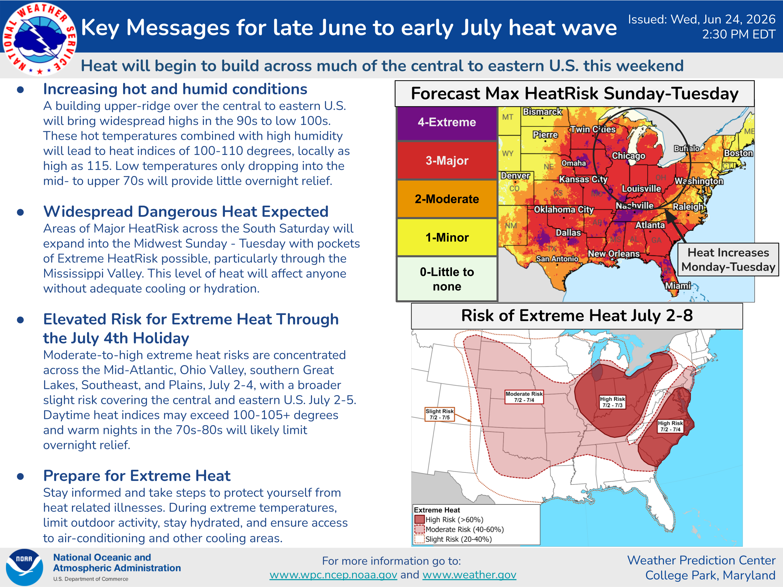
Heat will become an increasing issue in the U.S. as we head into next week and the start of July. A large, persistent dome of high pressure aloft is expected to build across the eastern half of the country, resulting in well above normal temperatures and humidity for most areas.
Record high temperatures will begin to be threatened by early next week, while record warm minimums will be numerous. This overall weather pattern is expected to continue through the Independence Day holiday. The combination of heat, humidity and limited overnight relief for many days will result in building major to excessive heat stress for much of the eastern and central portions of the country.
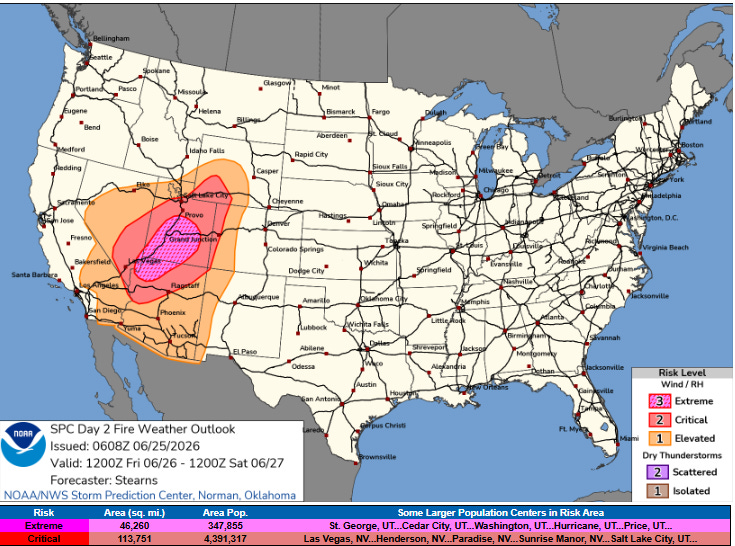
The heat dome over the eastern US will be developing downstream of an unusually strong upper level trough of low pressure that will be building across the West into this weekend. Unfortunately, this trough of low pressure will be bringing strong winds and dry conditions to a large part of the Great Basin and Southwest already suffering from extreme drought and numerous wildfires. This will mean a period of extremely dangerous wildfire conditions starting Friday, when the Storm Prediction Center has outlooked an area from northwest Arizona across a large part of Utah for extremely critical (level 3 of 3) fire danger.
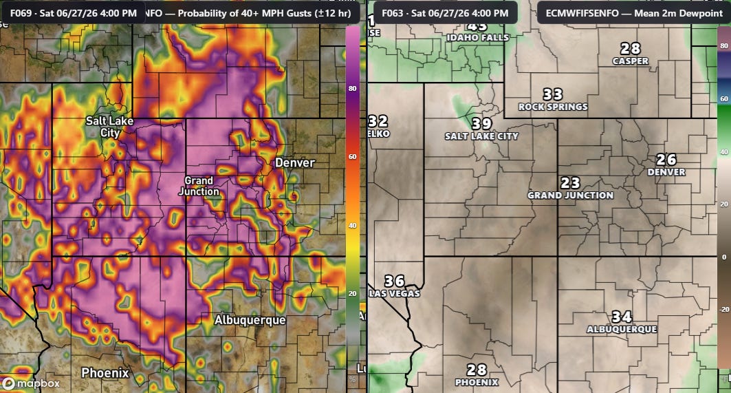
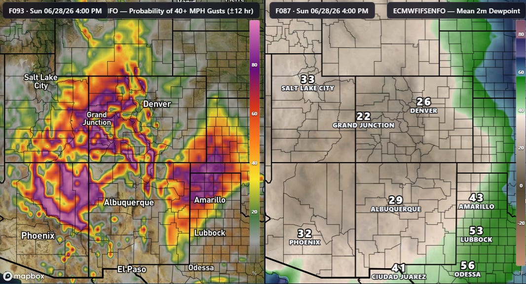
Strong winds and very dry air will expand east through the weekend, with a corresponding expansion of critical to extreme wildfire conditions, particularly where scattered thunderstorms over the last few days have not brought any wetting rainfall.
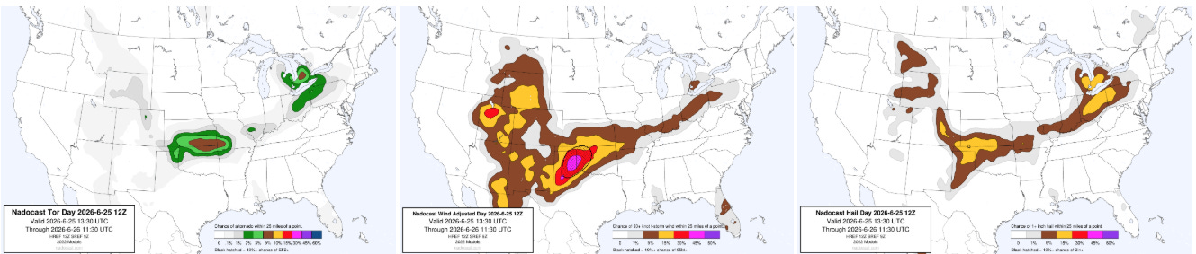
Of course, severe thunderstorms and flash flooding are going to be a threat over the next several days as well. Today the focus will be along a generally stalled out front running from the Southern Plains the eastern Great Lakes region. Any tornadic risk looks to be mainly in the eastern Great Lakes region and especially along the front in the vicinity of the Oklahoma/Kansas border.
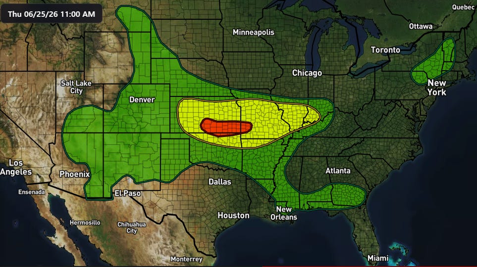
This area will also have the greatest risk of flash flooding through tonight as heavy rain producing storms could move repeatedly along the front. A moderate (level 3 of 4) risk is in place from the Weather Prediction Center.

As the upper level area of high pressure builds across the central and eastern United States over the next several days, the risk of severe weather will become focused around the edge of the heat dome in a “ring of fire” pattern as explained excellently by my colleague Matt Lanza in this post from his Substack. Saturday appears as if it could be a particularly active day across the Northern Plains region as a disturbance ejects across the region from the western US trough.
Programming Note: Given the ongoing active weather, I am utilizing the Substack Chat feature to share periodic real-time updates. I also do occasional live videos to provide briefings and updates about the evolution of severe weather and flash flooding risks. As a reminder, these are benefits that paid subscribers receive for their support of Balanced Weather. Any videos I do will also be recorded and shared to all subscribers. I also provide updates on my BlueSky and Facebook feeds, and via occasional Substack Notes.

Leave a comment