
Super Typhoon Champi continues moving west-northwest with risk to Japan increasing, while Atlantic shows some signs of late season life
11 minutes ago
It has been a couple of weeks since I have done a Monday deep dive on the tropics and El Nino, so let’s take the chance to do one today.
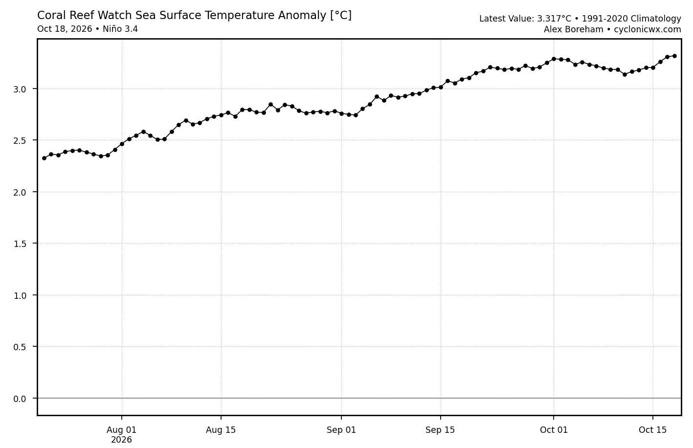
The sea surface temperature anomaly in the eastern equatorial Pacific has continued to gradually rise over the last few weeks, and now stands at just above 3.3C, with SST values at record levels for the time of year.
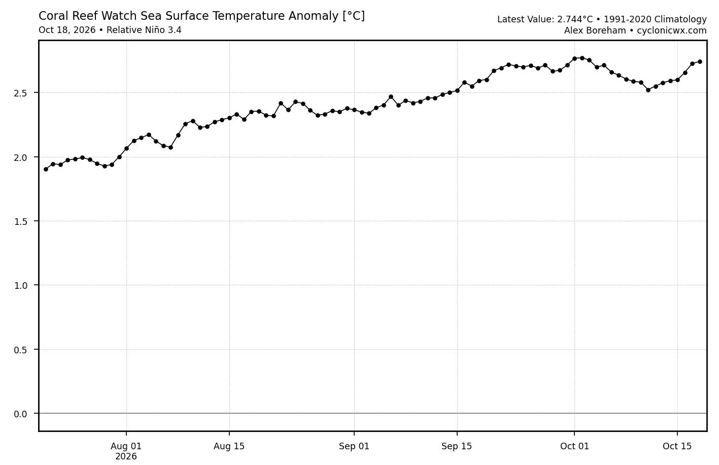
The Relative Oceanic Nino Index (RONI) which compares the anomaly in the equatorial Pacific to the remainder of the global tropics is also at record high levels. While El Nino events are historically analyzed based on longer term averages, it appears clear that this El Nino event is at unprecedented levels and does not show any signs of waning.
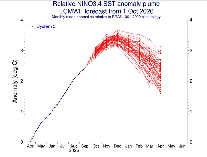
The most recent forecast from the European seasonal ensemble suggests that the RONI will continue to rise into the early winter before finally reaching a peak and gradually starting a decline.
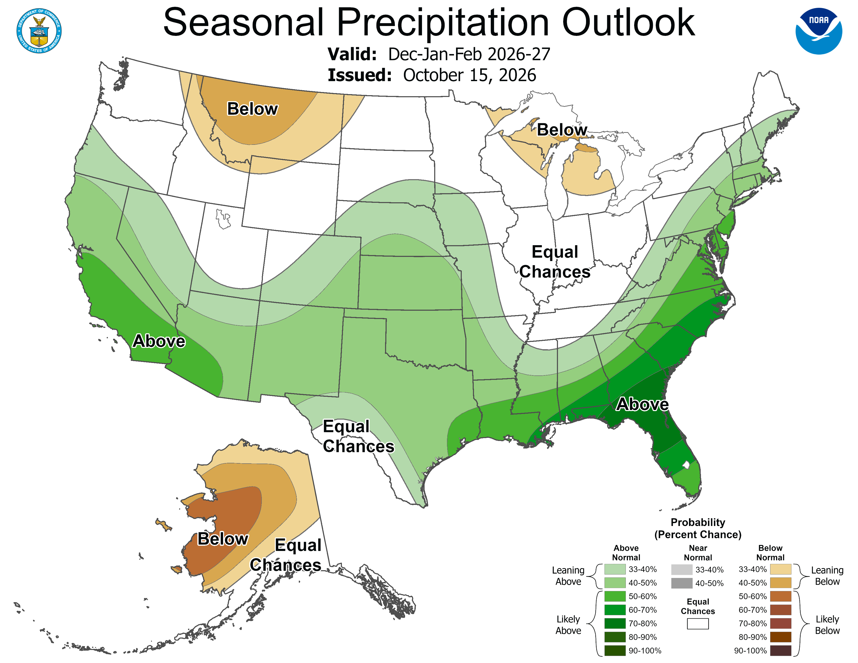
Last week the NWS released their seasonal outlook for the 2026-7 winter, and given the extremely strong ongoing El Nino the forecast is unsurprisingly very much aligned with a canonical El Nino winter. During an El Nino winter, the subtropical jet stream across the southern United States tends to be enhanced and dominates the weather pattern across the country, bringing wet and stormy conditions to the southern tier of states. El Nino tends to yield increased risk for severe weather and tornadoes along the Gulf Coast and in Florida, as well as storminess and potential flooding in southern California and the Southwest.
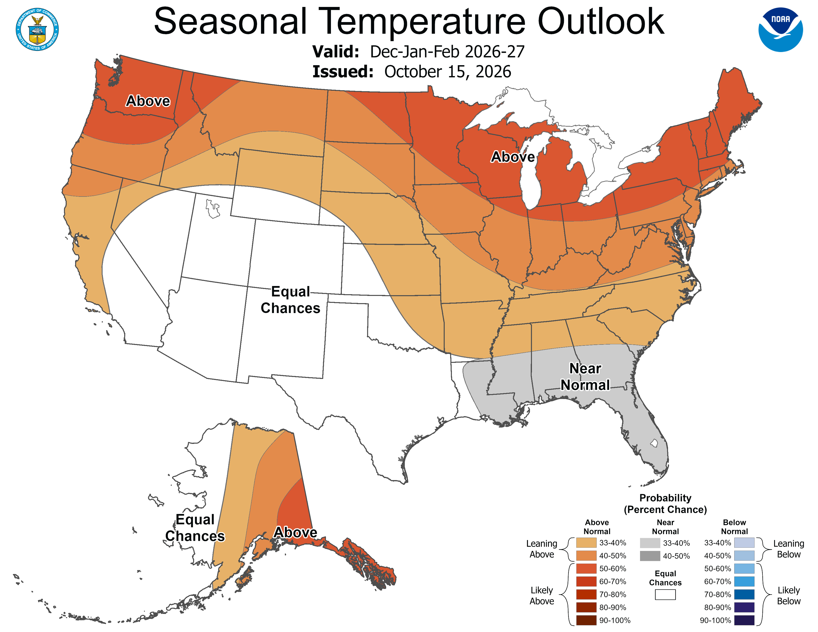
Much of the country sees warmer than normal conditions as a whole in an El Nino winter, although this of course does not mean there will not be occasional cold blasts. As one heads farther south, the storminess and associated clouds and precipitation tends to lead to cooler average temperatures.
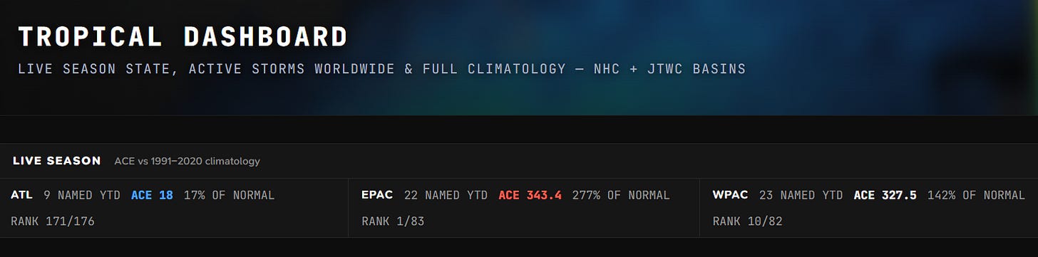
Turning to the tropics, so far this year has been about as classic of a season as one would expect with such an intense El Nino event. The Atlantic has only seen 17% of its normal Accumulated Cyclone Energy (ACE) to date; Isaias was the latest first hurricane on record during the satellite era, and the season has overall been one of the most inactive on record.
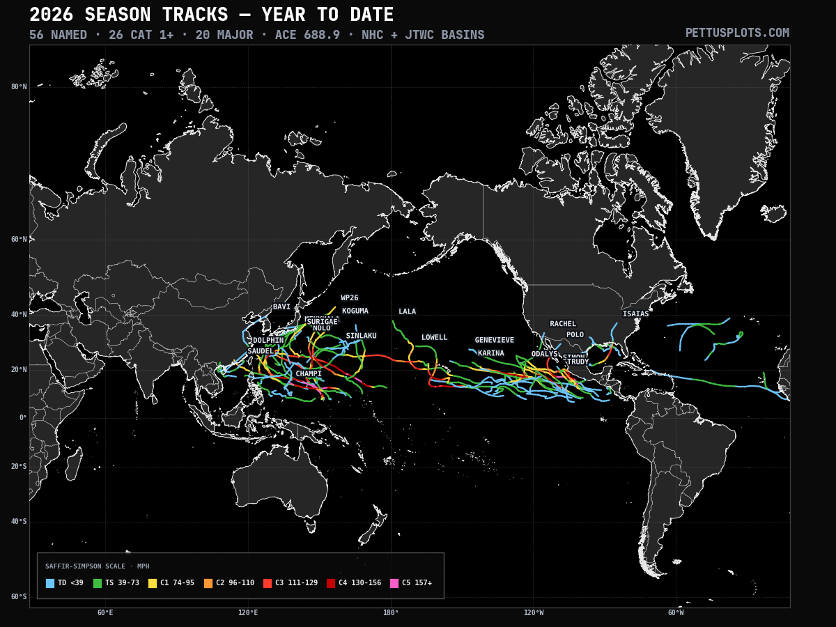
While El Nino suppresses activity in the Atlantic tropics, it does the opposite in the Pacific and indeed this year has been the most active season on record in the Pacific east of the International Date Line. There have been three category 5 hurricanes in the same season for only the fourth time on record — Hawai’i has seen impacts from three different tropical systems, including direct impacts from hurricanes Lowell and Lala. Meanwhile, the western Pacific has seen a well above normal typhoon season as well, with ACE totalling nearly 150% of normal so far.
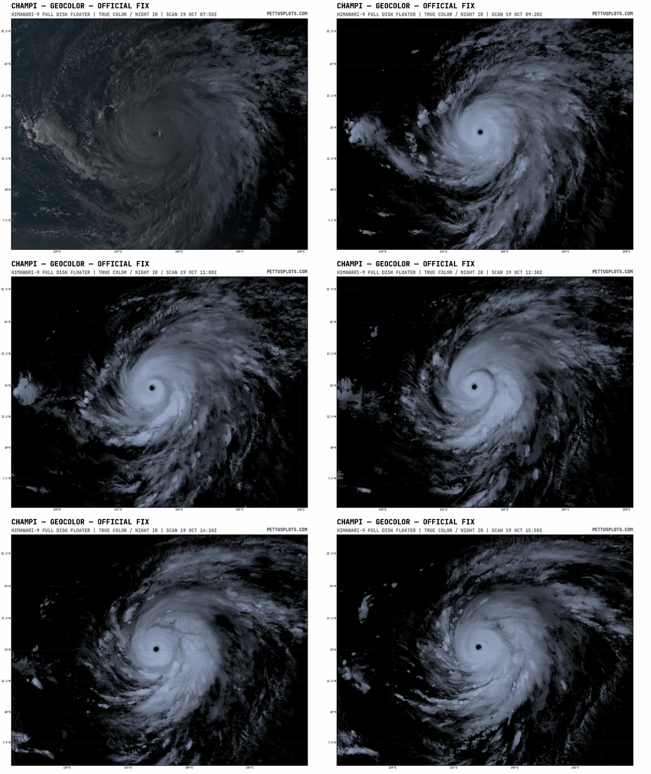
The Pacific does not show any signs of slowing down soon, with impressive category 5 Super Typhoon Champi currently moving west-northwest in the general direction of Taiwan.
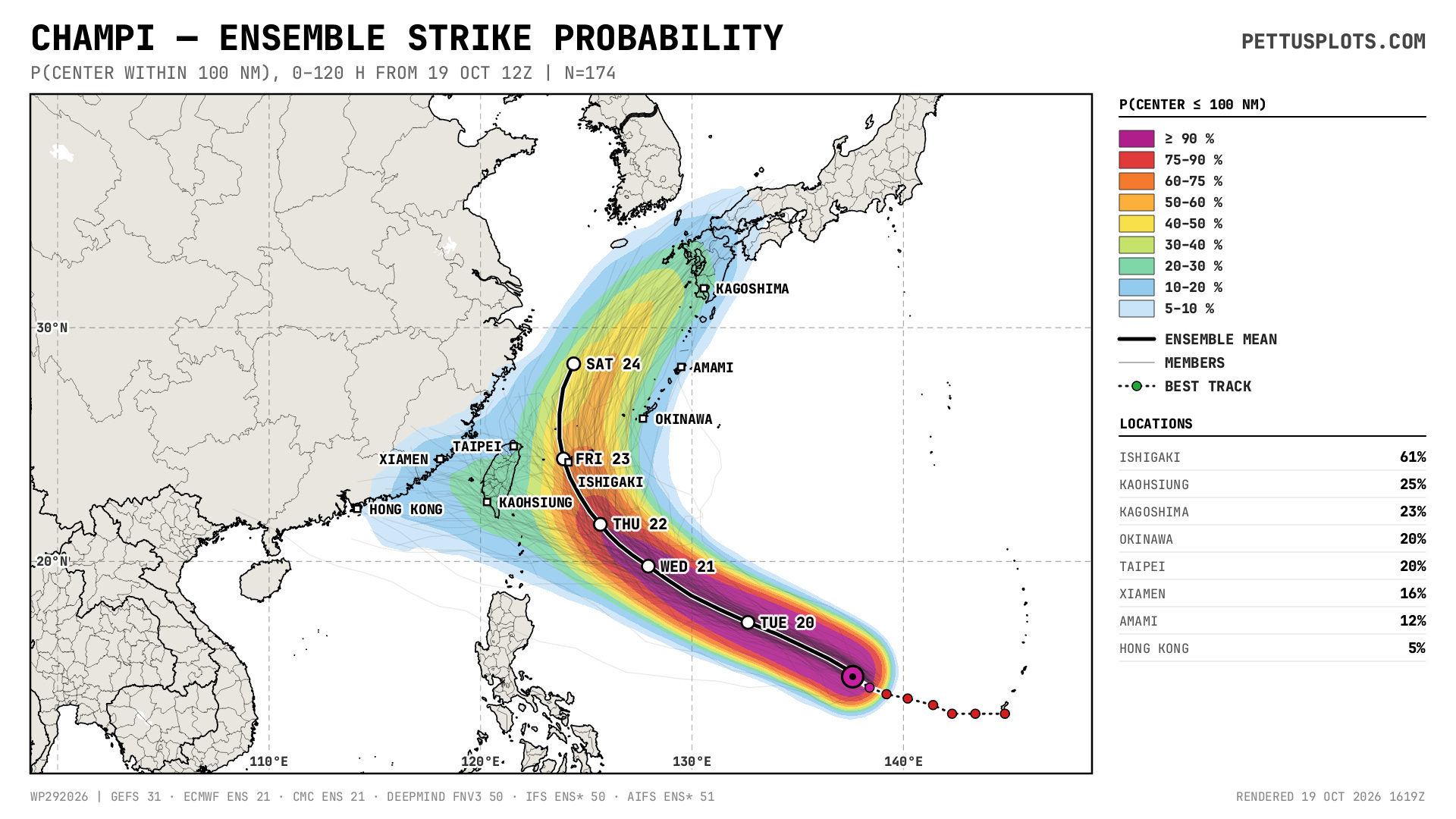
While there continues to be some uncertainty in the longer term track of Champi with a small percentage of model solutions showing a continued west-northwest track toward Taiwan and China, most of the ensembles including the Google DeepMind are now suggesting that Champi will recurve and eventually cause impacts to Japan by early next week. Recurving typhoons at this time of year also tend to cause significant upper level pattern changes downstream across North America, so this is something we will be watching the models for as we head toward the end of October.
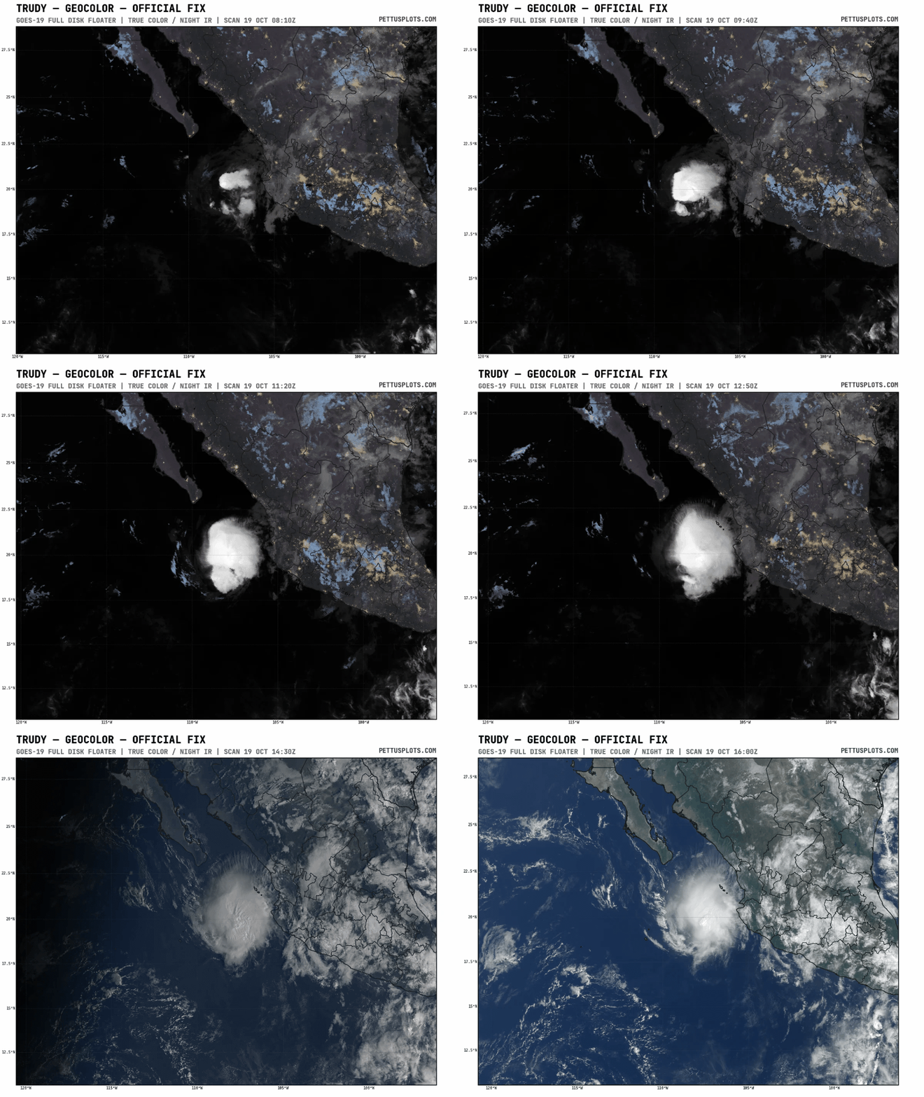
Trudy has weakened to a tropical storm off the west coast of Mexico and is expected to continue weakening.
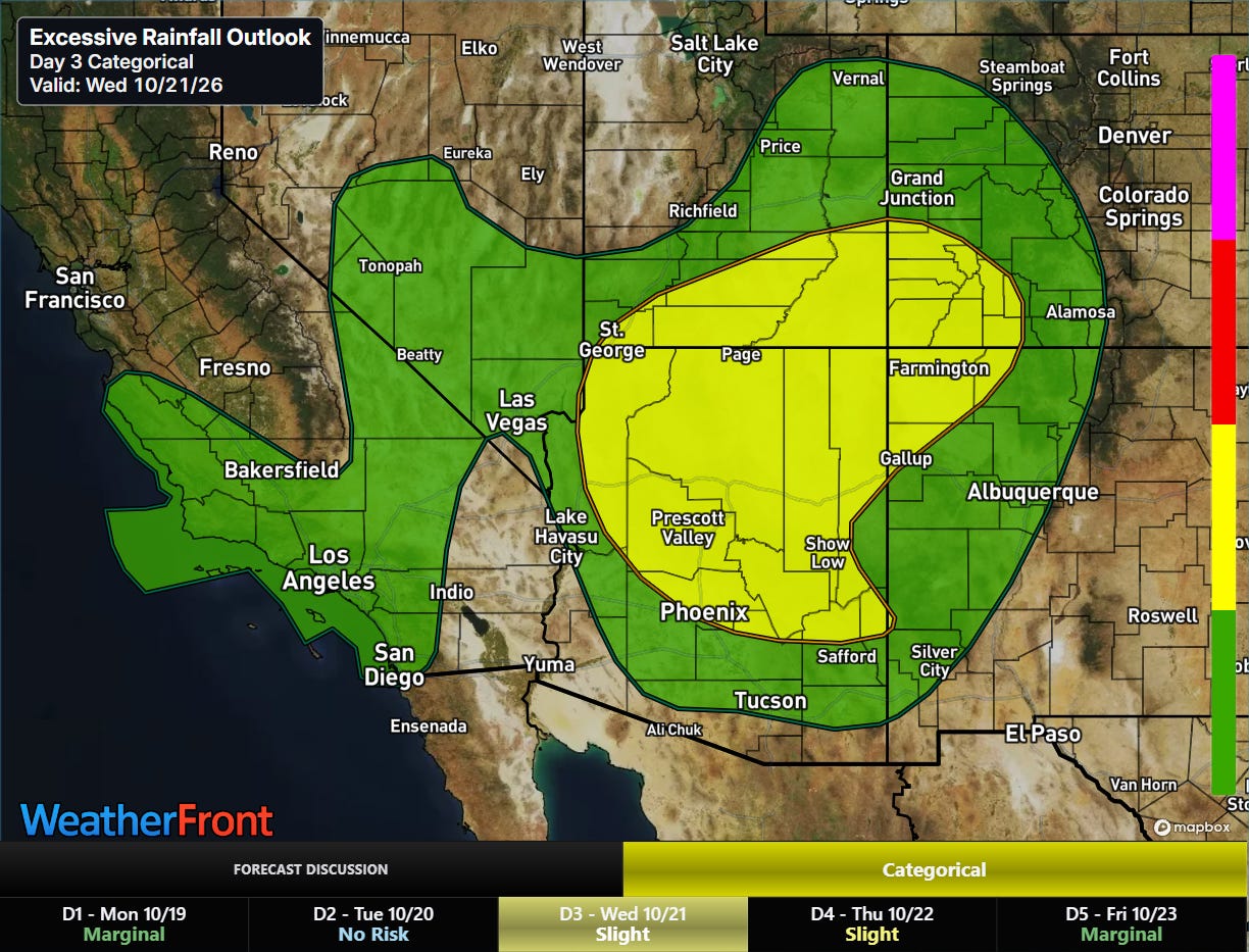
As the next upper level trough of low pressure digs into the Southwest, it will pull the tropical moisture from Trudy northeast and bring another risk of heavy rainfall and flash flooding the region by Wednesday.
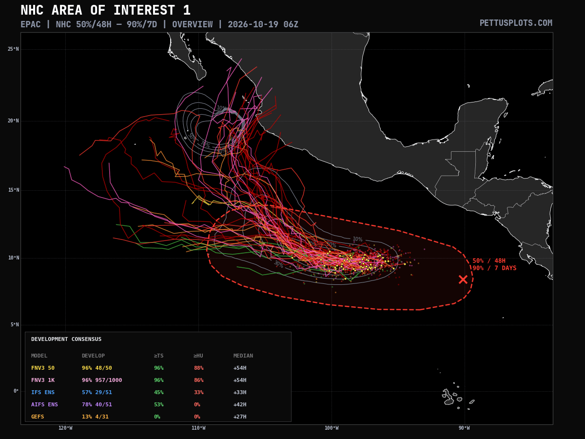
The next eastern Pacific system is evolving southeast of Trudy, and models suggest that this system is likely to become another significant hurricane late this week. While there remains uncertainty about the long term track, some ensemble solutions suggest it could eventually pose a threat to coastal Mexico.
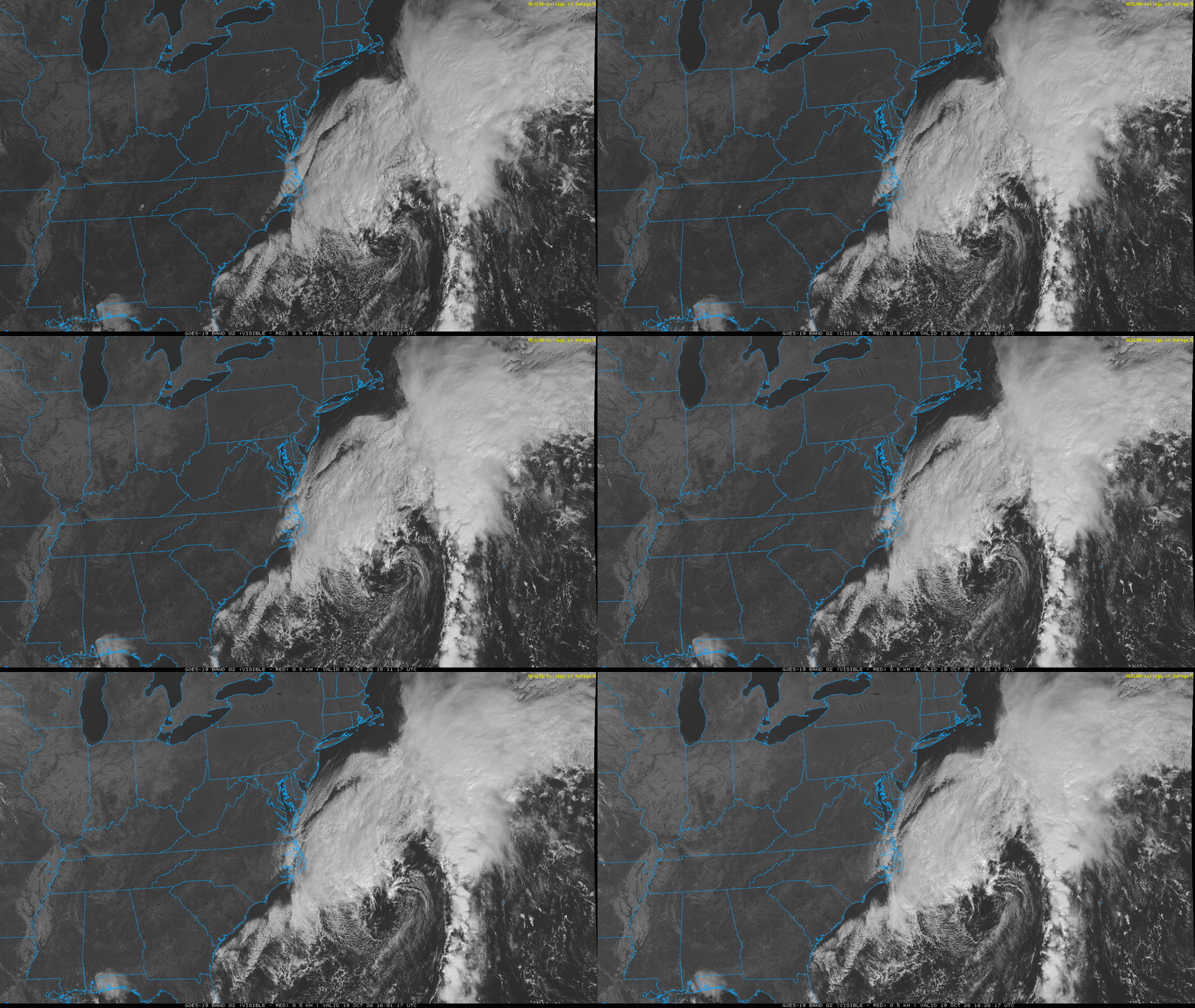
In the Atlantic, NHC continues to monitor the developing low pressure center off the Mid-Atlantic coast. Visible satellite imagery this morning clearly shows the low taking shape to the east-southeast of Cape Hatteras; however, all of the precipitation and thunderstorm activity is well separated from the center of the low, indicative of a non-tropical system.
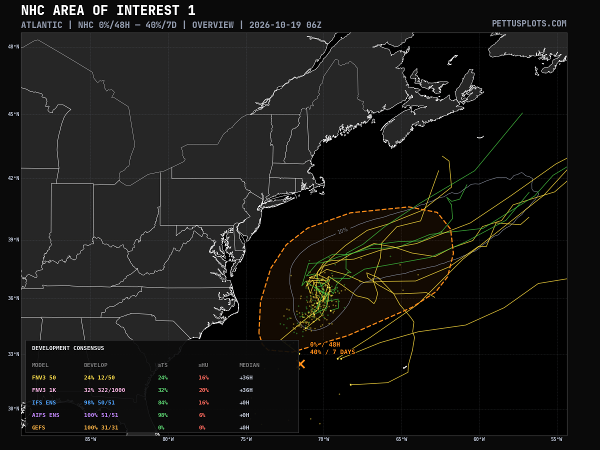
As the low meanders over warmer waters near and just east of the Gulfstream, it may eventually obtain some tropical characteristics. Model trends on this potential are mixed and currently NHC estimates the probability of it becoming a named system at 40%.
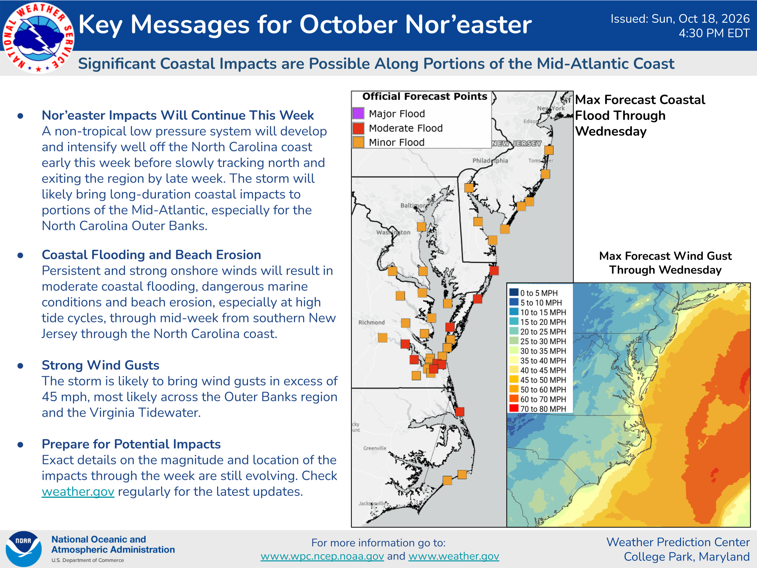
Regardless, it now appears as though the track of the system will be far enough offshore that the impacts from the system will be limited to coastal flooding, beach erosion and some gusty winds.
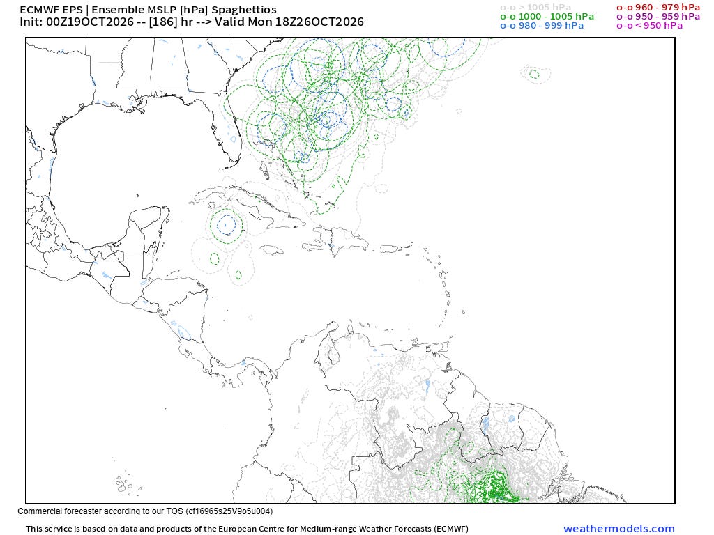
The longer range models also suggest the development of an upper level trough of low pressure in the vicinity of Florida and the Bahamas by next weekend, a weather pattern which can often support the development of a late season tropical system in that region. Indeed, the ensembles show some signs of this, with a number of the physics-based European ensemble (above) having a low pressure center developing somewhere in the area from the northwest Caribbean into the southwest Atlantic. Google DeepMind is less bullish, but about 10% of the members of its most updated model version show a system. This will be something to keep an eye on as we head toward the weekend and next week.
Thanks to all of the providers of graphics for today’s post, including PettusPlots.com, cyclonicwx.com, WeatherFront, College of DuPage, weathermodels.com, and of course NOAA and the European Centre for Medium-range Weather Forecasts (ECMWF).


Leave a Reply