March 26
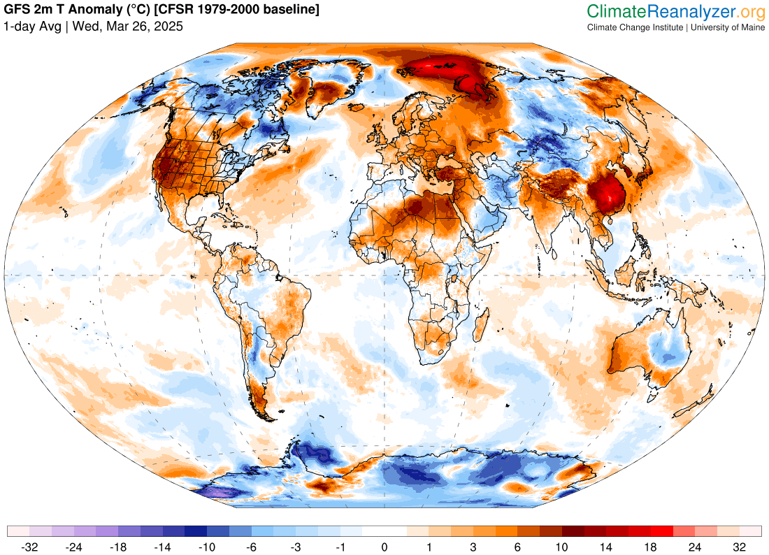
Let’s start off this morning talking about record warm temperatures. As can be seen above, much of the western United States is experiencing unusual warmth, and a number of record high temperatures were set yesterday. Phoenix fell just 1 degree short of reaching 100F for the first time this year and tying a monthly high temperature record; still, 99F set a daily record by 3 degrees. Other record highs yesterday included Palm Springs (100F, previous was 97F), Seattle (NWS site 75F previous was 66F), Portland, OR (80F, previous was 74F), Napa (88F, previous was 85F), San Jose (84F, tied). The temperatures in the Pacific Northwest were particularly unusual, as daily records were broken by several degrees in a number of locations.
The surface temperature anomaly map shows that the U.S. is obviously not the only part of the planet experiencing extreme warmth. An even darker red stain can be seen in eastern Asia. New national monthly records for warmth were set in China, Korea, and Japan, including China reaching 42C (108F). Hundreds of daily records for warmth (record high maximums and minimums) were set. The extreme warmth is fueling unprecedented wildfires in South Korea as the acting president said yesterday the “crisis is rewriting the record books for the worst wildfires in our nation’s history.” Sadly, at least 24 people have died, you can read more about this tragic disaster in this BBC article.
Severe weather and flash flood risks
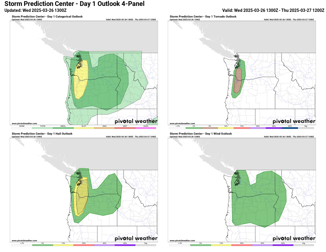
The unusual warmth in the Pacific Northwest is going to fuel a highly unusual risk of severe thunderstorms in the region today. An upper level trough approaching the coast will provide forcing and wind shear for severe thunderstorm development in western Washington and Oregon later this afternoon and evening. Given unusual levels of moisture and instability as well, several intense supercells capable of very large hail and tornadoes are possible. SPC has a slight (level 2 of 5) risk outlooked, including an explicit risk of greater than 2” diameter hail and a level 2 risk of tornadoes. You can read more about the rare meteorological setup in a special Balanced Weather post from yesterday afternoon. As I noted, there has only one report of 2” or larger hail in the last 75 years in western Washington and Oregon, so this is indeed a very rare meteorological setup.

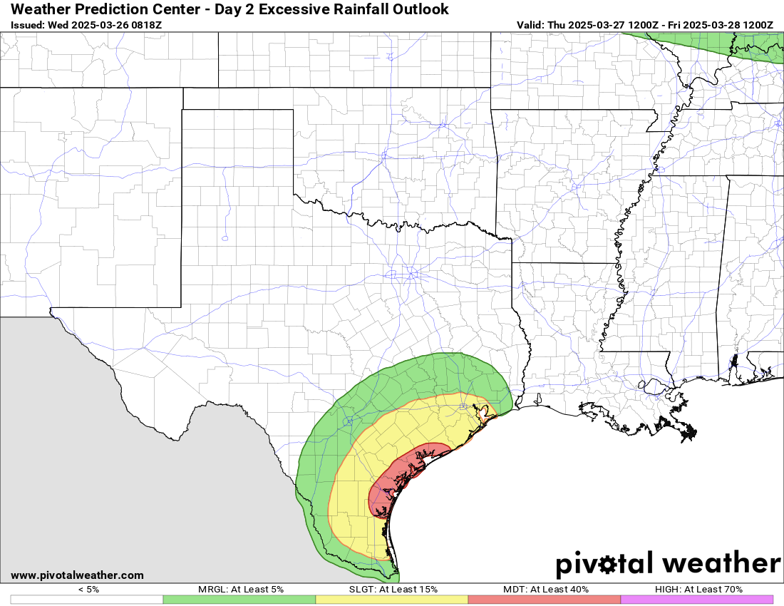
A separate disturbance in the southern branch of the jet stream will be moving across Texas the next couple of days, producing showers and thunderstorms across the state. The heaviest rain will be in deep South Texas, where a swath of 4 to 8” of rainfall is anticipated over the next 48 hours, and the Weather Prediction Center has placed a moderate risk of flash flooding today and Thursday as seen above.
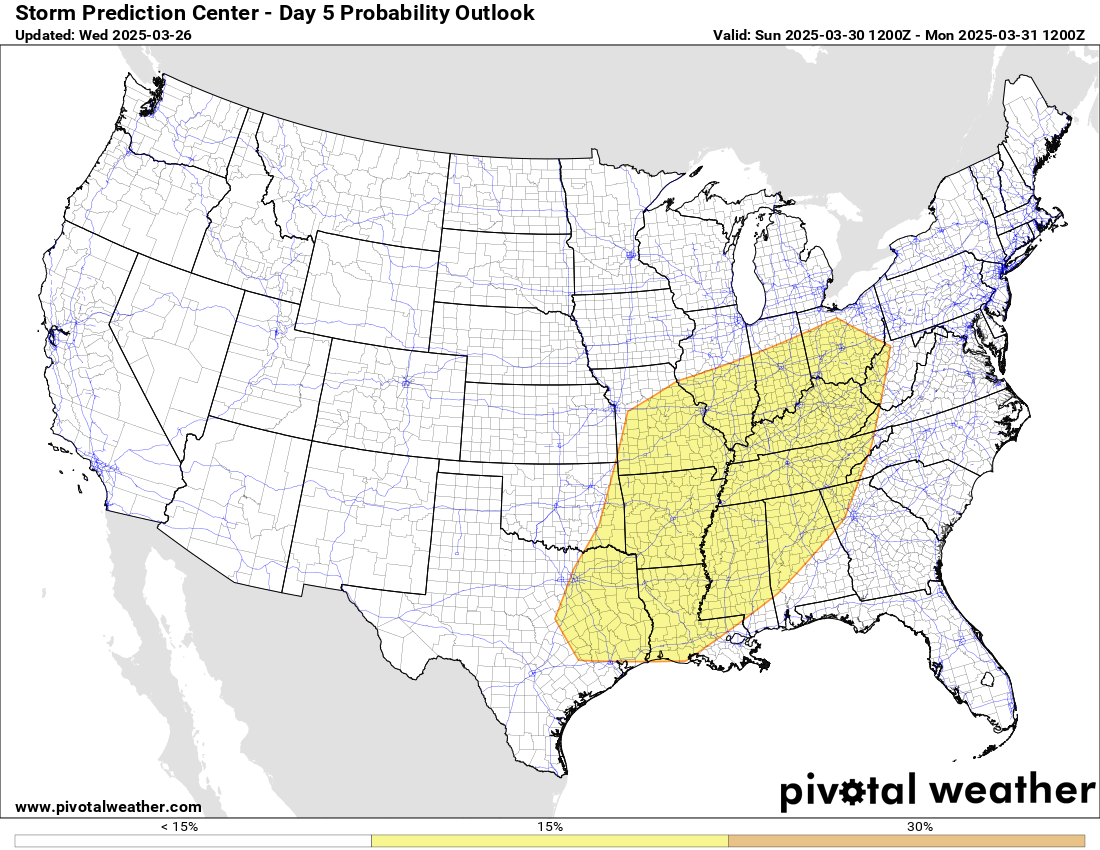
The weather system producing the severe weather in the Pacific Northwest today will shift the warmer weather east over the next couple of days, and when it reaches the Midwest this weekend will fuel another severe weather risk this weekend. Sunday looks like the primary day for severe weather with this system, and SPC has outlooked a large area from the Ohio Valley to the central Gulf Coast for the risk of severe storms. Not much has changed since yesterday; it still looks like this will be an event with a rather large area of favorability for severe weather and possible tornadoes, but we will need to get closer to the event to narrow down any areas with greater risks for higher end severe storms. The system will produce some risk for severe weather in the eastern U.S. on Monday, but as of now it appears the system will weaken even further by then.

The weather models for next week suggest that an active regime will continue, with the overall pattern consisting of a large trough of low pressure aloft in the western half of the country and a ridge of high pressure aloft along the east coast. This sort of weather pattern in early April suggests a very active pattern for severe thunderstorms across the middle part of the country, so we will be watching this closely over the next several days.

Leave a reply to Ken Howard Cancel reply