In US, serious overnight flash flooding in Wichita; extremely critical fire danger in Southwest
Jun 26, 2026
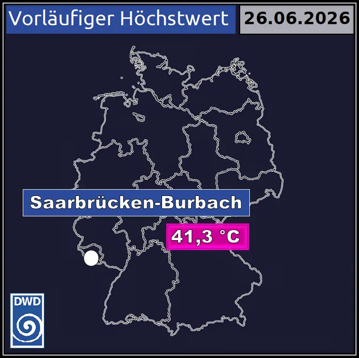
Starting off with breaking news from the German meteorological service (DWD) that a new all-time heat record has preliminarily been set for the nation today with a maximum of 41.3C (106F) at Saarbrucken-Burbach. It was pointed out on BlueSky by Michael Anderson that this reading broke the monthly record for the site by an astounding 4C.
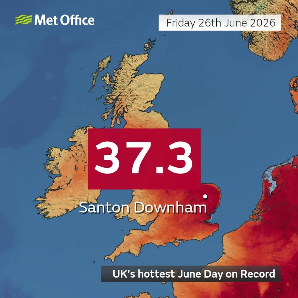
The UK set a new all-time June record for the third consecutive day with 37.3C (99F) at Santon Downham.

In France, Paris-Lariboisiere reported a morning low of 29.9C (86F), which climatologist M. Herrera reports is likely a global record for a low temperature for the northernmost minimum temperature of 30C ever observed.
All-time record heat has also spread into the Arctic region, with some areas seeing maximum temperatures as high as 35C (95F). As noted by M. Herrera, White Island at 73N latitude reached 28.3C (83F), shattering their prior all-time record high of 19.1C (66F).
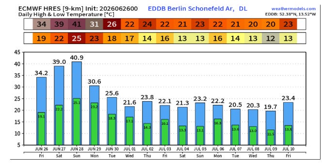
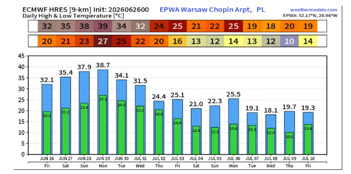
While cooler air will finally start to infiltrate western Europe over the weekend, the heat will be peaking over central and eastern Europe, with locations like Berlin and Warsaw likely to set all-time record high temperatures.
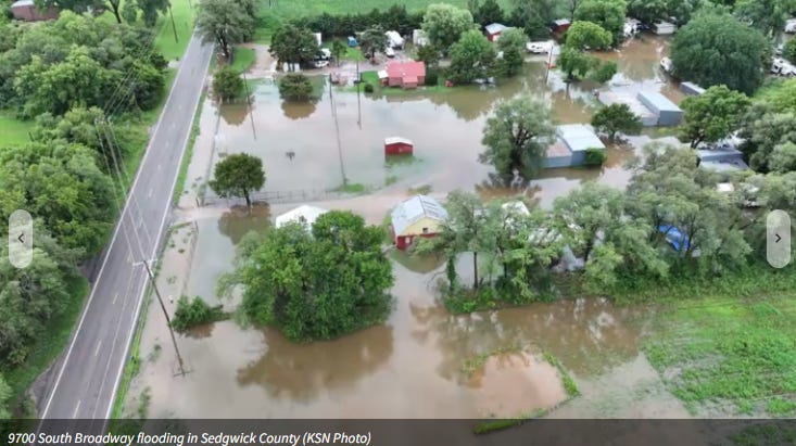
In yesterday’s newsletter, I highlighted the Weather Prediction Center’s moderate risk of flash flooding along the Kansas/Oklahoma border, and overnight thunderstorms produced significant flash flooding in the Wichita metro area.
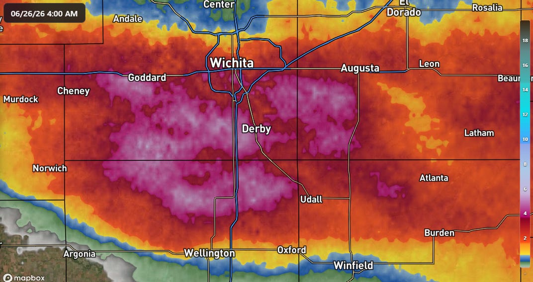
A large area of 4-7” of rain in a bit less than 6 hours fell, resulting in numerous road closures and more than 100 calls to Sedgwick County 911 for flooded vehicles and/or water rescues.
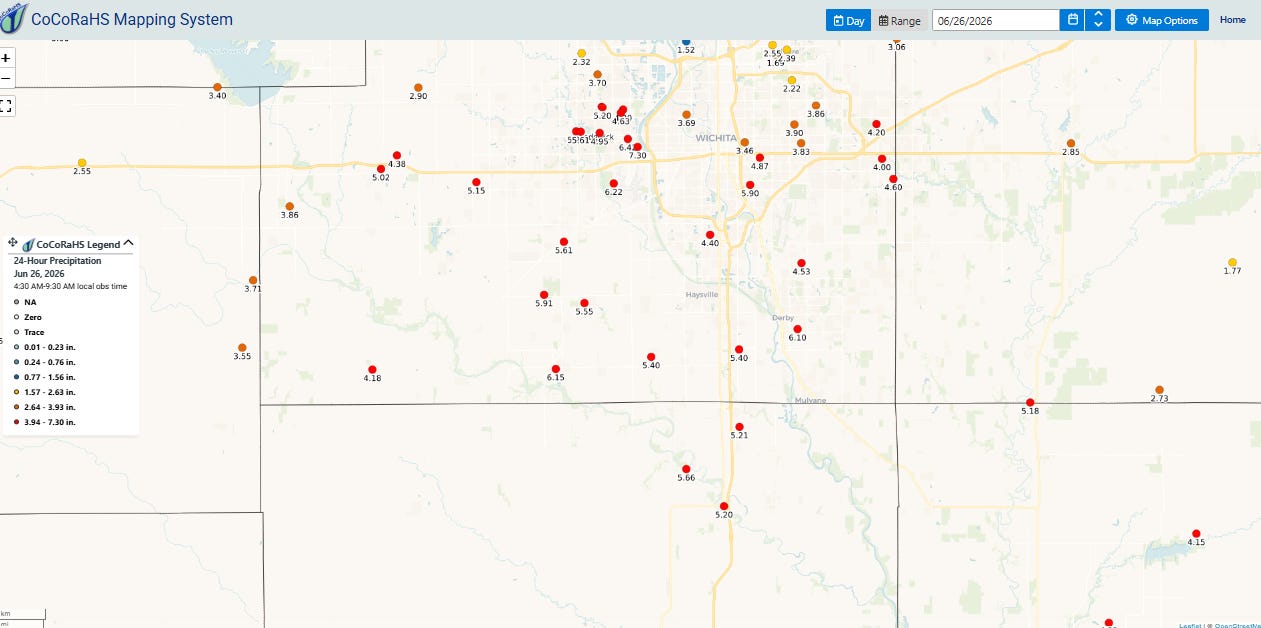
CoCoRaHS reports confirmed the radar estimates, with numerous reports of over 4” from the region and max of 7.30” on the west side of Wichita. Wichita Eisenhower National Airport reported an impressive 2.67” of rain in an hour ending at 11 pm CT, with a total of 5.95” by 4 am CT.
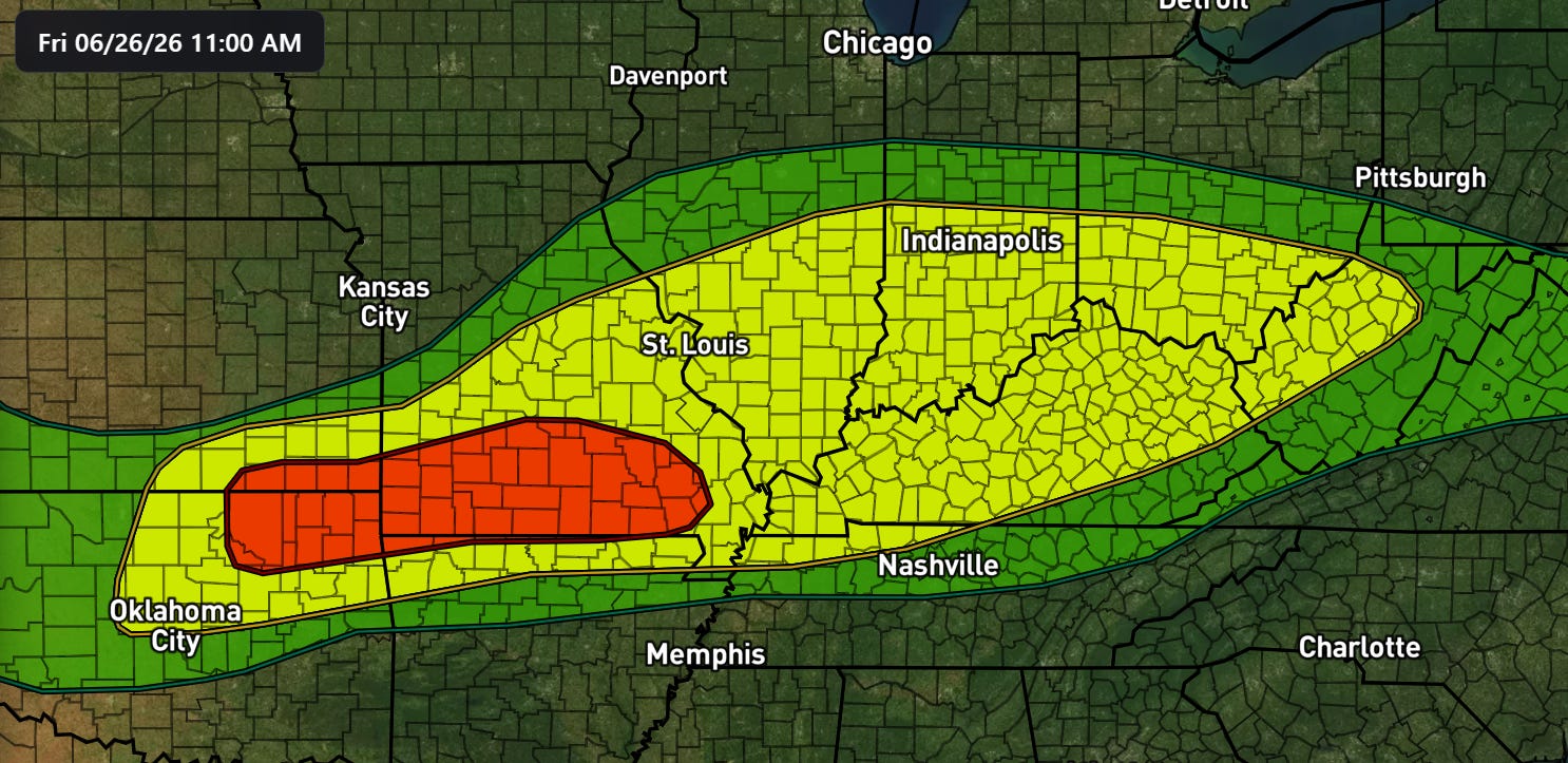
The threat for significant flash flooding will be a bit farther east today, with a moderate (level 3 of 4, red on map above) from southeast Kansas and northeast Oklahoma across the Missouri Ozarks. A large slight (level 2 of 4, yellow on map) risk of flash flooding surrounds the moderate risk, covering the Ohio and Mid-Mississippi Valleys. Flash flood watches are in effect for much of this region.
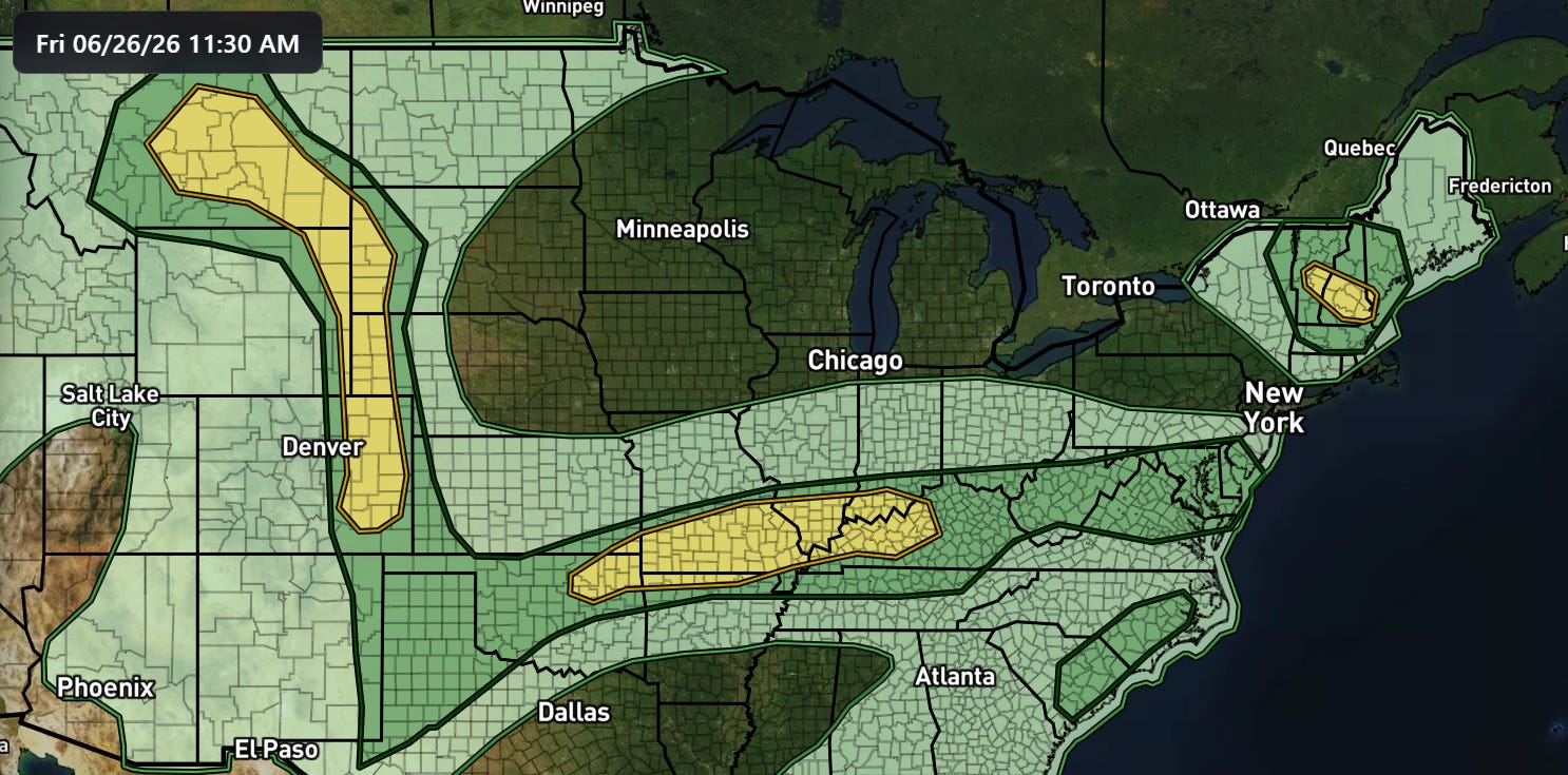
Severe thunderstorms will also be a concern in this area, with a slight risk (level 2 of 5) in place for potential scattered severe storms that could produce damaging winds and a few tornadoes. A similar risk exists over parts of New England today, while the Front Range will see the potential for the most intense storms to produce very large hail.
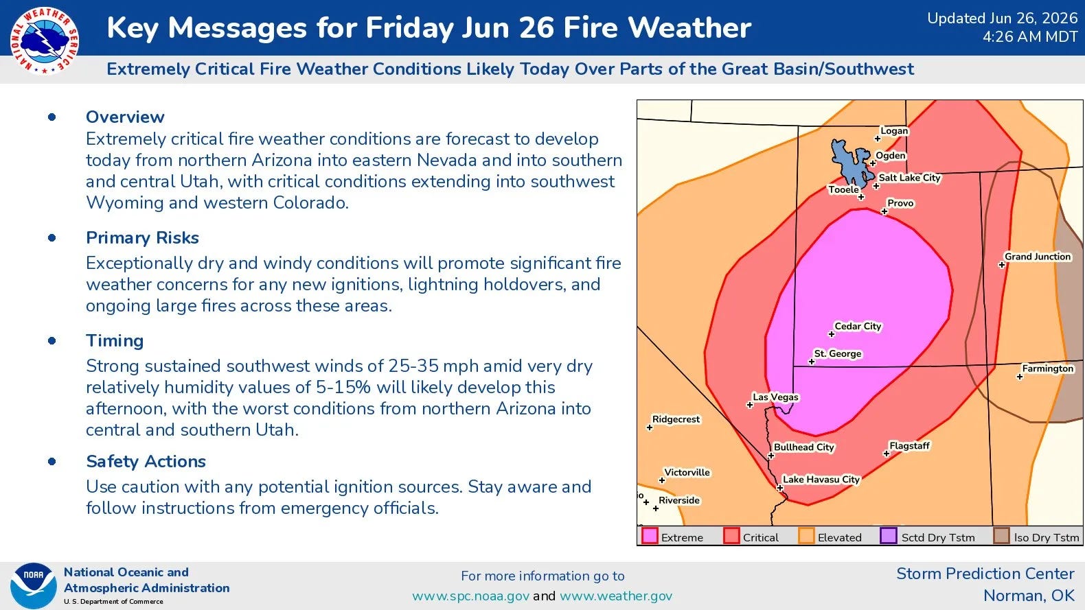
The other major weather story today continues to be anticipated extremely critical fire weather conditions across much of Utah and adjoining parts of southeast Nevada and northwest Arizona. High-based dry thunderstorm activity is also expected today over parts of the Rockies. All of this will be the start of a multi-day period of volatile fire weather conditions across large parts of the southwestern United States.
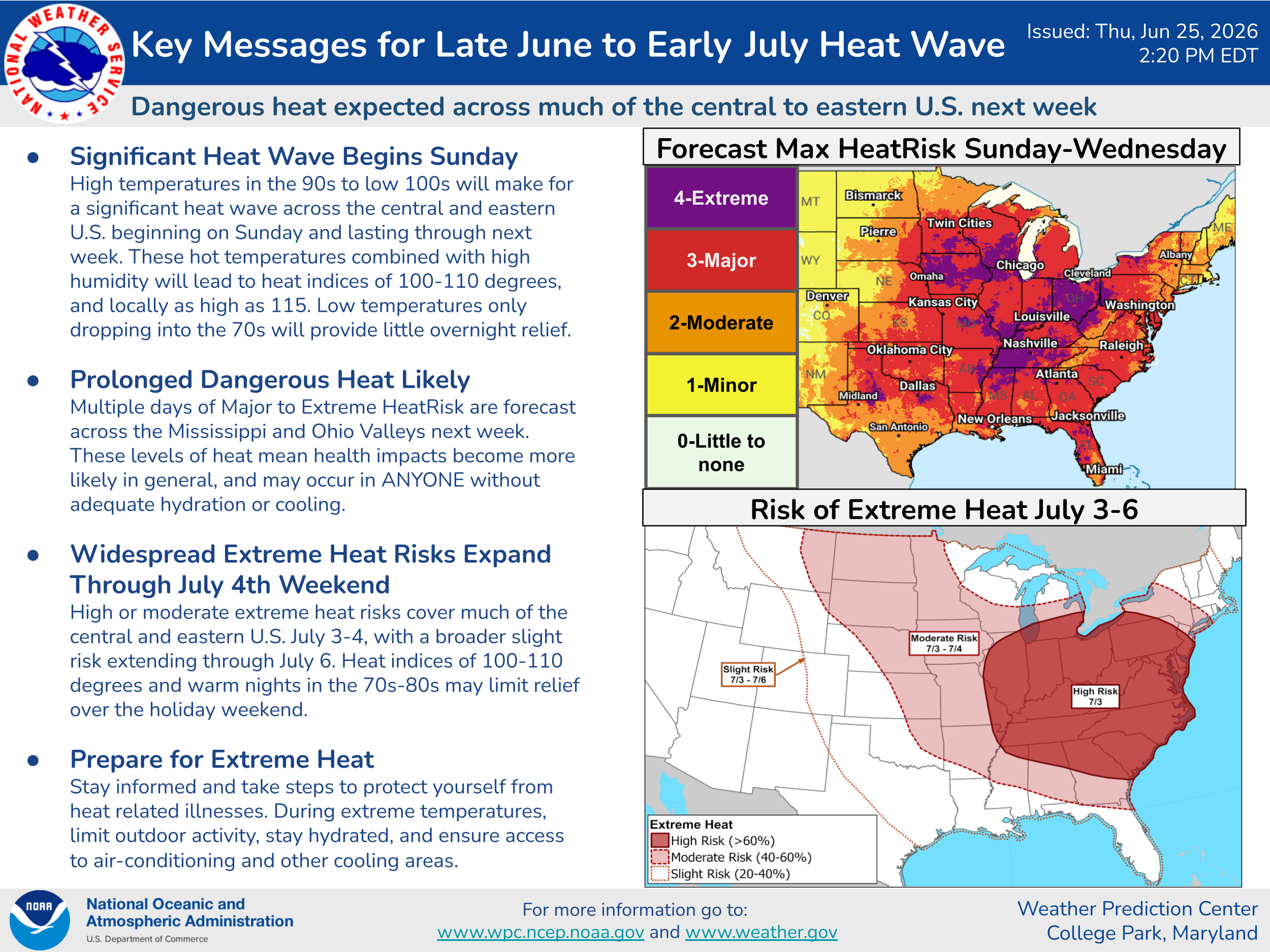
Attention continues to focus as well on our own anticipated major heat wave in the US for next week that I discussed yesterday. More to come on that of course in the coming days.

Leave a comment