
Salt Lake City and Billings lead the way – record heat will expand east over the next few days
Jul 12, 2026
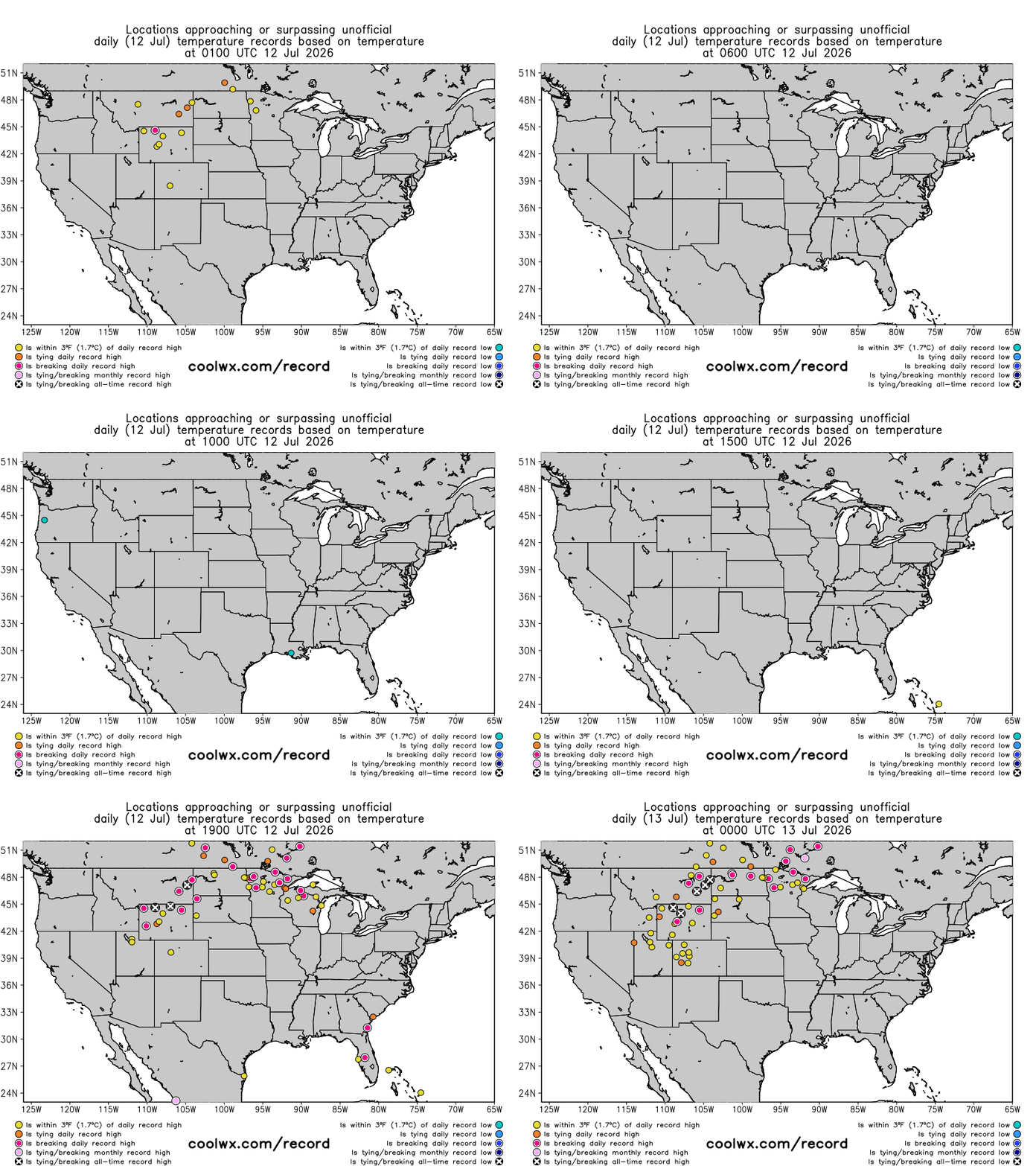
It seems like we are saying this rather frequently lately — but today was another historic day for heat in several parts of the globe. This included parts of the US, as areas from the Intermountain West into the north central United States saw more than a dozen locations record all-time record high temperatures.
Thanks to climatologist M. Herrera for their compilation of the all-time records today on the Extreme Temperatures Around the World Bluesky account. The 109F at Salt Lake City broke the prior all-time record by 2F (records back to 1874). With a high of 111F, Billings broke their all-time record by 3F (records back to 1934) while Miles City, MT set a new all-time record by 4F (records back to 1937).
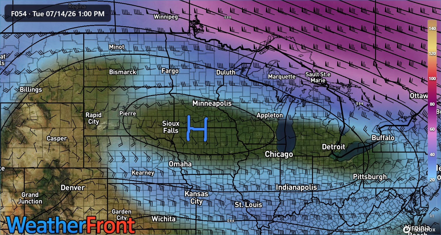
The heat will expand and shift east into the Upper Midwest and eventually the Northeast this week as the upper level high pressure builds. By Tuesday afternoon, the high will be centered along the Minnesota/Iowa border with a relatively large area of 500 millibar heights at or above 6000 m — indicative of an extremely intense “heat dome.”
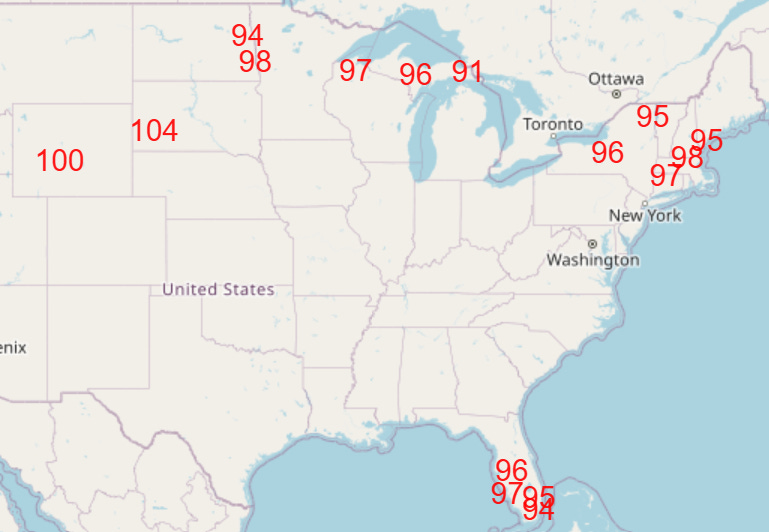
A number of record highs will be set from the Intermountain West to the Northeast Tuesday (locations where NWS forecasting record highs shown above) into Wednesday — as well as over Florida.
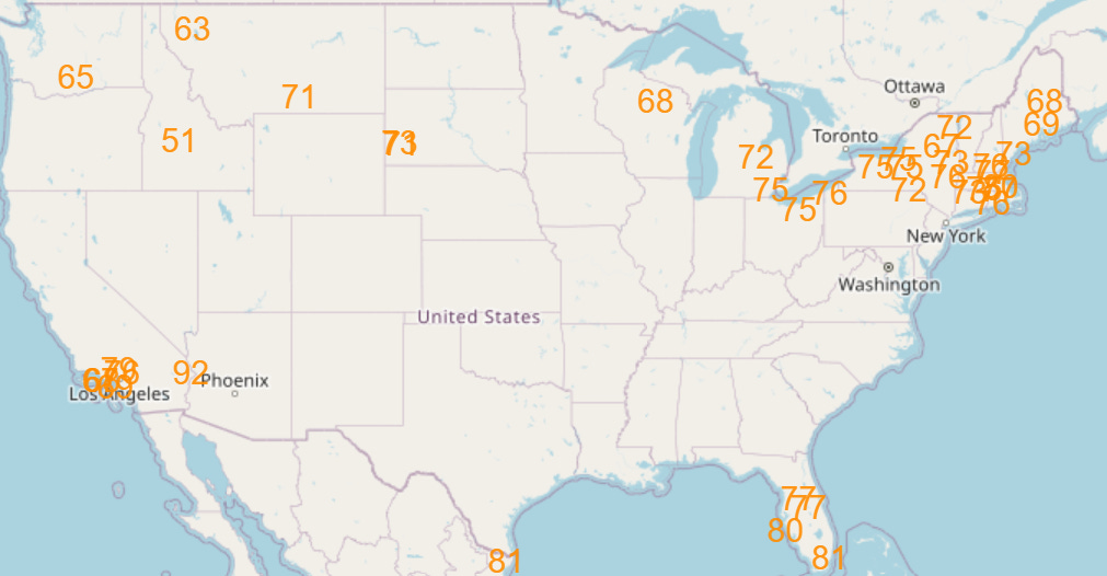
As has become expected in these heatwaves, record high minimums should even more numerous due to the combination of excessive heat and humidity (NWS forecast record high mins for Wednesday shown above).
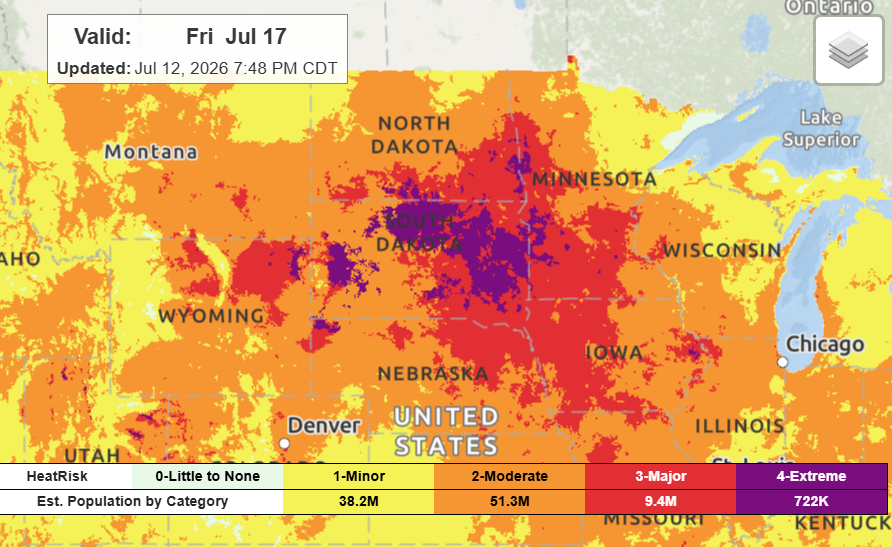
While record high temperatures will become less common late in the week as the upper level high pressure area weakens slightly, the combination of heat and humidity is expected to result in widespread major to extreme heat risk from the Dakotas into portions of the Midwest into next weekend (Friday NWS HeatRisk shown above).
Of course, the US is not the only place seeing record heat — Europe also continues to see locations reaching all-time or monthly heat records (compilation courtesy M. Herrera).
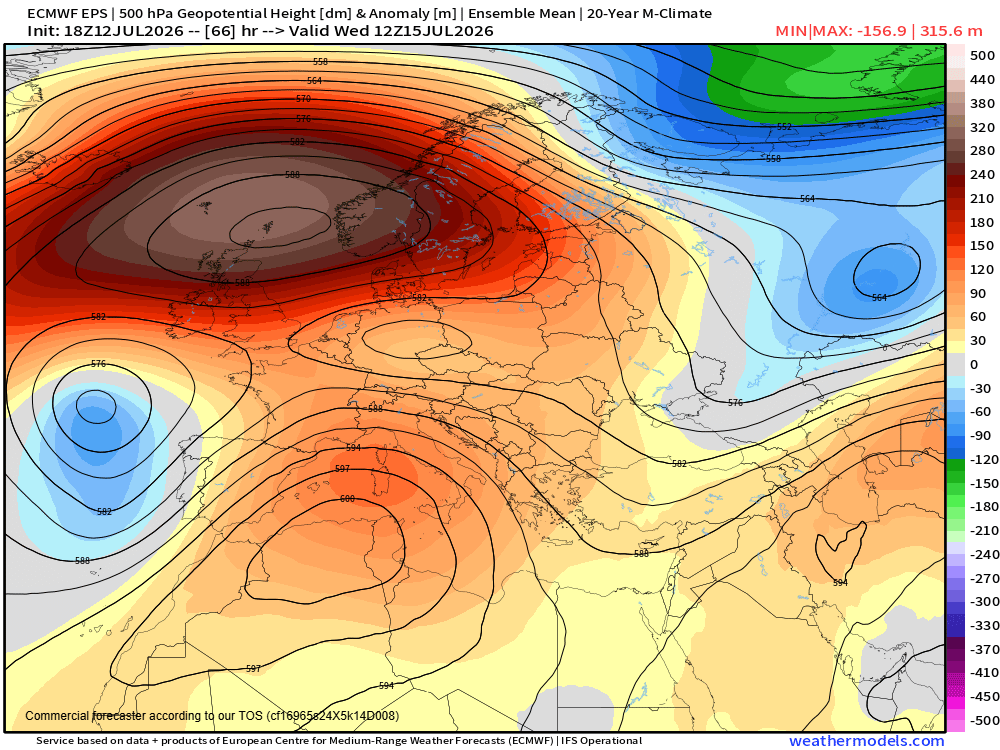
Yet another large 6000+ meter high pressure dome at 500 millibars is forecast to become established across northwest Africa and the southern Mediterranean this week, which will bring more record heat to that region which looks to eventually build back into the Iberian Peninsula by the upcoming weekend.
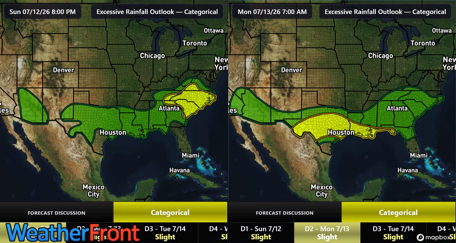
As far as thunderstorms over the US, flash flooding looks as if it will be the predominant risk the next couple of days, with slight (level 2 of 4) risks centered over the Carolinas tonight and across Texas and the central Gulf Coast on Monday.
Programming note: posts will continue to be more sporadic than normal through the early part of the week.


Leave a Reply