
Minneapolis sets record for highest 500 mb height ever observed, with triple digit heat reaching Minnesota/Ontario border. Unusual enhanced severe risk for US/Quebec border region Tuesday.
Jul 13, 2026
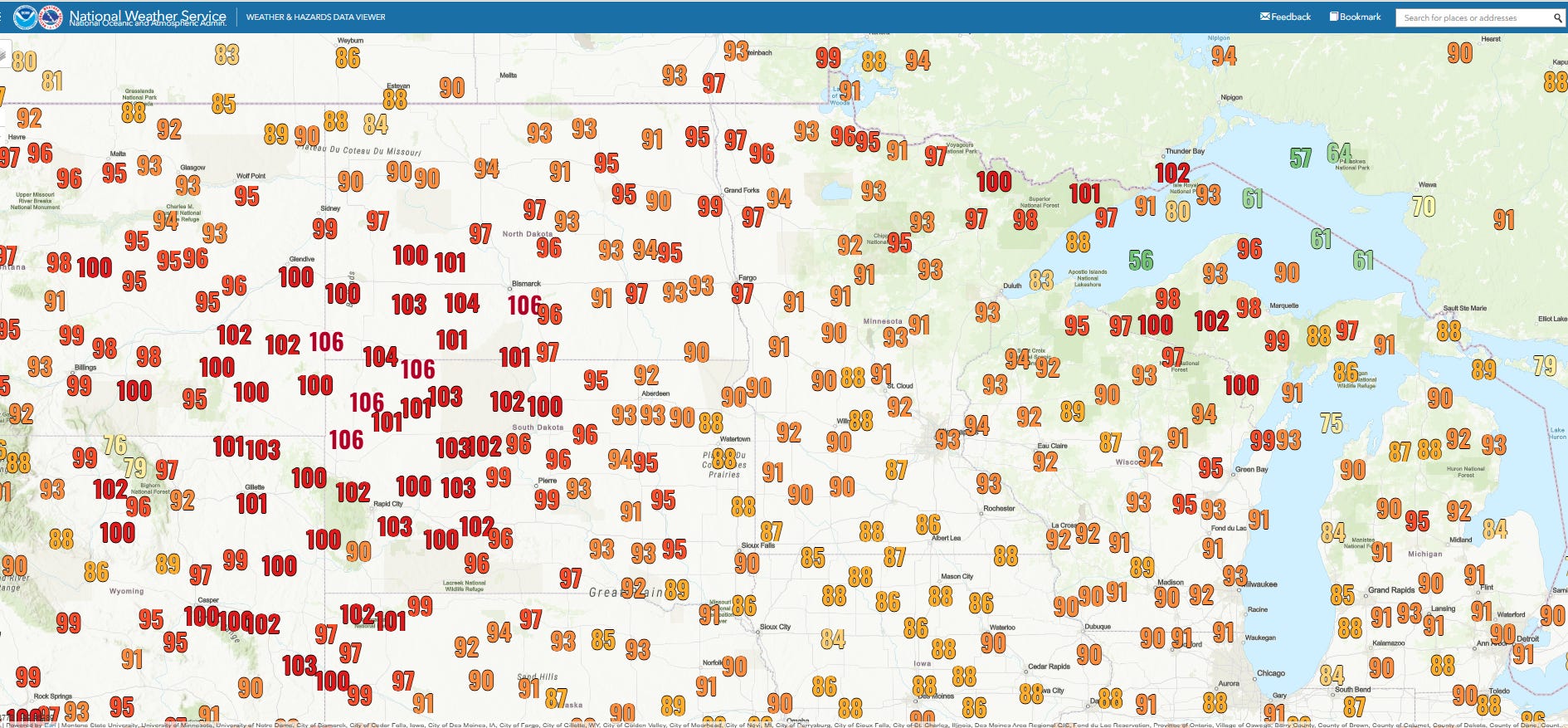
Today was another day of record heat across the Upper Midwest. New daily records were set at Bismarck (105F, broke record by 5F), Marquette (96F, broke record by 3F), and International Falls (97F, broke record by 4F), with all-time records set at some shorter term climate sites such as Iron Mountain (100F) and Copper Harbor (96F) in the U.P. of Michigan. Triple digit high temperatures made it all the way to the Canada/Minnesota border, with Thunder Bay, Ontario along the north shore of Lake Superior reaching 102F.
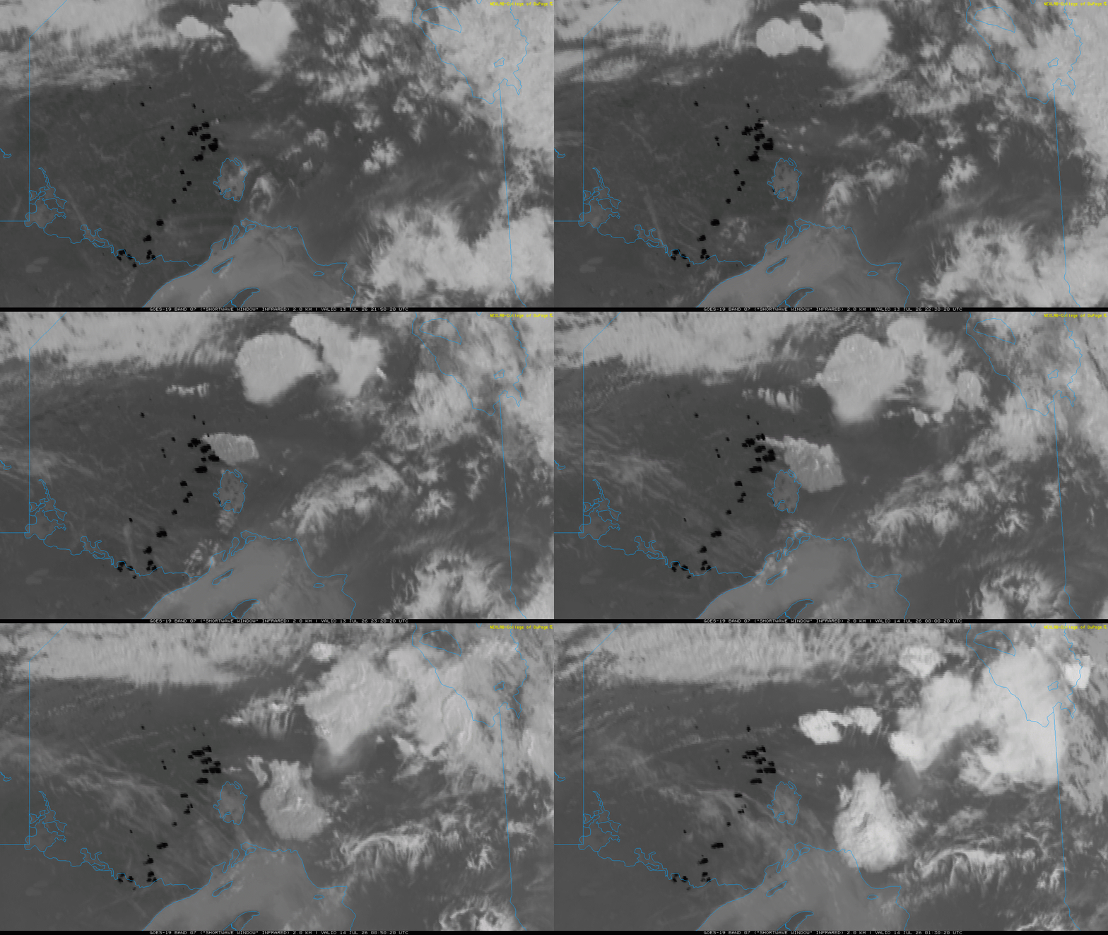
Hot, dry and breezy conditions are continuing to fuel massive wildfires along the Boundary Waters region along the US/Canada border and north into southwest Ontario. Shortwave infrared satellite imagery clearly reveals the many large, spreading hot spots and associated smoke plumes. The wildfires have forced the US Forest Service to close the popular Boundary Waters Canoe Wilderness Area.
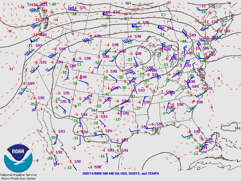
As we have been discussing, this heat is being driven by a historically strong middle and upper level area of high pressure that can clearly be seen on this evening 500 millibar (~18,000 feet) AGL weather map above. The upper air balloon data at Minneapolis and Aberdeen, SD both recorded 500 millibar geopotential height values of 6000 meters — a rarely seen (although it seems as if it is being seen more frequently lately) value.
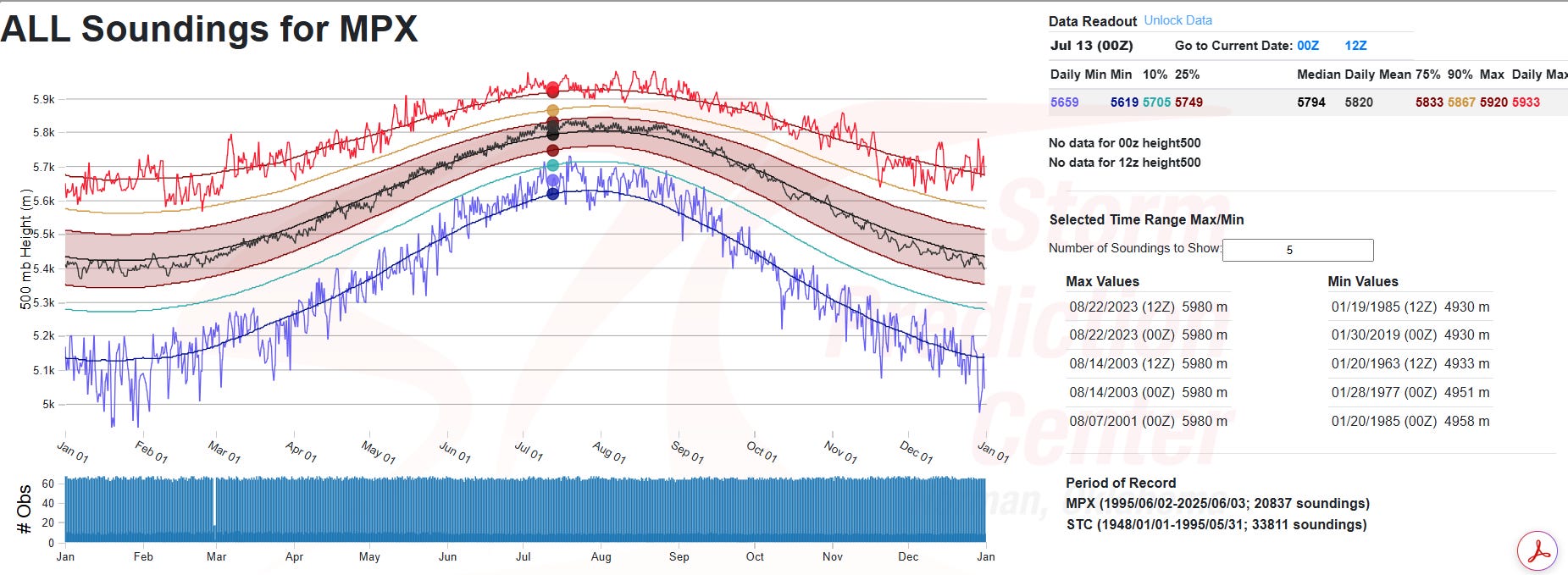
Per the NWS Storm Prediction Center’s climatology of upper air data, the 6010m observed 500 millibar height at Minneapolis is an all-time record and the first time that the 6000m level has been crossed in records that go back to 1948. It is the fourth time in the Aberdeen historical record that a 6000m height has been recorded at 500 millibars.
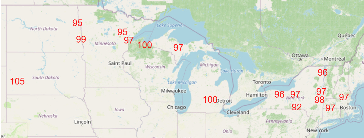
The record heat will continue in this region tomorrow and also expand into the Northeast, with highs approaching 100F in parts of upstate New York and southern New England.
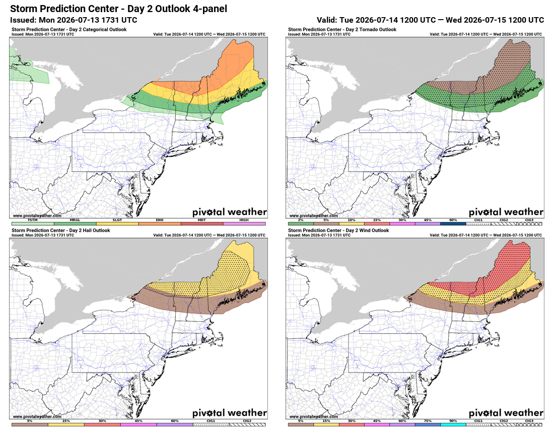
The heat and humidity in the Northeast along with an upper level weather disturbance moving southeast around the periphery of the strong upper level high pressure area will bring an unusually potent risk of severe storms to areas along the US/Quebec border Wednesday afternoon and evening. An enhanced (level 3 of 5) risk of severe storms is place, with organized lines of severe storms capable of all modes of significant severe weather (very large hail, damaging straight line winds of 75+ mph and EF2+ tornadoes) possible.
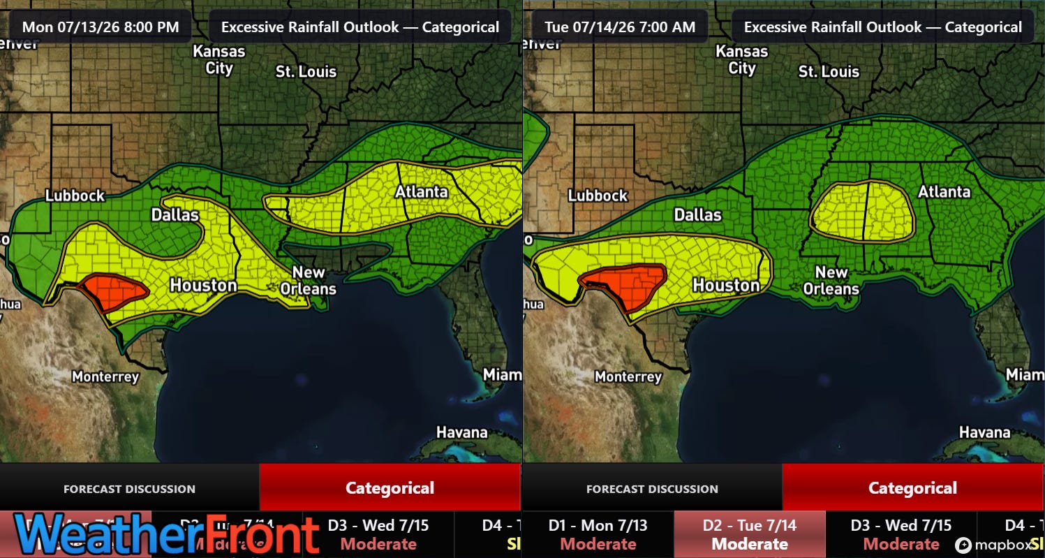
Flash flooding is also expected to be a significant concern for parts of the southern US the next few days as east/southeast winds on the south side of the “heat dome” will cause slow, westward moving clusters of thunderstorms with torrential rainfall. As an example of the kind of rainfall rates these storms can produce, the Downtown Shreveport airport reported nearly 6” (5.83”) of rainfall in about two and a half hours early this evening, with 3.10” falling in just an hour. This rainfall caused serious urban flash flooding with numerous flooded vehicles and water rescues reported.
In the tropics, for the first time since the brief system that was Arthur, we have something to talk about in the Atlantic. To the south of the large area of high pressure bringing the heat to the northern states, waves of low pressure will be moving west in an environment that will become at least marginally conducive for tropical development by this weekend.
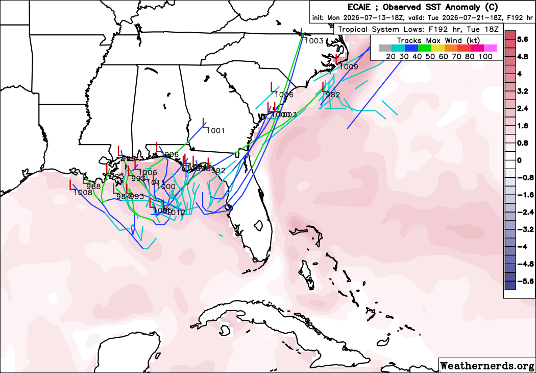
The signals in the models for any development are quite mixed, with the European AI ensemble model (above) the most consistently bullish, with a decent number of members developing a tropical system in the Gulf of Mexico by early next week. The “regular” physics based European ensemble is much less excited — and the Google DeepMind AI model is even less so, with just one or two of its 50 displayable members showing an organized system — and actually has a bit more support for a system in the southwest Atlantic in the 7-10 day period. The bottom line is that conditions will be a bit more supportive of possible development somewhere from the Gulf into the southwest Atlantic for a tropical system in the next 10 days — and it will be worth keeping a bit more of a watch than we have needed so far this year.
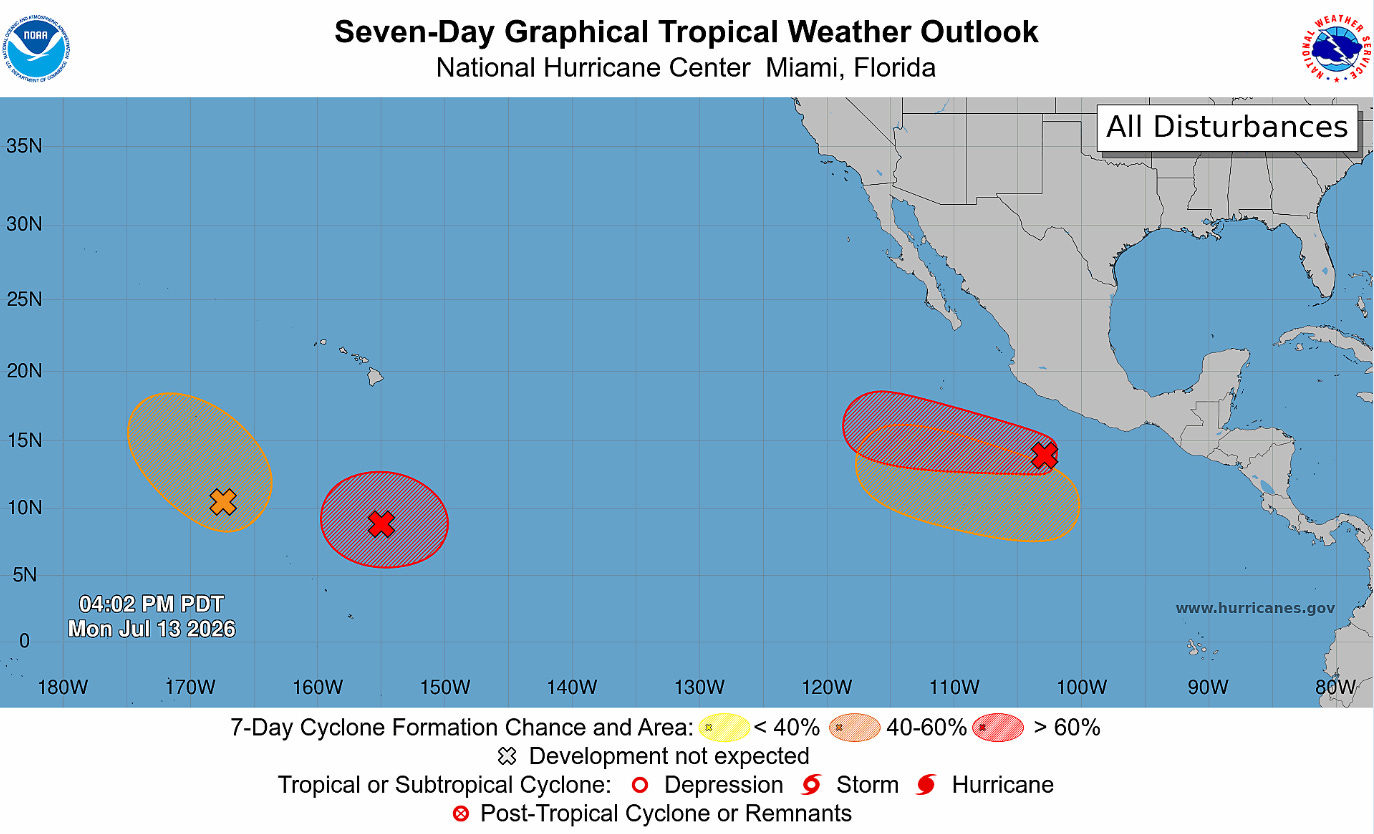
Meanwhile, the central and eastern Pacific are finally starting to show signs of life more aligned with a strong El Nino environment, with several areas being monitored by the National Hurricane Center for moderate to high risks of development in the next 7 days. However, at this point none of these systems are expected to pose any threat to land.
Programming note: posts and updates will continue to be more sporadic than normal this week as I attend to some personal issues.


Leave a Reply