After a few day break, severe weather risks start to ramp up again next couple of days
Apr 21, 2026
Gonna be traveling tomorrow and since I really did not talk about weather in my newsletter today, I wanted to do a quick weather update this evening.
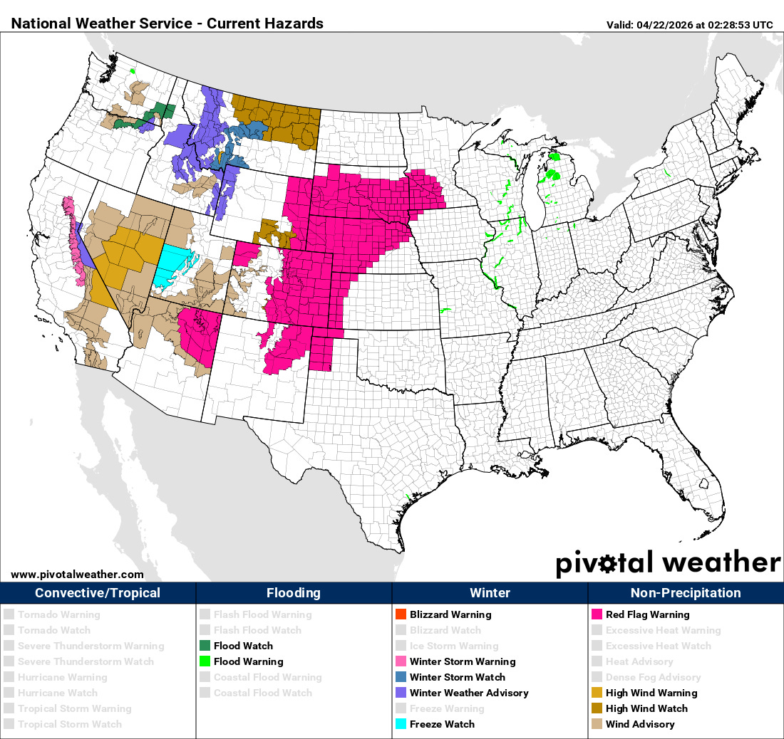
Most of the busy weather in the next 36 hours will be in the western half of the country with an upper level area of low pressure moving east. Strong winds and high elevation mountain snow are expected west of the Continental Divide, while gusty southerly winds and continued dry conditions in the High Plains and parts of the southern Rockies will result in critical wildfire conditions with Red Flag Warnings in effect. Meanwhile, wildfires continue to become a greater issue in parts of Florida and Georgia, with more than 10K acres now burned in the region and Amtrak forced to postpone service due to fire concerns.

After a couple of day break in severe weather, the risk should gradually ramp up as the upper level trough of low pressure moves farther east. A relatively widespread risk of severe storms is expected Thursday across the central U.S. as shown in the National Center for Atmospheric Research AI severe weather probabilities for that day (upper right hand map in graphic above). Severe weather risks are expected to continue and shift a bit farther south through the weekend and into the first part of next week as the jet stream drops south and disturbances continue to move east.

Leave a comment