Severe thunderstorms impacted much of Alabama Monday, leaving more than 200K customers without power
Jun 02, 2026
Before I get into my delayed weekly tropical update post, I wanted to do a quick recap of the severe weather yesterday. As I discussed in my post Sunday, several days of AI forecasts and the overall weather pattern suggested that some of the Midwest thunderstorm activity from Sunday night could pose a renewed and more robust severe weather risk on Monday afternoon as it moved southeast into the Tennessee Valley.
This did in fact materialize, as a loosely organized complex of severe storms with damaging winds and some hail moved south-southeast across the region as this 24-hour loop of the MRMS reflectivity mosaic product shows.
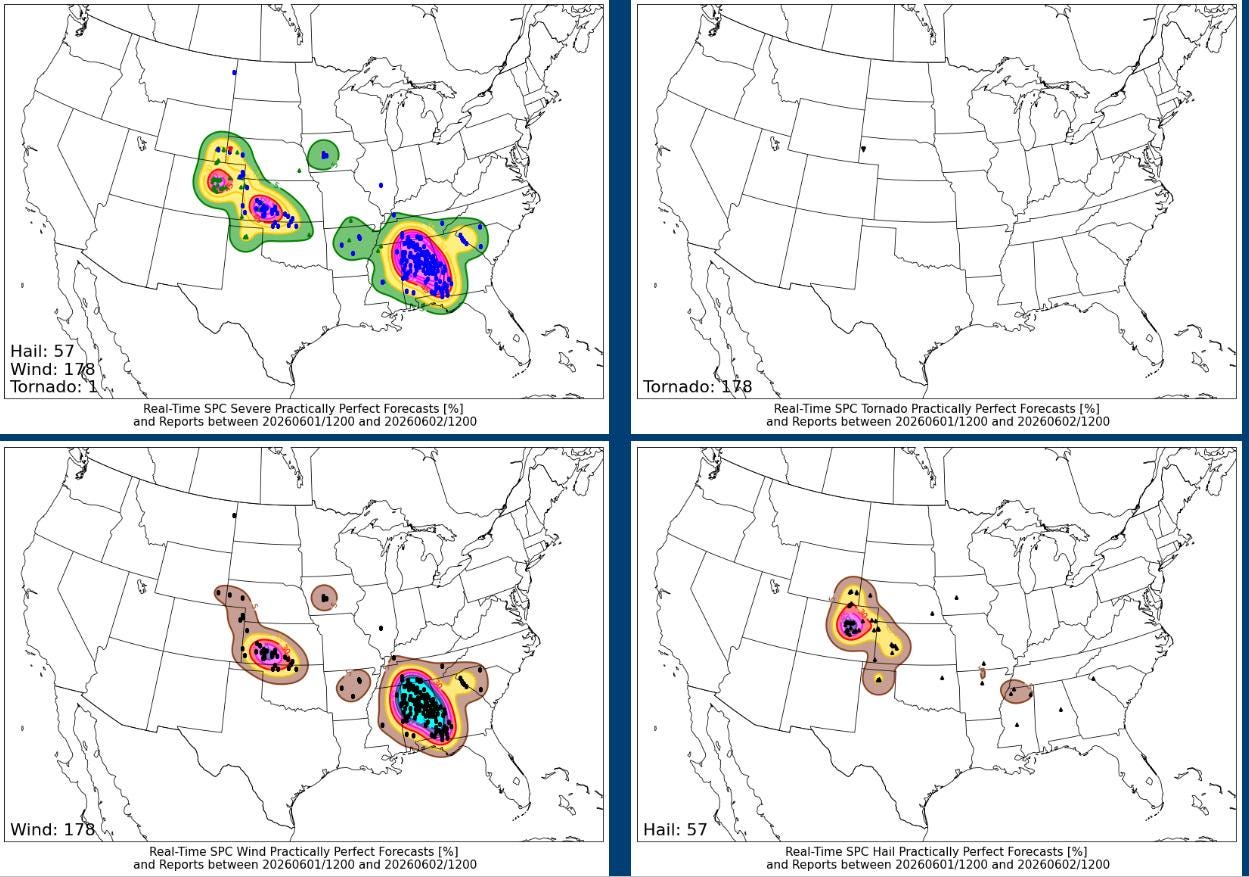
Numerous reports of downed trees and powerlines were received across Alabama, and at one point Monday evening, at least 200,000 customers were without power in the state.

The overall severe weather setup still looks relatively quiet this week, with most of the risk the next few days over the High Plains region.
Monday marked the “official” start of the Atlantic hurricane season, a season that is anticipated to be dominated by the development of a potentially strong El Nino in the tropical Pacific Ocean.
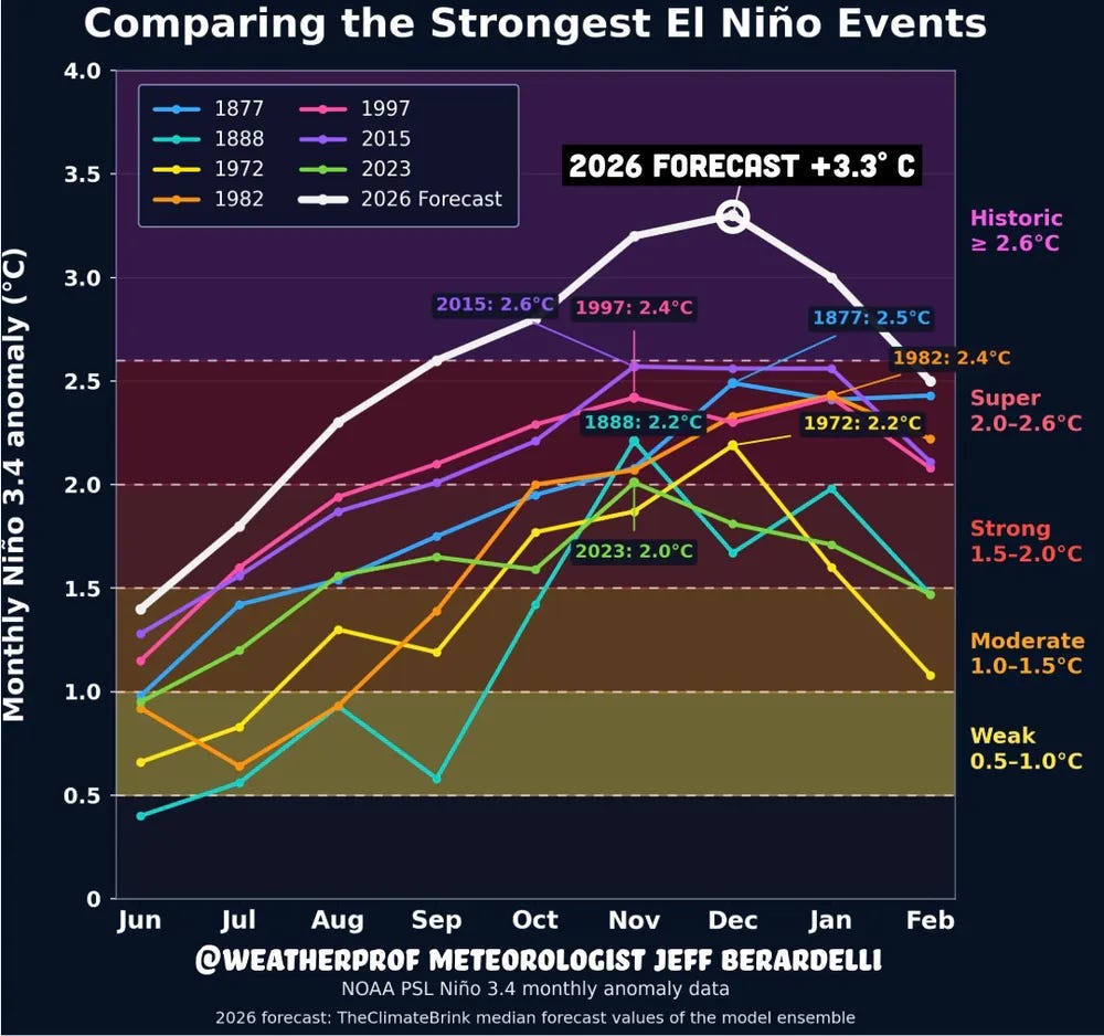
I talked about that in more detail in last Monday’s initial weekly tropical newsletter, but I did want to note that with the start of the new month we are getting in updated climate model forecasts for this anticipated El Nino event, and the models have continued to trend incredibly strong. This graphic from Jeff Berardelli shows that the median of the model ensemble forecasts show the sea surface temperature anomaly in the critical Nino 3.4 region of the tropical Pacific peaking this winter at +3.3C, which would be a historic event. While there is reason to be cautious and skeptical about such a forecast at this time horizon, the fact that the model consensus is in this range shows the potential strength that this El Nino event could have.
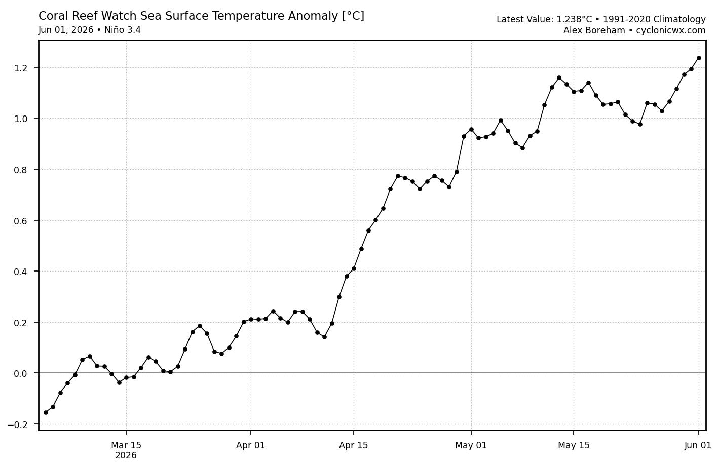
Regardless of the strength of the El Nino event, its implications for this year’s tropical activity hinges significantly on how quickly it develops and the atmosphere responds to the changes in SST patterns. While ENSO events are officially measured on a 3-month average in SST anomaly, the shorter term trends are useful for gauging how quickly things may be evolving, and the latest Nino3.4 SST anomaly is now up to about +1.3C — which if it persisted for several months would be in a moderate El Nino range.
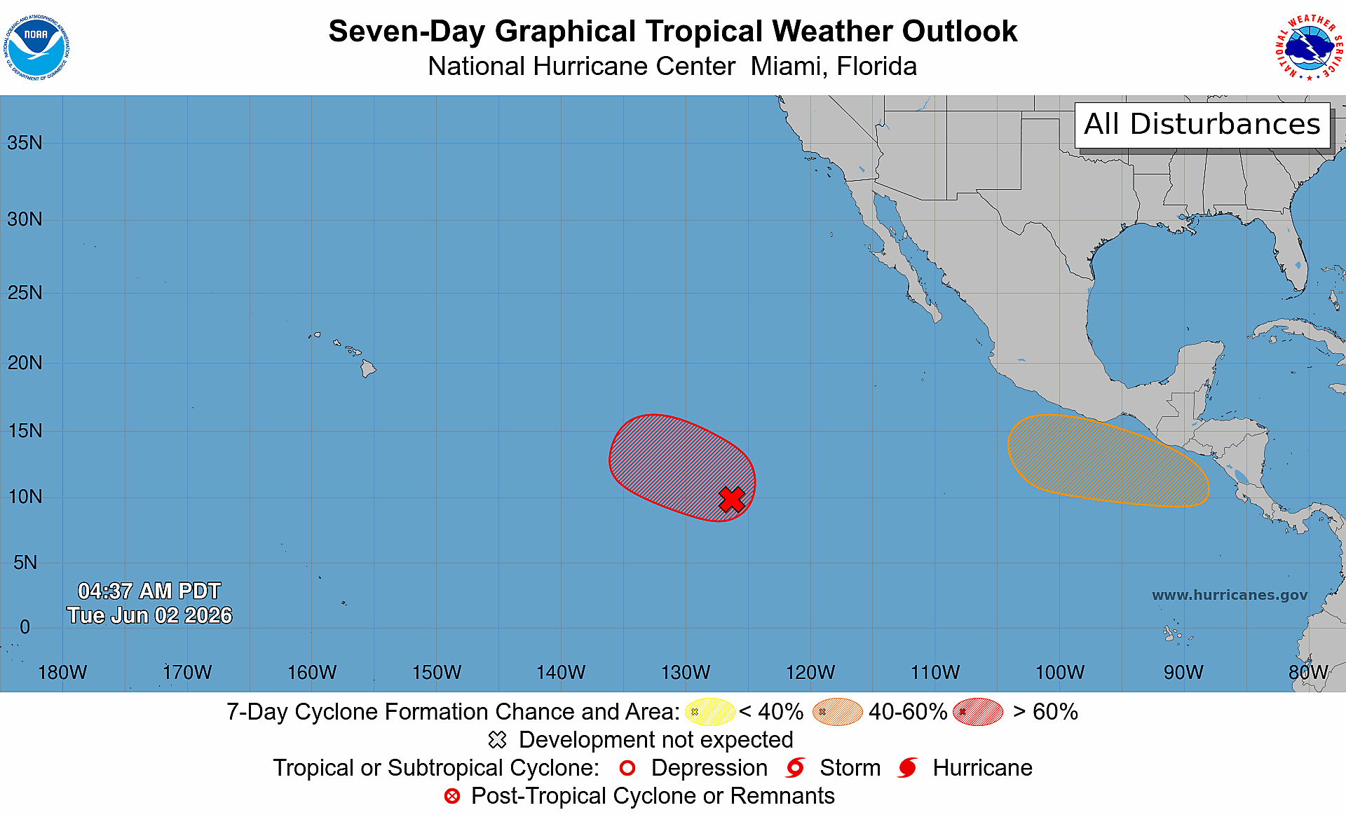
While the El Nino phenomenon (El Nino Southern Oscillation or ENSO) plays a key role in the seasonal climate pattern, the Madden Julian Oscillation (MJO) is a subseasonal tropical disturbance that can become active and provides more or less favorable conditions for tropical cyclones as it propagates east around the globe. A favorable phase of the MJO is currently progressing east across the Pacific, and over the next week is expected to spawn the first two tropical cyclones of what should be an active 2026 East Pacific hurricane seasons. The easternmost system will bear watching as some of the model guidance suggests this could become a hurricane and could be a potential issue for southwest Mexico depending on how steering currents evolve.
The Atlantic is currently quiet, but there are some signs in the model guidance that as the MJO tries to continue to work east, conditions could become more favorable over the Gulf or western Caribbean for a system to form during the week 2 period. Several members of the European model ensemble as shown above do show a system developing — but as of now there is no consistent signal as far as when or where any development might occur. Right now we will just be keeping an eye on the potential for a somewhat more favorable period for development as we head toward mid-June.

Leave a comment