Record warmth expands across the central and eastern US as dry and windy conditions develop for parts of the West
Jun 05, 2026
Happy Friday! Let’s recap the week’s weather and look ahead into the weekend and next week.
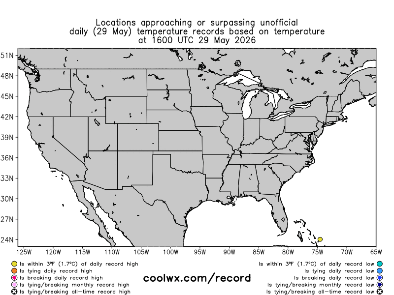
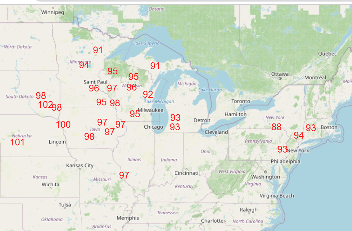
Over the last several months, a highly amplified jet stream pattern has brought some wild temperature swings to parts of the US, particularly the East. The Mid-Atlantic has seen this a few times in recent weeks, including after mid-May all-time monthly record warmth and a more than 50 degree plunge after mid-March record warmth. This week started off with unusually cool conditions in the East with a number of record low temperatures set over several days, but the pattern has yo-yoed back to unusual warmth over the last couple of days with a handful of record highs set in the Northeast and eastern Canada.
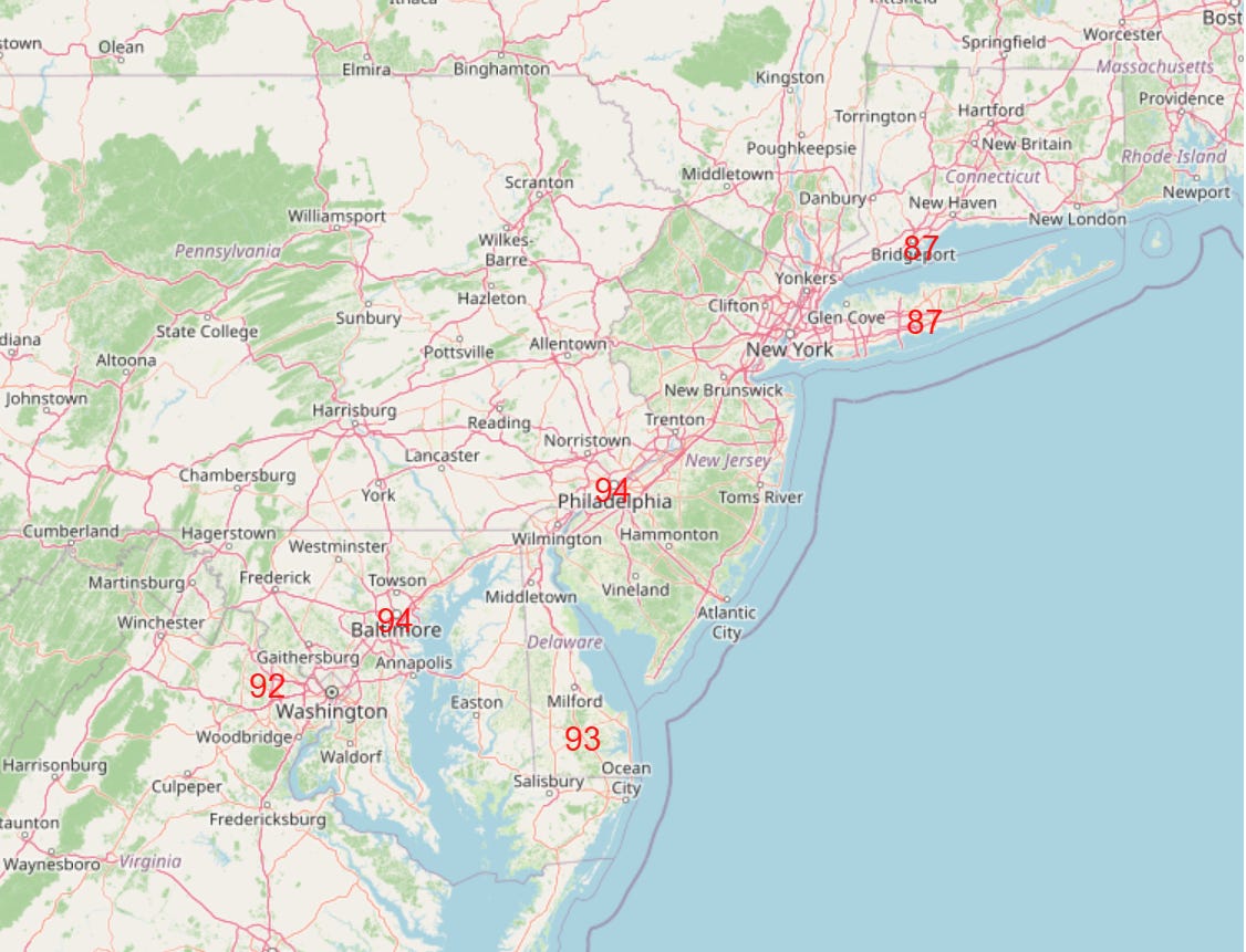
A number of locations in the Mid-Atlantic are expected to approach of reach record high temperatures today as readings surge into the 90s across the region.
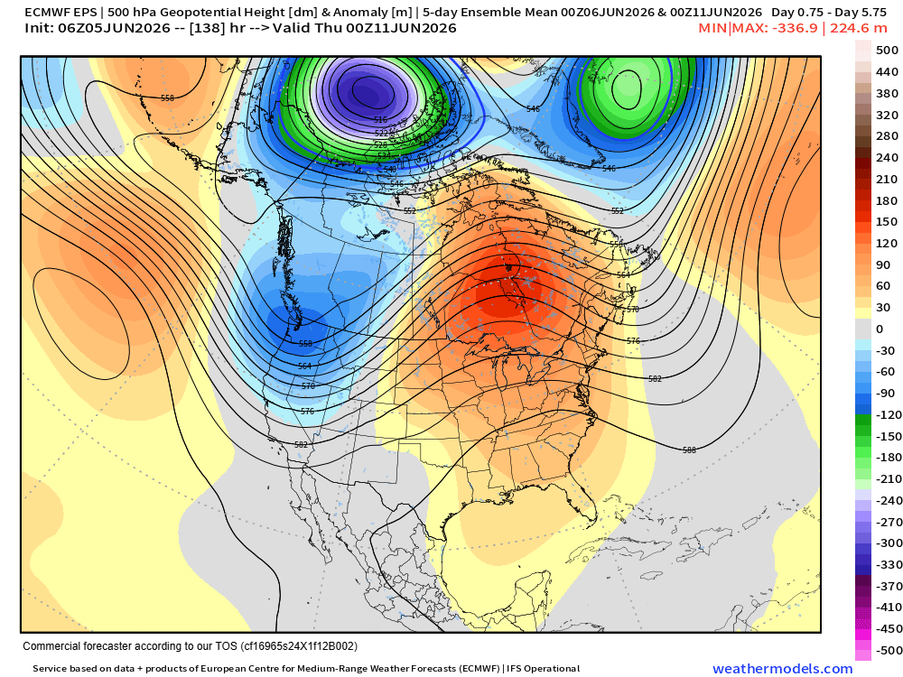
This looks to be the start of a multi-day period of warmth across much of the eastern half of the country as the amplified jet stream pattern continues, with a trough of low pressure setting up just inland from the West Coast and a downstream upper level ridge of high pressure becoming established across eastern Canada and the Great Lakes.
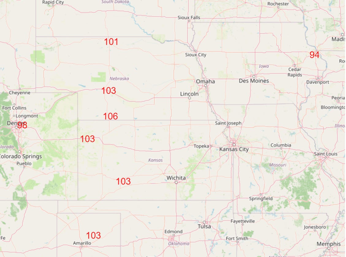
Waves of warm air will build across the central US and shift east over the next week, with the likely peak of heat developing in the Central Plains by midweek with a number of record high temperatures likely.
This record heat will build north and east as we head toward the end of the week.
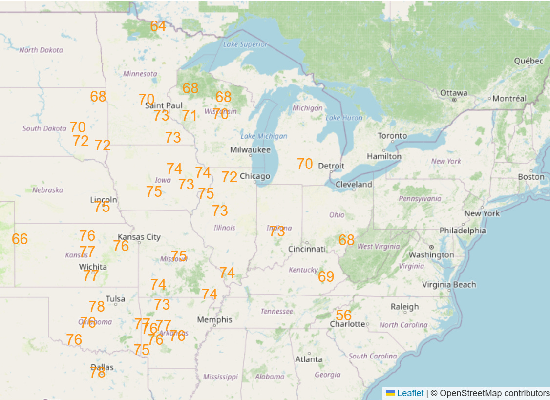
Humidity levels have been rather pleasant the last several days given the cooler and drier airmass that started the week over the East. This will gradually change as southerly winds not only cause the heat to build but also transport Gulf moisture north, and by late next week that humidity will result in even more widespread record warm minimum temperatures across the Midwest.
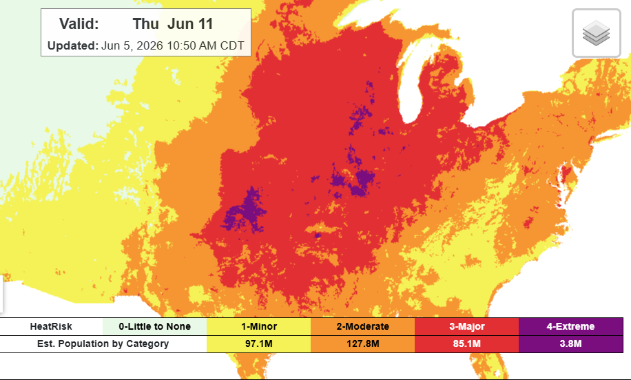
The combination of heat and humidity should result in the year’s first period of widespread major to extreme heat risk across the country east of the Rockies.
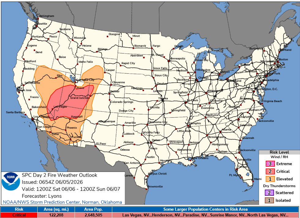
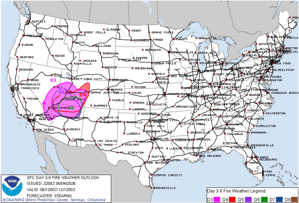
Another major weather concern over the next week will be a prolonged period of critical fire danger across the Southwest and Four Corners regions. The area just east of the anticipated upper level trough of low pressure will experience periods of strong winds as disturbances move through the trough. Combined with dry air and ongoing severe drought conditions, there will be serious concern for new wildfire starts with rapid growth. A particularly active period of fire weather could develop for the Intermountain West around the midweek period as the trough of low pressure begins to pull east.

With regard to precipitation, the trough of low pressure in the West will bring some welcome precipitation to the Pacific Northwest, particularly the higher elevations. Between that trough and the ridge over the east, increasing moisture and disturbances moving northeast will bring waves of thunderstorms to the Northern Rockies and the central part of the nation over the next several days. Tropical moisture building north will bring increasing rainfall to Florida.

Severe weather risks will primarily be driven by upper level disturbances moving northeast across the central US ahead of the western US upper level trough. As those disturbances rotate over the upper level ridge over the eastern US, some severe weather risk will also exist over the Northeast and Mid-Atlantic at times, particularly Saturday and again later next week.
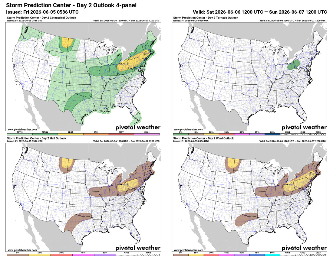
Saturday’s risk will see the potential for severe storms with damaging winds and large hail focus from Ohio into southern New England.

Leave a comment