Severe weather outbreak expected Monday across parts of the Midwest into the Mid-South
Apr 26, 2026

An intense supercell severe thunderstorm dropped southeast across north Texas Saturday evening, producing multiple tornadoes, measured winds near 90 mph, and numerous reports of very large hail up to 3” in diameter. NWS survey teams confirmed an EF2 tornado from this storm over Wise County, TX in the community of Runaway Bay, killing 1 person and injuring 6, with 20 families displaced. An additional EF1 tornado was confirmed by the NWS a bit farther south near Springtown in Parker County. 1 person was killed in Parker County when their mobile home was destroyed by intense straight line winds from this storm.

The path of severe reports from this intense southeast moving supercell stands out very clearly across north Texas on the Storm Prediction Center map of severe weather reports from Saturday. Other severe storms produced a few tornadoes across Oklahoma as well as numerous reports of very large hail across the Arklatex region.
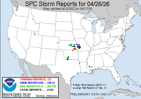
Today has been another quite active severe weather day across parts of the central U.S., with very large hail again the dominant severe weather incidence and eastern Kansas into western Missouri the primary area.
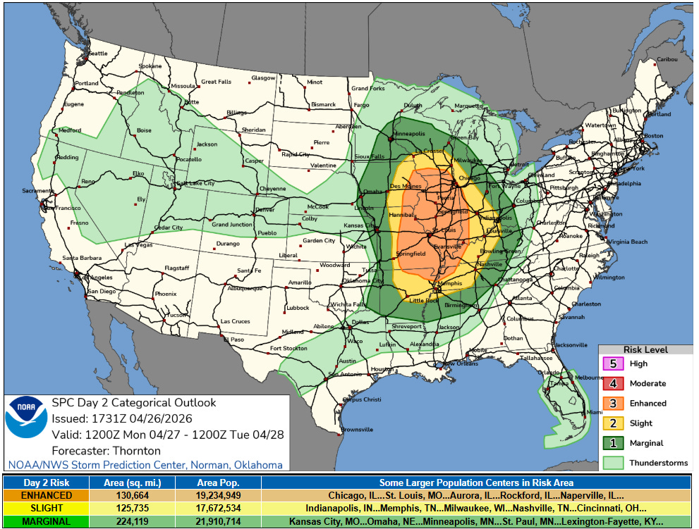
Monday looks as if it could be the most impactful severe weather day of this sequence of severe weather events. As a strong upper level disturbance swings east into the Midwest, a potent low pressure system will develop at the surface across the upper Midwest. Meanwhile, a moist and very unstable air mass is expected to be in place ahead of this system. The combination of atmospheric forcing, strong instability and wind shear is expected to result in the development of numerous severe thunderstorms across the Mississippi Valley region where an enhanced (level 3 of 5) risk of severe storms is in place.
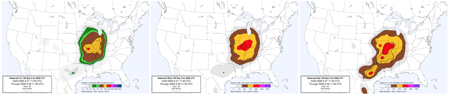
The most recent severe weather probabilities from the Nadocast AI system suggests that the highest risk for the most significant severe weather — including strong tornadoes, very large hail, and damaging straight line winds — should be across parts of southern Missouri into central and southern Illinois, which seems reasonable based on a quick perusal of the most recent global model data and recently arriving evening high resolution models. Given the combination of very high instability and strong winds in the atmosphere, a few intense tornadoes are possible as part of this anticipated outbreak of severe storms — the exact maximum risk areas will likely be near a warm front across parts of central Illinois and along atmospheric boundaries left behind by thunderstorm activity that is expected overnight and into Monday morning.
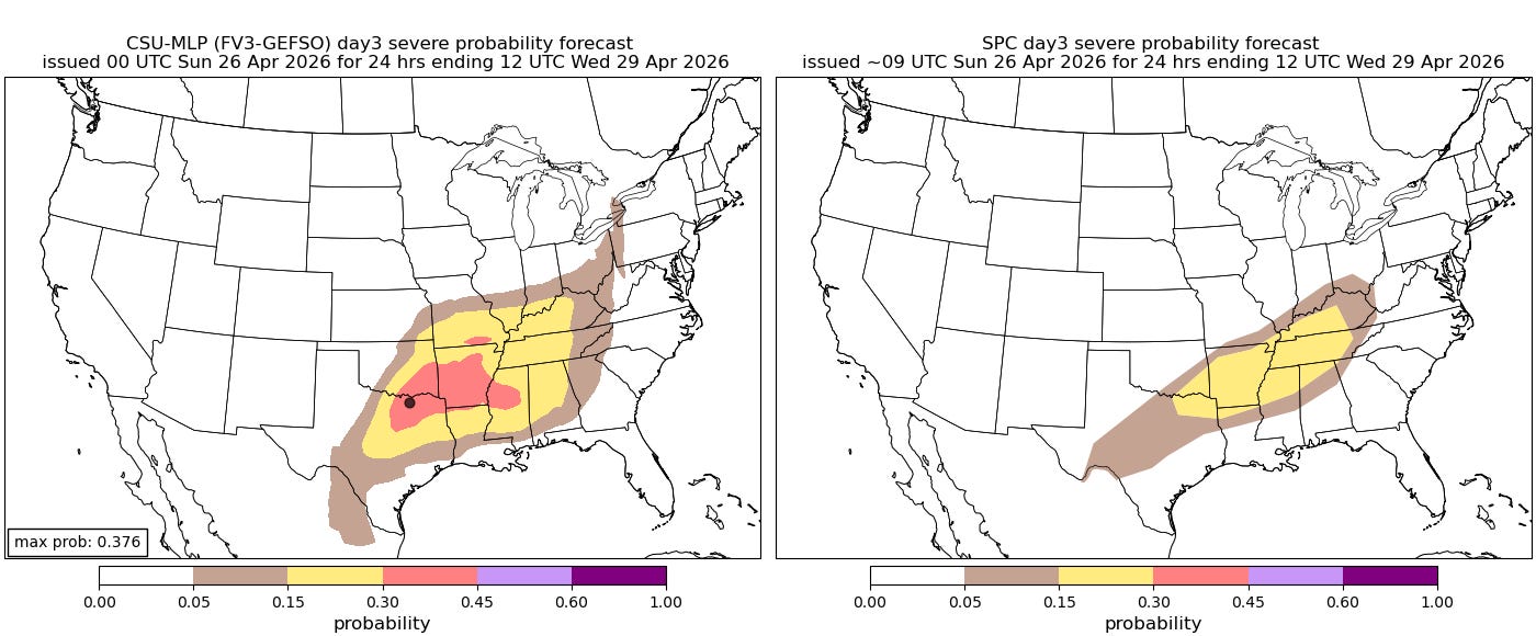
The aforementioned surface low will move northeast into Canada by Tuesday, leaving a trailing cold front sagging south across the Arklatex and Mid-South region. Additional upper level disturbances moving along this front along with continued very unstable air ahead of it will result in additional severe thunderstorms on Tuesday as shown above.

Leave a comment