And a meteorological lesson on how “diffluence” helps thunderstorm development
Apr 23, 2026
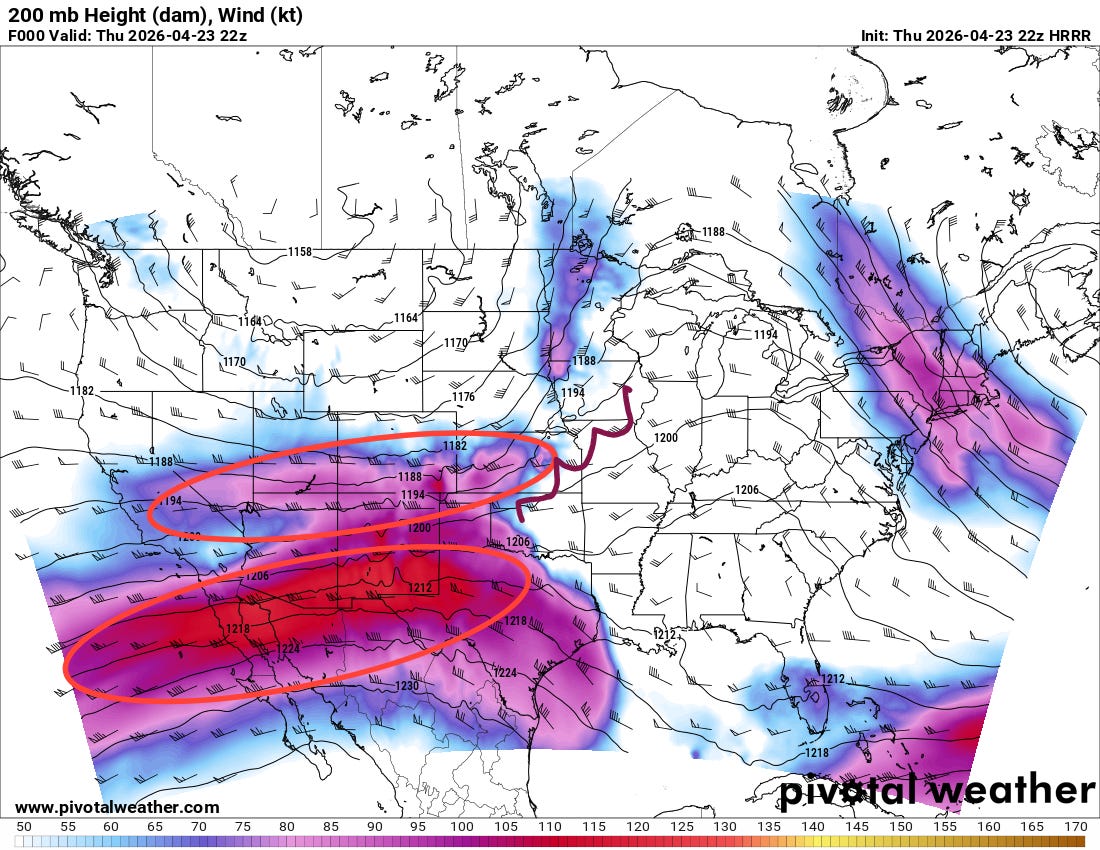
I want to start off this evening’s post with a little classic meteorology I noted in the ongoing weather this evening. The chart above shows the current winds this evening at 200 millibars (about 39,000 ft AGL), the upper levels of the atmosphere where we can look for the jet stream. There is a maximum of winds greater than 120 knots across northern Baja and into west Texas – what meteorologists call a jet maximum or “jetmax.” The area to the northeast of that jetmax, is a favorable area for atmospheric lift and — if other conditions are favorable — thunderstorms.
If you look at the wind barbs, which show the direction of the winds, you can see that the winds are blowing from the west-southwest in the jet max but then turn more northwesterly as winds exit the jetmax. Meanwhile, to the north of that jetmax is another less intense jetmax across the central Rockies — the winds are blowing west-southwest through that maximum as well, but then turn more northeast exiting the jetmax. In between the exit region of the two jet maxima where I have drawn a brown squiggly line, the winds are what meteorologists call “diffluent.” This diffluence further enhances the atmospheric lift and can further help support thunderstorm development.
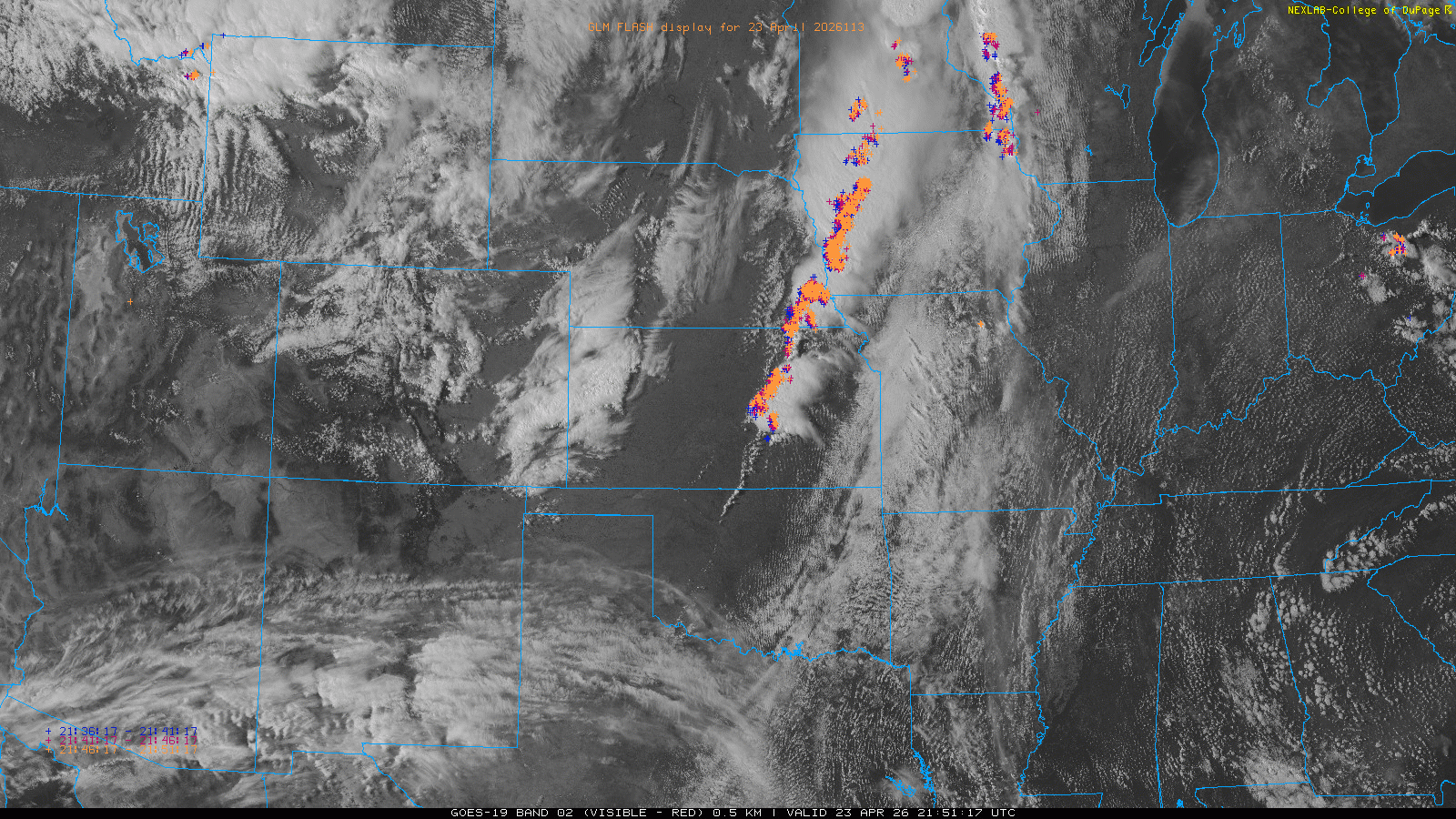
What is extra cool to me — and why I wanted to share this meteorological setup — is you can actually see all of this happening on the visible satellite loop this evening. Cirrus clouds streaming across the southwest indicate the presence of that southern jetmax, and you can see the winds turning more northwesterly across Texas. Meanwhile, over western Kansas and eastern Colorado, you can see the high clouds streaming to the northeast in the exit region of the northern wind maximum. In between — in the diffluent wind area — severe thunderstorms have erupted from the Oklahoma/Kansas border north across eastern Kansas. Being able to visualize these sorts of atmospheric processes are a key to why satellite imagery is so important to meteorologists.
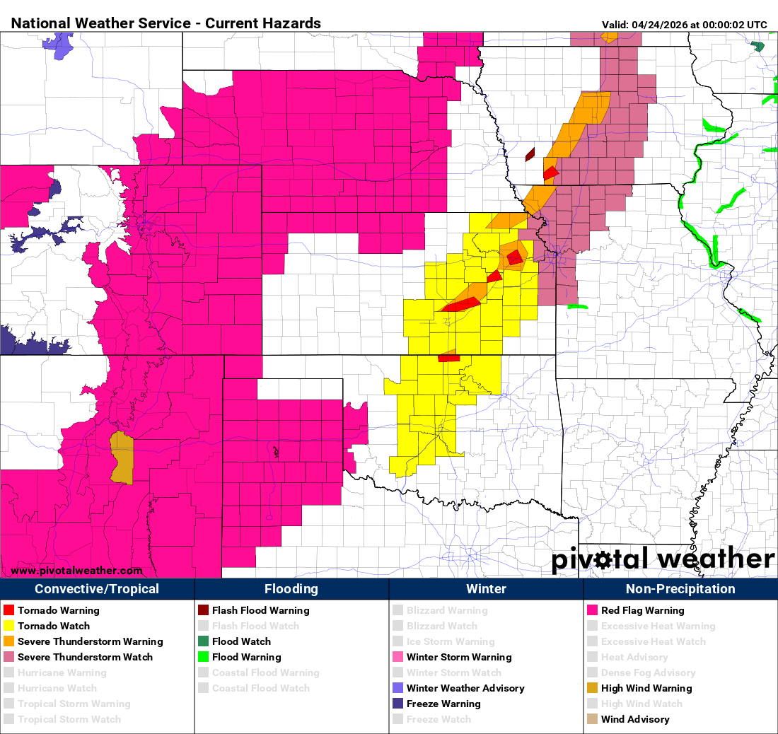
These severe storms are within an area of highly unstable air and moderate wind shear, and as a result supercell storms with very large hail and potential tornadoes are ongoing.
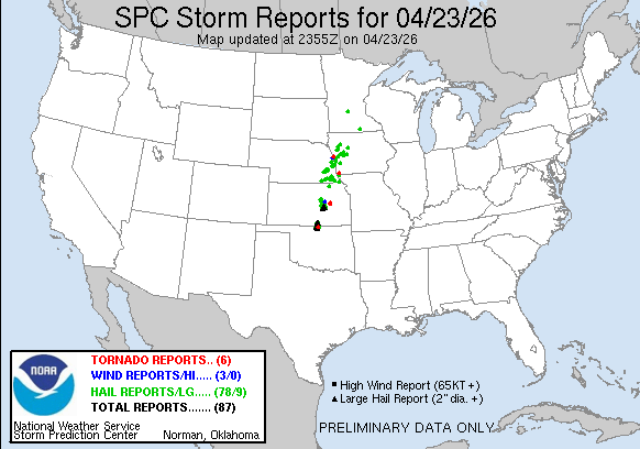
Farther north, a line of severe storms has been sweeping across the Missouri Valley region with numerous reports of large hail and a few tornadoes.

Today looks to be the start of a very active pattern of severe weather which will persist well into next week (as one of my colleagues succinttly put it: the pattern the next 10-14 days will ROCK!) Weather disturbances moving through an active jet stream will be interacting with what looks to be a persistently moist and very unstable airmass, resulting in numerous rounds of severe thunderstorms over at least the next week as shown in the National Center for Atmospheric Research AI probabilistic severe weather forecast for the next 8 days above.
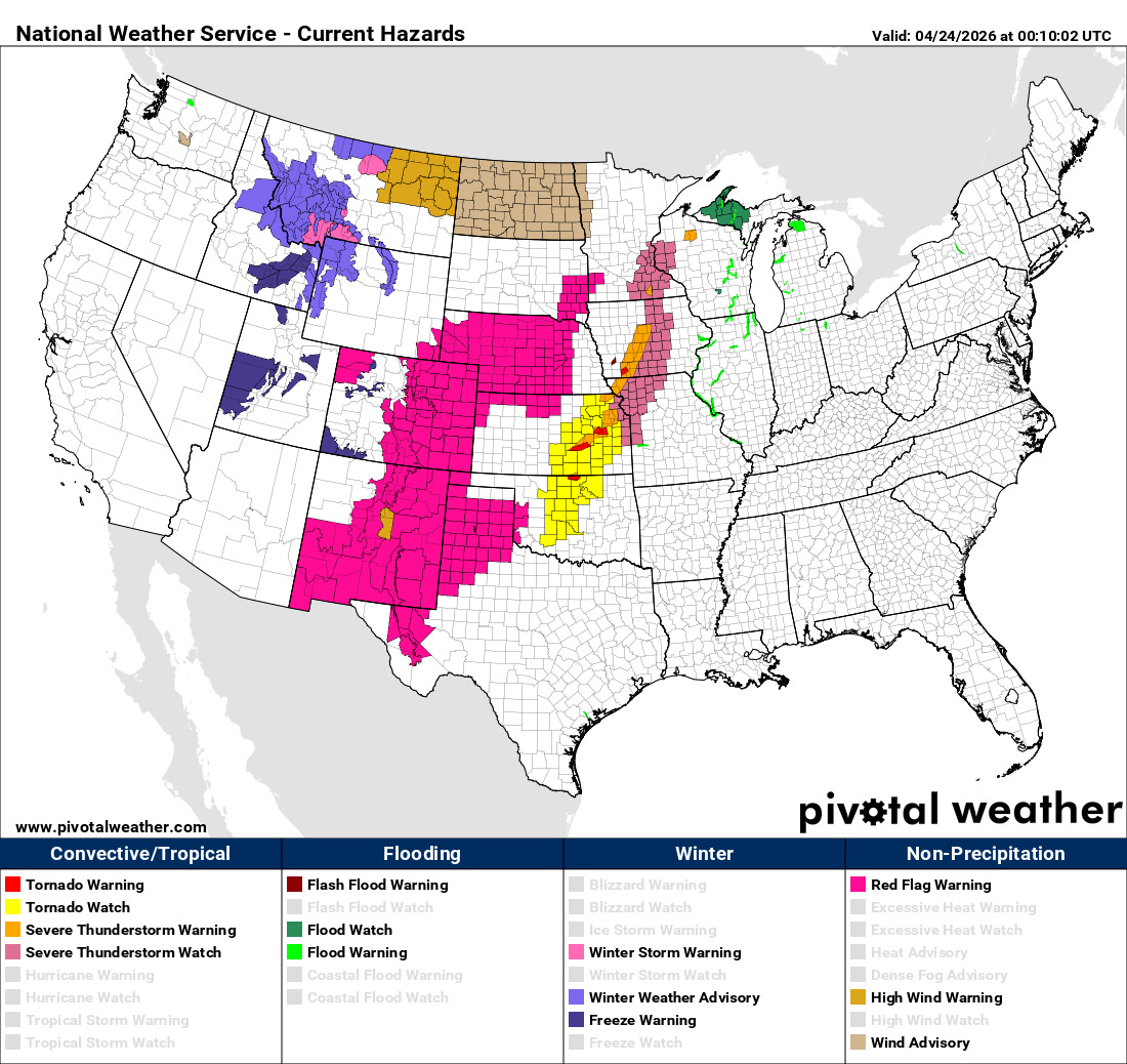
Along with active severe weather, this pattern also looks busy for wildfire danger across parts of the central US. Red flag warnings are currently in effect for a large region over the High Plains where strong winds and dry conditions are yielding spreading wildfires this evening, including one that has forced evacuations near Fort Collins, CO.

Wildfires also continue to burn mostly out of control in the extreme drought area of northern Florida and southern Georgia, with nearly 100 homes now reported destroyed in south Georgia. While rain and thunderstorms will bring some drought relief to parts of the Mid-South and Tennessee Valley by later this weekend into next week, areas farther southeast toward south Georgia and Florida look to see relatively limited rainfall for the next 7-10 days as of now.

Leave a comment