Active couple of days presage a busy period of severe weather into next week
Apr 24, 2026
")
Shortly after I made my post last night about the ongoing severe weather in the Plains, an intense supercell severe thunderstorm produced a large, violent tornado near Vance Air Force Base and the south side of Enid, Oklahoma.
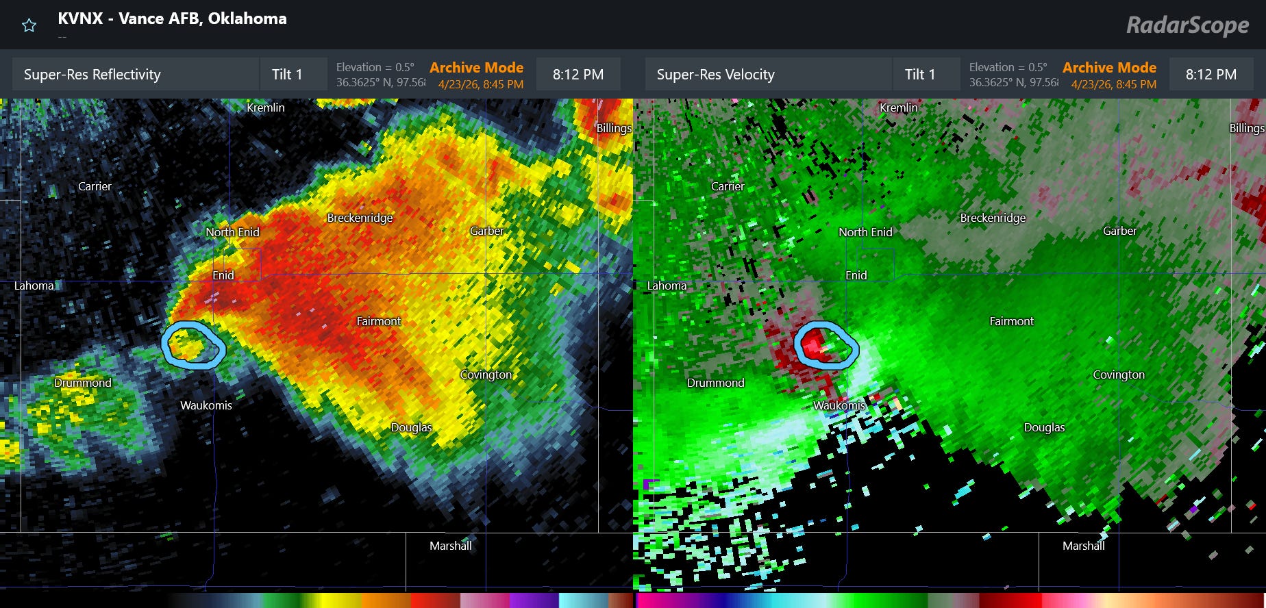
This is an image of radar reflectivity and velocity (Doppler winds) image from the Vance AFB NEXRAD radar (located about 15 miles northwest of the base) from 8:12 pm CT, about the time the NWS damage survey estimated that the tornado started. The storm was exhibiting a classic “hook echo” pattern in reflectivity data, and showed a very tight tornadic circulation with a wind difference of about 150 mph (gate-to-gate Delta-V as meteorologists refer to it).
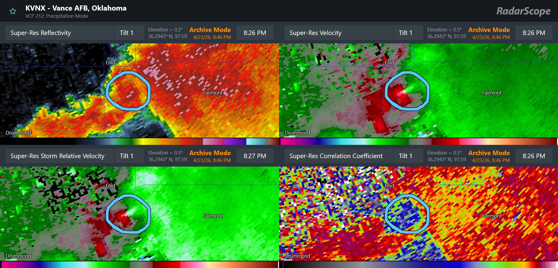
About 15 minutes later, the reflectivity and velocity data was similar, but by this point there were also clear signs of lofted tornadic debris being detected by the radar. The reflectivity values near the circulation (circled) showed values greater than 60 dBZ – this showed where the radar beam was striking objects of debris lofted by the tornado, causing higher levels of power to be reflected back to the radar. This enhanced reflectivity due to tornadic debris is referred to as a “debris ball.” Additionally, in dual-polarization correlation coefficient data (lower right), a large area of very low (blue) values was detected, indicating where the radar was discerning objects of different shapes and sizes, again due to the presence of lofted debris. This dual-polarization radar signature is known as a “tornadic debris signature.” Debris was detected in the dual-pol data to a height of at least 20,000 feet, an indication of an intense tornado.
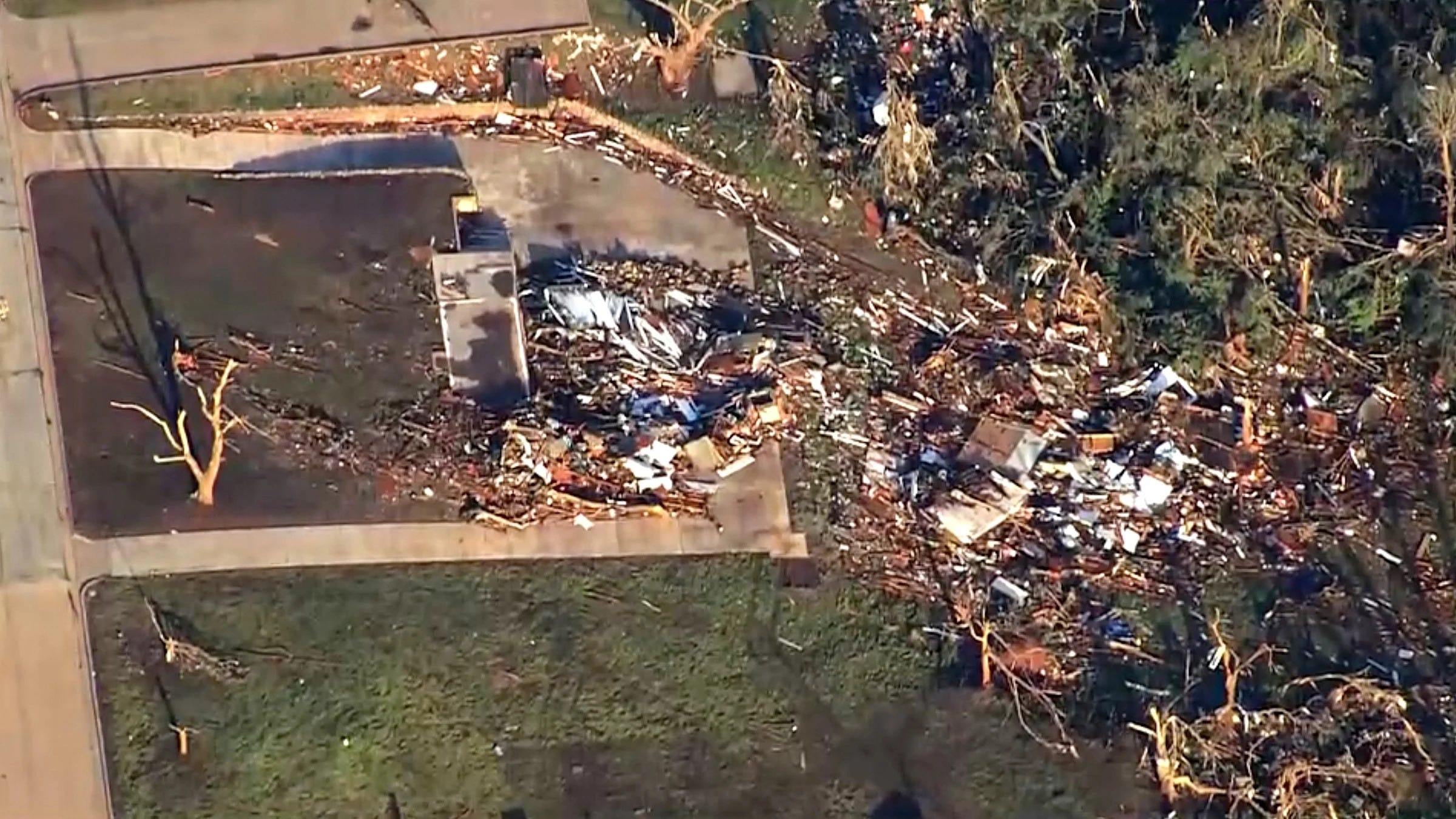
An NWS damage survey confirmed that the tornado was at least an EF4 with maximum winds of 170 mph. In spite of dozens of homes being heavily damaged or destroyed, amazingly no fatalities were reported.
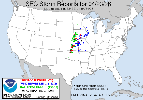
This tornado was one of nearly 300 incidences of severe weather reported to the Storm Prediction Center on Thursday, including numerous reports of very large hail (2+ inches) and more than 20 reports of tornadoes.
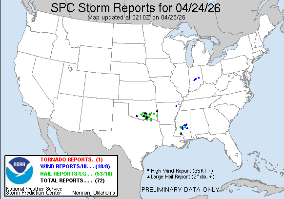
Today has been quite active as well, with Oklahoma again seeing significant severe weather but this time in the southern part of the state where hail up to baseball sized was reported. Other severe storms impacted Mississippi, with damaging winds caused a tree to fall through a house in Pelahatchie, injuring a person.

As I have been discussing, the last couple of days were the start of a multi-day period of active severe weather for the country, with the National Center for Atmospheric Research AI severe weather probabilities above highlighting areas at risk over the next several days. Saturday afternoon and evening look quite active from Kansas through the Arklatex region. An extremely unstable airmass will fuel intense supercell severe thunderstorms with very large hail and tornadoes — some of which could be strong — possible.
Sunday into Monday looks to bring the potential for an outbreak of severe weather. This risk starts in Kansas and the Mid-Missouri Valley Sunday afternoon and evening, and should shift into the Mississippi Valley and Mid-South regions on Monday. Very large hail, significant tornadoes, and damaging winds will be possible from the most intense storms during this period.
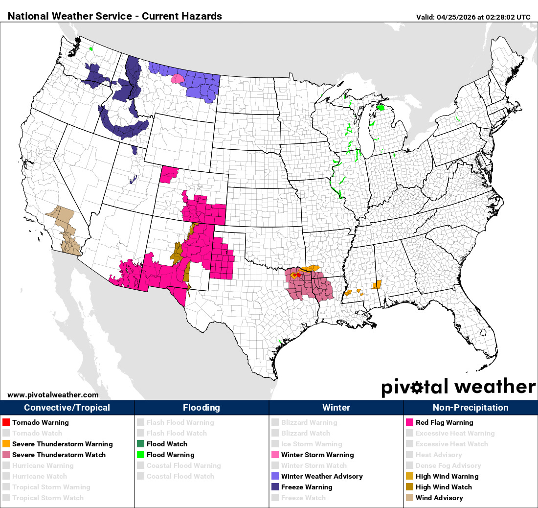
I do not want to forget the other big weather story headed into this weekend, wildfires and fire danger. In addition to severe weather, this weather pattern will also bring increased wildfire danger to the southern Rockies and High Plains, and red flag warnings are in effect this weekend. Dry weather also continues to fuel growing wildfires across Florida and southern Georgia, where more than 100 homes have been destroyed by a major wildfire. More than 150 wildfires are burning in this region, and a Florida firefighter was sadly killed battling a wildfire in this area.

While widespread moderate to heavy rainfall is expected over the next several days for parts of the drought plagued Mid-South and Southeast, most of this rainfall should remain northwest of the most impacted areas from southern Georgia into Florida.

Leave a comment