Numerous reports of very large hail and damaging winds today – but so far, tornadoes have been less numerous and intense than anticipated
Apr 27, 2026
Good evening, I wanted to give a quick update on the severe weather so far today. As more or less expected, a number of severe thunderstorms developed across the Mid-Mississippi Valley this afternoon and has now congealed into a large band of severe thunderstorms from central Indiana to southeast Missouri. Meanwhile, more discrete supercell thunderstorms also developed across northeast Texas and southwest Missouri and have been moving east the last several hours — and more recently storms have begun to increase across parts of Arkansas.
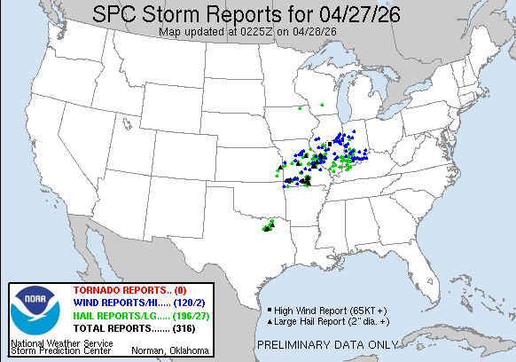
While these storms certainly produced the anticipated severe weather outbreak with more than 300 reports of severe weather, so far the more significant tornadic impacts have (thankfully) not materialized. As of now, it seems as if most of the tornadic activity has occurred this evening with areas of rotation embedded with the line of storms moving across Illinois.
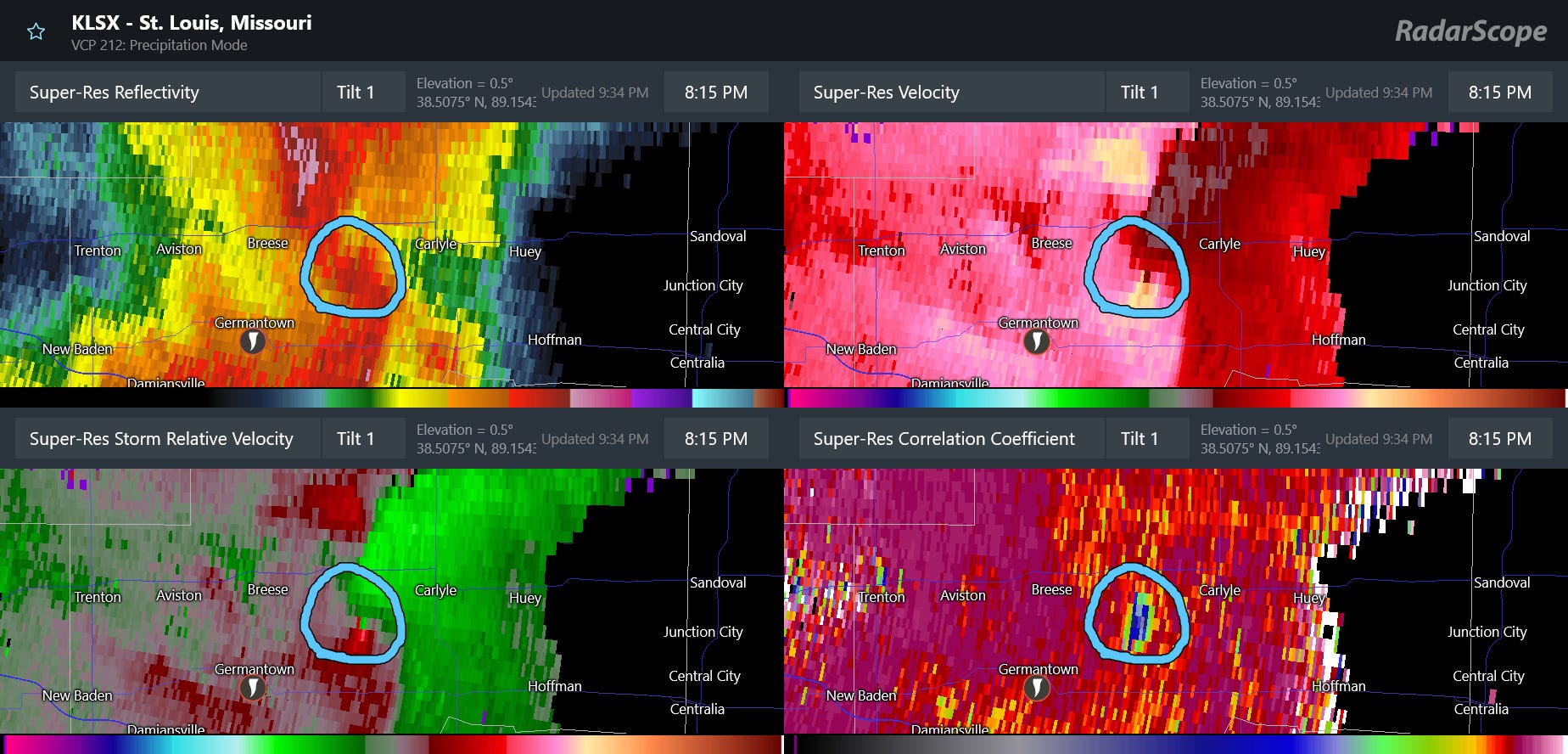
Although not shown on this report map, there have been confirmed tornadoes in the area east of St. Louis, including this potentially strong tornado with a well defined radar detected tornado debris signature between Germantown and Carlyle, IL.
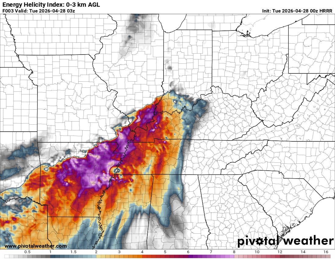
While to this point storm evolution has kept the tornado activity less than anticipated, the overall environmental conditions will remain favorable for significant tornadoes for the next several hours. This graphic shows the Energy Helicity Index (EHI) at 10 pm CT from the latest High Resolution Rapid Refresh model. EHI is a parameter that combines instability and shear to give meteorologists a quick idea of how favorable the environment is for tornadoes, and these values across the Mid-South and lower Ohio Valley are quite supportive of the potential for strong tornadoes.
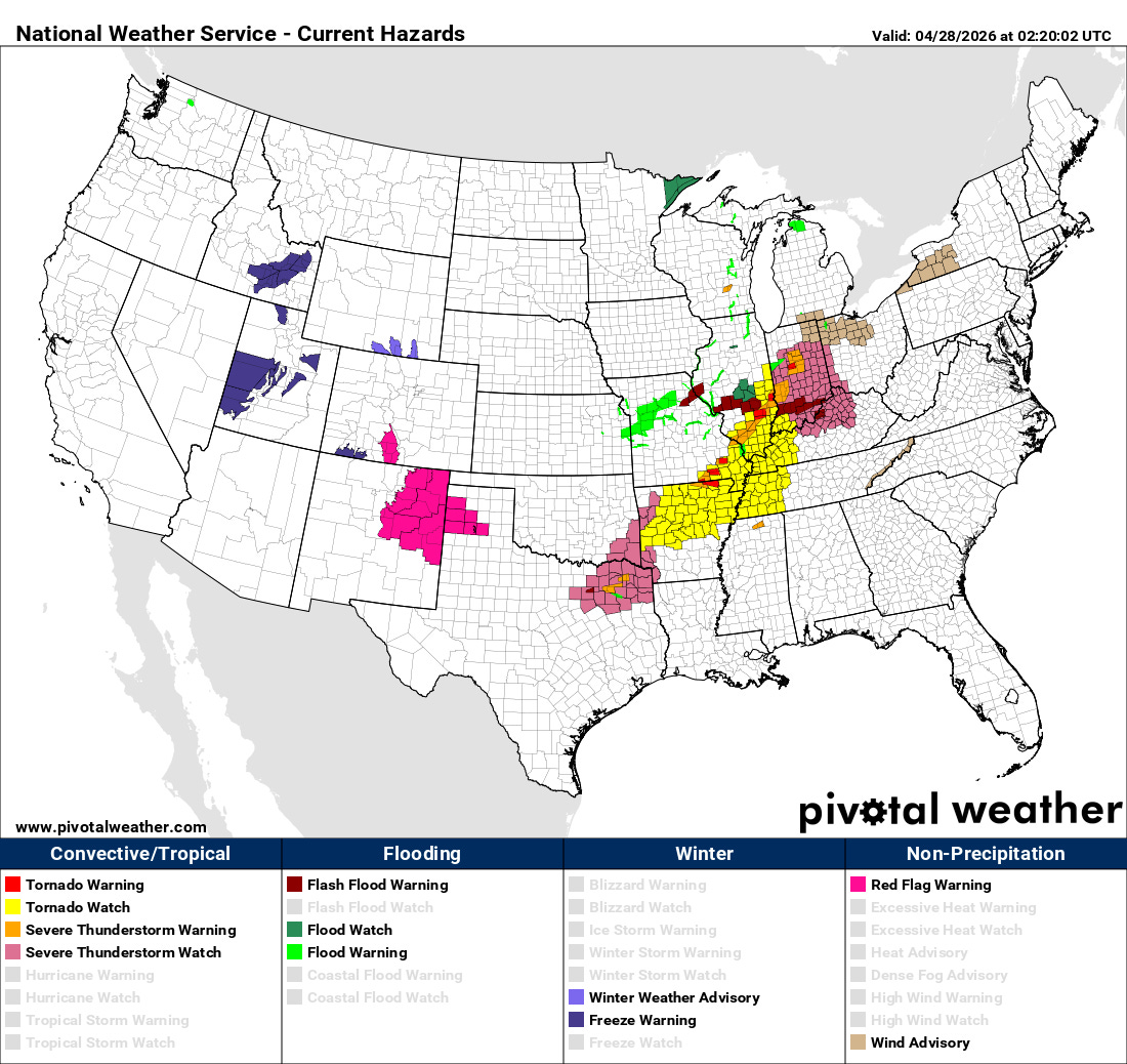
As a result, tornado watches are in effect for the next several hours as these storms move east and southeast. The intensity of the line should start to wane as it moves farther east into more stable air across the Tennessee Valley after midnight, but at least of slight risk of severe weather including damaging winds and a few tornadoes will continue into the early morning hours.
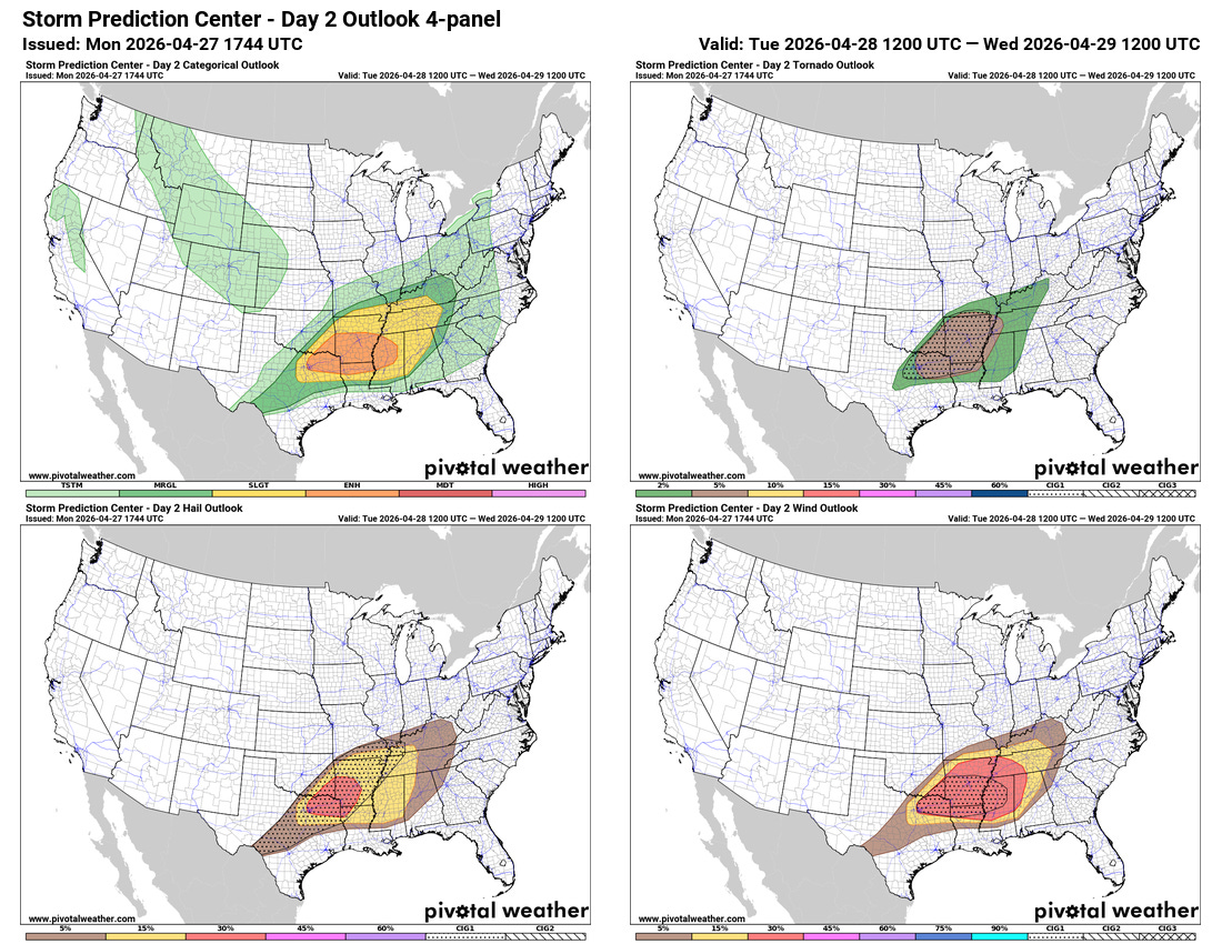
Tuesday is anticipated to be another busy day of severe weather, with an enhanced (level 3 of 5) risk of severe storms from the Arklatex east across northern Mississippi. As of now, it looks like a couple of waves of severe storms will move east-southeast across this region, supported by increasing middle and upper level winds and a very unstable atmosphere. Damaging winds, very large hail and tornadoes will be possible with these storms.
I will be traveling home on Tuesday, so my updates may be more limited until the evening. However, if any major events or changes happen tonight or in the morning, I will get out at least a quick post.

Leave a comment