Level 4 of 5 risk for Mid-Mississippi Valley
Apr 27, 2026
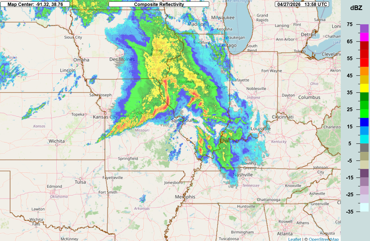
Good morning everyone, I just wanted to do a quick post to update the severe weather risk for today. The radar at 9 am CT shows a band of strong thunderstorms crossing the Mississippi River north of St. Louis and extending back to west central Missouri. This band of storms is moving to the east — and the widespread cloudiness and precipitation in areas of northern Illinois and eastern Iowa should temper the magnitude of the severe weather risk in these areas today.
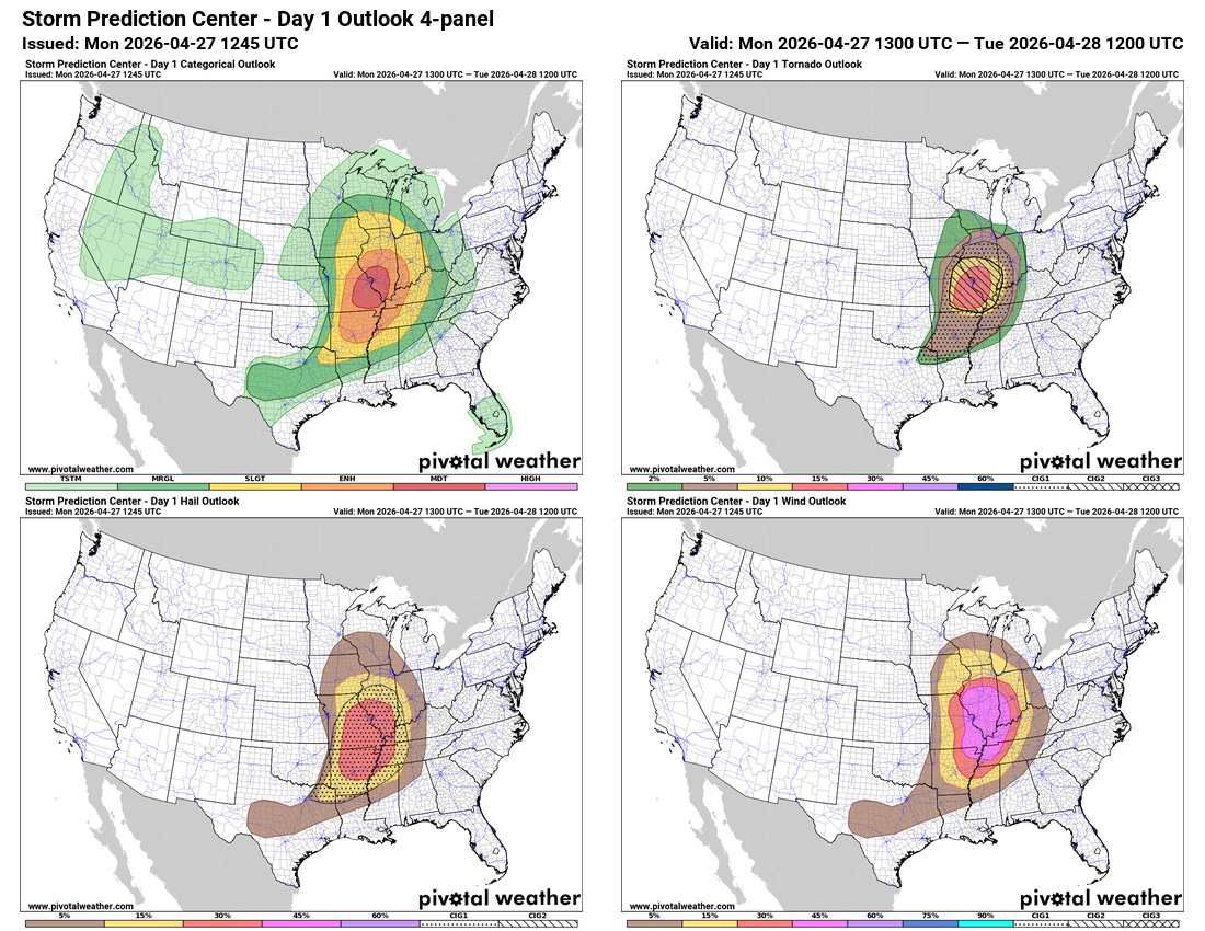
This has resulted in the Storm Prediction Center reducing the risk of severe weather for today in these areas, and as I discussed in last night’s post the greatest risk for significant severe weather appears as if it will focus this afternoon and evening from central Illinois into parts of the Mid-South with an enhanced risk for potentially intense tornadoes across east central and southeast Missouri and southern Illinois. SPC has upgraded that area to a moderate (level 4 of 5) risk of severe weather today.
The risk of supercell severe storms — capable of very large hail and significant tornadoes — should increase in the mid afternoon and continue into the evening hours across this region. By late evening, it is expected that the storms will form into a squall line which will push east into the Ohio and Tennessee Valley regions with a risk of damaging winds and tornadoes.

Some of these thunderstorms across the Mid-Mississippi Valley will be training west to east today, resulting in localized very heavy rainfall that could post a risk of flash flooding. A slight (level 2 of 4) risk of flash flooding is in place as shown above.
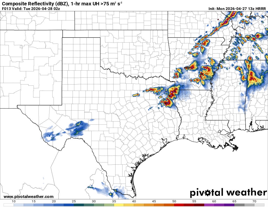
Another area I want to highlight is from the Arklatex northeast toward Memphis. While this area is to the southwest of the main area of focus over the Mississippi Valley, the short range models have been trending toward more widespread thunderstorm development in this region late this afternoon and evening (latest High Resolution Rapid Refresh forecast radar for 9 pm CT shown as an example). Conditions are expected to be quite favorable for intense supercell storms with very large hail and possible tornadoes in this region.
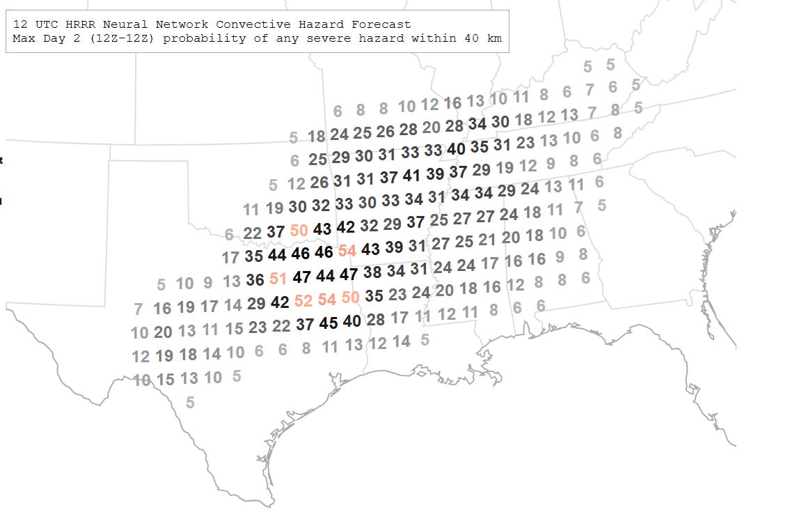
As the cold front associated with today’s severe weather sags into the South on Tuesday, it will provide the focus for additional severe storm development across a broad area from Texas into the Mid-South as shown in this morning National Center for Atmospheric Research AI forecast of severe weather probabilities.
I will be providing updates on the severe weather today via social media, Substack notes and potentially another article or two. Additionally, I am planning to do an ongoing Substack Chat about the evolving severe weather risks and potentially a live video update or two. As a reminder, access to these features are a benefit that paid subscribers receive for their support of Balanced Weather — any videos will of course be made available to all subscribers as soon as I can get them processed.

Leave a comment