Significant severe weather and wildfire risks across the Plains and Midwest, while record warmth builds east
May 15, 2026
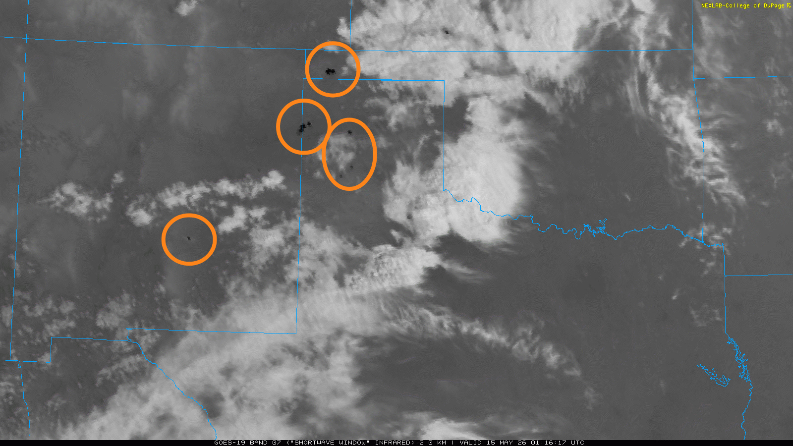
Starting off today with fire weather issues. Yesterday a combination of very dry conditions, lightning from high-based, dry thunderstorms and strong westerly winds yielded a number of wildfires developing and spreading across eastern New Mexico, southwest Kansas and the Texas and Oklahoma Panhandles. Several of the fires were large enough to be clearly visible as dark “hot spots” on shortwave infrared satellite imagery as seen above. Mandatory evacuations resulted from some of the rapidly spreading fires.
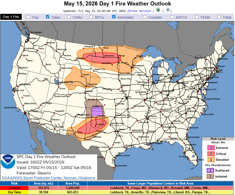
Similar weather conditions are anticipated across the Southern Plains this afternoon, with critical wildfire and dry thunderstorm areas outlined across the region by the Storm Prediction Center.
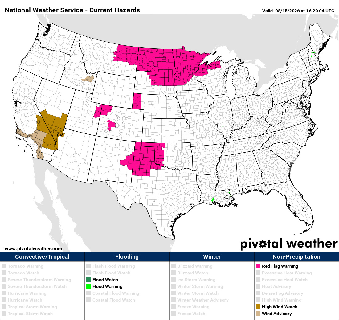
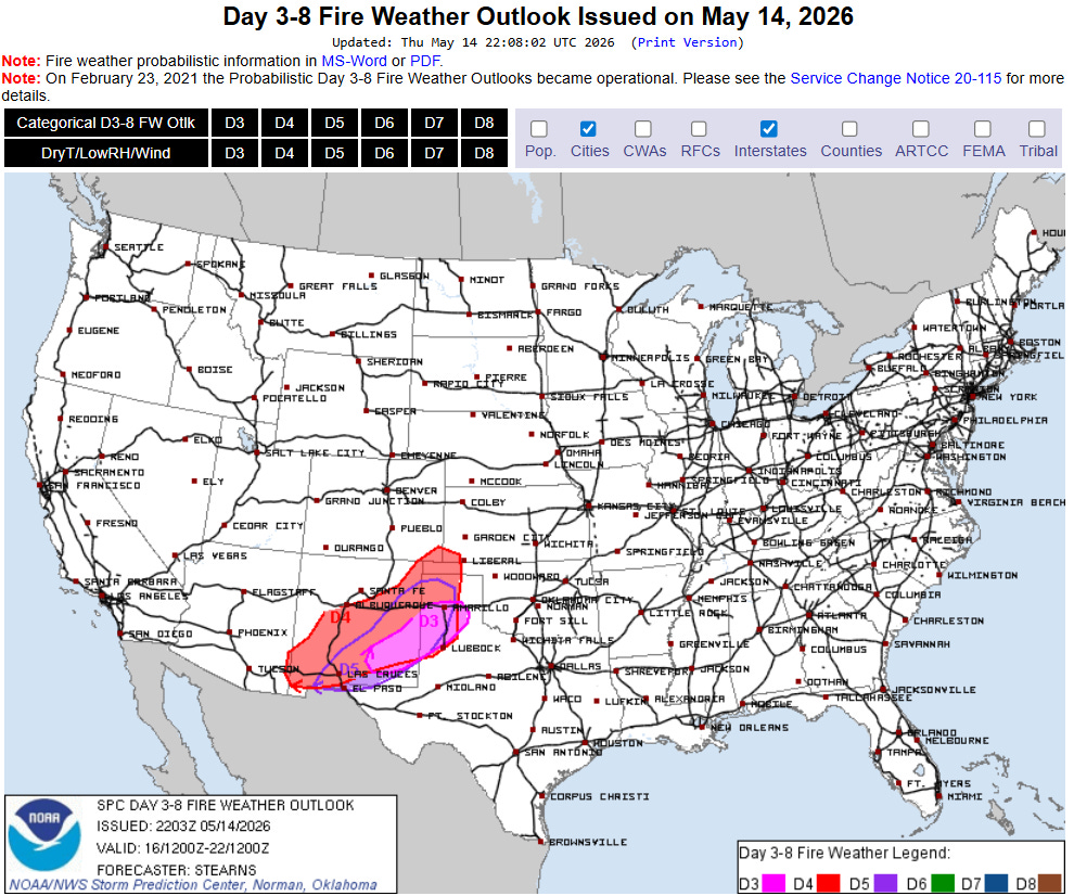
Red Flag Warnings for heightened wildfire danger are in effect across this area, as well as for much of the Northern Plains and Upper Midwest where gusty westerly winds, dry air and ongoing drought are expected to produce dangerous wildfire conditions.
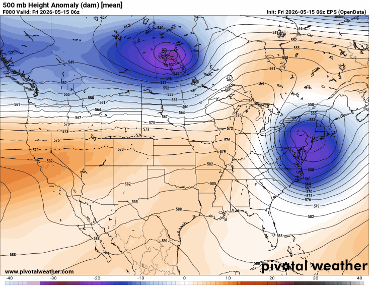
The upper level weather pattern over the next several days will be dominated by an evolving trough of low pressure over the West and downstream anomalous high pressure ridge centered along the East Coast. In between, the weather will be very active as upper level weather disturbances eject northeast ahead of the trough. A north-south dryline — a boundary between unusually moist air to its east and very dry air to its west — will develop over the High Plains. East of the dryline multiple days of heightened severe thunderstorm risks will exist, while to the west of it strong westerly wind, dry air, drought and high-based dry thunderstorm activity will fuel critical fire danger.
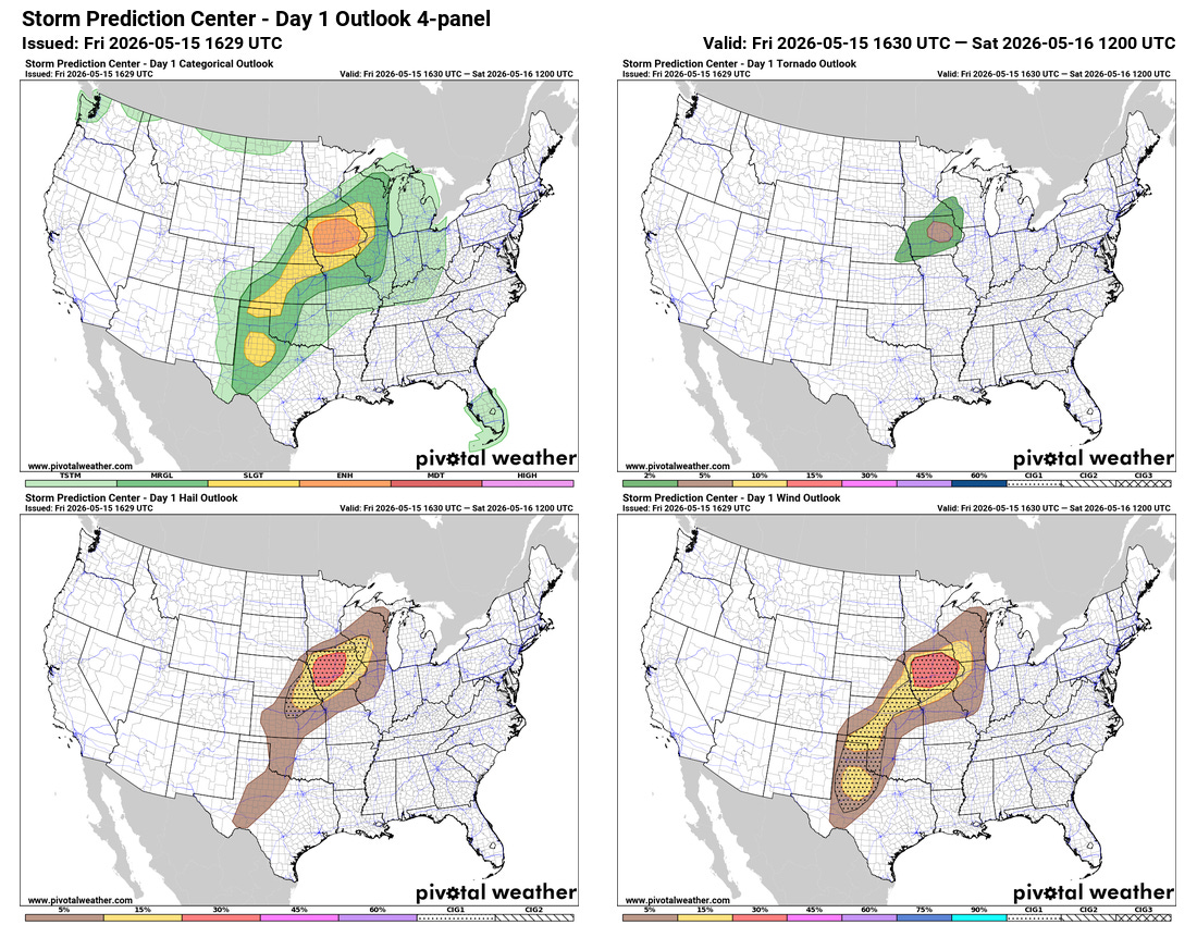
This severe weather risk will get going in earnest today across Iowa where SPC has placed an enhanced (level 3 of 5) risk. Supercell severe thunderstorms with the potential for very large hail and a few tornadoes are expected to develop late this afternoon near the Missouri River and spread east as they organize into more of a line of storms. This line should have an increasing risk of damaging winds and a few tornadoes into this evening. Other more isolated supercell storms are possible farther southwest into Kansas — while west of the dryline high-based thunderstorms could produce dry microbursts with significant severe wind gusts along with enhancing wildfire danger.

Severe weather will continue to be a serious risk — including the potential for the most intense storms to produce very large hail, strong tornadoes and significant straight line wind damage — across the central part of the country through the weekend as shown above by the NCAR AI severe weather probabilities based on the European ensemble model.
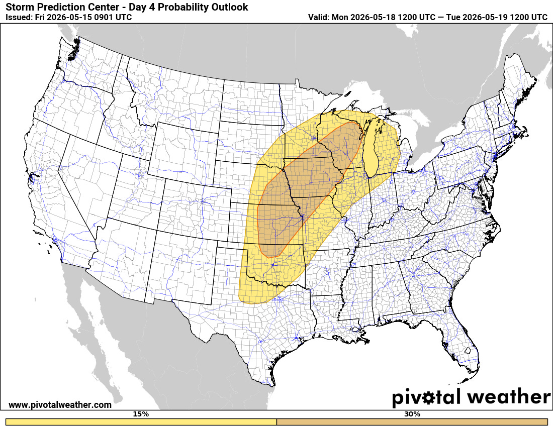
As the main upper level weather disturbance starts to eject northeast on Monday, SPC is explicitly discussing the potential for a severe weather outbreak — again with possible strong tornadoes — across a large part of the Midwest and Plains.
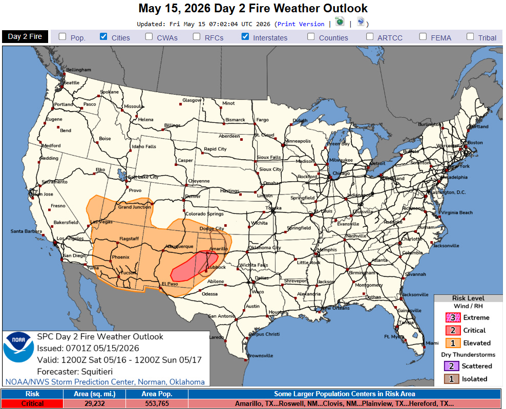
Critical wildfire danger will continue west of the dryline across the Southern High Plains into parts of far southeast Arizona.
Another weather story into early next week will continue to be record warmth, with record warm minimums becoming particularly numerous and widespread (NWS forecast near record mins for Monday shown above) due to very warm and moist air coming north off the anomalously warm Gulf of Mexico.
Programming note: As a reminder with severe weather expected the next several days that as my schedule permits I will be doing live Substack chats and occasional videos with updates and interesting things I see. These are benefits that paid Balanced Weather subscribers receive in thanks for their support. Any videos I do will be available as soon as I can get them processed as posts and on my YouTube Channel.

Leave a comment