
Additional flash flooding risks in coming days
May 21, 2026
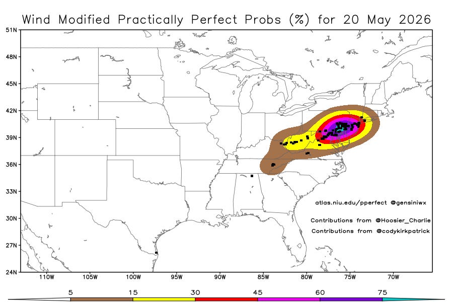
After days of the central U.S. being the focus of severe thunderstorm activity, the Mid-Atlantic got in on the action Wednesday as a band of strong to severe storms with damaging winds developed along a cold front moving into record warm air. More than 100 reports of damaging wind were received from the region, including a number of reports of measured severe winds gusts (58 mph or greater).
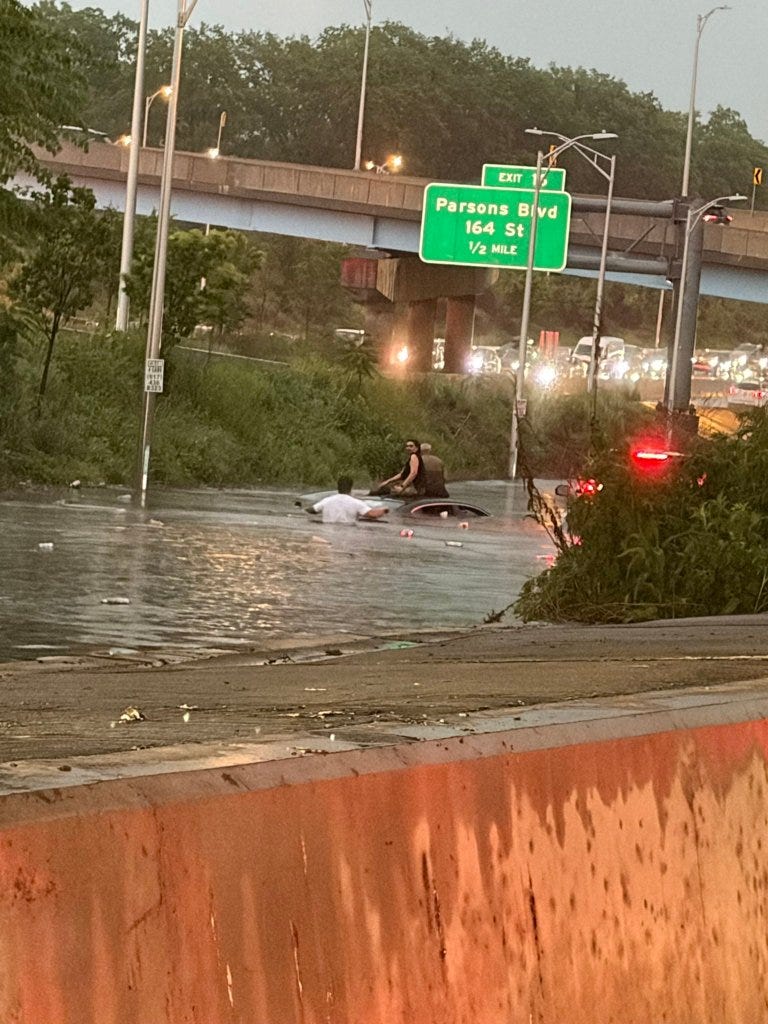
While the storms’ winds and lightning caused tens of thousands to lose power at their peak, even bigger impacts appear to have been from torrential downpours that caused flash flooding, particularly in the New York City metropolitan area. Storms with instantaneous rainfall rates of up to 5”/hour moved slowly across the region during evening rush hour, causing massive traffic and commuting issues including flooded subways. Luckily it does not sound like any lives were lost, though numerous stalled vehicles, closed highways and streets, and water rescues occurred.
NSSL’s Multi-radar Multi-sensor (MRMS) system is probably the main tool meteorologists have to monitor rainfall rates and associated impacts in situations like this, and this loop of rainfall rates from last evening shows thunderstorms with more than 5” per hour rates moving across the hardest hit areas of Brooklyn and Queens during the rush hour period. Rain gages in the area measured more than 2” of rain in an hour’s time.
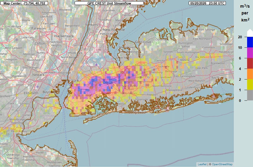
The MRMS FLASH unit streamflow product — generated by running the MRMS rainfall estimates through a hydrologic model to provide meteorologists with real-time inundation estimates — clearly shows the impact of this heavy rainfall on the urban environment. Unit streamflow values of greater than 10 are highly correlated with serious urban and flash flood impacts.
These sorts of situations are particularly challenging for warning meteorologists, as anticipating these localized heavy rainfall events and issuing flash flood warnings with any sort of lead time to spur proactive societal measures is very challenging — this is why I have long though that rapidly updating storm-scale weather modeling systems like NSSL’s Warn-on-Forecast System (WoFS) may have an even bigger positive impact on improving the weather enterprise’s flash flood services than for severe thunderstorms.
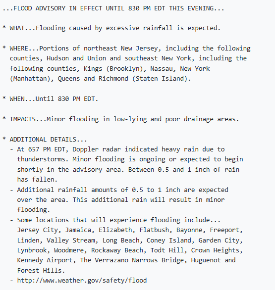
Having stated the challenges, I am very confused by the NWS choice to only issue a flood advisory (above issued at 657 pm ET) in this situation. I could understand an advisory being the initial product issued given that an office like NWS New York does not want to issue a flash flood warning for every thunderstorm moving through the area. However, once the MRMS products started providing the signals above and (I assume) reports of flooding started being received, it would seem like the issuance of a flash flood warning was clearly needed to alert people of the need to stay off of area roadways and get out of vulnerable areas.
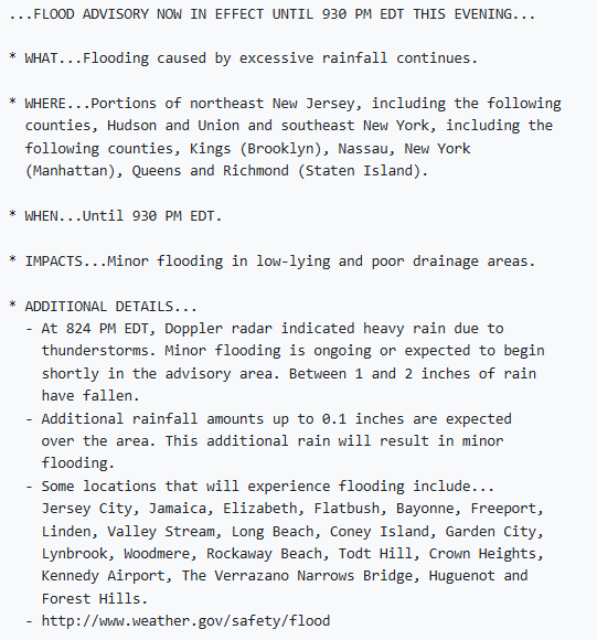
Yet even at 824 pm ET — about 30 minutes after the FLASH product above — this was the advisory the NWS issued about the ongoing flooding.
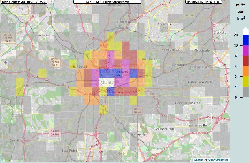
What is particularly interesting is that a very similar urban flash flood situation occurred during evening rush hour yesterday in Atlanta. Thunderstorms moved through the downtown Atlanta area late in the afternoon, producing similar rainfall amounts to the NYC storms (2+” in an hour) and caused similar major impacts to the evening commute.
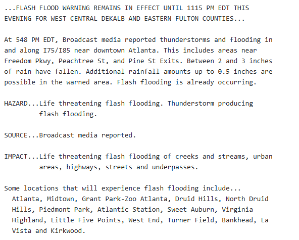
NWS Atlanta handled the situation very differently (and in my opinion, more effectively). The issued a flash flood warning — which receives more attention and widespread dissemination than a flood advisory — at 516 pm ET. Once reports of impacts began being received, they upgraded the warning to a “considerable” flash flood warning in the statement above, which triggers the Wireless Emergency Alert system on cell phones.
I want to be clear that these sorts of differences in how local NWS offices handle similar situations is not some sort of new phenomenon. This inconsistent service has been ongoing for many years — and is particularly a problem in the flash flood and hydrology programs where the NWS warning and product suite is incredibly complex and opaque. A big reason for these issues in my opinion has been a lack of NWS leadership focus on the severe weather, flash flood and hydrology service programs for many years — a topic I intend to cover more deeply in future posts.
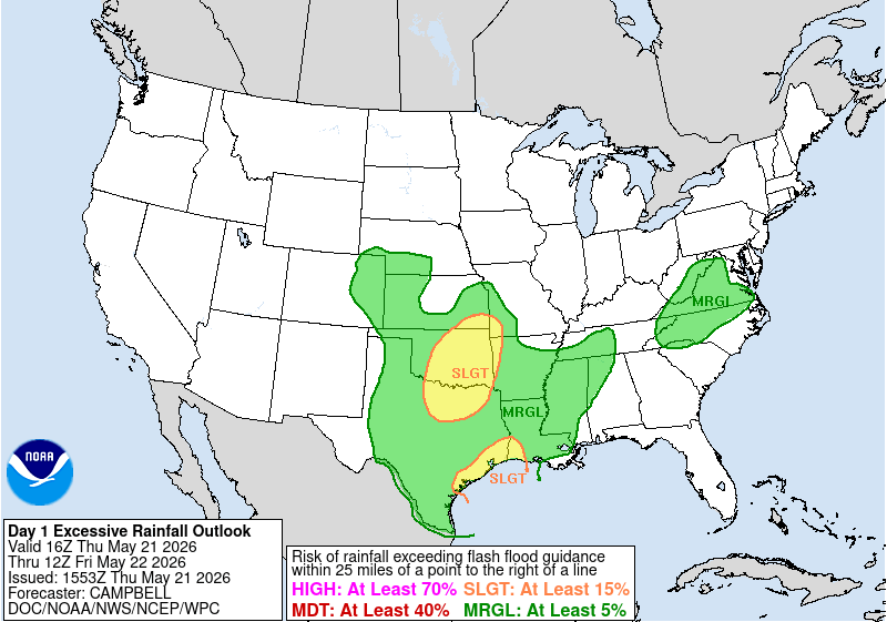
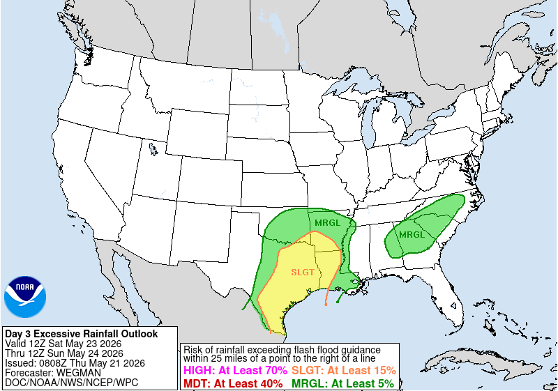
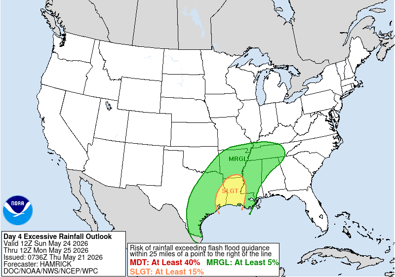
We will likely have plenty of opportunities to talk about flash flooding in the next several days, as thunderstorms with heavy rainfall will provide a flash flood risk in the south central United States. More to come on these risks in the coming days.


Leave a Reply