
Intense western Europe heatwave continues with national monthly records broken
May 25, 2026
I am going to be traveling tomorrow and probably will not be able to do a post — and with a couple of big weather stories happening today, I wanted to get a newsletter out this evening to discuss them.
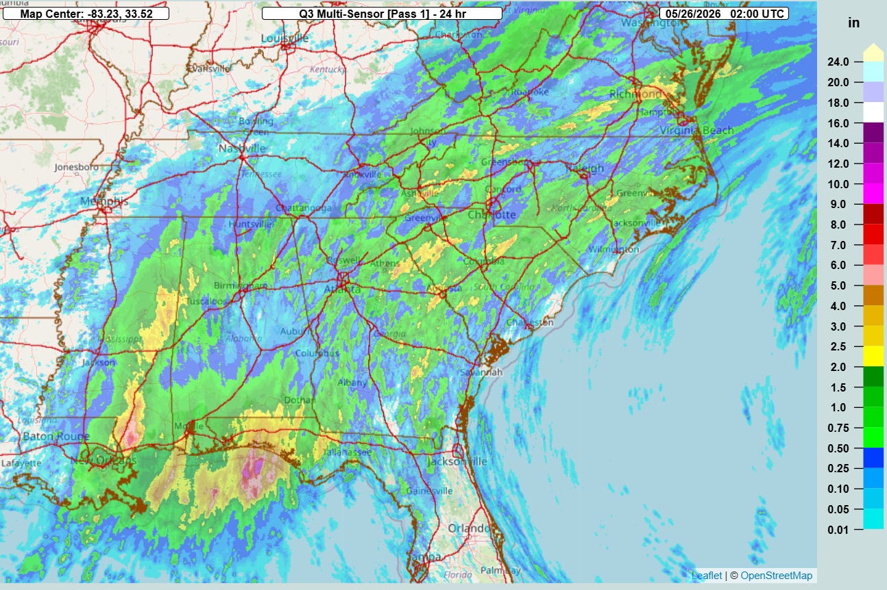
As I discussed in this morning’s newsletter, training thunderstorms with torrential downpours produced areas of heavy rainfall across the Gulf Coast and Southeast today.
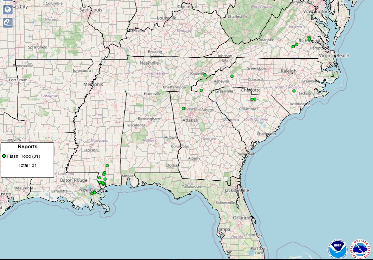
A number of reports of flash flooding were received from the areas where the heaviest rain fell.
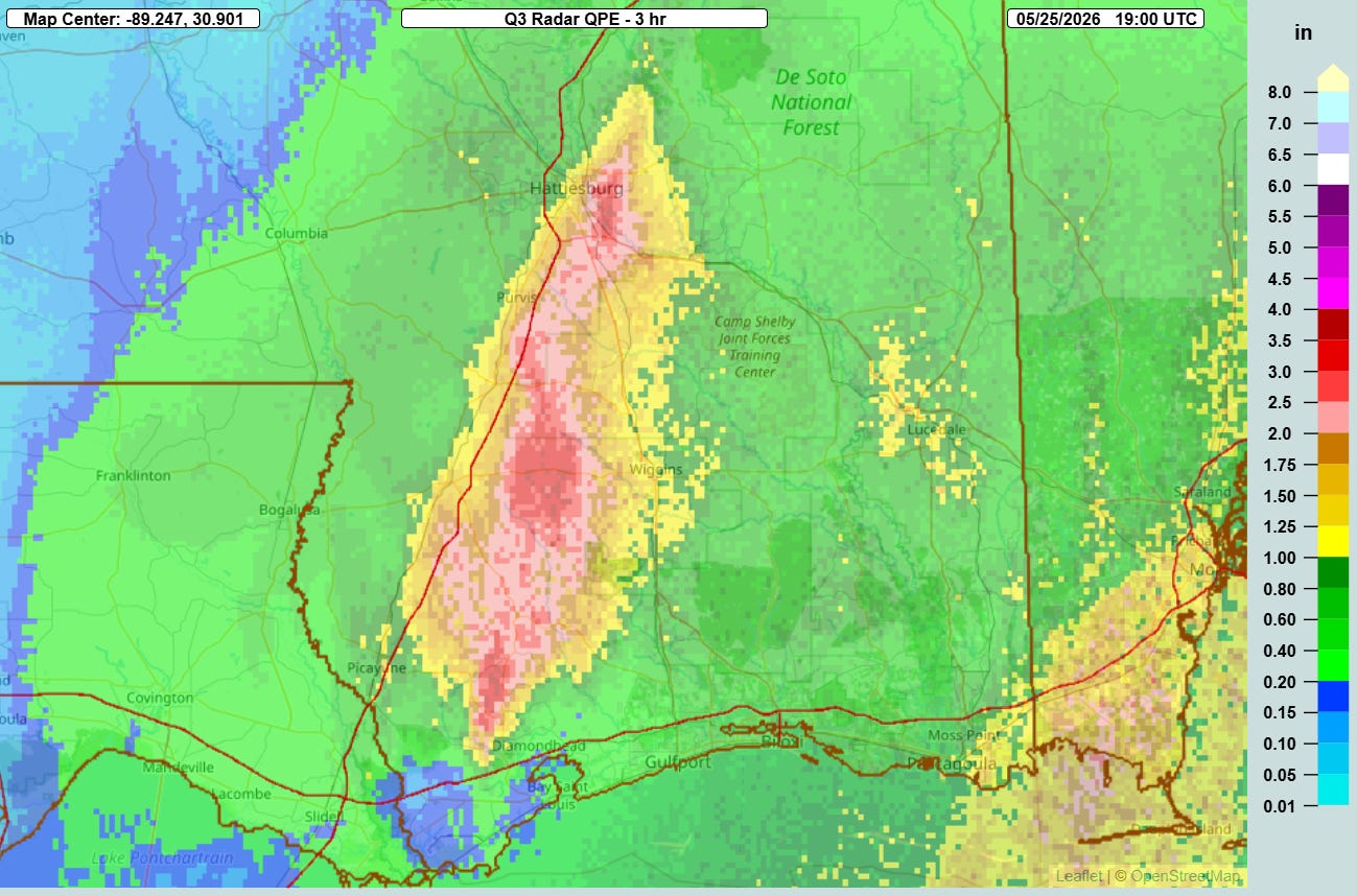
The peak of rainfall and flash flooding evolved in southeast Mississippi during the midday hours, with as much as 4” of rain falling in 3 hours per MRMS radar estimates.
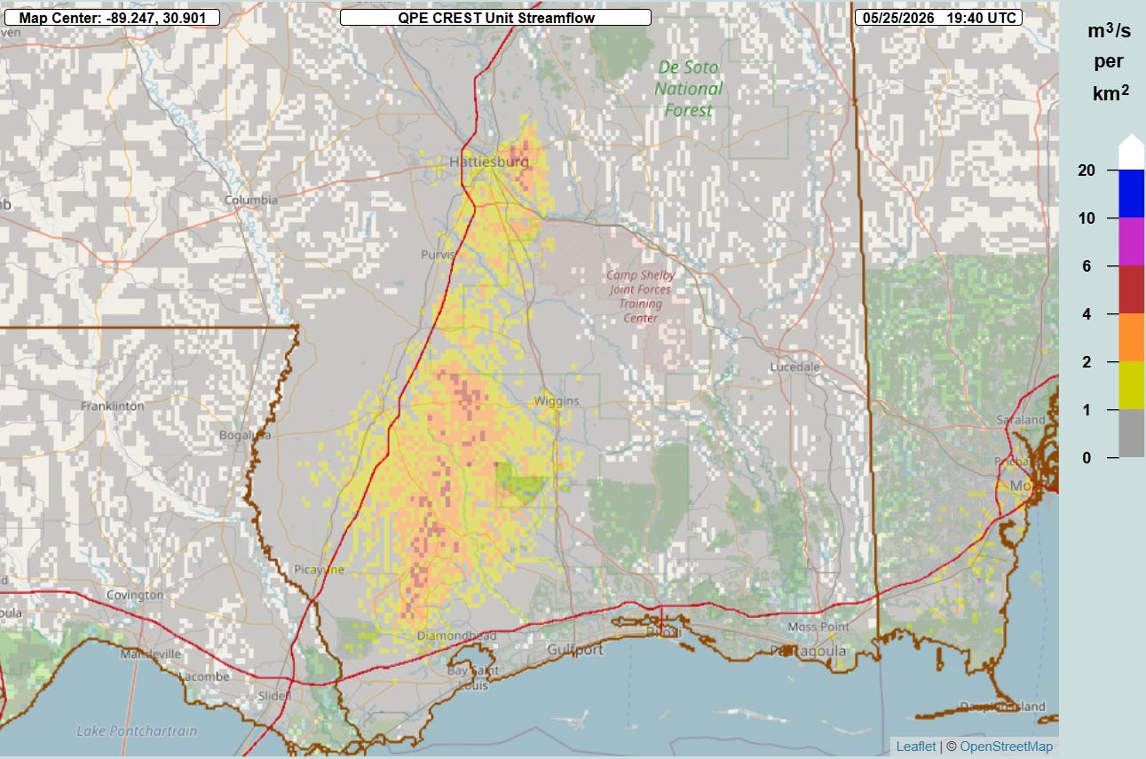
The high rainfall rates resulted in flash flooding, with the MRMS FLASH unit streamflow product showing values approaching 10, indicative of potentially significant inundation.

Unfortunately, in the urban area around Hattiesburg a woman was killed when flash flooding swept away her SUV.
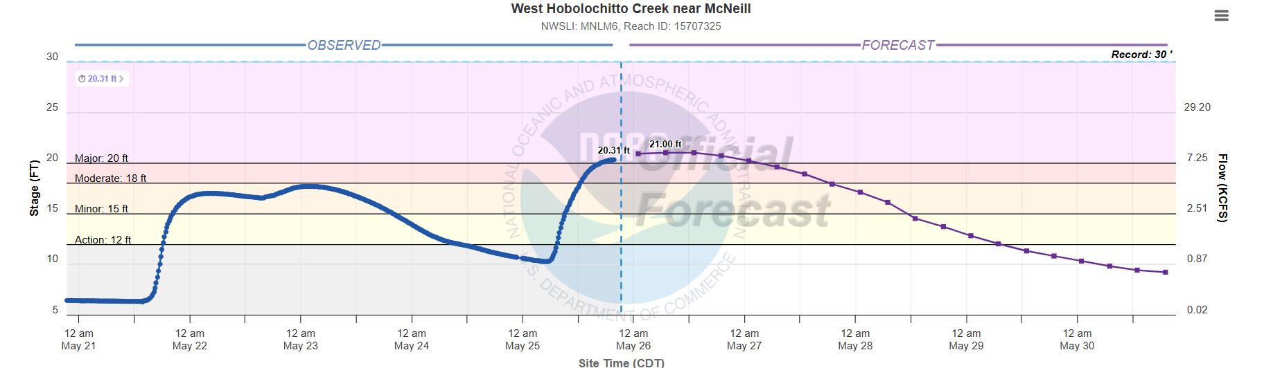
Some of the heaviest rainfall occurred along the axis of the Hobolochitto Creek stream basin, resulting in moderate to major flooding on both the west and east forks of the creek in Pearl River County, MS with impacts to homes. NWS Slidell noted on social media that these will be the highest levels on these streams since Hurricane Katrina.
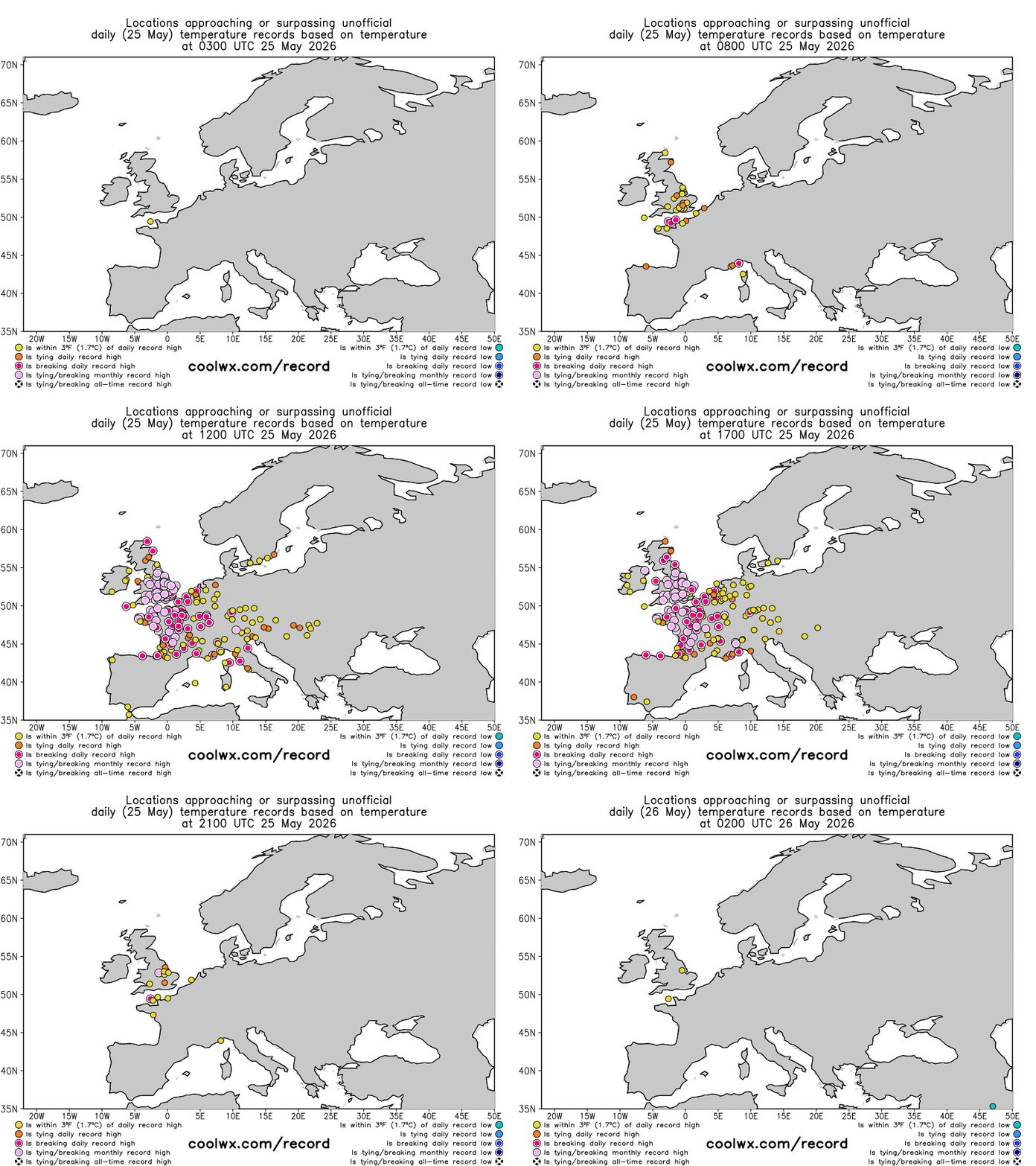
The other big weather story today was the incredible ongoing multiday heatwave in western Europe, where today dozens of locations in the United Kingdom, France and nearby areas set all-time record highs for the month of May.
Kew Gardens near London was one of 13 sites in England that the UK Met Office reported as exceeding England and the UK’s national May maximum temperature record today. With a high of 95F, Kew Gardens shattered the previous national record by 2C/4F. Climatologist M. Herrera on his Extreme Temperatures Around the World account noted that Ireland, Wales and the Channel Islands all set their national May records as well. In fact, the Channel Islands broke their previous May record by 5C (!) and also their June record when the Maison St. Louis observatory reached 31.9C (89F).
After a night of potentially record warm minimums, even hotter temperatures will be possible over this same area on Tuesday as this incredible heat wave continues.


Leave a Reply