
Explaining the GFS “fantasy cane” problem, but also how we can anticipate real threats.
May 28, 2026
I want to start off today’s newsletter by highlighting a new piece from my friend and colleague Matt Lanza’s Substack. Matt has lived in Houston and done a terrific job covering Gulf Coast weather for many years, and today shared a thought provoking piece about recent research showing that New Orleans needs to start planning “relocation” now due to the anticipated timing of sea level rise in the coming decades due to climate change. Matt really does a great job talking about the human beings affected by these impacts of climate change, and why the communication of the science is as important as the science itself. As someone who loves the Gulf Coast and thinks that New Orleans is its crown jewel, I really encourage you to read Matt’s post.
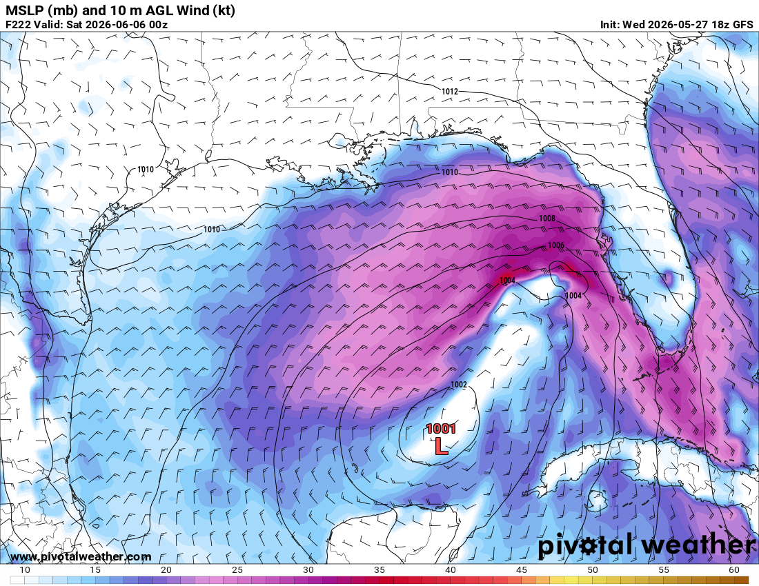
Speaking of Gulf Coast weather, they call The Masters golf tournament a “tradition unlike any other” — but in my opinion, the start of hurricane season and the US global weather model (GFS) spinning up fantasy tropical storms and hurricanes in the Gulf of Mexico is the true annual tradition with no parallel. The GFS has been showing tropical systems developing in the Gulf in recent long range forecasts, and the typical social media barrage of posts with images like the one above (a forecast from yesterday’ afternoon’s GFS model for next week) showing a “tropical threat” has started.
This happens every year because the GFS has a very well-known bias of overproducing tropical cyclones — and that bias is particularly pronounced early in the season. It enables a lot of social media hype generators to get people wound up about hurricane threats right off the bat — but I want to emphasize that this is a known problem with the model, not a sign of something real in the atmosphere.
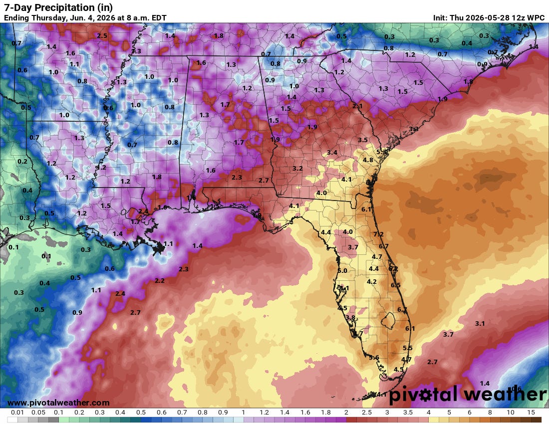
Of course the fact that the GFS has this issue does not preclude the possibility that the real atmosphere will not produce an actual tropical system. June 1 is the official start of the Atlantic hurricane season, and there are meteorological reasons to be particularly alert to development in the Gulf as we head into an El Nino. The weather pattern definitely looks as if it will become increasingly disturbed in the Gulf and southwest Atlantic the next several days, as an active subtropical jet stream moves disturbances through the region producing areas of showers and thunderstorms with heavy rainfall.
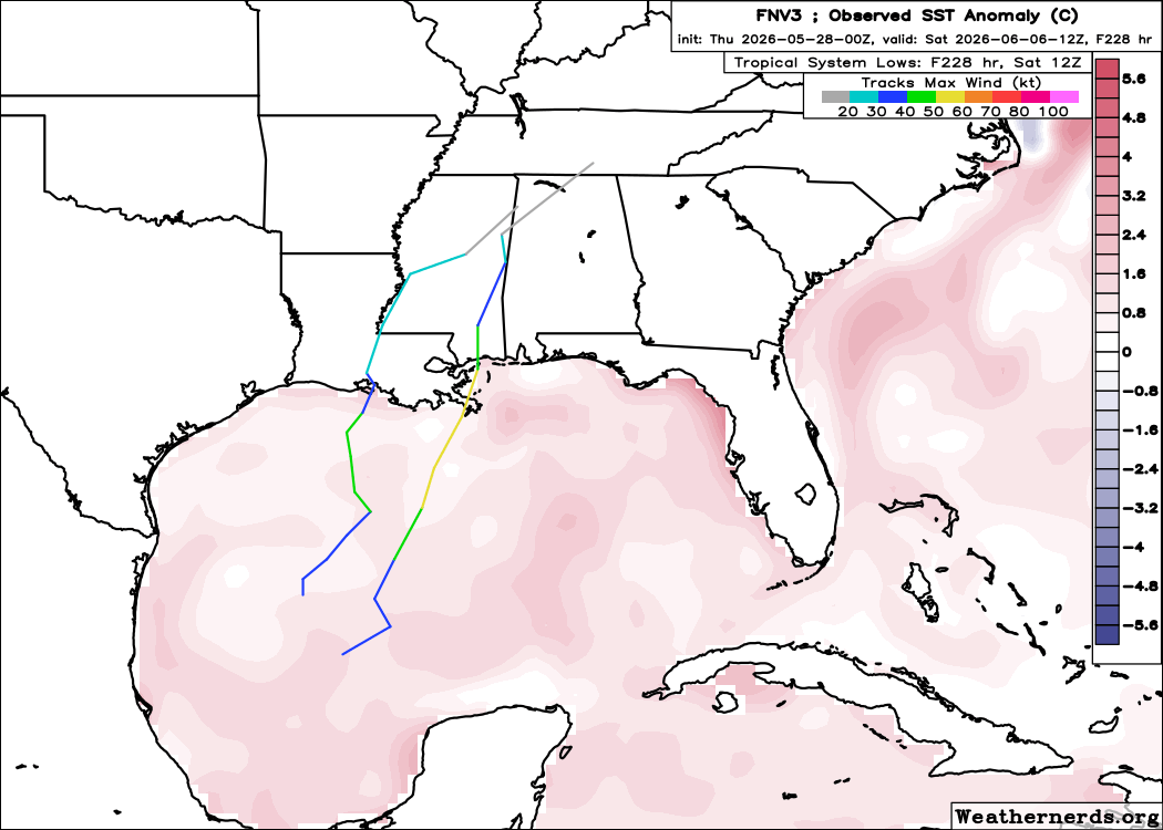
This is a pattern where an early season (typically weak but heavy rainfall producing) tropical system can certainly develop, and some of the other models besides the GFS are hinting at that potential. Recent runs of the European and Google DeepMind ensembles have a few members showing a system evolving, but as of now the signal is pretty weak given the percentage of members showing a system is less than 10%. Obviously we will be keeping an eye on it as we go into early June — but currently there is nothing to be overly concerned about other than an increased risk for heavy rain in parts of the Gulf Coast and Southeast which will help drought conditions but also potentially cause some flash flooding.
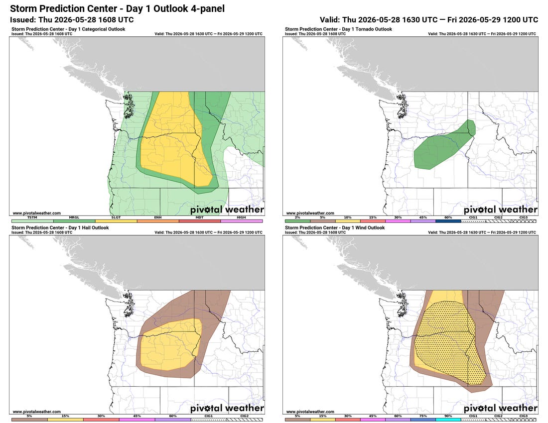
Something else I will be keeping an eye on today will be a somewhat unusual risk for organized severe thunderstorms in Pacific Northwest region, focused in eastern Washington and Oregon. An upper level trough of low pressure moving into a warm and relatively moist (for the region) airmass will support the development of scattered severe thunderstorms including some rotating supercells. Damaging wind gusts (some potentially greater than 75 mph), large hail and even a couple of tornadoes appear likely.


Leave a Reply