
Reminder of the critical role weather radar plays for our society
May 29, 2026
Last night when the Blue Origin New Glenn rocket exploded in a massive fireball on its launchpad at Cape Canaveral, the nearby National Weather Service WSR-88D (NEXRAD) Doppler weather radar at Melbourne, FL captured the dramatic event during its routine meteorological scanning.
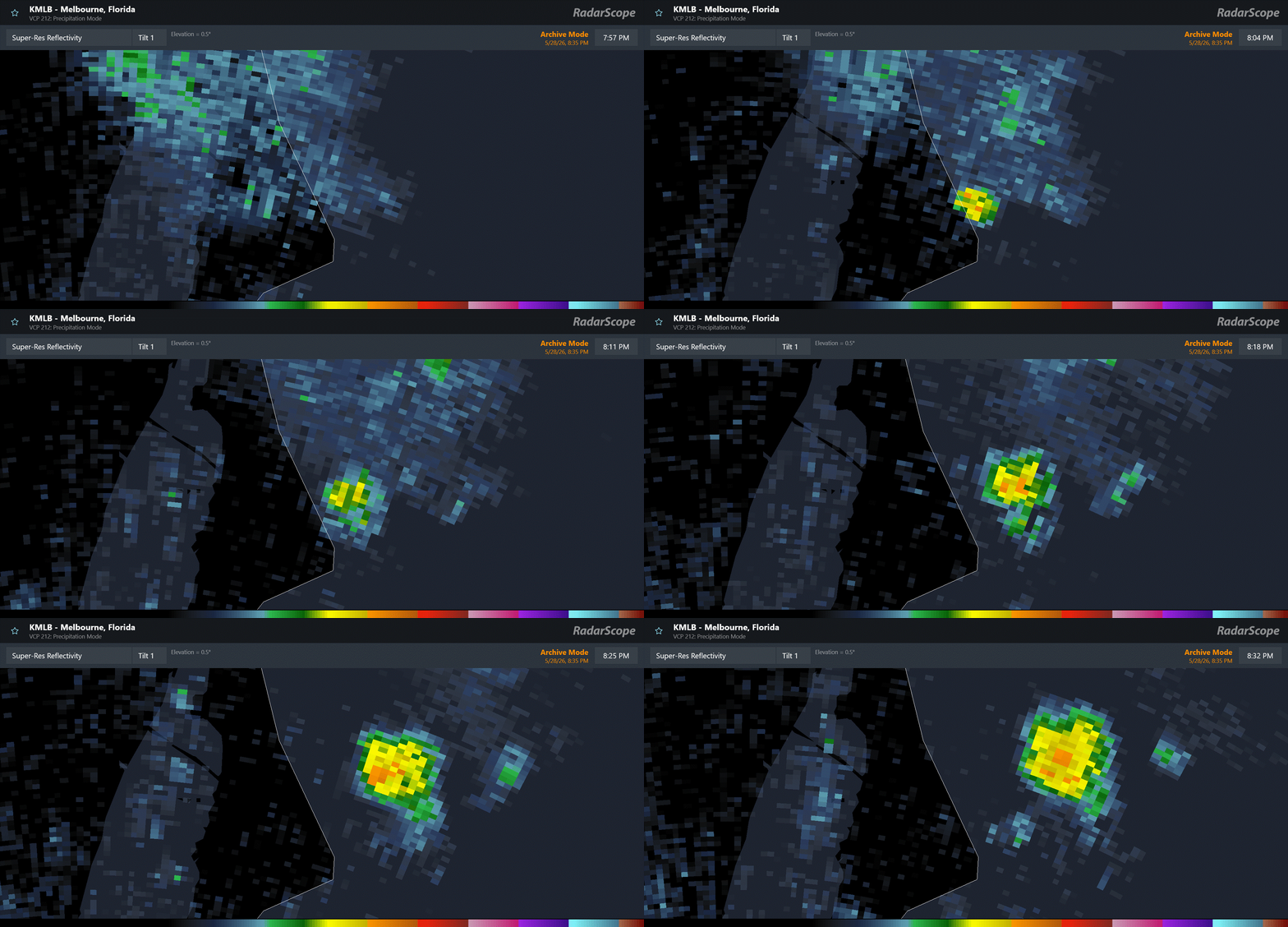
In this animation of reflectivity data (the power returned to the radar from its emitted energy), a small but relatively high area of reflectivity appears over the launchpad site at 8 pm CT, the time the rocket exploded. With time, the echoes expand and drift northeast with the low level winds.
We know that this is the debris from the explosion not just because of its appearance at the time of the incident. When non-meteorological targets are detected by the NEXRAD, they have distinct characteristics in dual-polarization data that enable scientists to recognize it as debris rather than precipitation.
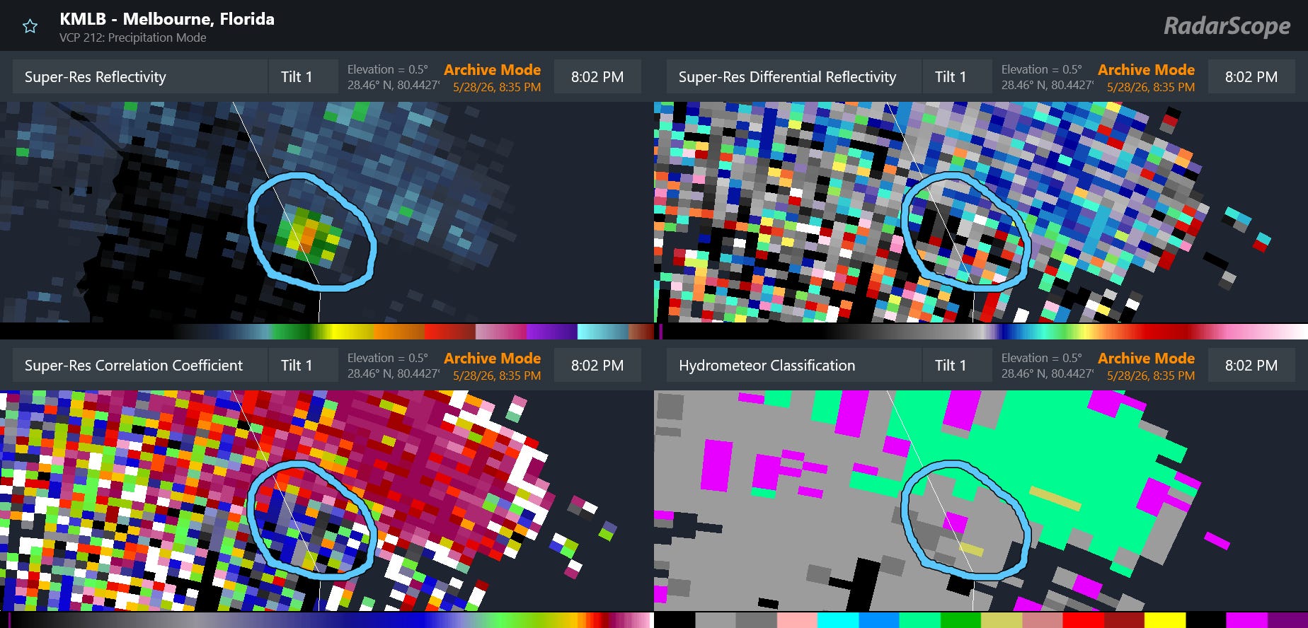
In the 4-panel display of radar data from 8:02 pm CT, the correlation coefficient data shows very low values with the debris — very different from the meteorological echoes to the north and northeast. This is very similar to the tornadic debris signature (TDS) we see when debris is lofted by tornadoes. My retired NOAA colleague Ken Howard — who has extensively studied the use of weather radar to track space debris — told me that the debris signature with an explosion like this is most like a TDS immediately afterwards. With time, it begins to exhibit some characteristics similar to a volcanic ash plume. Interestingly, the radar algorithm that provides automated guidance regarding what sort of target is being detected identified the targets as ground clutter or “unknown” — but was able to distinguish that it was not precipitation.
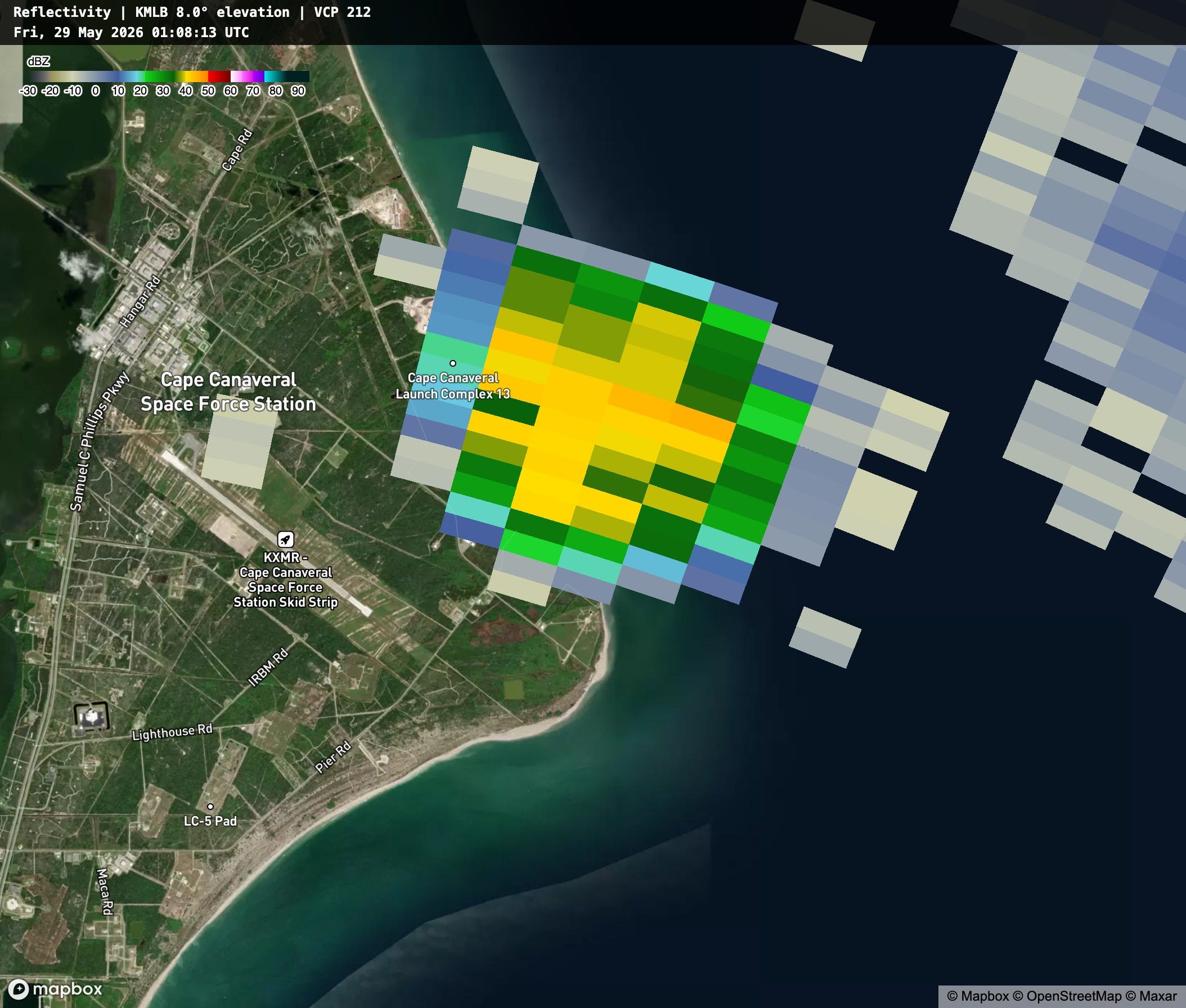
The radar data I showed above was all from the lowest elevation of the radar, but NEXRAD radars operate using “volume coverage patterns” that also gather data from aloft. This image is an 8 degree reflectivity image from 8:08 pm, enabling us to see that the debris has already rapidly reached at least 20,000 ft AGL.
All NEXRAD radar data is permanently archived and immediately available for forensic analysis for events such as this. After the Columbia Space Shuttle tragedy in 2001, radar data from the Shreveport, LA radar clearly showed the debris plume reentering the atmosphere, and was utilized by the military crews responsible for the search and salvage of the wreckage. Local officials along the Florida Space Coast are warning that the debris radar showed moving over the Atlantic after the explosion last night may now be washing ashore on area beaches and should be avoided.
Events like this serve as a reminder of the role our national NEXRAD Doppler weather radar network plays in providing critical info about an incredible variety of meteorological and non-meteorological hazards. As I have discussed in earlier posts, that network is now more than three decades old and dealing with increasing maintenance issues, including failure of parts that budget and manufacturing issues are making harder to replace. With the Radar Next program, the NWS is developing a plan for a new replacement Doppler weather radar network, but even in a best case scenario the implementation of a new network is years away.
Congress and the administration need to recognize that our national Doppler weather radar network is truly a unique, invaluable part of our national critical infrastructure. Ensuring that the current network is maintained as effectively as possible and that a robust replacement network that will serve the nation in the coming decades should be a top priority for Congressional appropriators and NOAA officials going forward.


Leave a Reply