
“Debris Ballers” podcast looks at tornado emergencies
May 30, 2026
Good Saturday evening — sorry for no full newsletter today, I had a very busy day today helping my family at a library event in my hometown. I expect to have a full post sometime tomorrow. In the meantime, though, I wanted to share a couple of items of interest.
In keeping with yesterday’s theme of meteorological instruments being useful to observe non-meteorological phenomena, radar and satellite data was useful this afternoon in identifying and tracking a 3 foot wide meteor that entered the atmosphere over New England causing a loud explosive boom.
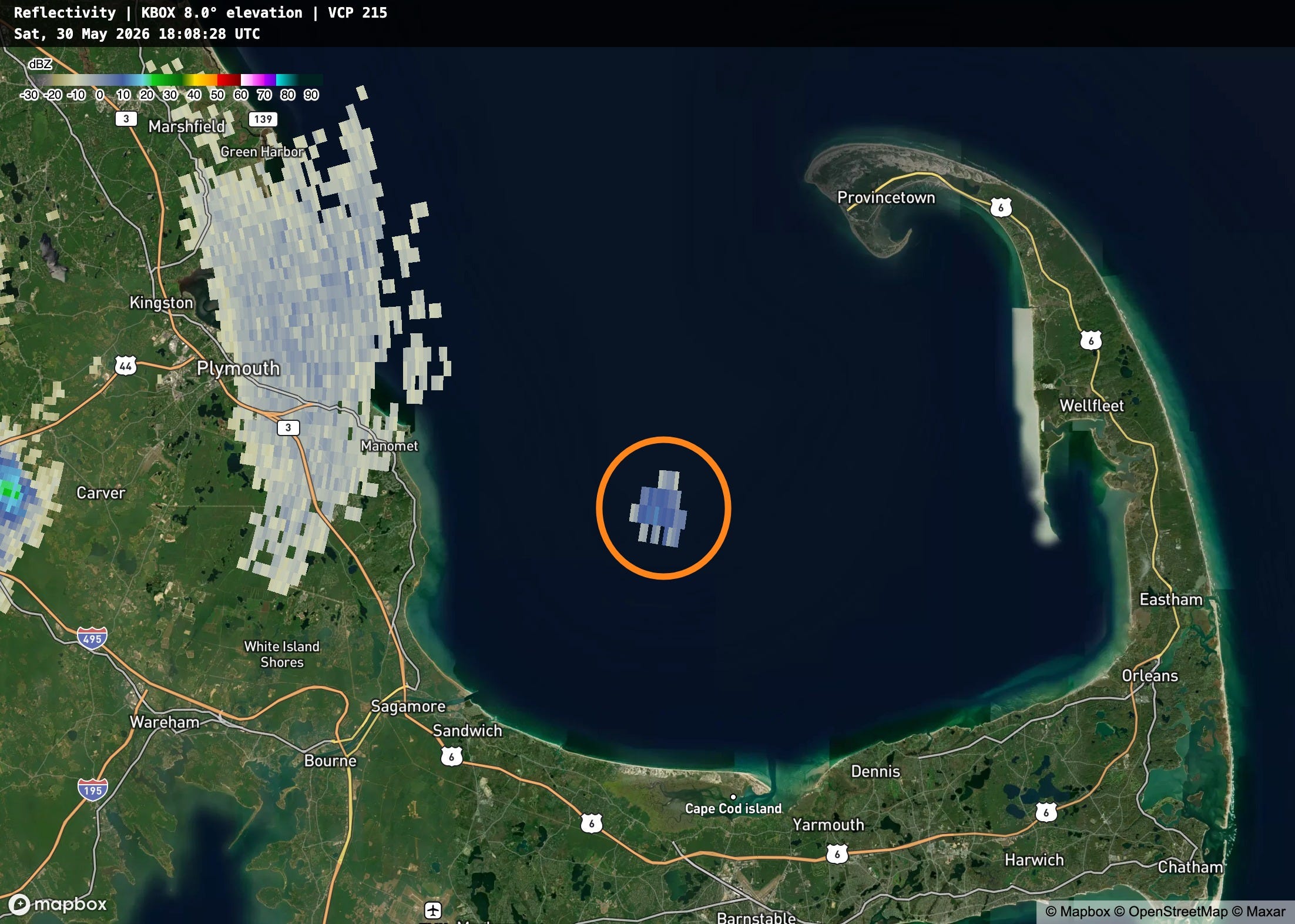
I actually posted back March about how radar and satellite data are useful in meteor detection after a meteor entered the atmosphere over the Great Lakes region. Today, the high elevation radar image above from the NWS Boston NEXRAD captured the signature of the meteor — my colleague Ken Howard reports that it was also visible on the NWS Portland, ME NEXRAD and Boston terminal Doppler radars. It was also captured by the satellite based GOES Lightning Mapper (GLM) instrument.
I also wanted to share that me and my Debris Baller colleagues have shared a new episode of our podcast focused on tornado emergencies. We took a deep dive into the history of this product and how the NWS came to issue this higher level of a tornado warning. We then took a detailed look at two recent tornado emergencies — one that was successful and one that appears to have been false alarm. It was a very interesting conversation to be a part of and we have already received a lot of feedback about it — you can check it out at the link below.


Leave a Reply