
New Mexico and west Texas look to become the focus for heavy rainfall by midweek
May 31, 2026
It has been a few days since I took a detailed look at US weather, so want to use today’s newsletter to do that.
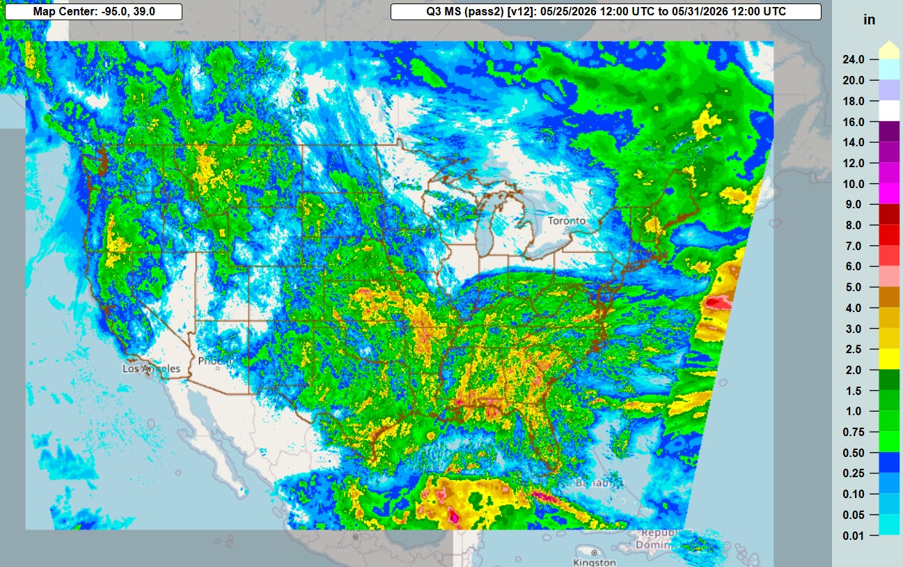
The multi-sensor weekly precip estimate from the NSSL Multi-Radar Multi-sensor system (MRMS) for the last week shows that precipitation was quite widespread across the nation — beneficial for many areas suffering from drought conditions.
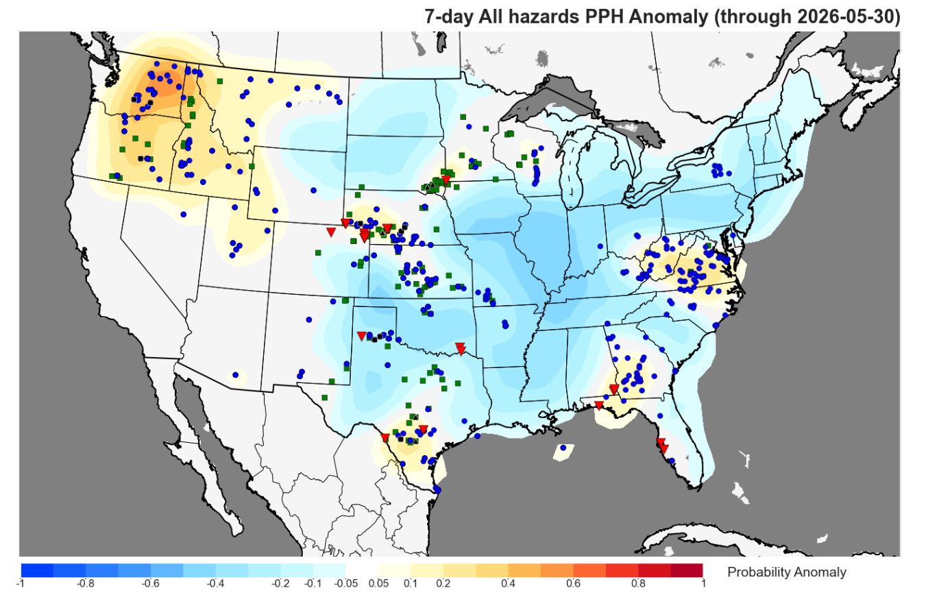
Rather unusually for the last week of May, we were able to obtain all this precipitation while severe weather was relatively benign, with much of the country experiencing below normal severe weather per the NSSL 7-day severe weather PPH anomaly analysis. The one notable exception was the Pacific Northwest, where an upper level trough of low pressure produced a number of severe thunderstorms on Thursday.
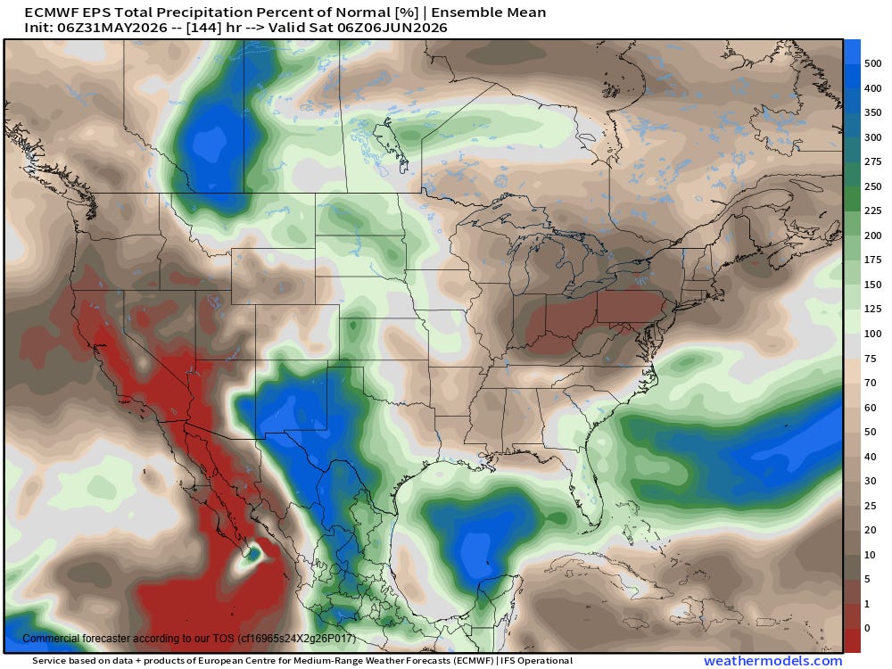
This upcoming week does not look quite as wet as last week, with the European ensemble model showing precipitation at or below normal for many areas. The big exception looks to be in New Mexico and western Texas, where a weak upper level trough of low pressure will tap into tropical moisture, producing periods of thunderstorms with heavy rainfall and potentially some flash flooding (but also drought benefits), particularly from Tuesday into the latter part of the week.
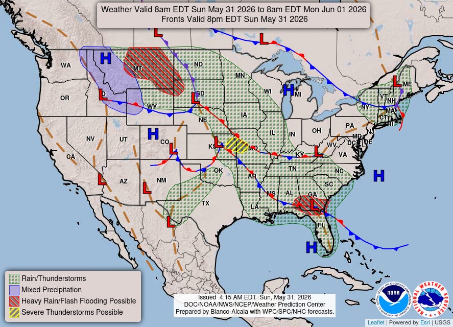
For this afternoon and evening, showers and storms will bring a flash flooding risk to parts of Montana and nearby areas, where a slight (level 2 of 4) risk of excessive rainfall is in place. Slow moving thunderstorms in a very moist environment will also bring a risk for some flash flooding in the Southeast.
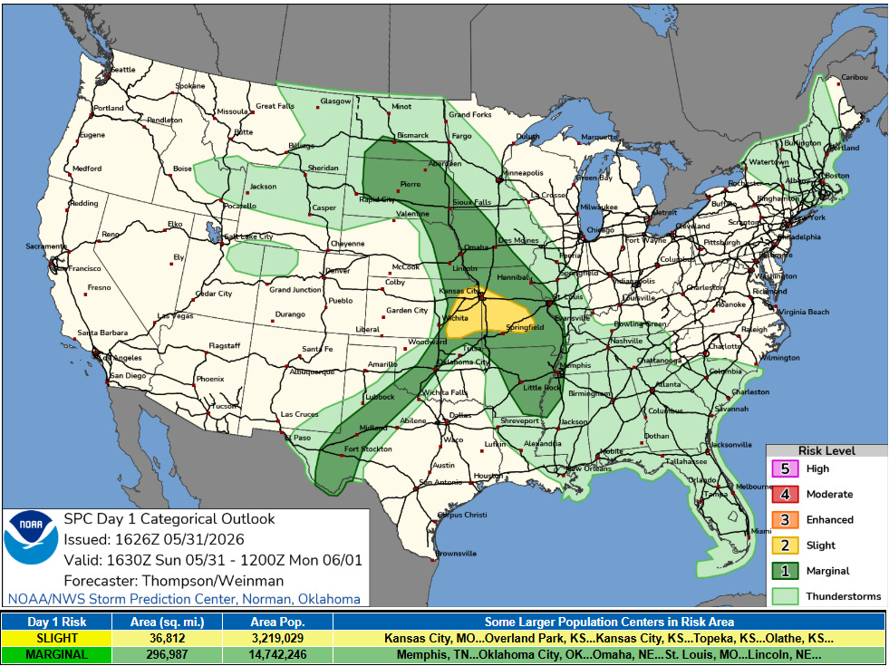
With respect to severe weather, a few severe thunderstorms are expected this afternoon and evening across the Mid-Missouri valley region where a couple of complexes of storms will likely form in a moist and unstable environment. Some flash flooding is also possible in this region as storms could train repeatedly over some localized areas into tonight.
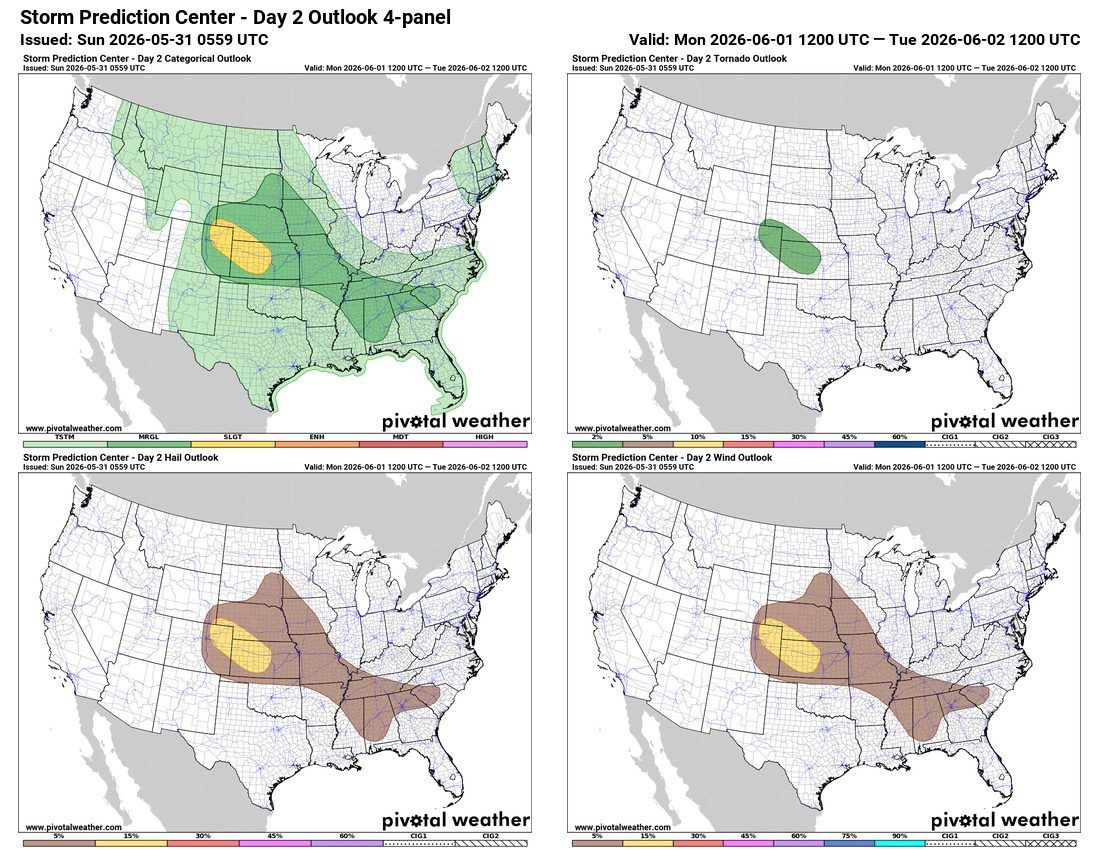
These storms will likely play an important role in the evolution of the severe weather threat on Monday, as the overall pattern and high resolution models suggest that a couple of complexes of strong to potentially severe storms will evolve out of this activity and move southeast toward the Lower Mississippi Valley and Tennessee Valley regions. While the exact details of this evolution are uncertain, AI severe weather forecasts have been consistently rather bullish in this region for Monday — and the combination of an unstable atmosphere and some increase in winds aloft suggest a decent risk of organized severe weather. Given all of this, I would not be surprised to see SPC increase the risk of severe weather in this area in later forecasts. A sight (level 2 of 5) risk is already in place for portions of the Central Plains where some supercell severe storms are expected to bring a risk of all severe weather hazards Monday afternoon and evening.
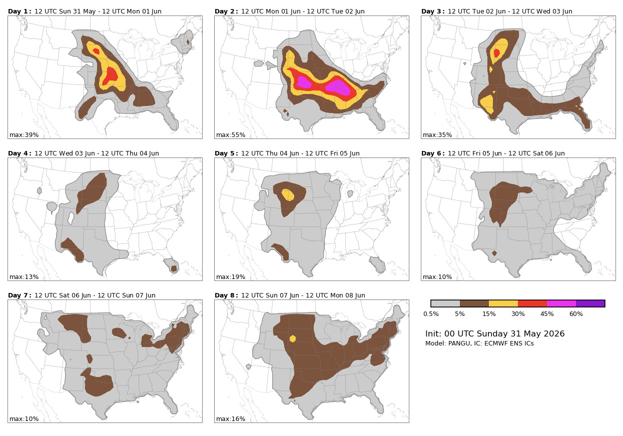
The overall weather pattern for the middle and latter part of the week once again suggests a generally less than active severe weather pattern than normal, with the jet stream continuing to be in a rather weak, blocky setup.


Leave a Reply