Four die in Kentucky flooding, while three federal firefighters killed in”burnover incident” in rapidly spreading wildfire along Utah/Colorado border
Jun 28, 2026
Good Sunday morning — y’all, there is just so much insane weather to talk about right now. I feel like I am using that word “insane” too frequently — but then I look back at what I describe with it and think, yes, that truly is insane. So, sadly…

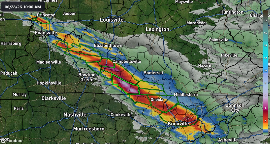
We are starting with the tragic flash flooding in Kentucky. More torrential rain fell overnight along a band from Evansville to Knoxville, with the heaviest centered to the east of Bowling Green where MRMS radar estimates a band of 5-7” of rainfall over the last 6 hours. A flash flood emergency (bright green polygon above) was issued for these areas.
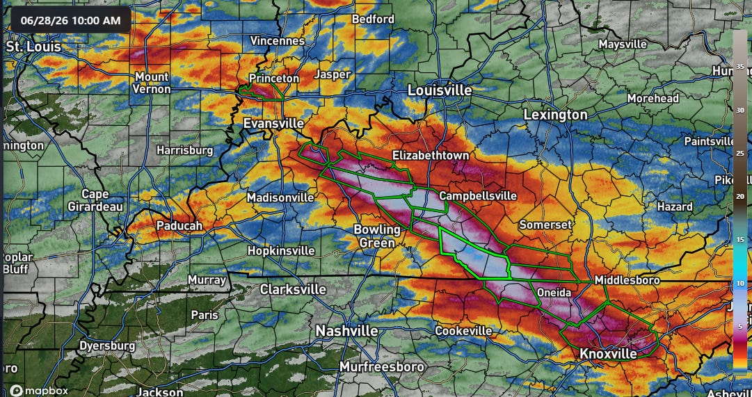
A rather impressive swath of 5-11” of rain has fallen in the last 24 hours right across central Kentucky into northeast Tennessee.
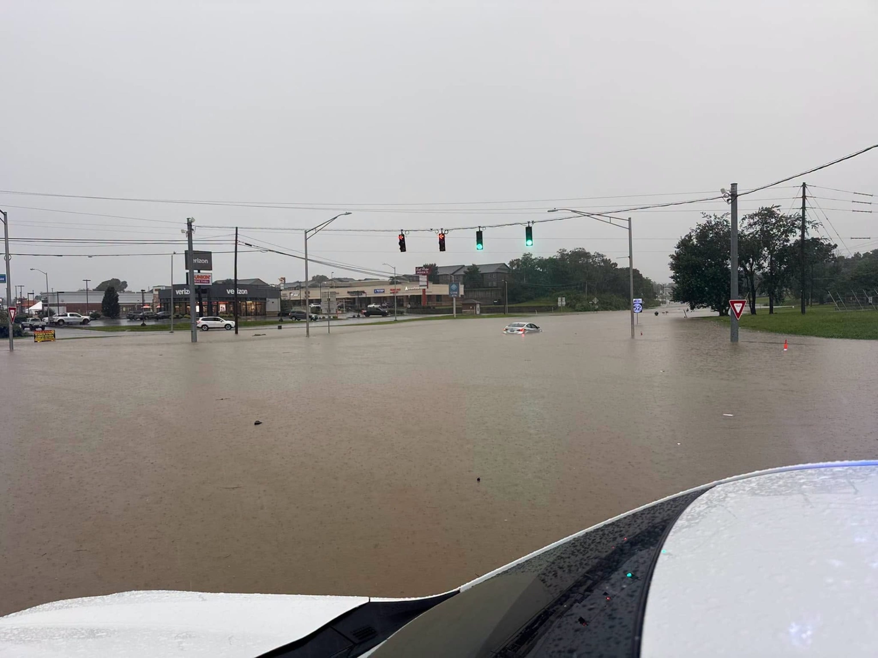
While serious flash flood impacts have occurred in these areas, demonstrating how flash flooding is about more than just rainfall totals, the most catastrophic impacts appear to have been in the hills just south and southeast of Lexington, where four people died on Saturday from flooding in the area. Luckily, the rain is tapering off over this region and drier weather is expected in the coming days.
Unfortunately, tragic loss of life also occurred on Saturday from a weather-related incident in the western United States. As expected, extreme fire weather conditions in the Southwest caused a number of ongoing large wildfires to rapidly expand on Saturday afternoon, with a number of new fires also starting.

The large fire along the Utah/Colorado border west of Grand Junction became particularly active, and sadly resulted in a “burnover incident” where the wildfire overtook a crew of federal firefighters. Three of the firefighters were killed and two others are being treated for burn injuries. Meanwhile, in Utah the largest wildfire, the Cottonwood Fire, continues to remain entirely uncontained. The fire has already destroyed or severely damaged a number of cabins and a ski resort, and the towns of Marysvale, Junction and Circleville have been place on alert for possible evacuation orders.
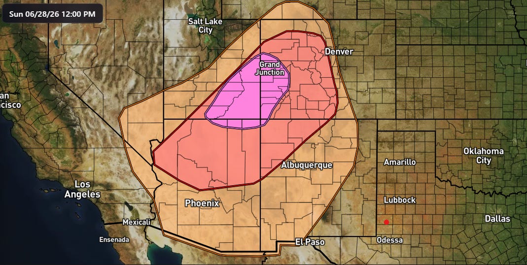
(Update 12:15 pm CT) With their midday update, the Storm Prediction Center upgraded eastern Utah into western Colorado to extremely critical fire weather conditions again today. Widespread critical fire weather conditions are anticipated across the entire region this afternoon, with gusty winds and low relative humidity values. While conditions will slightly improve after today, no major improvement in fire weather conditions is expected in the Southwest this week, with gusty southwest winds, low relative humidity values, and limited to no rainfall.
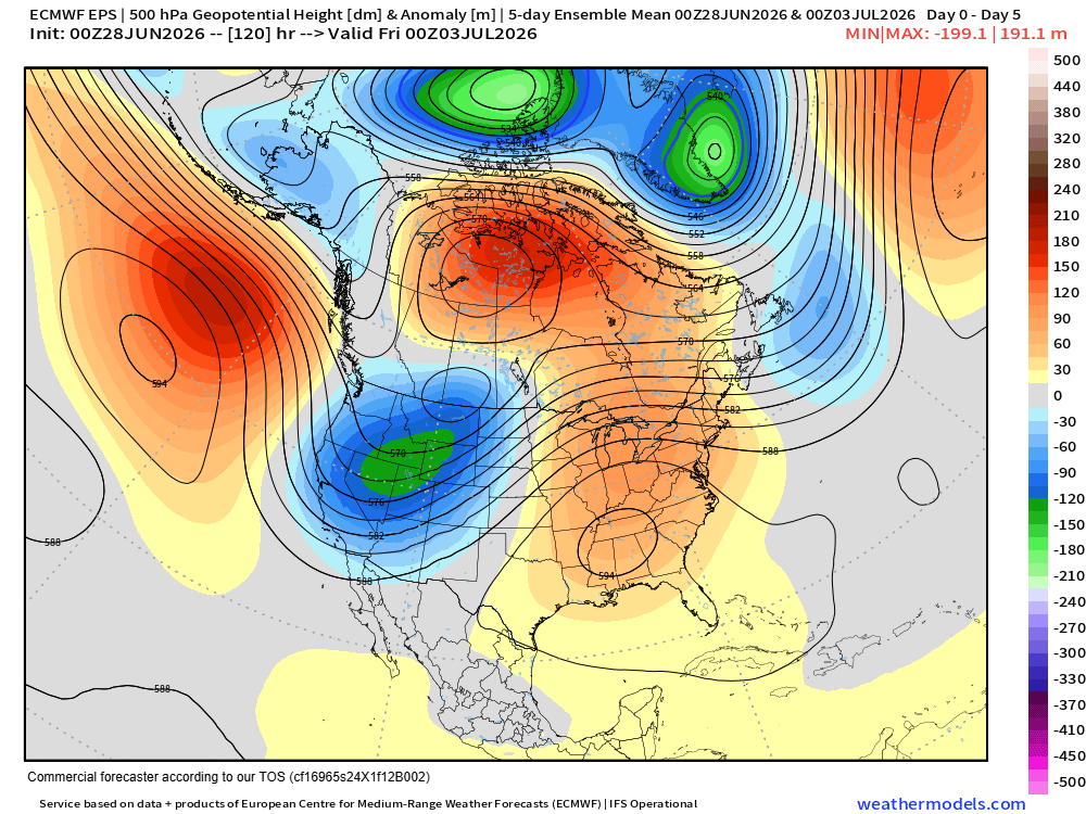
These fire weather conditions will be occurring at the base on a persistent upper level trough of low pressure across the western United States for the next several days — and which will actually result in unseasonably cold air and some high elevation snowfall in the northern Rockies. Downstream of this trough, an intense upper level anticyclone will develop across the East and produce what is now looking to be a record-breaking heat wave for the eastern half of the country this week.
Over the last few days, trends in the model forecasts indicate that this heatwave will be prolonged and intense, with several consecutive days of dangerous heat and humidity expected through this week.
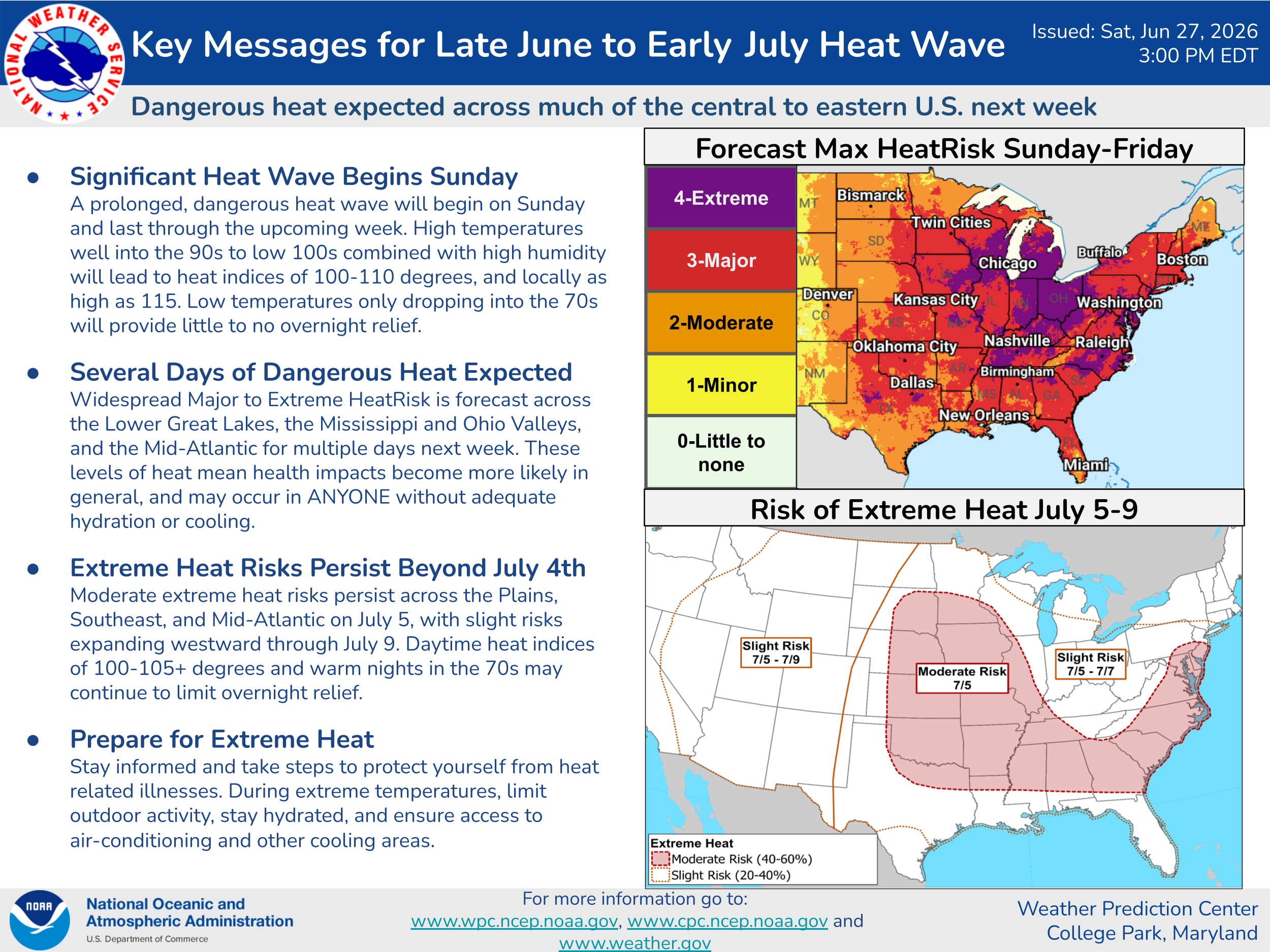
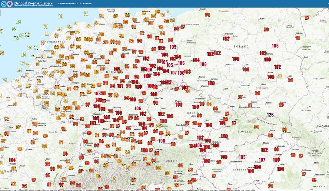
Numerous record high temperatures are anticipated across the eastern part of the nation starting Wednesday and lasting through at least the 4th of July, with Thursday (NWS forecast record maxes shown above) and Friday likely to have the most records.
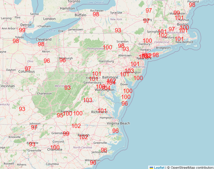
Even more incredible will be the record warm minimums, with dozens of records expected each day for the foreseeable future (Friday shown above).
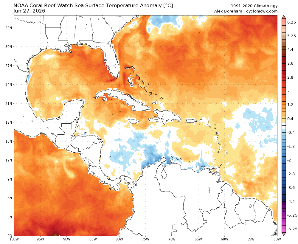
Anomalously warm sea surface temperatures in the Gulf of Mexico and southwest Atlantic are helping to fuel unusual levels of low level moisture which will be transported by southerly winds across the eastern US. This will a big factor in keeping the overnight lows particularly warm along with boosting daily heat index values. Days of this heat and humidity with limited overnight relief will compound the health related risks of this heatwave. I am planning to do a video sometime later today or this evening with a deeper dive on the meteorology of this event.
Turning to Europe, while some cooler air finally made it to the UK and the Atlantic coast of western Europe, central and eastern Europe are sweltering under historic heat.
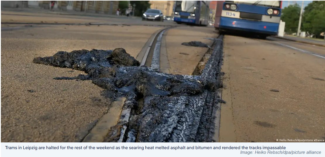
Many locations have seen triple-digit high temperatures (Fahrenheit) this weekend, including 40C (104F) at Berlin which set an all-time record high temperature for the city. Germany has set a national high temperature record on three consecutive days, including 41.7C (107F) today in Coschen in Brandenburg. Poland also set a new national record high temperature of 40.5C (105F).
As insane as the record high temperatures have been, similar to what is anticipated this week in the eastern US, the incredibly warm overnight low temperatures have really been even more insane as discussed here by climatologist M. Herrera. Per his BlueSky posts, that 29.4C minimum at Kubschut was north of 50N latitude, the warmest minimum ever globally that far north.
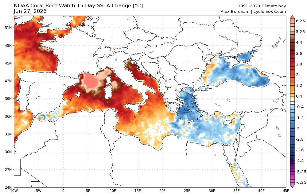
These incredibly warm overnight low temperatures are almost assuredly being driven by abnormally high humidity resulting from very anomalous sea surface temperatures in the Mediterranean Sea and the Atlantic off the west coast of Europe. SST anomalies are literally off the chart off the coast of the Riviera.
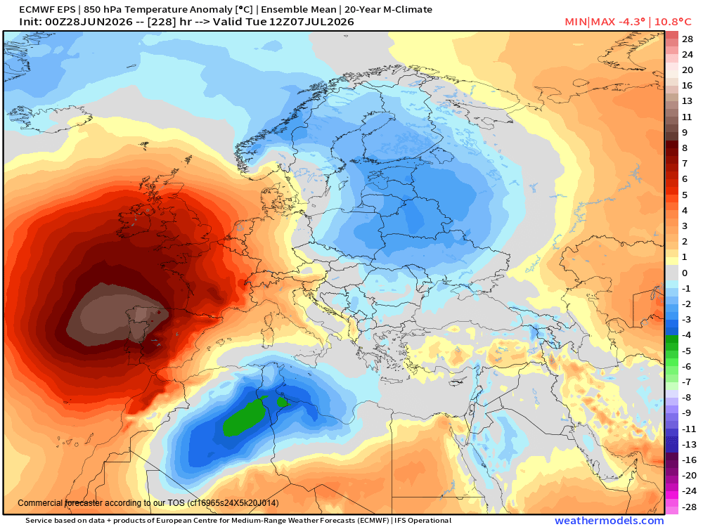
While cooler weather is expected to spread east across Europe this first part of this week, unfortunately there are increasing signs that a new major heatwave is going to build west across the UK and western Europe starting next weekend and particularly into the following week.
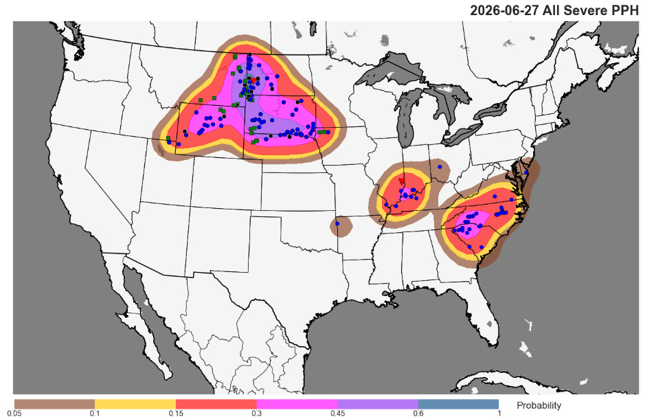
Severe weather has taken a backseat the last few days to everything else going on, but I do want to highlight that there was plenty of it on Saturday and Saturday night, particularly over the Northern Rockies and Plains were a powerful line of severe thunderstorms produced more than a dozen measured significant severe (75+ mph) wind gusts.

Severe weather this week will be driven by disturbances rotating around the large upper level anticyclone in the East in a “ring of fire” pattern. Typically, damaging winds and flash flooding are the biggest risks from these complexes of severe storms driven by extreme heat and humidity along the edge of the heat dome.
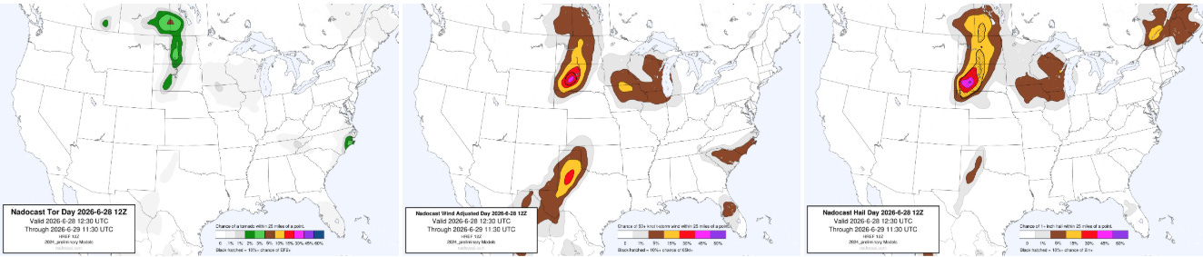
Today’s risk is again focused in the Northern Plains and Upper Midwest, with parts of Maine under a smaller risk. A few severe storms may also develop along the dryline in the Southern Plains.

Leave a comment