
Flash flooding to be a risk here today as well as in south Texas. Record heat continues in California.
5 minutes ago
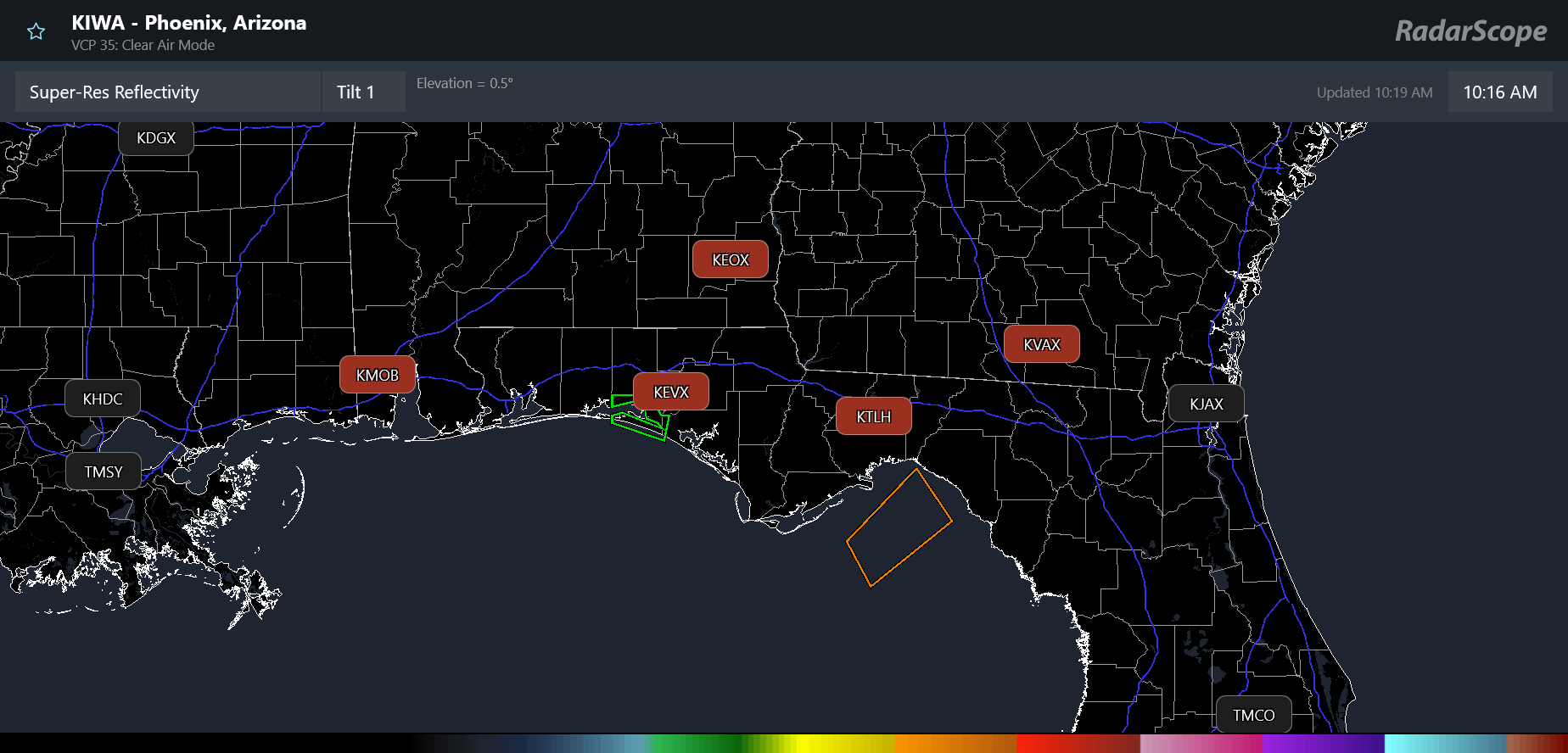
Starting off today with an update on the communications outage impacting the eastern Gulf Coast NWS offices in Mobile and Tallahassee. Unfortunately, the outage persists this morning, more than 24 hours after it started. RadarScope shows that data from the five Gulf Coast region radars from Mobile to Moody AFB, GA (KVAX) remains unavailable.
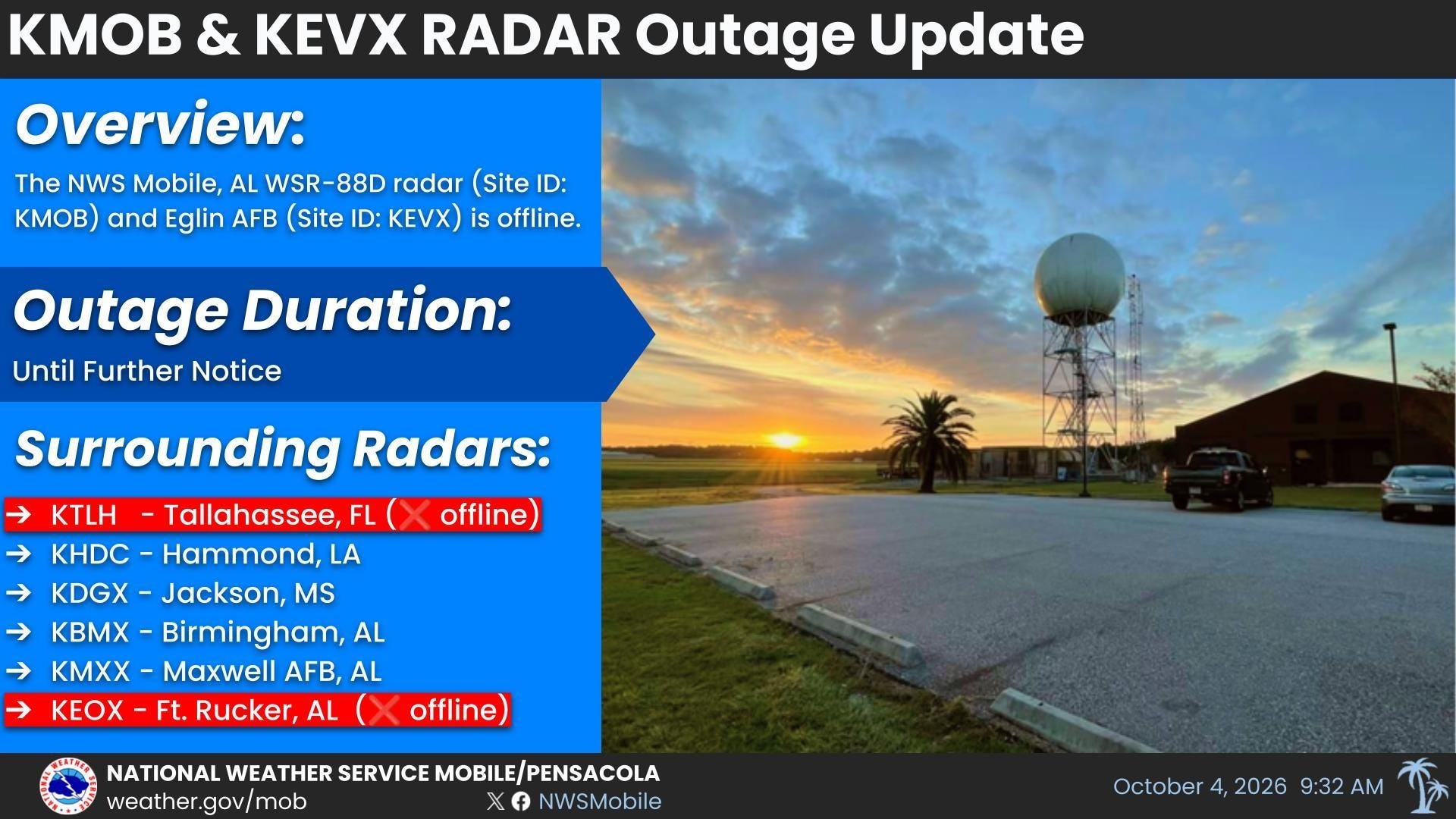
This notice is on the NWS Mobile webpage this morning, and I appreciate the effort to keep the public informed. However — unless I am completely misunderstanding what the situation is here — this graphic is not quite right and in my opinion adds confusion. The radars themselves are not inoperable or “offline.” They are operating normally, and the local NWS offices can see the data from their associated radars (NWS Mobile manages their own radar and Eglin AFB, FL; NWS Tallahassee has Moody AFB and Fort Rucker, AL in addition to their own radar). The issue is that the main comms line to both the Mobile and Tallahassee offices is down, and as a result the radar data is not being disseminated.
The communications outage also means the offices are unable to issue forecasts and warnings, requiring other offices to provide what the NWS calls “service backup.” In this situation, NWS New Orleans is issuing forecasts and warnings for Mobile’s service area, and NWS Jacksonville is doing the same for Tallahassee’s area.
I want to stress that I would much rather be using my Substack platform to talk about weather and science than these sorts of issues. However, the NWS is an agency I feel passionate about given its critical role in our society, and I think it is important that these issues are brought to light and people understand some of the behind the scenes aspects. As I and others have discussed multiple times in the last several months, these sorts of the communication issues are becoming more frequent and impactful.
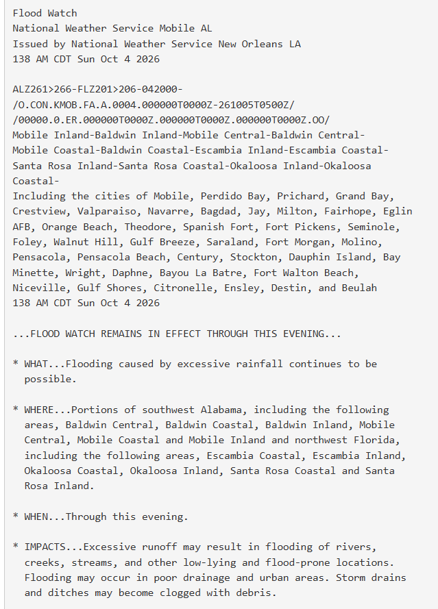
While the NWS does have service backup plans to ensure that critical products like this ongoing flood watch for parts of Mobile’s area are issued (you can see in the header at the top that it was issued by NWS New Orleans instead of NWS Mobile), nobody should think that this is just “business as usual.” For example, at least some NOAA Weather Radio services are impacted as communications between the offices and transmitters are interrupted.
With regard to radar data, the New Orleans and Jacksonville NWS offices do not have access to the critical radar information needed for severe weather and flash flood warnings. While they can at least talk to their colleagues in the Mobile and Tallahassee offices to discuss what they can see in the radar data, this is by no means an optimal situation for issuing time critical, life-saving short fused warnings. Obviously, having to provide services for a second service area is a significant workload impact for the New Orleans and Jacksonville offices, especially during active weather as we are seeing today.
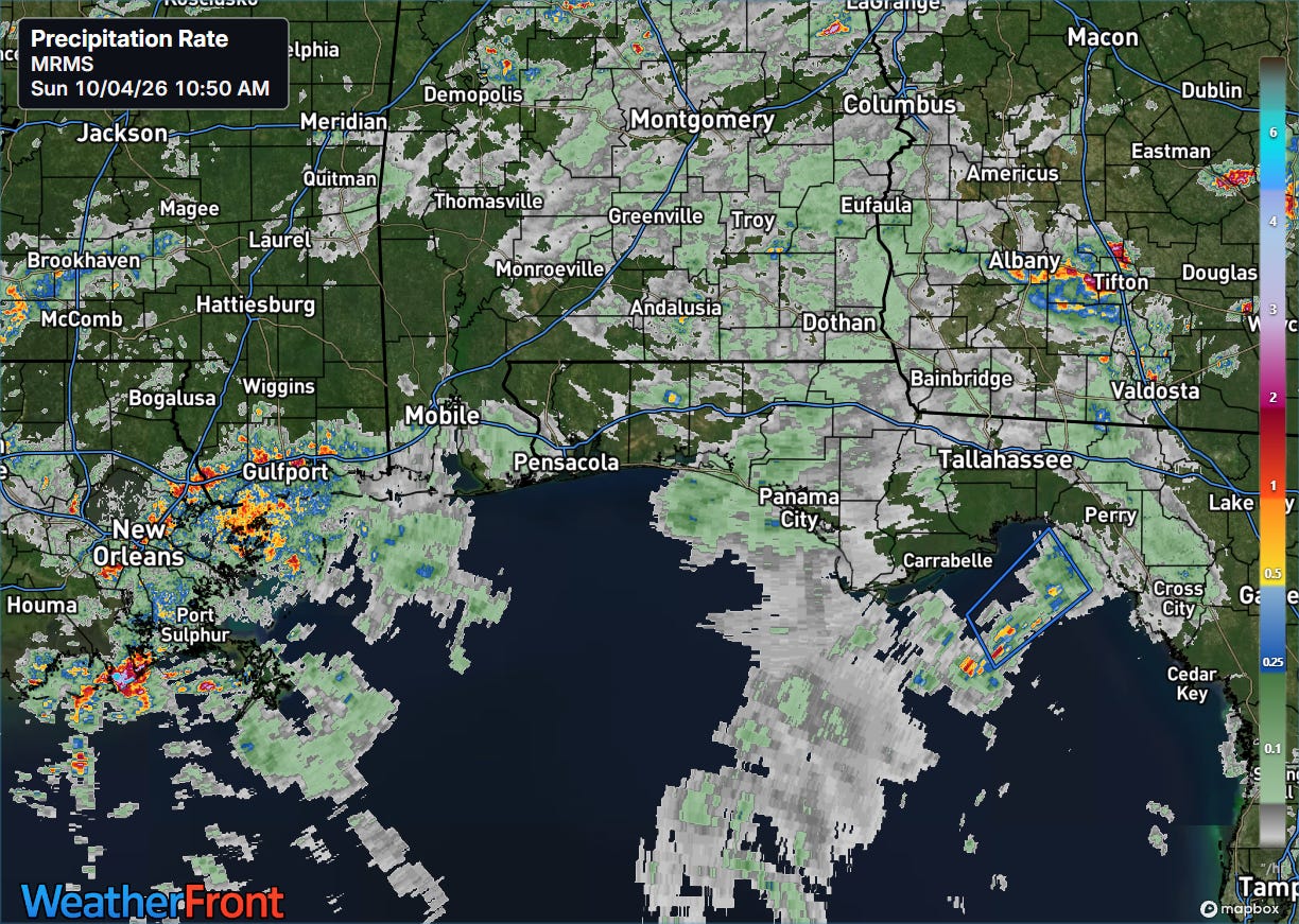
Radar data is also an important input into weather models and systems like the operational Multi-radar Multi-sensor System (MRMS) that produces products such as rainfall rate (above) and other hydrometeorological guidance that is relied upon by NWS forecasters for issuing flash flood warnings and flood information. Missing data from five NEXRAD radars in a region almost certainly degrades the quality of information produced by MRMS.
MRMS — and radar data in general — is also heavily relied upon by many other critical users in the broader weather community and society in general. The vulnerability of the NWS communications network to outages such as this was made clear 25 years ago during Hurricane Katrina — and clearly the vulnerabilities still exist today as our society has become even more reliant upon meteorological information.
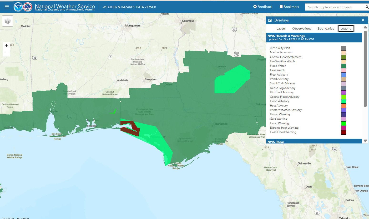
With today’s outage, the impacted region is dealing with potential flash flooding — and IT and comms issues impacted dissemination of warnings during the August derecho. Imagine if a major hurricane were making landfall this morning in Mobile Bay or the Florida Panhandle — there is no question that NWS services would be degraded for such an event.
As the NWS continues its reorganization and works to modernize its IT infrastructure, developing short-term and long-term fixes for these communications vulnerabilities and having redundant, reliable backup communication options in place must be an absolute top priority. If NOAA needs additional funding and resources to ensure this happens, then Congress should work to provide those resources and establish a process to hold Department of Commerce and NOAA leadership accountable for ensuring that these issues that have been ignored for decades are finally fixed.
In the meantime, the NWS also needs to be much more transparent and explain these outages and periods of service backup more clearly. I have had numerous direct queries about this situation and seen many more people on social media questioning the missing radar data and other products. While some communication is likely occurring with core partners on NWSChat, the NWS needs to have a defined procedure to ensure all their customers and the public know what is happening.
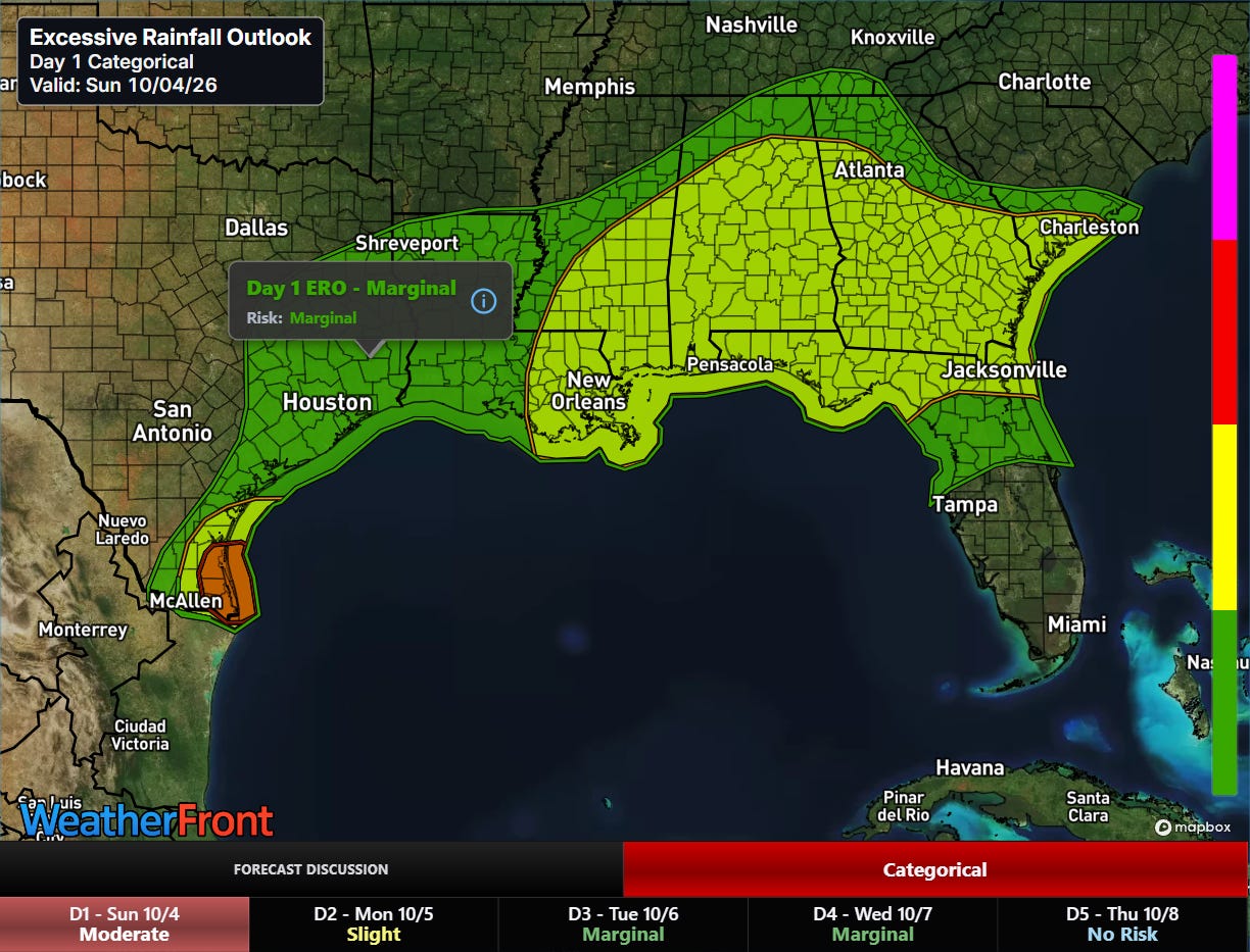
As far as the weather is concerned, a large slight (level 2 of 4) risk of flash flooding is in place across the Southeast as tropical moisture will continue to feed strong thunderstorms moving across the area.
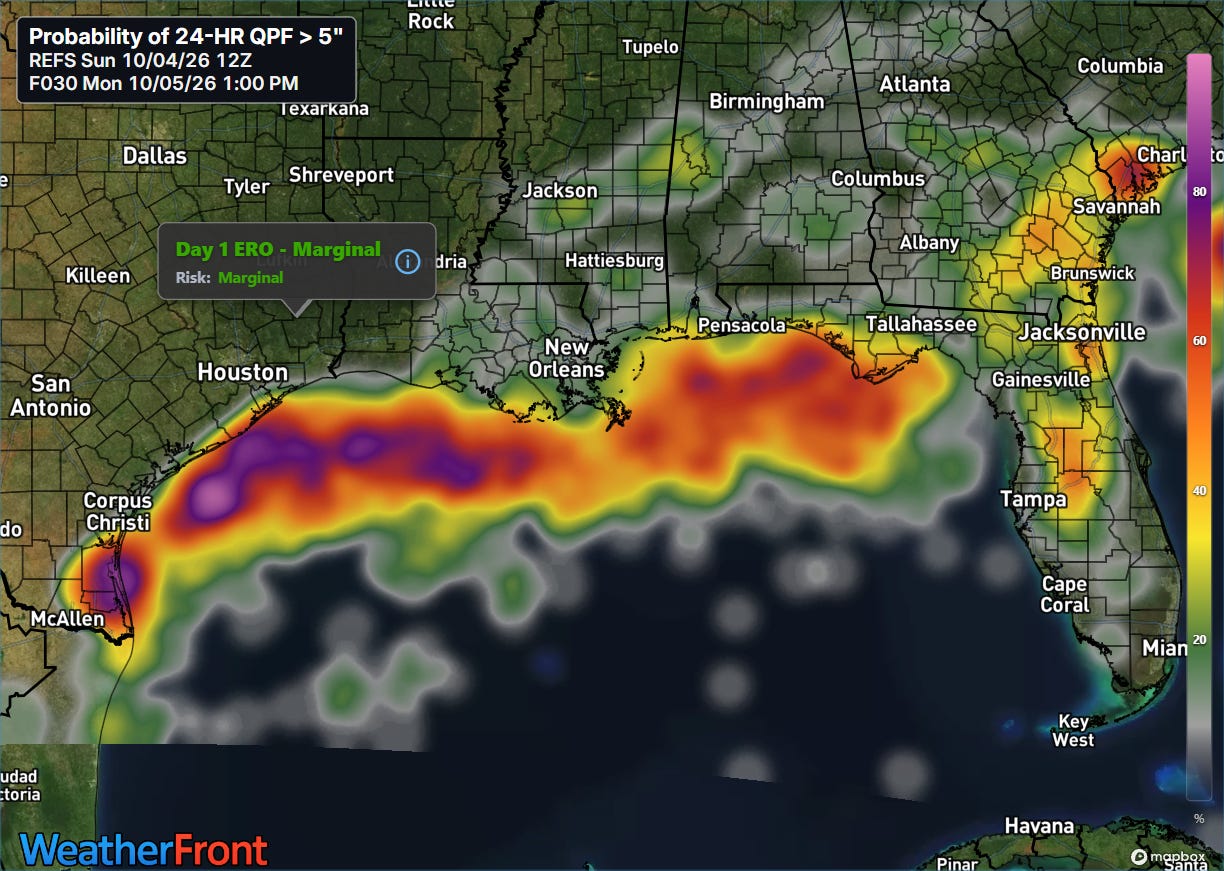
A moderate (level 3 of 4) risk is in place in deep South Texas where the latest high resolution ensemble forecast suggest a high probability for 5+ inch amounts in the next 24 hours. Areas from central Florida north into coastal South Carolina also have relatively high probabilities.
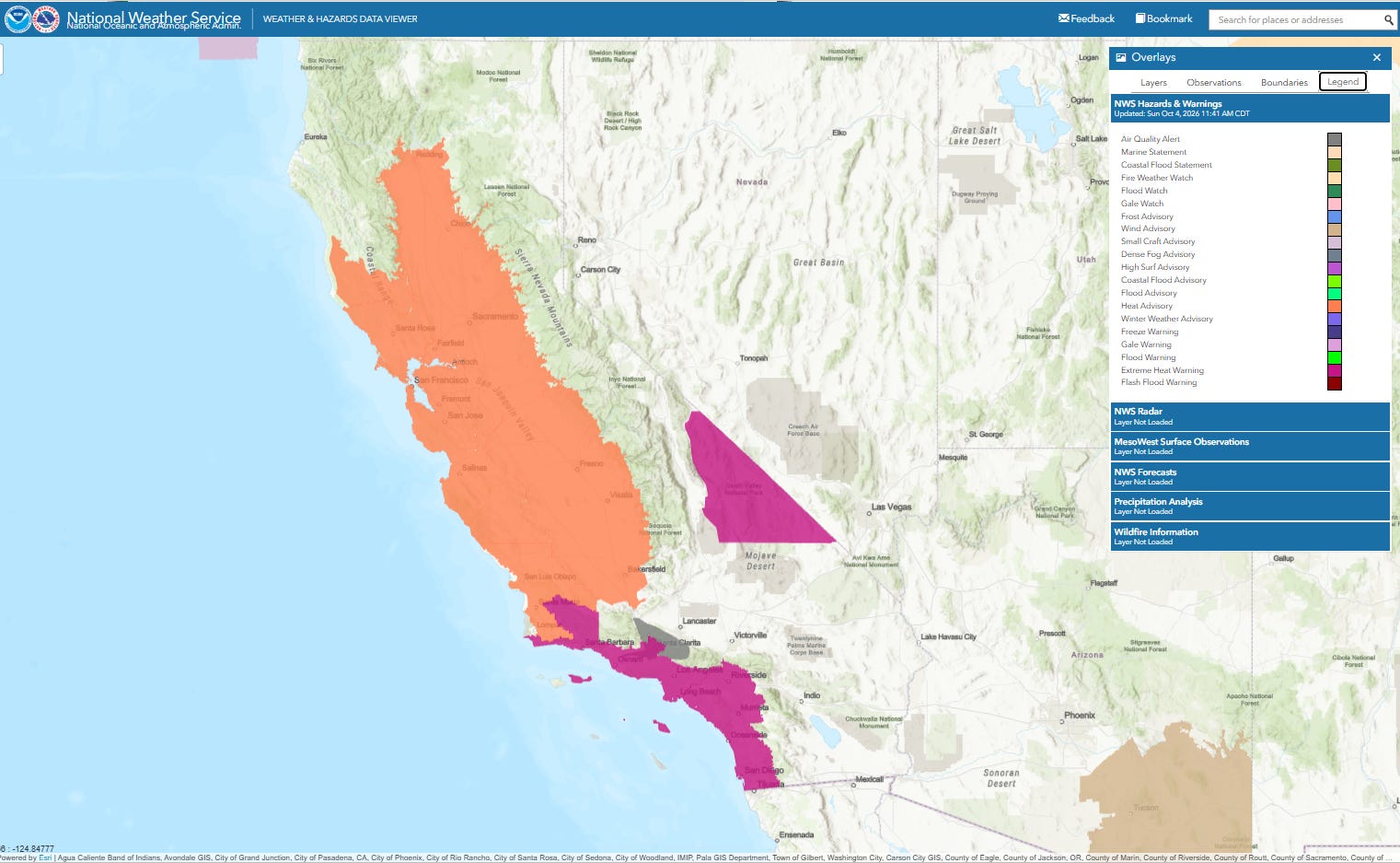
Record heat will continue today — and much of this week — across the West, with particular impacts in California. This can be a particularly hot time of year in southern California, but even here the level of heat is unusual as a number of record highs were set again on Saturday. This included San Diego reaching 105F to set a new daily record (data back to 1875), Santa Ana reaching 107F to break their daily record by 5 degrees (records back to 1906) and Vista tying their all-time record high temperature with 108F (records back to 1957).


Leave a comment