
Western United States facing prolonged heat wave for at least the next 7-10 days
2 minutes ago
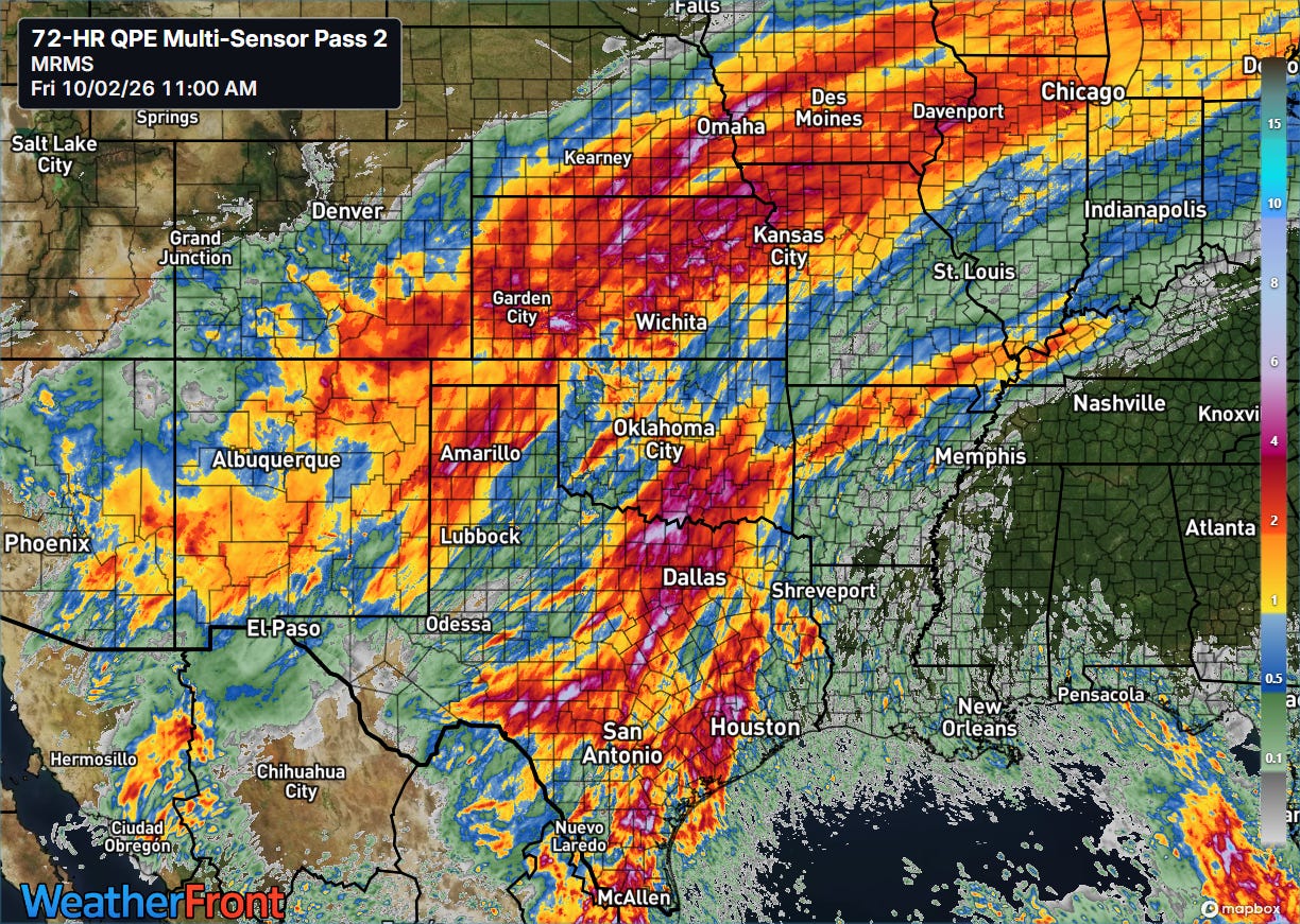
The last few days have seen waves of thunderstorms with torrential downpours fed by tropical moisture from the eastern Pacific — primarily from the remnants of Hurricane Polo — moving across the central part of the country. The 3-day multi-sensor rainfall estimates from the NSSL Multi-radar Multi-sensor System (MRMS) above shows several large pockets of 5-10” of rainfall scattered from Omaha to deep south Texas. Lincoln, NE set an all-time record rainfall in a single calendar day on Wednesday when the official site received 6.15” of rainfall. The rainfall total broke the prior record of 5.45” set in 1910 — climate records in Lincoln go back to 1887.
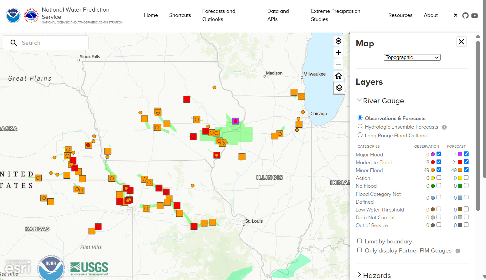
Flooding impacts from the rainfall appear to have been maximized in the Midwest where conditions have been wet over the last several weeks. Significant flash flooding did occur in other areas: a flash flood emergency was issued near Dodge City as flooding impacted residences and flash flooding forced water rescues in Fort Worth.
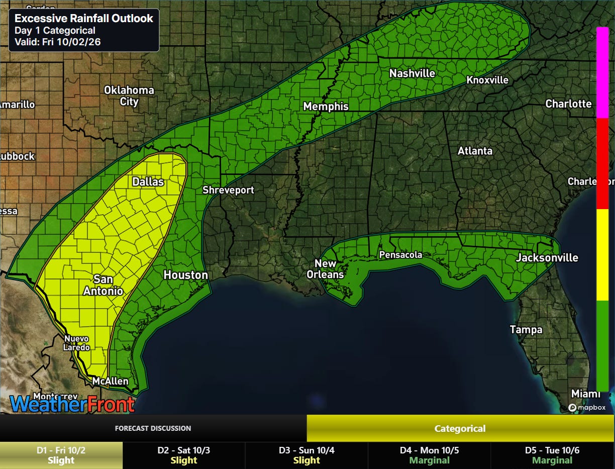
The flash flood risk through tonight should be highest along the Interstate 35 in corridor in Texas where residual tropical moisture will fuel additional thunderstorms with high rainfall rates in areas that have seen heavy rainfall the last couple of days.
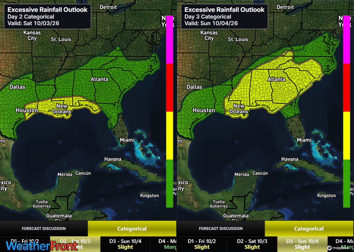
The threat for heavy rainfall and potential flooding will shift to the central Gulf Coast and Southeast over the weekend as an upper level disturbance and tropical moisture moves northeast ahead of a cold front moving into the eastern United States.
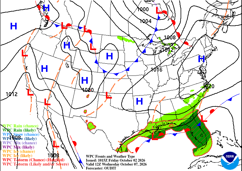
That front will move off the East Coast by early next week, bringing drier and somewhat cooler weather to much of the country east of the Rockies. The exception will be along the Gulf Coast and Florida where the front will hang up, resulting in continued wet weather — and at least the low potential for tropical development in the Gulf which we will be keeping an eye on next week.
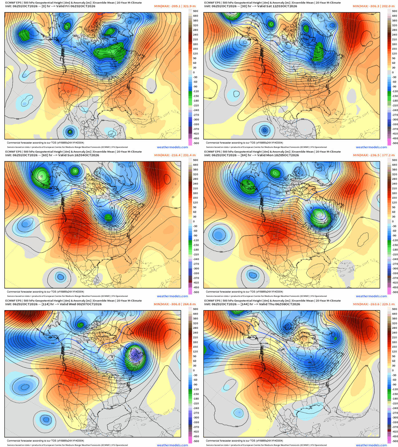
Overall, the main impact weather story over the next week should be the heat wave that will dominate the western United States as an unusually strong upper level ridge of high pressure takes up residence for the foreseeable future.
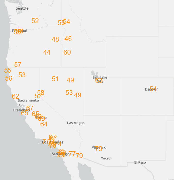
While a number of record high temperatures are expected, once again this heatwave will be dominated by numerous record warm minimum temperatures (forecast records for Tuesday shown above as an example).
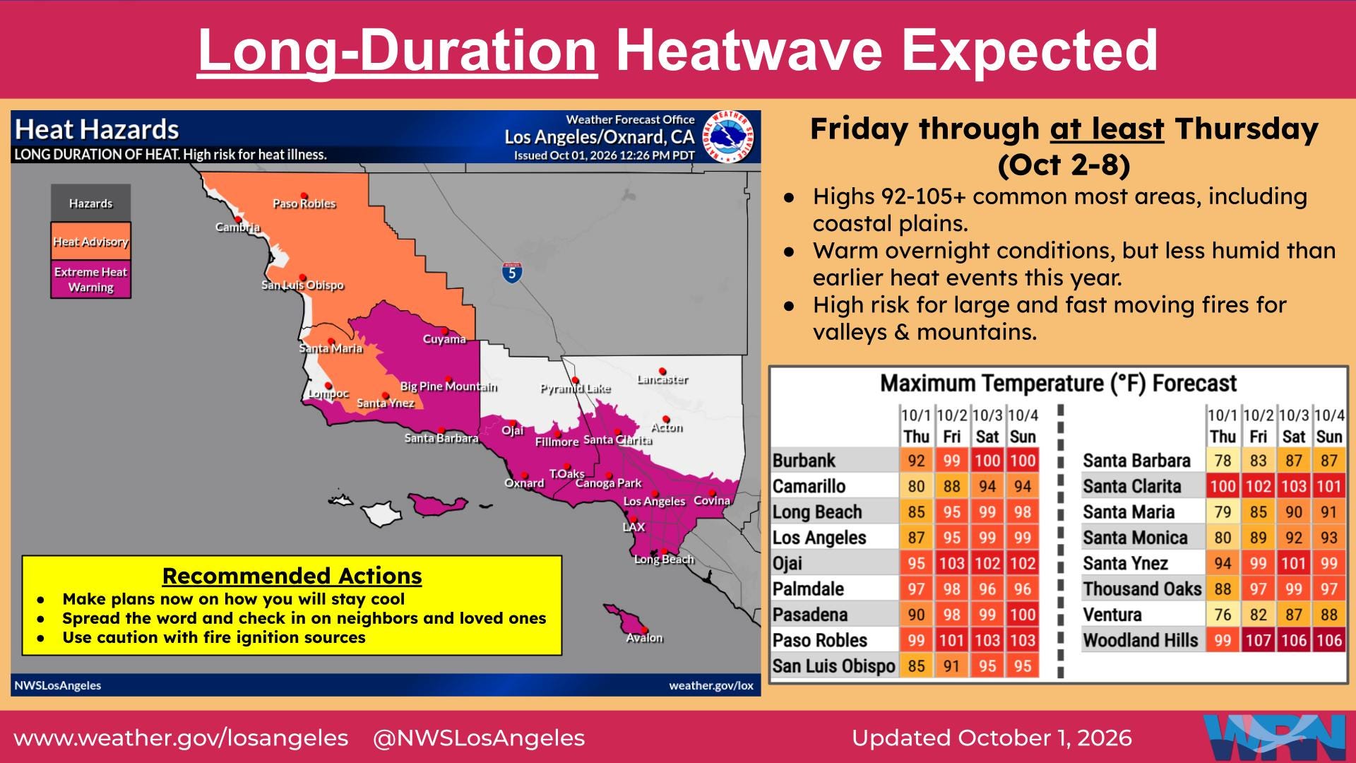
It will also be prolonged, with model forecasts indicating that unusual warmth should persist for at least the next ten days across much of country west of the Rockies.
Thanks again for being patient with less content this week — still on the road for a couple of more days but should be gradually heading back toward normal.


Leave a comment