
Eastern Pacific now has three hurricanes with potential for impacts growing
4 minutes ago
Tons of weather going on as we head into the weekend, and I want to start today with the East Coast system as I feel like I have kind of given it short shrift the last few days — and even as we get into the range of some of the higher resolution models there is still quite a bit of uncertainty surrounding it.
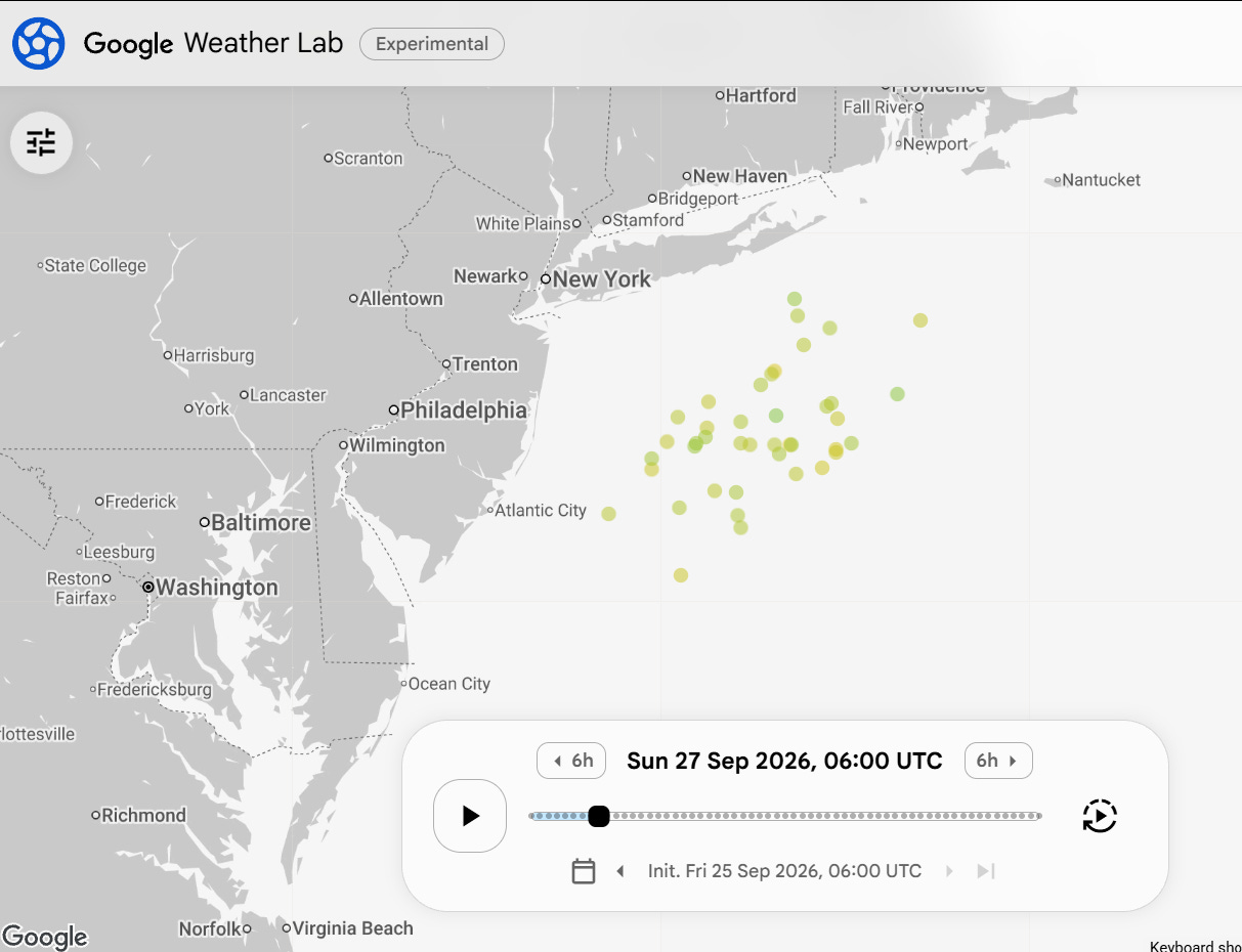
I have discussed in earlier posts this week how there is some question as to whether or not this system would be purely non-tropical or have some tropical characteristics as some models were hinting at. The Google DeepMind (GDM) AI tropical forecasting ensemble has been picking up on the system at some level basically since it started showing up in the models, and in its latest run (above) a majority of members are showing a strong storm system (mostly high end tropical storm intensity) somewhere offshore south of Long Island tomorrow night around midnight.
At a very basic level, non-tropical storm system are what meteorologists call “cold core” systems, because they are colder at the center than the surrounding air, while tropical systems are “warm core” because they have a warmer air than surrounding air at the center. To make things more complicated, we can get hybrid systems in which a non-tropical low starts to get a warmer center due to thunderstorms and other convective processes near the center. I am unsure how the GDM distinguishes between a tropical and non-tropical system within its model, but assume that the thermal core plays a role and that what it is detecting is more a hybrid system than a pure tropical system.
As I have discussed in numerous posts over the last 18 months about systems like this, impacts are what we should focus on, regardless of whether it is tropical or non-tropical. Having said that, I will say that the more “tropical” a system is, the more there is potential for curve balls and uncertainty in those forecast impacts as the more harder to model thunderstorm processes dominate a system, the more the models may struggle with fully capturing it.
Now that we are within the range of the high resolution models — called “convective allowing models” (CAMs) because they run at a resolution to enable the model to contain actual thunderstorm processes rather than parameterizing them — we can see what they are doing with the system. Forecast radar from the morning run of the Rapid Refresh Forecast System (RRFS) above shows that this system evolves from a non-tropical looking system with a large precipitation shield to its northwest into a tighter, more tropical looking system as it moves northwest and eventually turns west toward the New Jersey coast late Saturday night into Sunday.
While I would not put stock in any one CAM forecast, most of the morning CAMs have a similar type solution, and generally agree with the GDM ensemble and the European modeling solutions (which have been trending more toward this westward move toward the coast on Sunday as I discussed in a brief paid subscriber chat last evening).
Depending on how exactly the finer details of this system evolve, it could bring enhancement to winds and coastal flooding as it moves toward coast as shown in this RRFS forecast of wind gusts. Regardless, prolonged strong east-northeast flow between the low and a high pressure center to the north will bring persistent strong winds along the eastern Massachusetts coast and into Long Island and the New York City metro area through the weekend. Power outages will be a concern across the region.
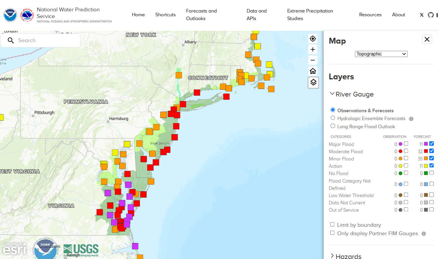
Coastal flooding will initially be a serious concern for the Delmarva area and spread north as the low develops and initially moves north. The long, strong east-northeast fech of winds into eastern Massachusetts will raise concerns from high surf and beach erosion in this area.
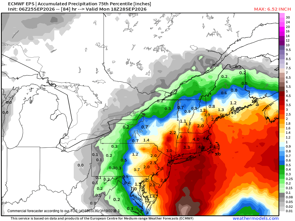
All of this will be complicated by heavy rainfall, with the European ensemble model 75% percentile (reasonable worst case scenario) rainfall showing the potential for 3-5” of rainfall across the region. The bottom line is that this should be an impact event with multiple hazards — and given the somewhat tropical nature of it and the inherent uncertainty, people will want to be paying close attention to the weather and later forecasts and updates this weekend.
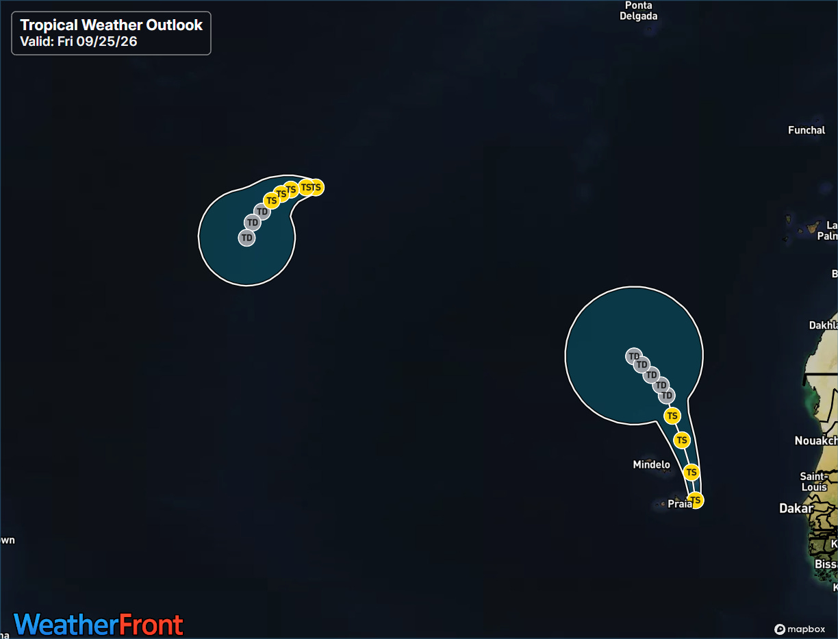
The tropics themselves are active, and the contrast between the Atlantic and Pacific in this strong El Nino year is particularly stark today. We do actually have two tropical storms in the Atlantic — Fay in the central Atlantic and Gonzalo near the Cabo Verde islands. Fay has been more resilient than expected and has 60 mph winds this morning — but is showing signs that shear is starting to impact it again. Gonzalo has 50 mph winds and will bring gusty winds and heavy rainfall to Cabo Verde where tropical storm warnings are in effect, as well as some heavy rainfall to coastal west Africa. Neither system is expected to intensify much further and should eventually weaken and dissipate by early next week.
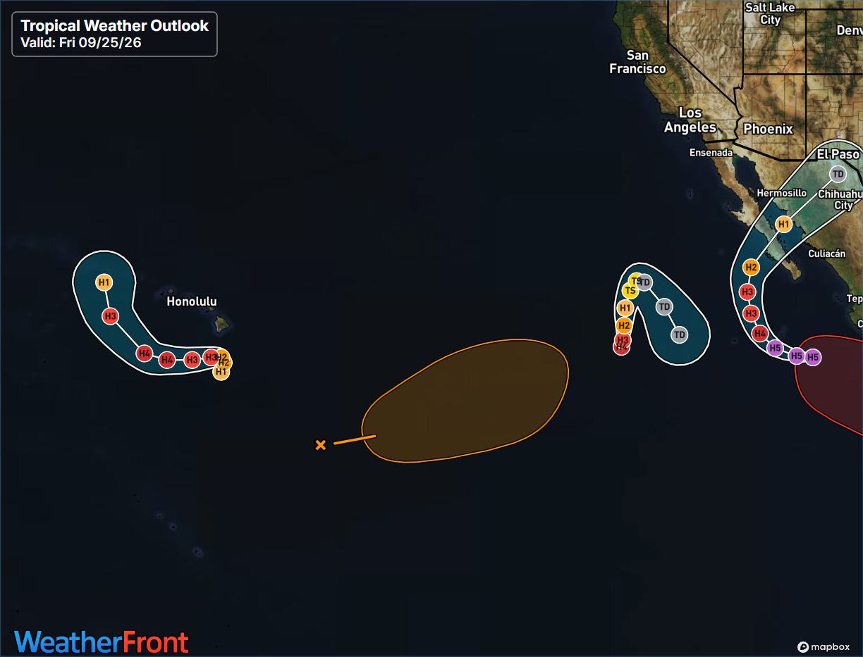
Meanwhile, the Pacific is literally insane, with three hurricanes ongoing. West to east we have Polo, which is once again a category 5 with maximum sustained winds of 180 mph, Odalys with has somewhat unexpectedly rapidly intensified into a category 4 hurricane with maximum sustained winds of 130 mph, and Nolo to the south of the Big Island of Hawai’i with maximum sustained winds of 85 mph.
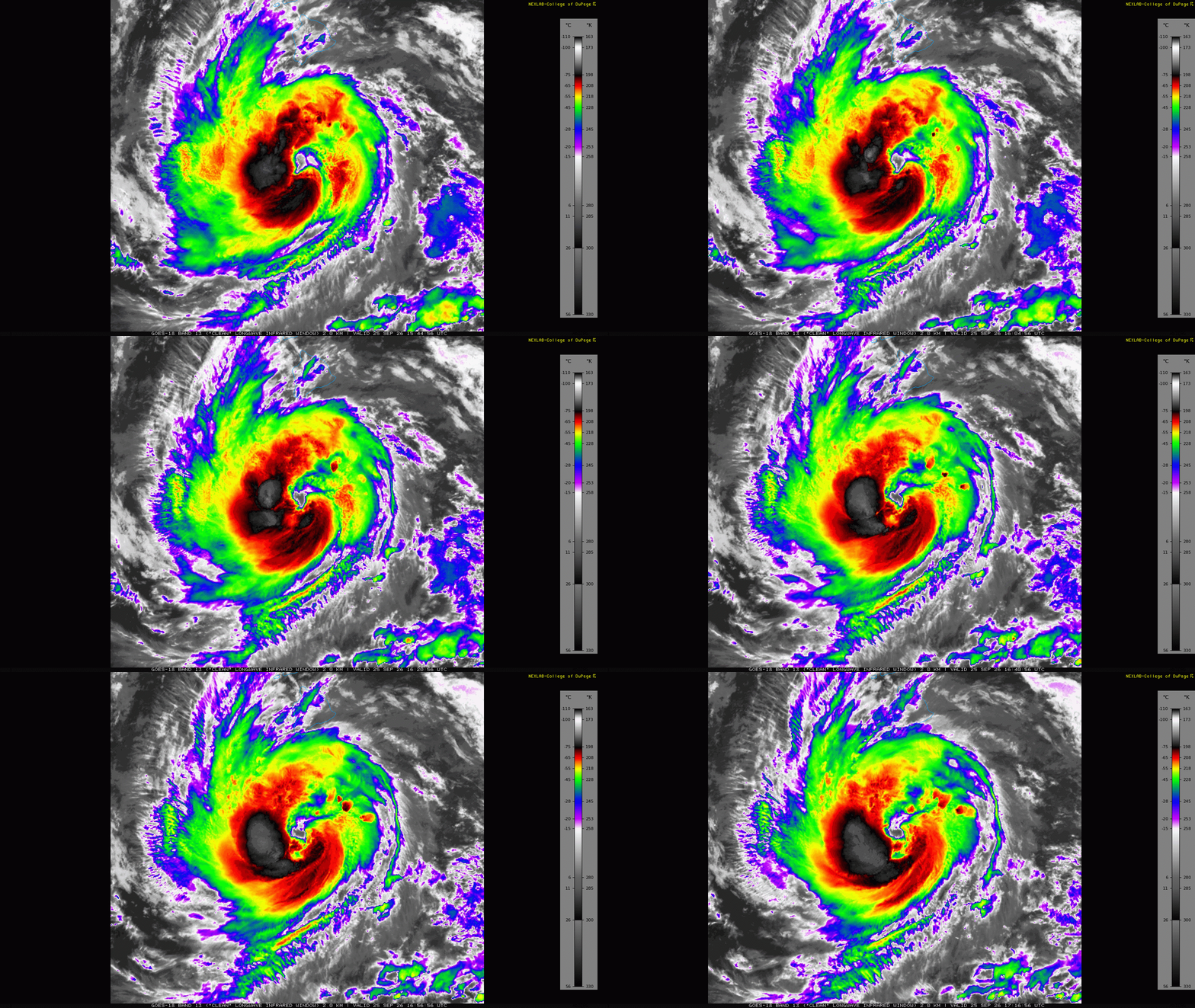
Nolo is definitely getting better organized, with strong thunderstorm activity building in the southern semicircle and wrapping around a gradually warming eye feature. It is forecast to intensify into a major category 3 hurricane as it moves north-northeast in the general direction of the Big Island, before sharply turning west away from the island.
![[Key Messages]](https://substackcdn.com/image/fetch/$s_!y5Et!,f_auto,q_auto:good,fl_progressive:steep/https%3A%2F%2Fsubstack-post-media.s3.amazonaws.com%2Fpublic%2Fimages%2F2566bc51-fc89-4134-b04d-0ae5bb925c5e_897x736.png "[Key Messages]")
The models have continued to trend toward this turn happening farther south — more like the newest experimental version of the GDM ensemble (I had the two versions confused in my initial newsletter yesterday, corrected it shortly after publication). This means that the worst case scenarios of direct hurricane impacts to Hawai’i and gigantic rainfall totals are now unlikely — but still very heavy rainfall with the potential for serious flash flooding and mudslides exists, particularly in the higher elevations of the Big Island and Mau’i.
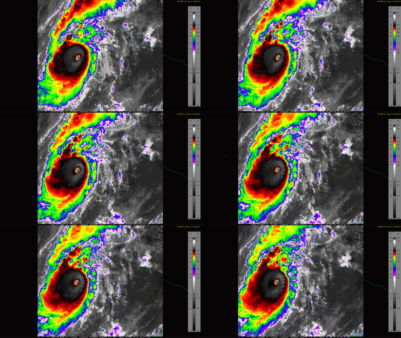
Nolo once again went through a significant intensification phase in the last hours, with reconnaissance aircraft finding a central pressure down to 900 mb and winds up to 180 mph. It is an incredibly impressive hurricane in infrared satellite imagery.
![[Key Messages]](https://substackcdn.com/image/fetch/$s_!BRET!,f_auto,q_auto:good,fl_progressive:steep/https%3A%2F%2Fsubstack-post-media.s3.amazonaws.com%2Fpublic%2Fimages%2Fbc9efe08-34fb-4a77-bbf0-e614a64e8730_897x736.png "[Key Messages]")
The models are in fairly good agreement on a weaker — but still major hurricane intensity — Polo eventually recurving toward the north and northeast and making landfall in Baja California Sur early next week. Significant direct wind, surge and rainfall impacts are expected.
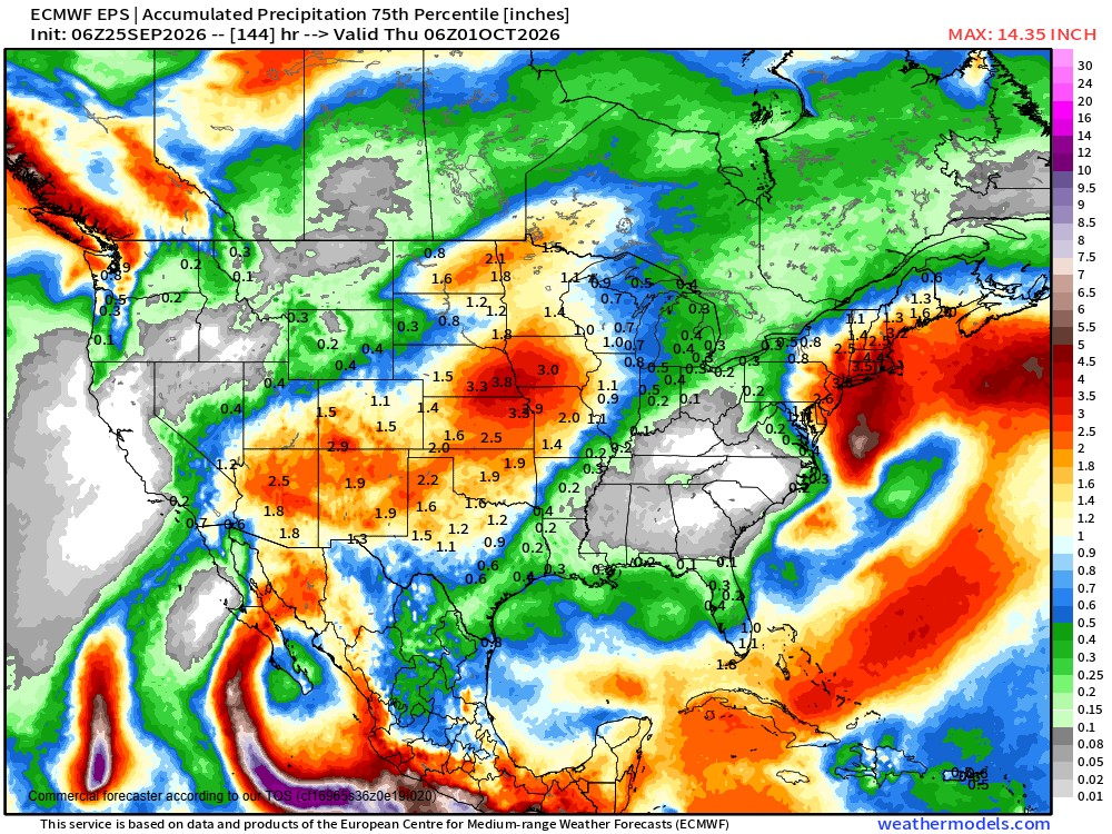
The models appear to be trending slower and deeper with the upper level trough of low pressure that will be picking up Polo early next week, raising the potential for more significant rainfall and flooding impacts into the Southwest which we will be watching closely. Regardless, moisture from the eastern Pacific including Polo and Odalys will continue to feed the wet weather pattern that has been plaguing the area from New Mexico into the central US with continued flooding concerns.


Leave a comment